
- Brief description
-
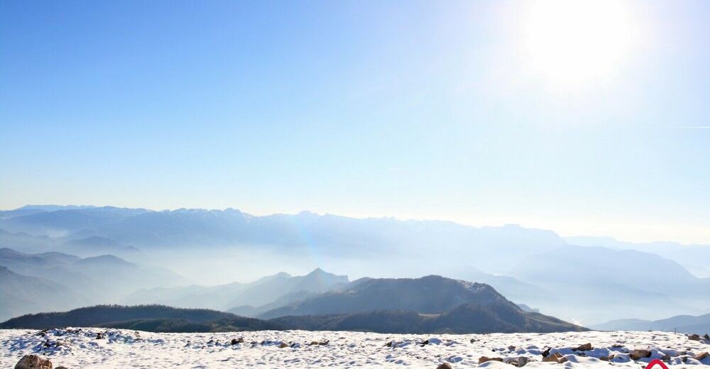
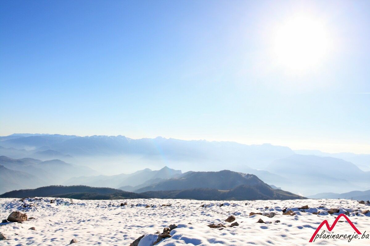
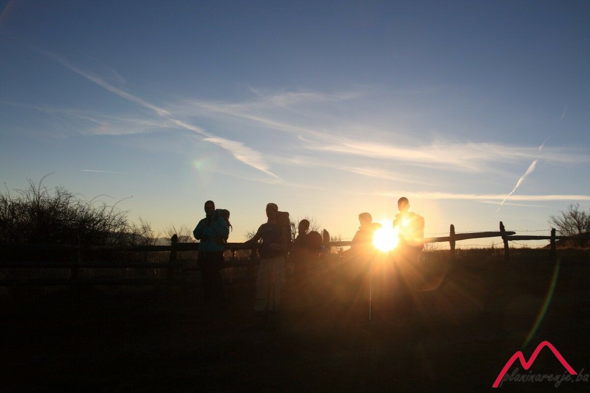
This is a moderately difficult and technically undemanding trail leading over beautiful terrain, with short steep sections and at least two fountains offering drinking water. The summit of Lisin offers one of the most beautiful views of the highest number of mountains of Bosnia and Herzegovina.
- Starting point
-
The start of the trail is hidden behind the last house to the right in Bradina, in the direction of Konjic, 20 m away from the M17 road.
- Route
-
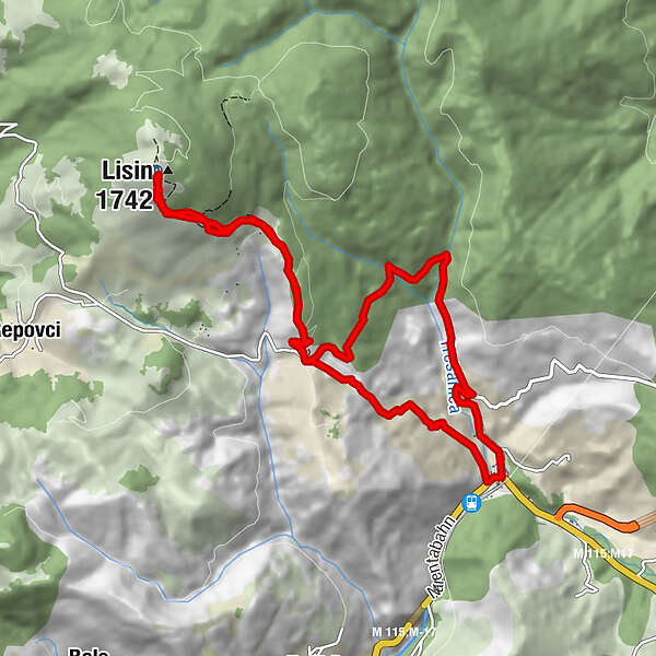
BradinaLisin (1,742 m)5.1 kmKatolička kapela sv. Ane12.1 kmCrkva Uznesenja Gospodnjeg12.1 kmBradina12.3 km
- Description
-
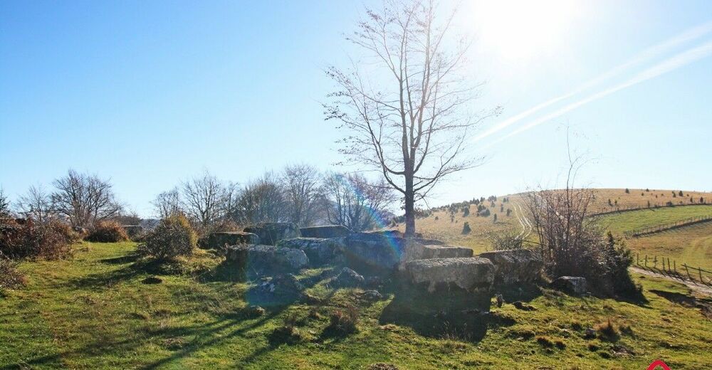
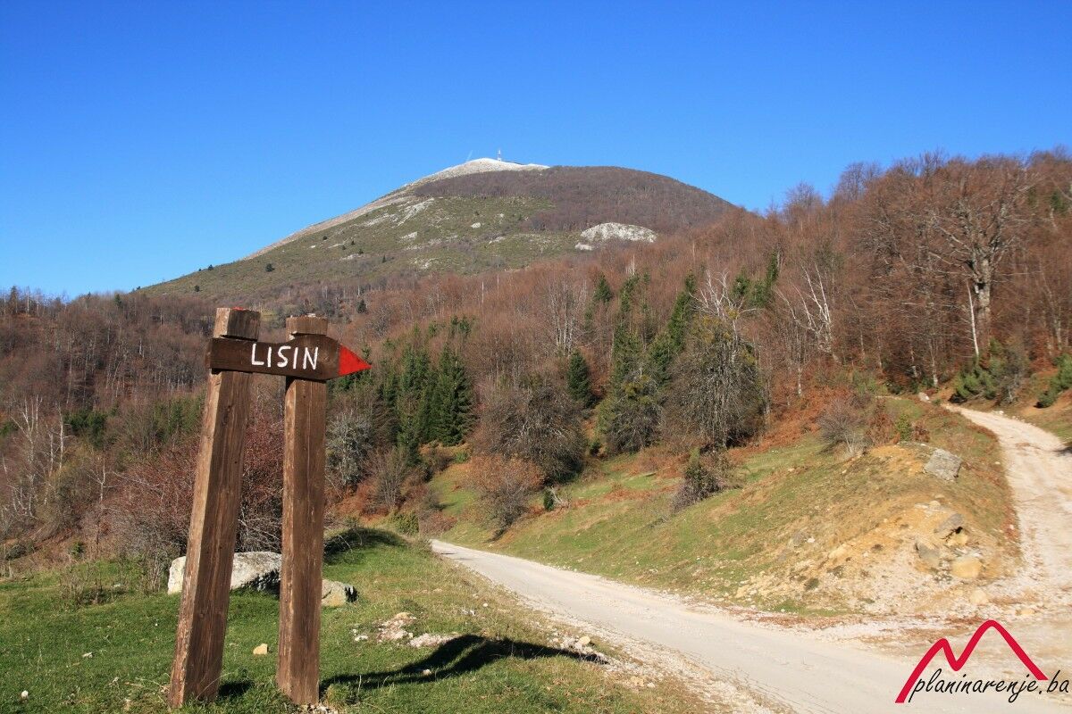
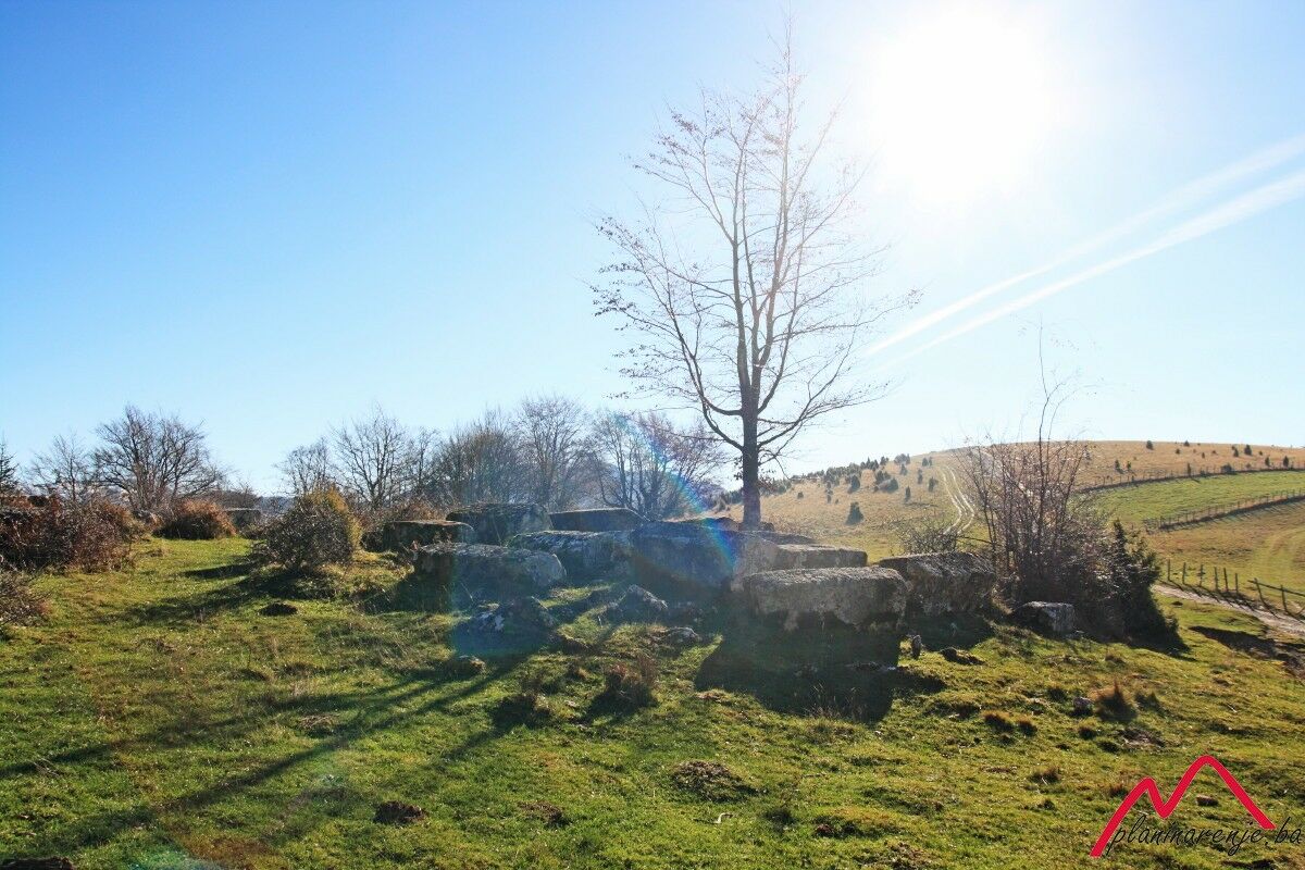
The start of the trail is hidden behind the last house to the right in Bradina, in the direction of Konjic, 20 m away from the M17 road. If you want to cross the entire track on foot, you can park your car in Bradina. There are some felled trees along the path and the trail is overgrown with thorny bushes, meaning that it is rarely used. The markings are rather poorly done but the trail is clearly visible despite being overgrown. After a one-hour walk, you will reach an area with stećak tombstones which you can also reach by car via an asphalt road and so shorten the trip to the summit. A forest path leads from the tombstone area to the village at the foot of the summit. Upon arriving at the village, the easiest way is to go is straight up the hill at the edge of the forest, while the trail through juniper shrubs is marked by plastic bags which are tied to the branches, making them easily noticeable.
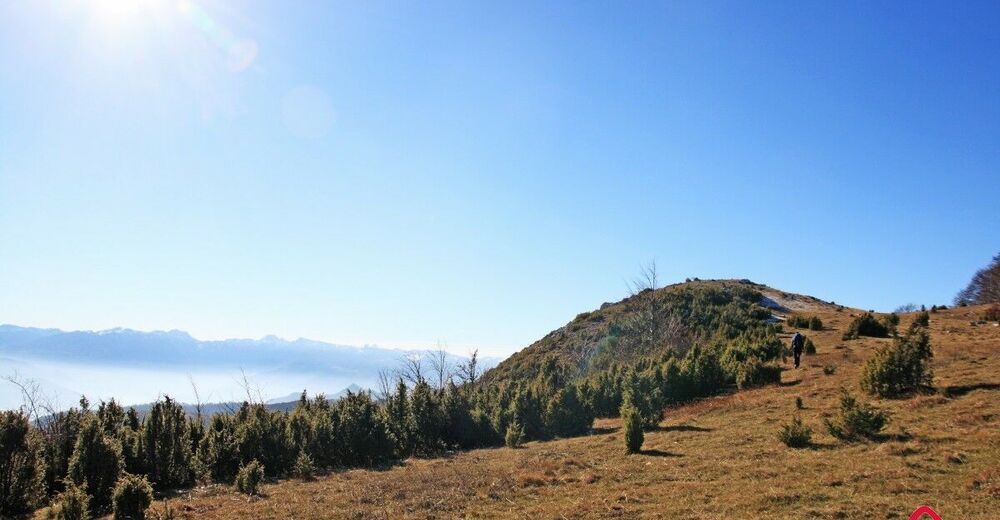
On the promontory (Treskavica, 1324 MASL) you can take a little break and then proceed along the edge of the forest towards the summit. A 100-metre ascent leads to the summit and the climb may be more difficult if the ground is covered with snow. Weather conditions on the summit can be quite cold and windy. A BH Telecom facility can be found there but it is often locked, meaning that you can find shelter behind an electrical substation. If you are going back after dark, the best path to take is the same route leading to the tombstones, after which you are supposed to proceed to Bradina via the asphalt road. Despite the fact that this section is twice as long compared to the trail used for arriving at the destination, it is more easily traversable in the dark so you will hardly need to use your headlamps.
- Directions
-
The trail begins on the M17 road, behind the last house to the right in Bradina. The trail which is poorly marked in the initial section immediately leads to the beech forest above the creek, followed by abandoned village ruins. It is necessary to stick to the remains of an old overgrown path which is covered by flowing water in several locations. The markings are sporadically missing, so one should proceed in the west-northwest direction. There is a fountain with drinking water further along the trail.
Upon reaching a macadam road, one can observe an attractive and preserved tombstone necropolis above it, with the path leading through it to the spring with captured drinking water. The water can be used only at times when there is a surplus of it. Next, the trail leads directly to the north (Voznik) and it is adequately marked until you reach two cottages. There is a fountain in front of the upper cottage which you need to use to resupply your water reserves as it is the last source of water on this trail.
Proceed along the road to the point where it takes a sharp turn to the left. There, you should leave the trail and move towards the top of the steep meadow, where it is necessary to go over the fence in order to reach an area with juniper bushes which are rather hard to navigate through. Upon leaving the bushes and reaching a grassy plateau, it is possible to arrive at its exposed section on the left side i.e. the lookout of Treskavica (1324 m above sea level). Next, one should trail along the edge of the forest and follow sporadic markings until reaching the Lisin peak with antennas and BH Telecom facility.
- Highest point
- 1,718 m
- Endpoint
-
Bradina
- Height profile
-
 © outdooractive.com
 - Equipment
-
Standard mountaineering equipment.
- Safety instructions
-
It is a technically undemanding route without the danger of landmines.
- Tips
-
There is a BH telecom facility on the peak which often houses a crew. They are not obliged to shelter walkers.
- Additional information
- Directions
-
Bradina is located on the M17 road en route between Sarajevo and Mostar.
- Public transportation
-
Bus lines Sarajevo – Konjic – Mostar, and train from Sarajevo or Mostar.
- Parking
-
A car park is located close to the main road, with a widening which is used as a bus station.

-

-
AuthorThe tour Bradina - Lisin is used by outdooractive.com provided.