


- Brief description
-
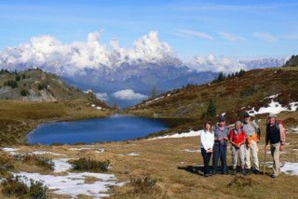
Quiet alpine pasture hike in almost untouched nature, off the beaten tourist track you can enjoy the day all by yourself.
- Difficulty
-
medium
- Rating
-
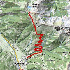
- Starting point
-
Ottino car park
- Route
-
Klausalm0.8 kmMoosalm3.5 kmSulzbühel (1,552 m)5.6 kmKönigsbergalm7.4 kmSchwarzenbach7.7 km
- Best season
-
JanFebMarAprMayJunJulAugSepOctNovDec
- Description
-
The hike begins at the former Ottino snack station. We follow the forest path to the Moosalm, from there a small but somewhat steeper path leads past a fish pond and ends at the Moaralm, which is no longer managed. Past the Moaralm, hiking trail no. 56 leads to the Sulzbühel and downhill to the Königsbergalm. After the Königsbergalm, you briefly cross the alpine meadow, followed by another forest road - whereby you return to the original forest road in the direction of the Moosalm.
- Directions
-
A slightly ascending alpine path starts from the Ottino car park. After only a few minutes' walk, a path (no. 56a) branches off to the right to the Klausalm. However, we stay on trail no. 56, after about 1 hour we reach the Moosalm. From the Moosalm, turn left along trail no. 56c, past a small fish pond. A somewhat steeper ascent follows to the Moaralm (not managed). The walking time is approx. 30-40 min. From the Moaralm we follow trail no. 56 again to the Sulzbühel and continue descending on trail no. 60/59a to the Königsbergalm. Take trail no. 56b, which descends somewhat more steeply to the Moosalm forest road (no. 56) and return to the starting point at the Ottino car park.
- Highest point
- 1,649 m
- Endpoint
-
Ottino car park
- Height profile
-

- Equipment
-
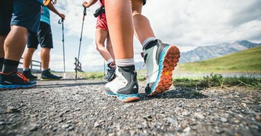
Sturdy, ankle-high footwear
Walking sticks
Headgear
Sun protection
Sunglasses
Rain protectin
Drinks and a snack
Necessary medication
First aid kit
Hiking map - Safety instructions
-
Self-assessment Check your physical fitness before every mountain tour and correctly assess your strength as well as that of your companions - especially those of your children! Surefootedness and a head for heights are often very important!
Planning and preparation Plan each intended mountain tour in detail beforehand. Hiking maps and guides as well as information from alpine associations and local experts such as mountain guides and mountain hut keepers can be helpful.
Equipment On the mountain, you will need appropriate equipment and clothing, especially sturdy, high shoes with good grip soles. Weather and cold protection are essential, as the weather can often change unexpectedly.
Weather forecasts Take note of the current weather conditions at: www.zamg.at
Together Follow the 10 rules for the correct handling of grazing animals and do not leave any waste in nature!
Do not kick stones Do not kick stones as this can seriously endanger other hikers. Marked places with a danger of falling rocks should be crossed as quickly as possible and with attention and caution.
Turn back in good time This is not a disgrace, but a sign of common sense. It becomes necessary when the weather changes, fog rolls in, and also when the path is too difficult or not in good condition.Emergency numbers: Alpine emergency call: 140
International emergency call: 122 - Tips
-
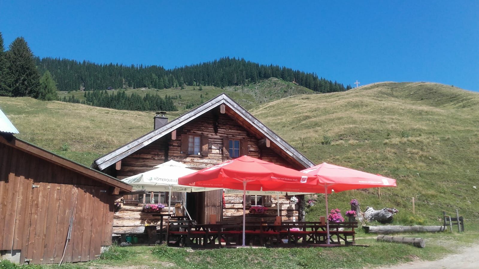
The Königsbergalm is a herbal alpine pasture, a stopover is a "MUST
- Additional information
- Directions
-
Coming from Salzburg: Take the A10 freeway to the Bischofshofen exit, then take the B311 in the direction of Bischofshofen. Follow the Hochkönig Bundesstraße/B164 to Mühlbach and further to Dienten.
Coming from Innsbruck/ Kufstein: On the Loferer Straße/B178 in the direction of St. Johann i.T., then on the Hochkönig Bundesstraße/B164 via Saalfelden and Maria Alm to Dienten or to the Filzensattel.
A valid vignette is required to use the Austrian motorway and motorway network. It is also compulsory to carry a first-aid kit, warning triangle and high-visibility waistcoat. Further information can be found under Asfinag. - Public transportation
- Parking
-
Free parking at the Ottino car park (former snack station)


- Author
-
The tour Alpine Hike in the Schwarzenbach Valley is used by outdooractive.com provided.


General info
-
Hochkönig
2024
-
Dienten am Hochkönig
536