


- Brief description
-
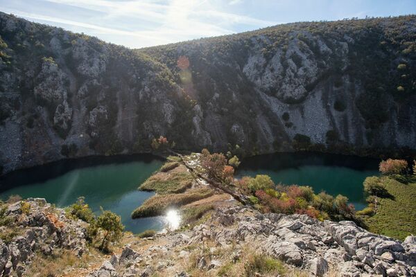
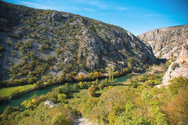
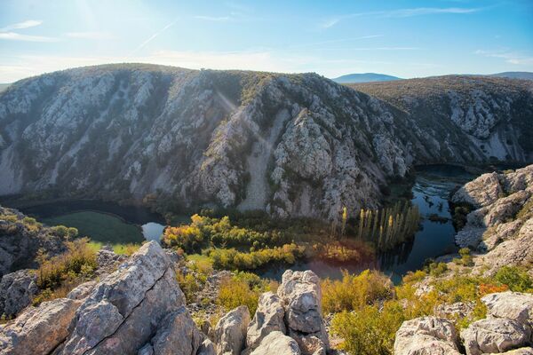
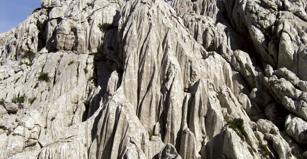
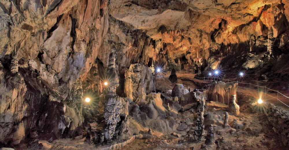
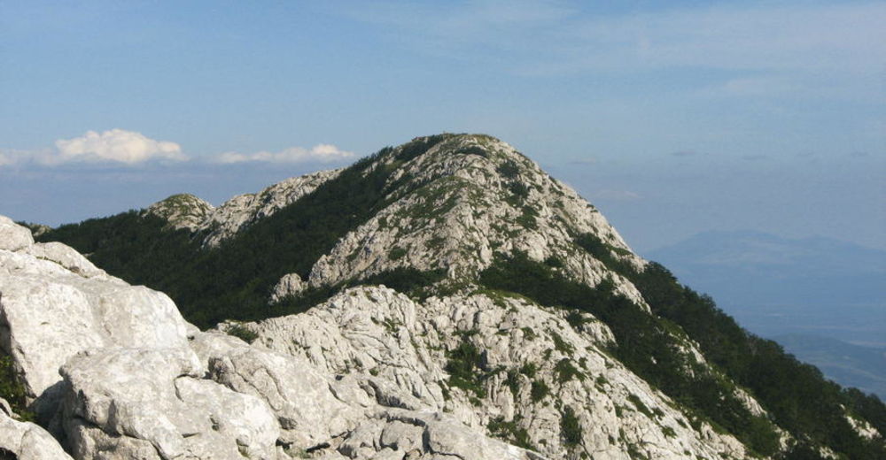
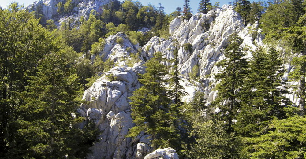
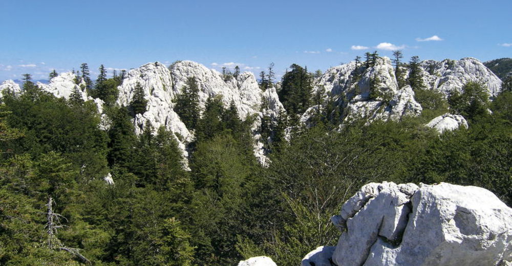
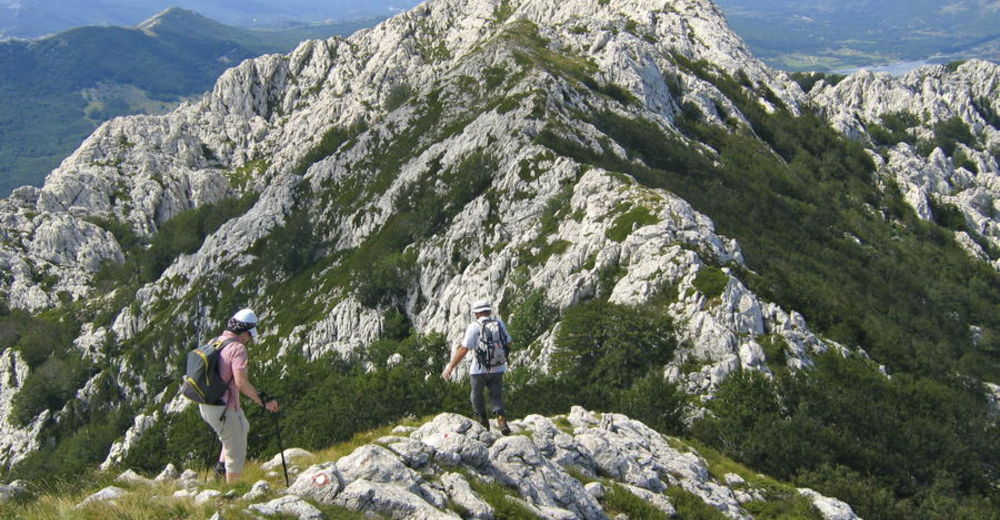
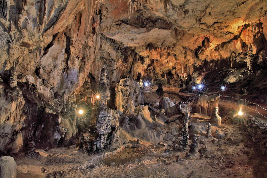
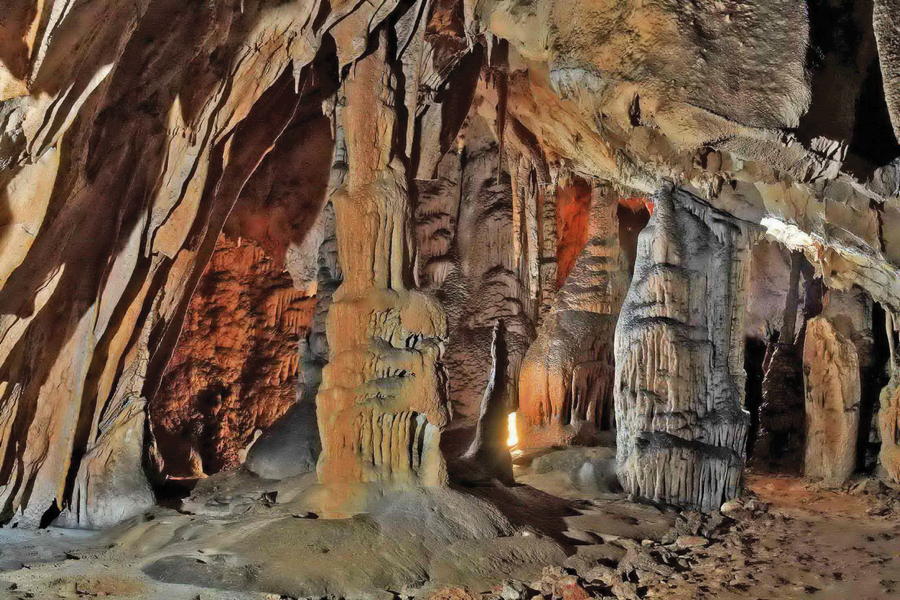
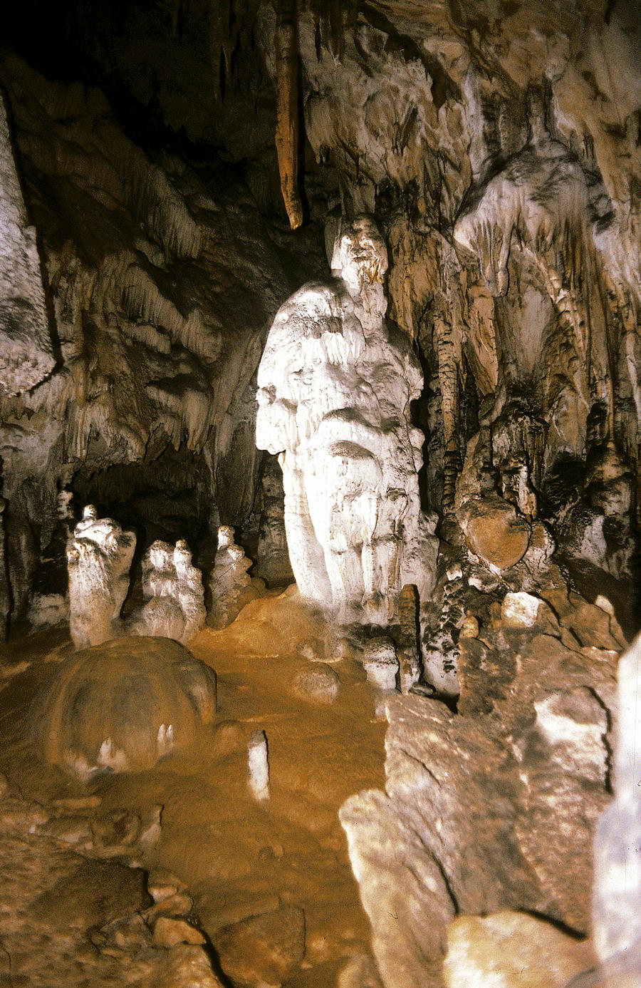
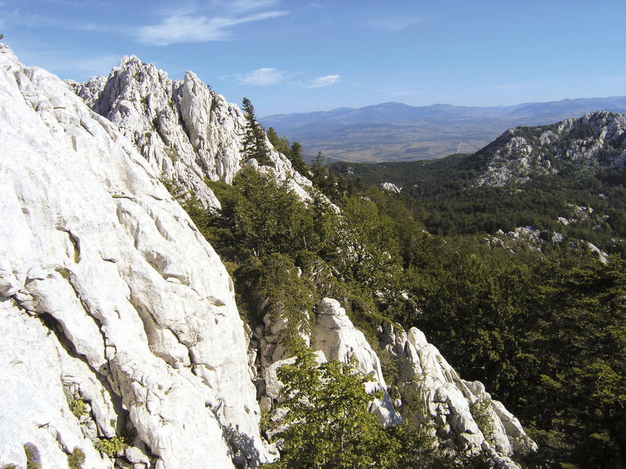
Crnopac is the southernmost section of Velebit, and also one of the mountain's most attractive parts. This terrain has very pronounced karst characteristics, and it is full of pits, deep dolines and steep cliffs – a true labyrinth of white rocky limestone peaks. This entire karst area is slightly separated from southern Velebit, thus providing wide views. The main ridge is predominantly covered in grass, spreading from northwest to southeast, marked by rocky peaks with strong karst characteristics. On the southern side of Crnopac, steep slopes tower above the canyon of Zrmanja. There are many caves and pits in the area of Crnopac. In the peak area, many pits can be seen right next to marked trails, and one can even descend to some pits along marked access paths. On the northern slopes, we come across Cerovačke Caves and the longest cave system in the area of the Dinarides: Kita Gaćešina - Draženova puhaljka cave system.
- Difficulty
-
medium
- Rating
-
- Starting point
-
Prezid
- Route
-
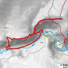
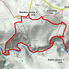
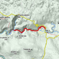
Šimlašica2.8 kmBili kuk (1,171 m)6.7 kmVeliki Bat (1,381 m)8.4 kmMali Crnopac (1,375 m)8.7 kmCrnopac (1,404 m)9.3 kmGaćeše17.1 kmĐekić-Glavica17.9 kmGraciaz19.0 kmKontići19.7 kmCrkva Uznesenja Gospodnjega20.6 kmTomić21.0 kmGrab21.5 kmRadusini23.2 kmKesići24.2 kmCerovacke Caves25.0 km
- Best season
-
JanFebMarAprMayJunJulAugSepOctNovDec
- Description
-
All marked routes in the area of Crnopac are highly demanding and they require good fitness level and skill, even though the most challenging parts are secured by wire cables, pitons and ladders. The main starting point for all the tours is the Crnopac mountain shelter. There are two marked approaches to the peak of Crnopac. The first approach begins on a branch of the road 200 meters from the tunnel, after the first bend towards Gračac. This approach leads straight to the peak (2 hours and 30 minutes of hiking), and then descends along difficult terrain to the shelter (2 to 3 hours of hiking). A much simpler access to the area of Crnopac is by using the forest road 800 meters before the tunnel, and then hiking through the forest to Crnopac mountain shelter. A demanding route to the peak is also available from the shelter (2 to 3 hours of hiking). The Little Prince Trail is a very attractive (but demanding!) trail also available in the area.
At this point, there is no suitable hiking trail that can be used to descend from the peak area of Crnopac towards Gračac and Cerovačke Caves. Therefore, the only solution is to return to the road on Prezid after a tour of Crnopac, and then take that road to descend to Gračac for supplies and accommodation.
- Highest point
- 1,368 m
- Endpoint
-
Cerovačke špilje
- Height profile
-
 © outdooractive.com


-

-
AuthorThe tour Via Dinarica HR-W-19 Crnopac is used by outdooractive.com provided.


-
Gračac
11