

- Brief description
-
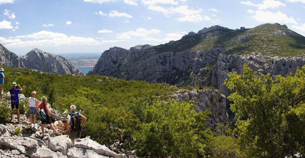
The trail leads along the canyon of Velika Paklenica, touring all localities that are interesting to climbers and ending at the mountain lodge.
- Difficulty
-
easy
- Rating
-
- Route
-
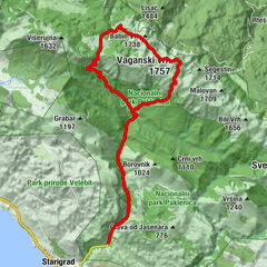
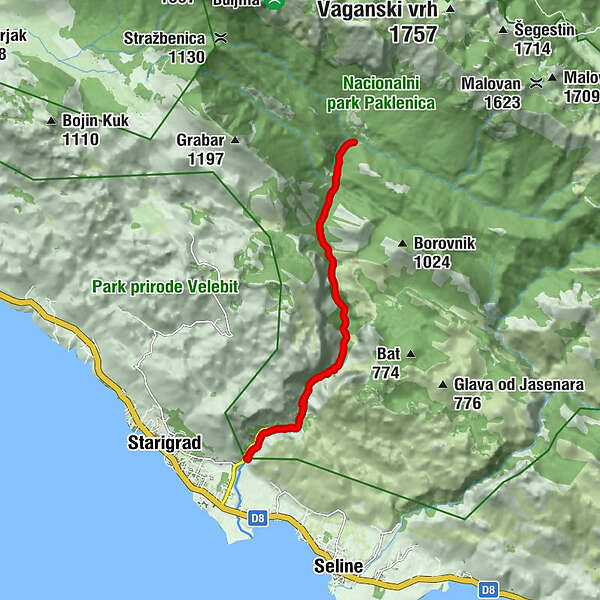
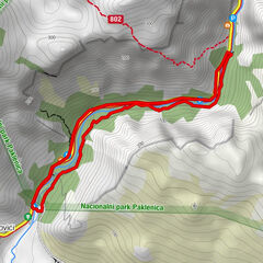
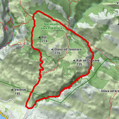
Klanci2.4 kmCrljena greda2.8 kmKatići5.1 kmLugarnica Foresters house6.2 kmPlaninarski dom Paklenica7.7 kmStrmac8.4 kmLugarnica Foresters house9.4 kmKatići10.4 kmCrljena greda12.8 kmKlanci13.2 km
- Best season
-
JanFebMarAprMayJunJulAugSepOctNovDec
- Description
-
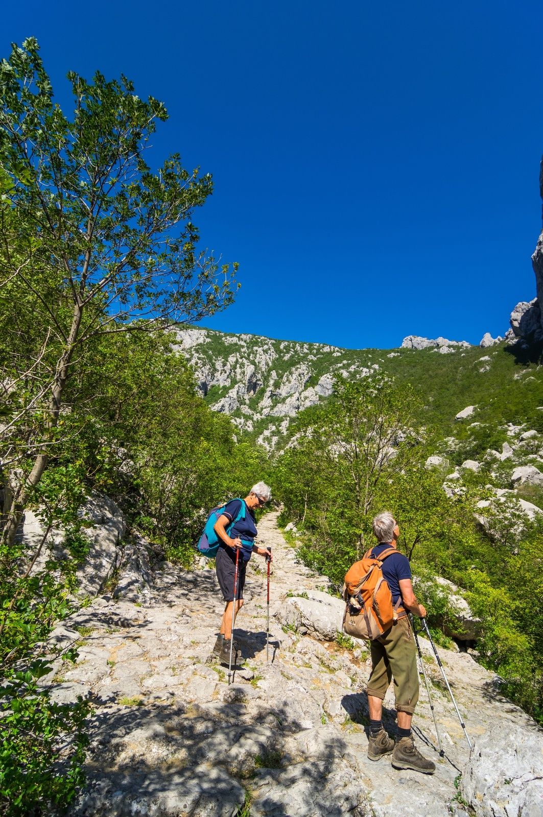
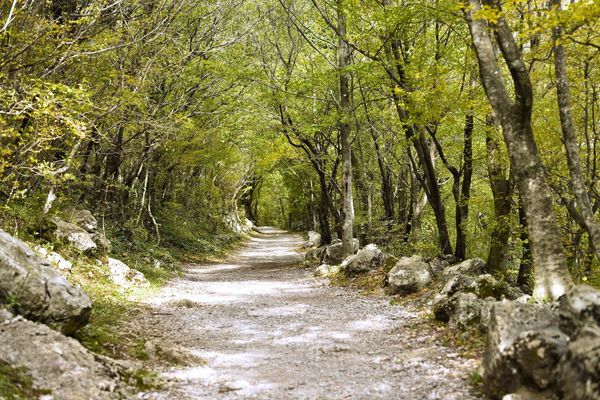
The Velika Paklenica canyon winds through the slopes of Velebit, making way for a stream of fresh mountain water until it pours right into the sea. Walking path is built along the stream taking visitors deep into the mountain. It's a joyous and educational walk. The canyon is mostly 500 to 800 meters wide, but at places only 10-50 meters with vertical rock faces rising on both sides. This is where canyon really takes your breath away, this is climber’s paradise. Visitors tour around the climber’s paradise starts at the park entrance. Educational 5143, beautifully arranged to follow the stream, serves as an introduction to the canyon. As you progress up the stream you soon reach the narrowest part of the canyon - a sport climbing area supported with national park infrastructure like a museum of climbing, caffe-bar and a souvenir shop. The stone stairway takes you up the steepest part of the canyon, but once you reach its end, hike again transforms into zero-stress walk trough the extraordinaire. But, remember - you are at the canyon, its valley is an easy walk, if you turn from the main path, be it on the right be it on the left, you are about to take the steep climb. If you are not shaped for a serious mountaineering you just keep the direction to the mountain lodge and harmlessly return the same way.
- Highest point
- 487 m
- Height profile
-
 © outdooractive.com
 - Safety instructions
-
-
- Tips
-
The path is groomed, alternating between a rocky surface and a well-trodden earthen path of very high quality. Just before the lodge, there is a segment of roughly piled rocks which is 200-300 metres in length.


- Author
-
The tour NP Paklenica / V. Paklenica - Planinarski dom is used by outdooractive.com provided.


")