
- Brief description
-
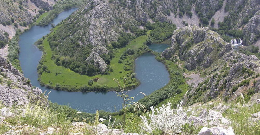
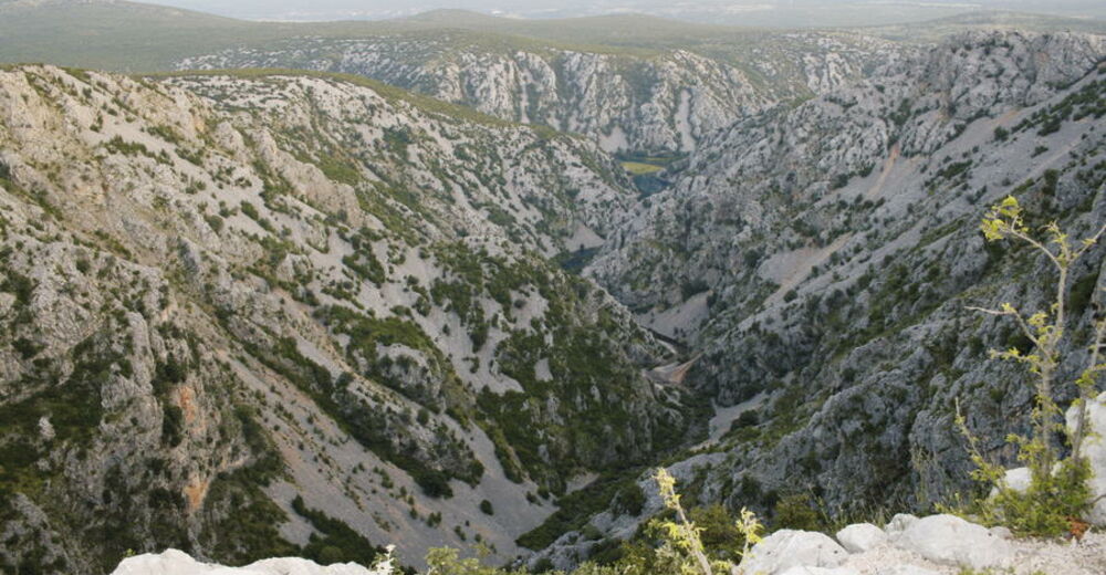
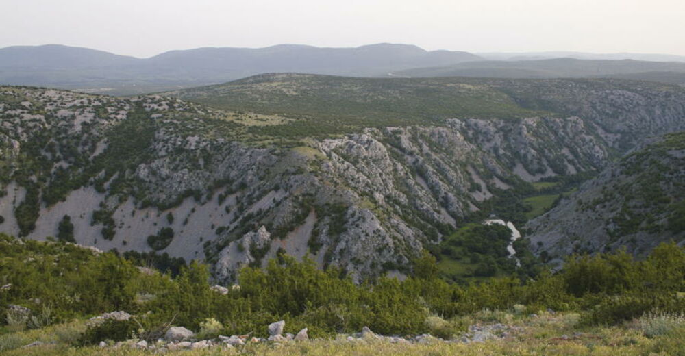
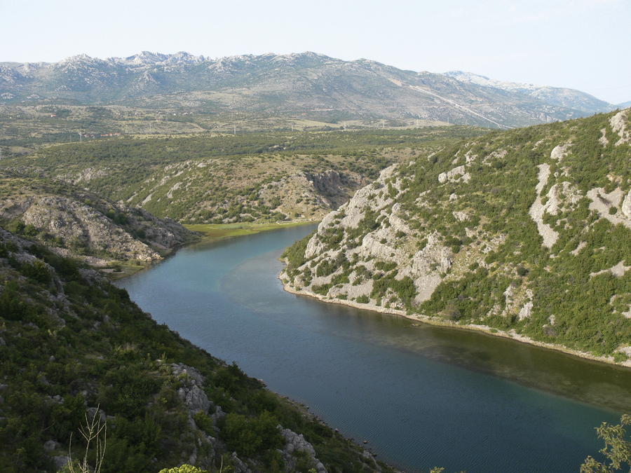
The Zrmanja River is a karst river with changing course, representing southern boundary of the mountain of Velebit. The force of the Zrmanja River and its tributaries has been making its way through the terrain towards the sea for thousands of years, creating one of the most impressive canyons in Croatia. The canyon is marked by numerous single and serial cascades, tufa barriers, endless talus and gravel deposits. Canyon rocks are up to 300 meters high in some areas. The canyon also served as scenery for a number of scenes in the movie series dedicated to the Native American hero Winnetou.
- Difficulty
-
medium
- Rating
-
- Starting point
-
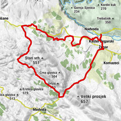
Kanjon Zrmanje
- Route
-
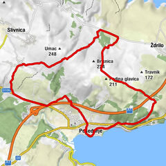
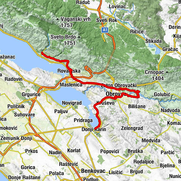
Škiljići0.9 kmJurline1.5 kmJukići3.2 kmKneževići4.5 kmBučići7.1 kmStanići7.4 kmModrič9.5 kmKapelica Gospe Velebitske9.7 kmVrilo Velebit9.7 kmVrulja Modrič9.8 kmRovanjska12.0 kmGiasenizze15.9 kmBurilovac Gornji16.6 kmNaderina20.3 kmZaton Obrovački25.1 kmAnita25.3 kmBravarica26.0 kmMilanci27.7 kmParavinje32.3 kmObrovazzo40.1 kmBrkići45.9 kmDonje Polje46.3 kmPodorljak49.5 kmŠušnjar II50.5 kmŠušnjar I50.9 kmVrkića Stan51.1 kmCicingaj51.3 kmVrulje52.0 kmPizzeria Pizzicato52.4 kmGornji Karin52.9 kmDonji Karin54.3 km
- Best season
-
JanFebMarAprMayJunJulAugSepOctNovDec
- Description
-
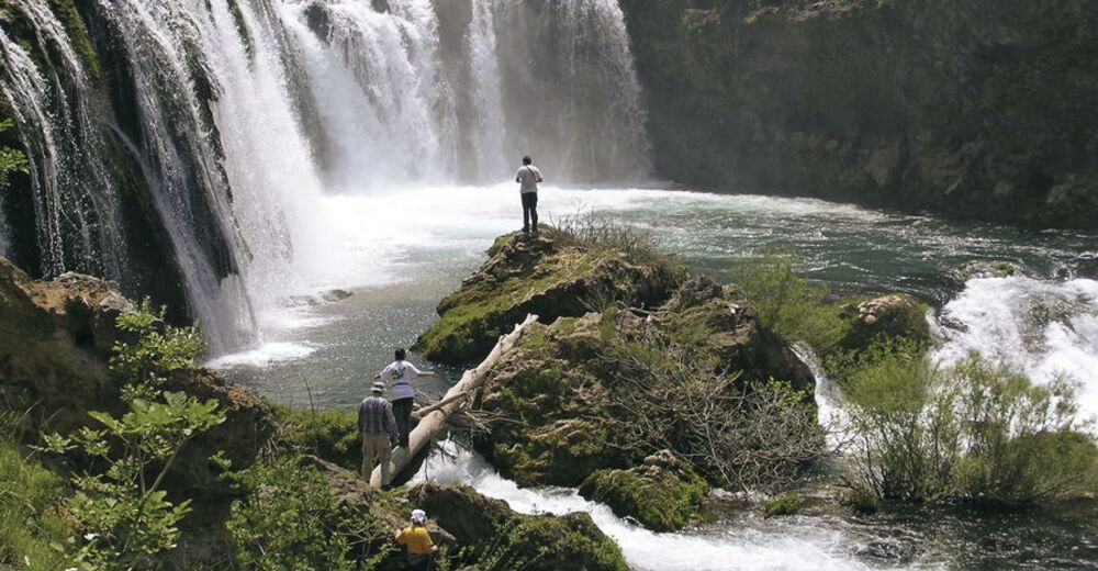
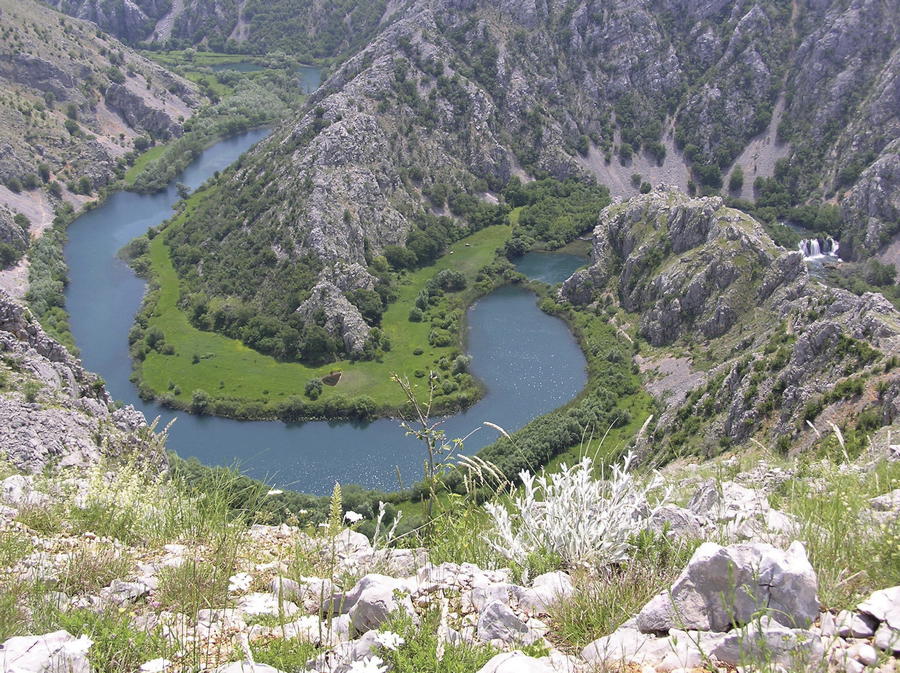
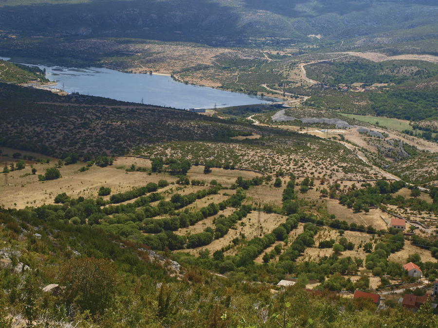
From its source below the mountain of Poštak to its confluence with the Adriatic Sea, the Zrmanja River passes 69 kilometers. It flows through Mokro polje (where it runs dry during summer), continuing through Ervenik, Žegarsko polje and Bilišane to Obrovac, finally entering the sea in the bay of Novigradsko more. The largest cascade along the river is Visoki buk, 11 meters high. On the site of Panin kuk, where the Zrmanja River receives its largest tributary the Krupa River from the right, there are remains of an ancient fortress.
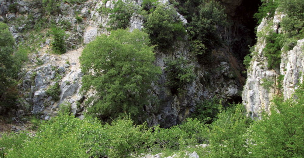
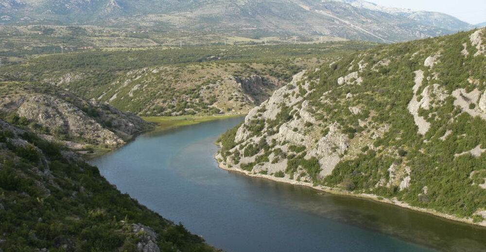
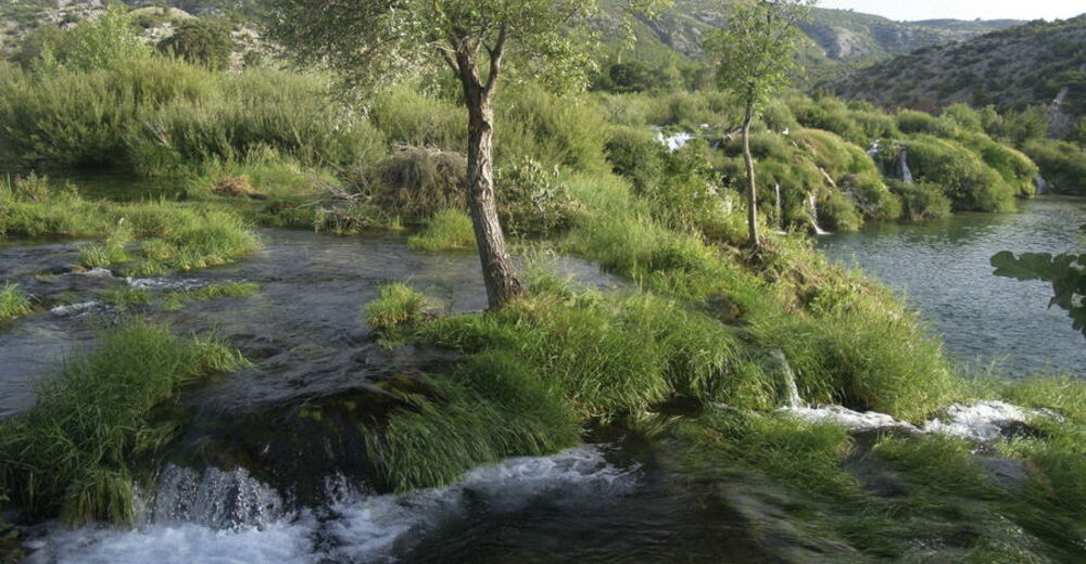
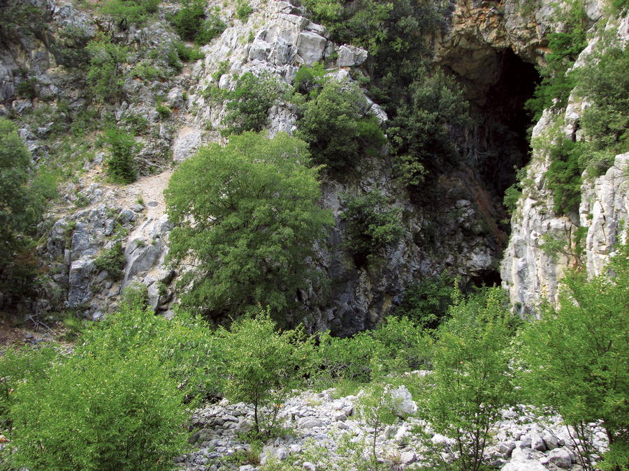
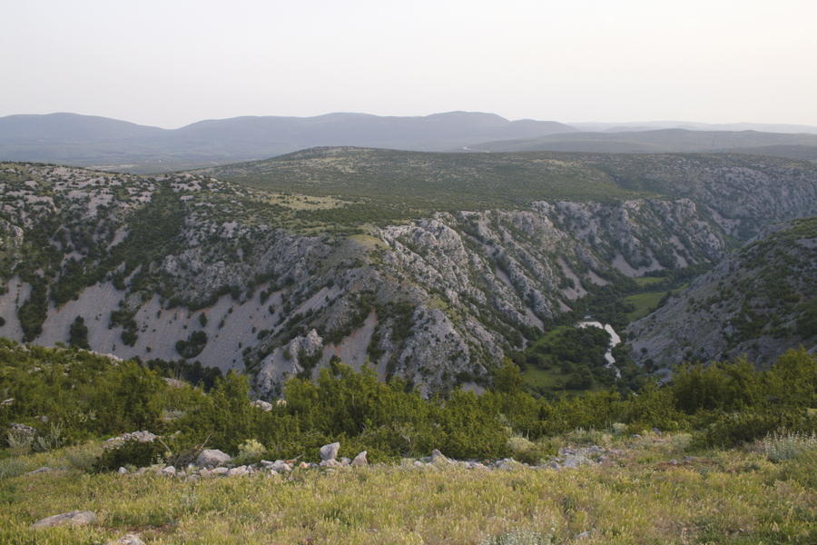
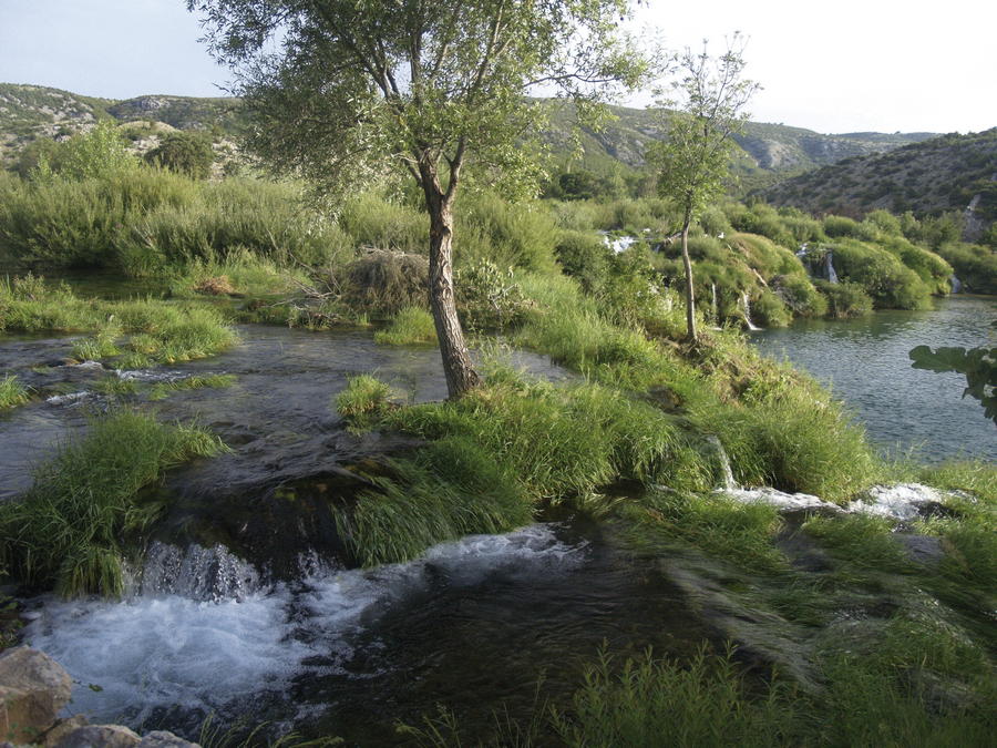
The Krupa River offers a unique experience of a fast mountain river that covers the elevation difference of over 110 meters in a series of cascades along 10 kilometers of its course. The Krnjeza River is a particularly picturesque tributary, rising out of an enormous cave and merging with the Krupa River after a short course. The Krnjeza River is one of the shortest and most beautiful rivers in Croatia, only 600 meters long.
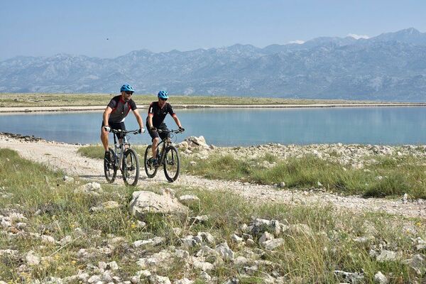
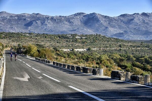
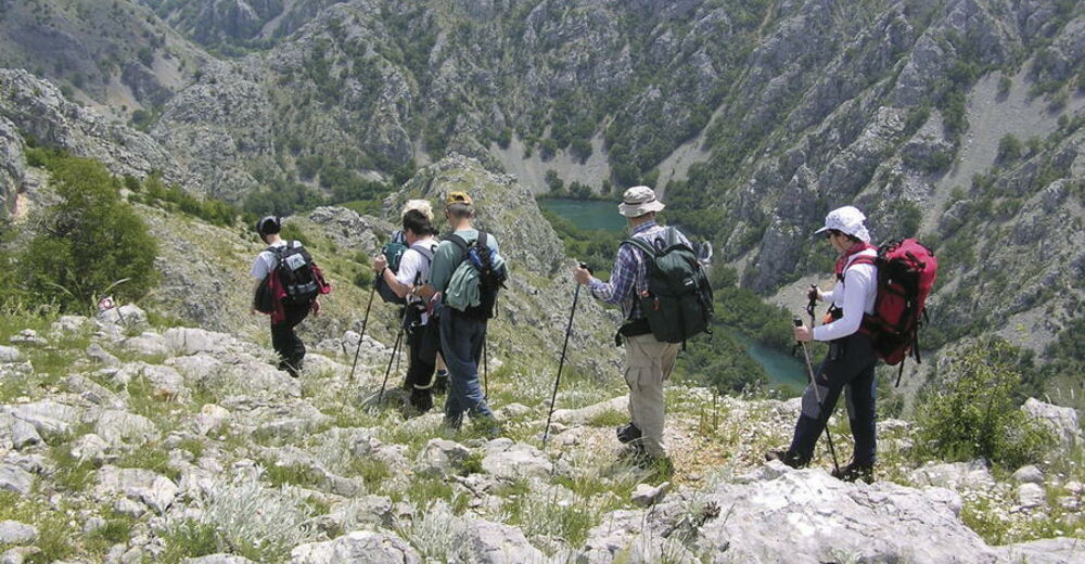
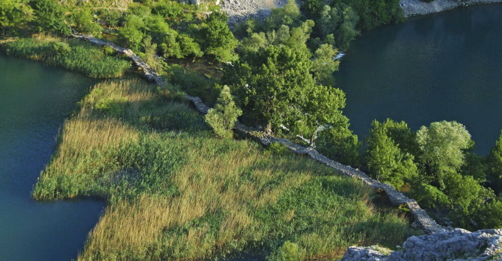
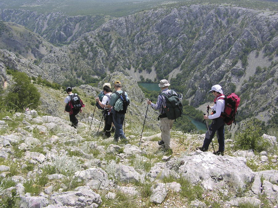
The most attractive part of this section of the route is a marked hiking trail descending from the village of Ravni Golubić on the Obrovac – Gračac road across the ridge called Vratolom to the confluence of the rivers Krupa and Zrmanja. Curious visitors can try to conquer the eastern bank of the Krnjeza River to the cave at its source. The trail leading along the bank is neither maintained nor marked, and it requires a certain level of rock climbing skill, so it is not recommended to inexperienced or unequipped hikers. One remarkably picturesque site on the Zrmanja River is Kudin most (Kude's Bridge) – built only of dry stone, without any adhesive. In touring the Zrmanja River, one should bear in mind that some sections of the route can get extremely hot during summer, since there is no shade.
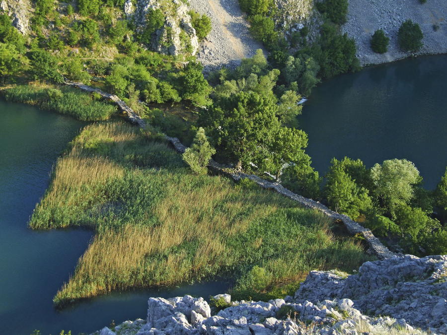
A tour of this area can be further enriched by visiting the Krupa monastery, located near the source of the Krupa River, and built in 1317. On the confluence of the rivers Krnjeza and Krupa, one can cross to the other bank of the river by walking from stone to stone, and then continue by taking the trail that leads along that river bank to the Krupa monastery. It takes slightly over one hour of upstream hiking to get to the monastery, which also has a museum for visitors, with a large collection of icons, books and other valuables.
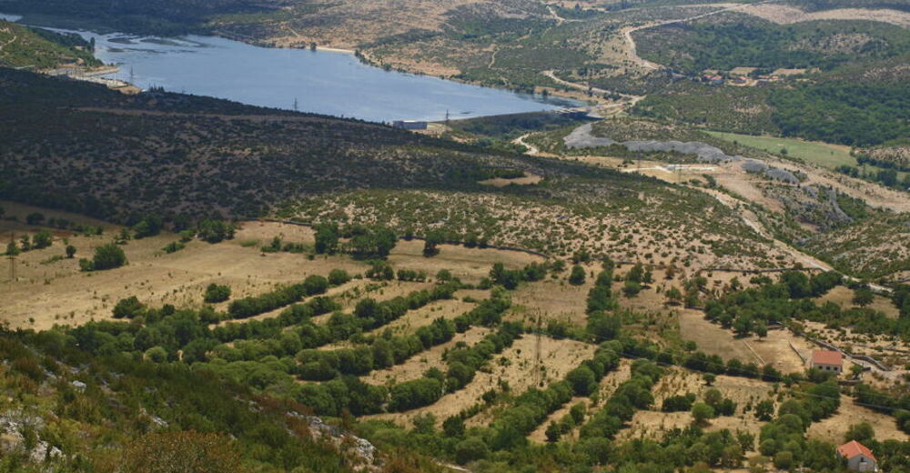
In the area of Bukovica, between Gornji Karin and Donji Karin, approximately ten kilometers away from Benkovac, there is an interesting canyon of the small river called Karišnica. The river springs from the elevation of 20 meters above sea level, and flows into the bay of Karinsko more after only 2400 meters of its course, forming a wetland with brackish water in the area called Tuvina that serves as an important resting and feeding area for many birds. The beauty of the Karišnica River can be explored by touring an educational trail in good condition. The nearby small river called Bijela, similar in its characteristics to the Karišnica River, adds to the beauty of the natural ambiance along the shores of Karinsko more. In the upper section of the Bijela River, from its source to the bridge below the village of Dupori, the river flows through a deep canyon with a series of cascades and steep slopes along the banks.
- Highest point
- 240 m
- Endpoint
-
Karašnica i Bijela
- Height profile
-
 © outdooractive.com


-

-
AuthorThe tour Via Dinarica HR-B-10 Rivers Zrmanja, Krupa and Krnjeza is used by outdooractive.com provided.


-
Obrovac
4