
- Difficulty
-
difficult
- Rating
-
- Starting point
-
Rovanjska
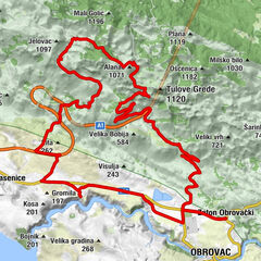
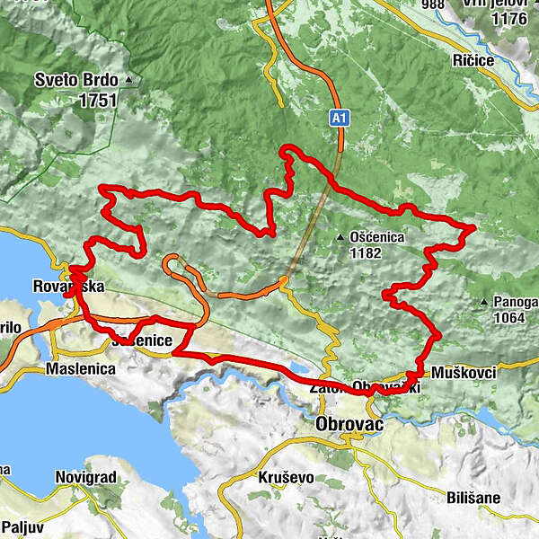
- Route
-
Bartol0.3 kmRovanjska0.4 kmGostionica Rovanjska0.4 kmLibinjska kosa (900 m)13.7 kmGornja bukva17.9 kmBaričevići20.1 kmKraljičina vrata (972 m)21.5 kmCrveni potoci29.7 kmPloča47.3 kmPećica48.5 kmMilanci50.3 kmBravarica52.2 kmAnita52.7 kmZaton Obrovački52.7 kmNaderina56.8 kmRovanjska69.8 kmBartol69.9 km
- Best season
-
JanFebMarAprMayJunJulAugSepOctNovDec
- Description
-
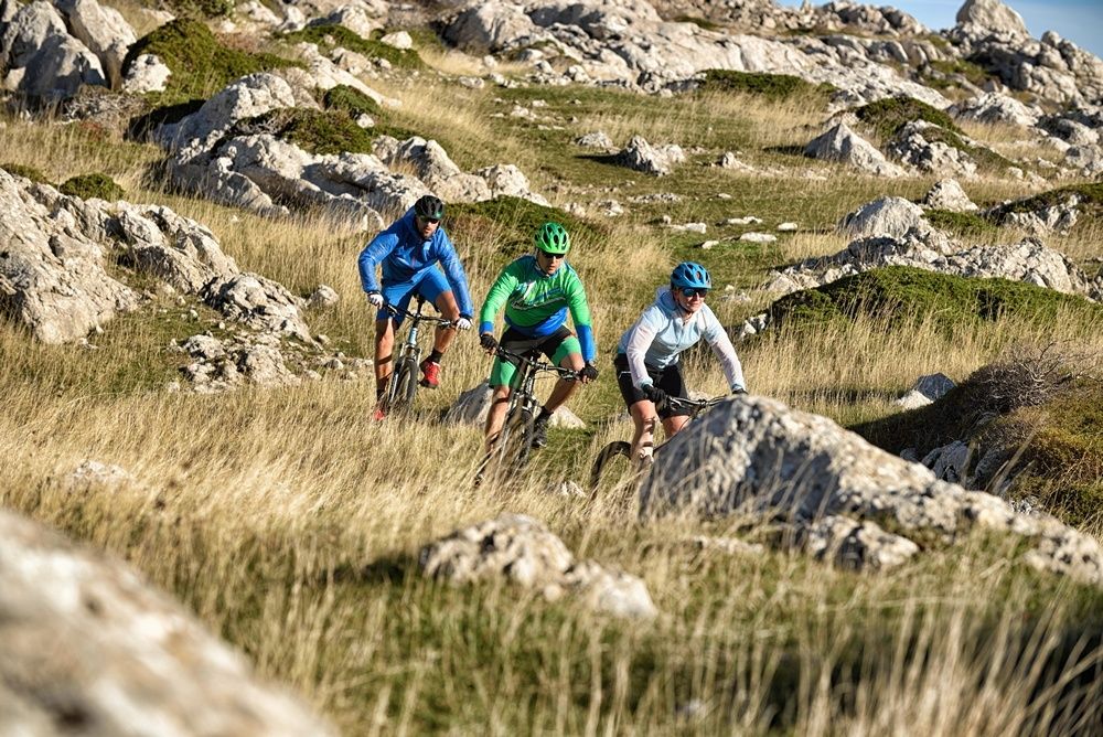
Right upon the start from Rovanjska a long and demanding ascent awaits you, by which you will come to the high rocky and rugged phenomena which will hover over you like guards – especially the tower-like rocky cliffs Tulove grede. The rugged Mediterranean landscape will be replaced by the mountains which will refresh you and lower the air temperature very quickly as well. On 33rd km you can re-fresh yourself with drinkable water before you start riding downhill towards the Zrmanja River canyon, which in some of its parts is very demanding. During your last 20 km you will enjoy in collecting impressions of blue-green Zrmanja River and views of the Zadar Archipelago.
- Highest point
- 1,048 m
- Endpoint
-
Rovanjska
- Height profile
-
 © outdooractive.com
 - Safety instructions
-
WARNING! Pay attention to signs and markings indicating the possibility of left-over mines. Do not leave the marked road or route.
- Tips
-
The riding on this demanding route, intended for recreational MTB riders in a physically and technically better condition, will offer a true experience of the Velebit Mountain Range.
- Author
-
The tour Velebit 2 is used by outdooractive.com provided.


General info
-
Obrovac
12