- Brief description
-
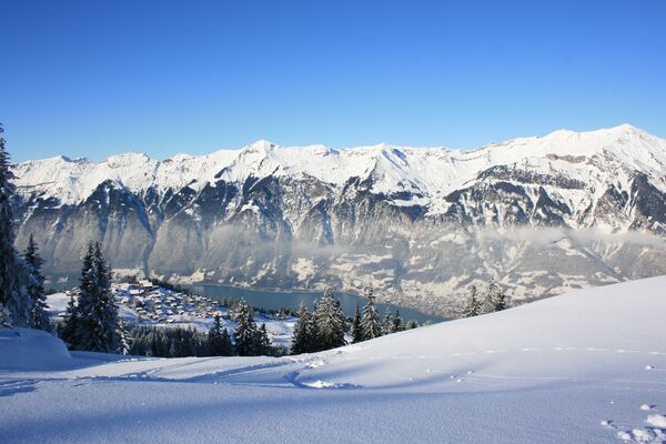
Tour from Mürren up to the Schiltgrat with breathtaking views of the Jungfrau massif.
- Difficulty
-
medium
- Rating
-
- Starting point
-
Mürren, Schilthornbahn (1650 m ü. M.)
- Route
-
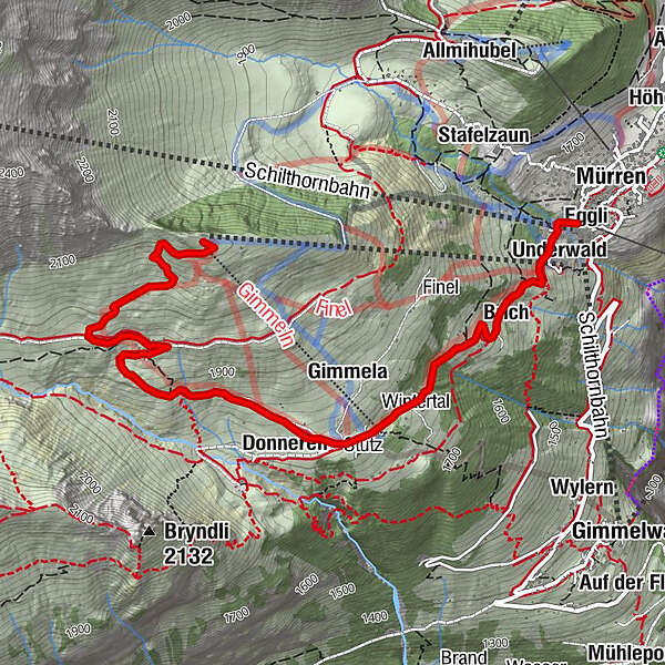
Auf den BalmenBeim SchulhausBachstutzAuf dem BühlMürren (1,650 m)EggliBrunnen0.0 kmHinter der Egg0.1 kmUnderwald0.2 kmBrich0.5 kmGimmeln1.4 kmDonneren1.6 kmGimmelenweid1.7 kmSchiltgrathüsi4.0 km
- Best season
-
AugSepOctNovDecJanFebMarAprMayJunJul
- Description
-
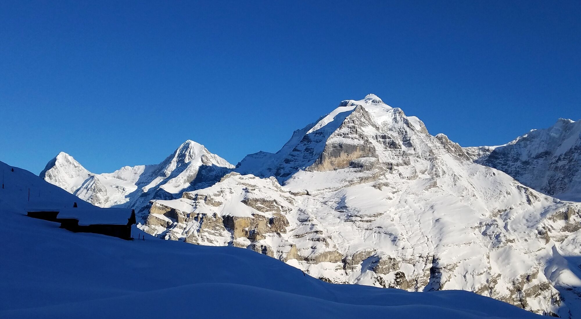
This medium-difficulty winter hiking trail starts at the station of the Schilthorn Cableway in the idyllic alpine village of Mürren. It gently ascends through the snow-covered forest to Gimmeln. The path winds past traditional wooden chalets towards the Schiltgrat. During the last break before plunging into the short but difficult final stretch to the destination of the Schiltgrat, revel in the magic of the mountain panorama with the Eiger, Mönch and Jungfrau one last time.
The trail follows the Apollo sledging run. The Schiltgrat chairlift can be used for the ascent to the Schiltgrat, which takes hikers from Mürren (Schilthorn Cableway) to the Schiltgrat. The descent from the Schiltgrat to Mürren is then done on foot.
The ride on the Schiltgrat chairlift is only possible uphill. - Directions
-
Mürren - Gimmeln - Schiltalp - Schiltgrat
- Highest point
- 2,112 m
- Endpoint
-
Schiltgrat (2127 m ü. M.)
- Height profile
-
 © outdooractive.com
 - Equipment
-
The sun’s rays are more intense in the mountains. Don’t forget to bring sunscreen with a high protection factor, a hat and sunglasses with UV protection.
We recommend bringing warm clothing and rain gear even in summer and in good weather in winter. We recommend layering your clothing.
Charged mobile phone
First-aid kit
Winter shoes with non-slip sole
Drinks and snacks
If available: hiking sticks - Safety instructions
-
After a snowfall, the ground can be softer and more difficult to walk on.
- Tips
-
The reward at the top for the physically demanding ascent is a typical «Schneeflöckli» (hot egg liqueur with cream) in the Schiltgrathüsi...
- Additional information
- Directions
-
Car: There are different ways to reach the region by car. The fastest way from Basel and Geneva is via Berne. The fastest route from Zurich is through Lucerne and the Brünig Pass. The pass is open in summer and winter.
From the south, the route goes over the Grimsel or Susten Pass into the region. Both passes are only open in summer. Alternatively, you can take the Simplon Pass and then Lötschberg car transport.
- Public transportation
-
Thanks to its central location in Europe, Switzerland is served by international trains from over 12 countries. Within Switzerland, Intercity trains run directly from Basel and Lucerne to the Jungfrau Region. Travellers from Zurich have to change in Berne. The trains run every half hour.
The cable car brings guests to the Grütschalp. From here you continue by train to Mürren BLM.
Alternatively, the aerial cableway Stechelberg - Gimmelwald- Mürren to choose from.
- Parking
- Author
-
The tour Mürren - Gimmeln - Schiltgrat is used by outdooractive.com provided.
General info
-
Oberwallis
303
-
Jungfrau Region
104
-
Mürren - Schilthorn
40