


- Brief description
-
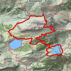
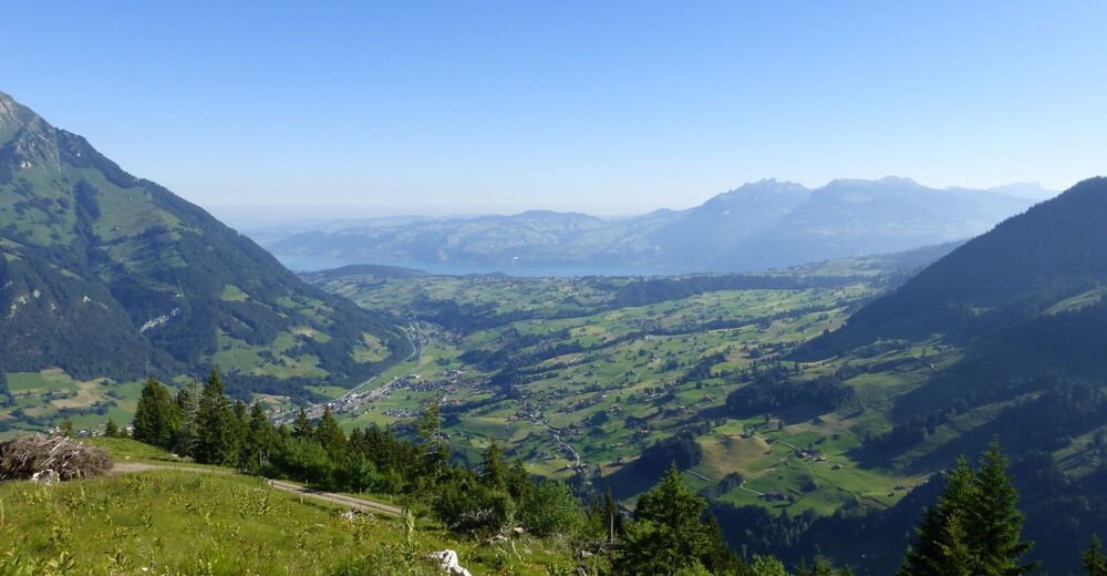
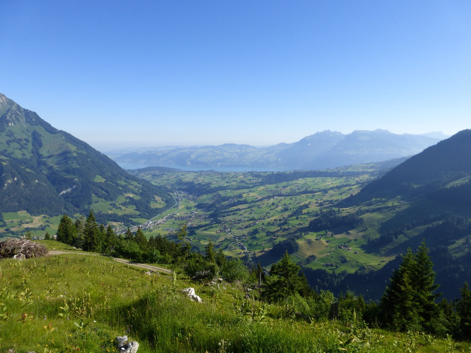
Pre-Alpine high-level trail from Kandersteg into the Kiental. The trail leads high above the Kandertal valley through forests and across alpine meadows; magnificent views down to the trains of the Lötschberg railway which run through the Kandertal valley.
- Difficulty
-
difficult
- Rating
-
- Starting point
-
Kandersteg
- Route
-
Kandersteg (1,176 m)0.0 kmKandersteg (1,174 m)0.3 kmSaregrabe2.5 kmUf der Flue4.2 kmHemlige4.7 kmFeeschflue5.9 kmÄbeli8.2 kmSchlafegg (1,456 m)9.8 kmFurggi14.3 kmBachwald15.1 kmRamslauenen16.7 kmBerghaus Ramslauenen16.9 kmEgg17.6 kmLoosmaad18.2 kmKiental (958 m)19.4 km
- Best season
-
JanFebMarAprMayJunJulAugSepOctNovDec
- Description
-
The route is signposted after Kandersteg railway station. It first heads along the river Kander and at the far end of the village parallel to the road it continues on the eastern slopes of Kandertal via Schlafegg, under the Gehrihorn as far as Kiental.Shortcut: take the chairlift from Ramslauenen to Kiental (altitude approx. 450 metres).
There are plenty of places to stop on the way after Blausee-Mitholz bus stations as well as Frutigen and Reichenbach rail stations.
- Directions
-
Kandersteg - Schlafegg - Kiental
- Highest point
- 1,639 m
- Endpoint
-
Kiental
- Height profile
-
 © outdooractive.com
 - Equipment
-
No need for heavy shoes here: this hike is well marked and secured in yellow or red and white.
- Safety instructions
-
Open hiking trails may also still be partially covered with snow. Hiking is at your own risk: Tourism Adelboden-Lenk-Kandersteg accepts no liability whatsoever when using local routes.
- Tips
-
One image, one clip, one comment – excursions to the Bernese Oberland also leave footprints on our social media channels. Active lovers of the great outdoors are sharing more and more alpine impressions on Instagram and Facebook
- Directions
- Public transportation
- Parking

-

-
AuthorThe tour Lötschberg Panorama Trail is used by outdooractive.com provided.


General info
-
Oberwallis
1872
-
Ferienregion Kandertal
1104
-
Kiental
266