
- Brief description
-
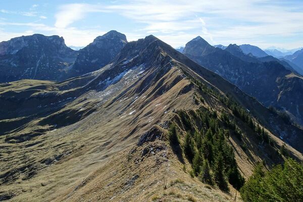
This circular trail goes around the Hornfluh and has a beautiful view.
- Difficulty
-
easy
- Rating
-
- Starting point
-
Schönried, Horneggli
- Route
-
Berghotel Hornberg1.6 kmHotel Hornfluh1.6 kmHornberg1.8 kmBerghaus Horneggli2.7 kmHorneggli (1,773 m)2.7 km
- Best season
-
JanFebMarAprMayJunJulAugSepOctNovDec
- Description
-
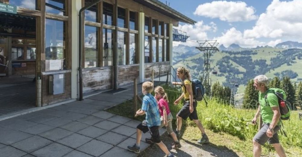
A chairlift brings us from Schönried to the starting point Horneggli. The chairlift runs up from the little village of Schönried – it leaves five minutes from the railway station, so is ideal for travellers arriving by rail.
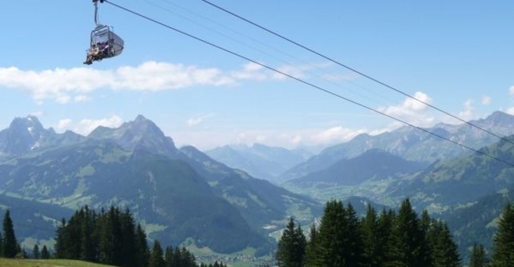
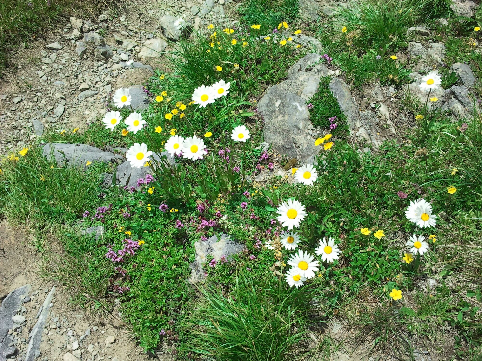
Two sections of this circular route take you around the Hornfluh. A third, steep section is located on the way up to Hornfluh. Apart from the third part the path segments are easily to walk. Best season is from late June to mid-September.On this hike you find as well the flower trail (Blumenweg). It gives an impression of what can bloom at the altitude of 1,800 meters. The ones which are less interested in the variety of flowers enjoy the beautiful views over the green Saanen landscape and beyond. In the north the Gastlosen and to the south the glacier mountains Wildstrubel and Wildhorn can be seen.
Please take note of the operating dates for the chairlift Horneggli. - Directions
-
Horneggli - Mountain Hotels Hornberg - Horneggli
- Highest point
- 1,865 m
- Endpoint
-
Schönried, Horneggli
- Height profile
-
 © outdooractive.com
 - Equipment
-
Good footwear, snacks to savor during a break - why not a Fondue-Backpack?
- Tips
-
Coffee break or “Zvieriplatte” at the Hornberg.
- Additional information
- Directions
-
The Destination Gstaad is located in the south-west of Switzerland right on the border to the French-speaking part of the country. The Destination is easily accessed by rail or car from the regions around Lake Thun and Lake Geneva and the Gruyere region Direct connections to the European high-speed rail network and all international airports in Switzerland guarantee a time-saving and pleasant journey.
- Public transportation
-
Schönried Trainstation
- Parking
-
Parking at the chairlift Horneggli.


-

-
AuthorThe tour Horneggli - Hornberg - Horneggli (Botanical path) is used by outdooractive.com provided.


General info
-
Thyon les Collons
1426
-
Destination Gstaad
729
-
Saanenmöser
187