


- Brief description
-
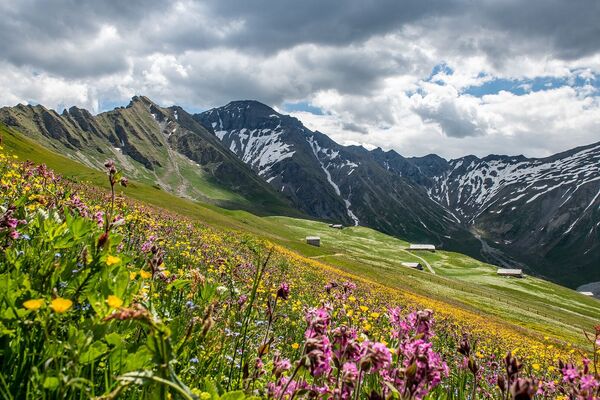
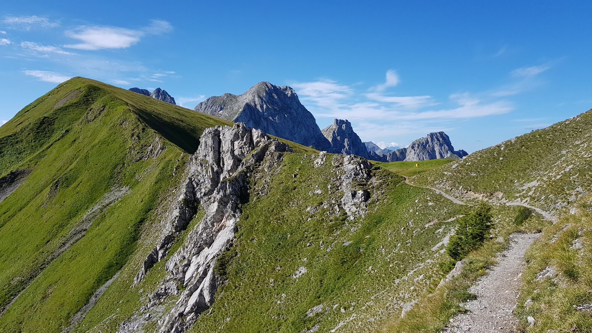
During this hike you are sure to be impressed by the Gstaad Dolomites around the limestone pillars of "le Rubli".
- Difficulty
-
medium
- Rating
-
- Starting point
-
Gondola La Videmanette
- Route
-
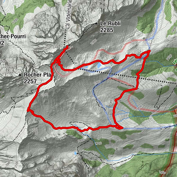
La Videmanette (2,155 m)0.0 kmCabane de la Videmanette0.2 kmCabane de la Videmanette6.4 kmLa Videmanette (2,155 m)6.5 km
- Best season
-
JanFebMarAprMayJunJulAugSepOctNovDec
- Description
-
At Rougemont, take the gondola lift to La Videmanette. This hike starts at the mountain station and is almost level for the first 800 metres. Good surefootedness is required in some places. You then make a steep descent towards Les Praz. After a further 2.5 km over the rather flat terrain with views of Saanenland there is a consistent climb of 350 height metres back to the La Videmanette mountain station. After your walk, enjoy a tasty treat at the La Videmanette mountain restaurant and take in the amazing and extensive views of the Bernese and Vaudois Alps.
Please take note of the operating dates for lifts and cable cars.
- Directions
-
Gondola La Videmanette – Les Prax – Ruble – Gondola La Videmanette
- Highest point
- 2,144 m
- Endpoint
-
Gondola La Videmanette
- Height profile
-
 © outdooractive.com
 - Equipment
-
Good footwear, snacks to savor during a break - why not a Fondue-Backpack?
- Tips
-
In summer, climbing enthusiasts have three via ferratas of different levels of difficulty to choose from at Rubli.
- Additional information
- Directions
-
The Destination Gstaad is located in the south-west of Switzerland right on the border to the French-speaking part of the country. The Destination is easily accessed by rail or car from the regions around Lake Thun and Lake Geneva and the Gruyere region Direct connections to the European high-speed rail network and all international airports in Switzerland guarantee a time-saving and pleasant journey.
- Public transportation
-
7-minute walk from Rougemont train station to the gondola La Videmanette.
- Parking
-
The parking space is at the valley station La Videmanette


-

-
AuthorThe tour La Videmanette – Les Prax – Ruble – La Videmanette is used by outdooractive.com provided.
GPS Downloads


General info
Refreshment stop
A lot of view
Other tours in the regions
-
Alpes Vaudoises
993
-
Pays-d’Enhaut Région
511
-
Rougemont
148