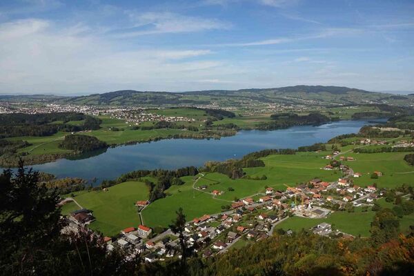
- Brief description
-
The easy high-mountain hike is breath-taking, especially because of its wonderful alpine panorama. It is ideally suited for families and senior citizens.
- Difficulty
-
easy
- Rating
-
- Starting point
-
Horneggli top station cable car
- Route
-
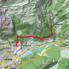
Horneggli (1,773 m)0.0 kmBerghaus Horneggli0.0 kmHornberg0.7 kmHotel Hornfluh1.1 kmBerghotel Hornberg1.1 kmAlp Parwenge3.2 kmParwengesattel (1,990 m)4.5 kmHindere Spitz (2,078 m)5.5 kmBergrestaurant Rinderberg-Spitz5.9 km
- Best season
-
JanFebMarAprMayJunJulAugSepOctNovDec
- Description
-
The 2,079m Rinderberg mountain rears up between Gstaad and Zweisimmen. In winter it’s beloved by skiers but in summer it turns into a hikers’ playground. A chairlift brings us from Schönried to the starting point Horneggli. The chairlift runs up from the little village of Schönried – it leaves five minutes from the railway station, so is ideal for travellers arriving by rail.
Once on the mountain, pick up the well-marked path towards Hornberg - Rinderberg; A rolling alpine path leads from Hornberg to Parwengen. From there the decent climbing to our summit Rinderberg starts. Its an easy uphill on a good mountain path with an incredible view of the Alps mainridge. From the Rinderberg 2,079m summit. Now it’s just a quick downhill to the Rinderberg mountain restaurant located at around 2,000m with its’ cow playground for kids. The gondola brings us back to the beautiful village Zweisimmen. Half way down there’s the option to downhill the rest of the mountain with a scooter.
- Directions
-
Horneggli - Hornberg - Parwengen - Rinderberg
- Highest point
- 2,067 m
- Endpoint
-
Rinderberg top station cable car
- Height profile
-
 © outdooractive.com
 - Equipment
-
Good footwear, snacks to savor during a break - why not a Fondue-Backpack?
- Tips
-
Coffee break at the Hornberg, “Zvieriplatte” at restaurant Rinderberg, playground at restaurant Rinderberg, scooter downhill from the middle station down to Zweisimmen.
- Additional information
- Arrival
-
The Destination Gstaad is located in the south-west of Switzerland right on the border to the French-speaking part of the country. The Destination is easily accessed by rail or car from the regions around Lake Thun and Lake Geneva and the Gruyere region Direct connections to the European high-speed rail network and all international airports in Switzerland guarantee a time-saving and pleasant journey.
- Public transportation
-
Schönried Trainstation
- Parking
-
Parking Sesselbahn Horneggli oder Gondelbahn Rinderberg


-

-
AuthorThe tour Horneggli - Hornberg - Rinderberg is used by outdooractive.com provided.


General info
-
Thyon les Collons
1431
-
Destination Gstaad
730
-
Saanenmöser
187