


- Rating
-
- Starting point
-
Interlaken Ost, Harderbahn valley station
- Route
-
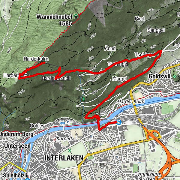
Interlaken Ost (567 m)Interlaken (568 m)0.3 kmMargel1.5 kmGoldswil2.0 kmGoldswilallmend2.0 kmÄgertli2.2 kmBaumgärtli2.2 kmWeidliboden2.2 kmTschingel2.6 kmÄbnit3.0 kmTschingel3.0 kmHardermandli3.9 kmHardermatte4.9 kmZwei-Seen-Steg5.2 kmPanorama-Restaurant Harder-Kulm5.2 kmHarderkulm5.3 km
- Description
-
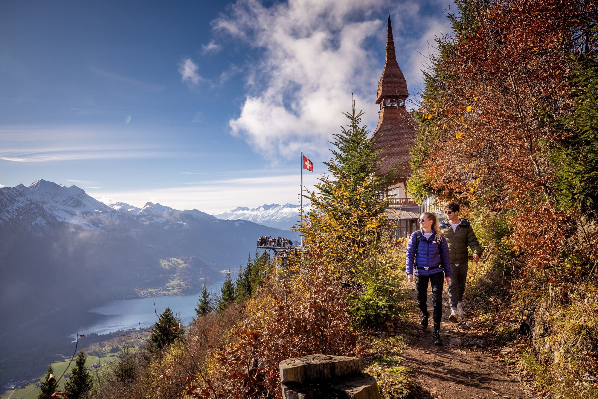
The footpath begins immediately to the left of the Harder funicular valley station. The wide path winds up to the Hohbüel pavilion at the end of the street where Felix Mendelssohn-Bartholdy once enjoyed the stunning views. From here, the hiking trail runs in the opposite direction, leisurely climbing along the slope towards Goldswil. After about 200 metres, the hiking trail crosses the Harder funicular and a little later the dirt road. On a clearing just before Goldswil, the trail then continues on a paved road to Goldswil. With the Burgseeli already in view on the right, the trail turns left away from the road into the forest and runs back in the opposite direction. Beyond the “Obere Bleiki” larch grove, the trail then follows a steep diagonal ascent, once again passing under the railway track, to a rest spot above the Hardermannli rock face. After another 20 minutes you reach the sunny terrace of the Harder Kulm restaurant where you are rewarded for your efforts by wonderful views and perhaps coffee and cake. The return to Interlaken takes eight minutes by funicular railway or about two hours on foot.
- Directions
-
Interlaken Ost - Goldswil - Bleiki - Harder Kulm
- Highest point
- 1,312 m
- Endpoint
-
Harderbahn, Bergstation
- Height profile
-
 © outdooractive.com
 - Equipment
-
Normal hiking gear, hiking boots with good soles.
- Safety instructions
-
Good hiking trail with no difficult passages.
- Additional information
-
Hiking trail 73
(in the printed summer panorama map of Jungfrau Railways)
- Directions
-
Via Bern or Lucerne to Interlaken. From the south via the Grimsel Pass (summer only) or via the Simplon Pass and then the Lötschberg car-transport train to Interlaken.
- Public transportation
-
Via Bern or Lucerne to Interlaken Ost.
- Parking
-
Uncovered car park right next to Interlaken Ost railway station.
- Author
-
The tour Interlaken - Goldswil - Bleiki - Harder Kulm is used by outdooractive.com provided.
General info
-
Aletsch Arena
1471
-
Interlaken
1098
-
Interlaken - Matten - Unterseen
460


