«Flower Trail» First - Bachalpsee - Waldspitz - Bort No. 4


- Brief description
-
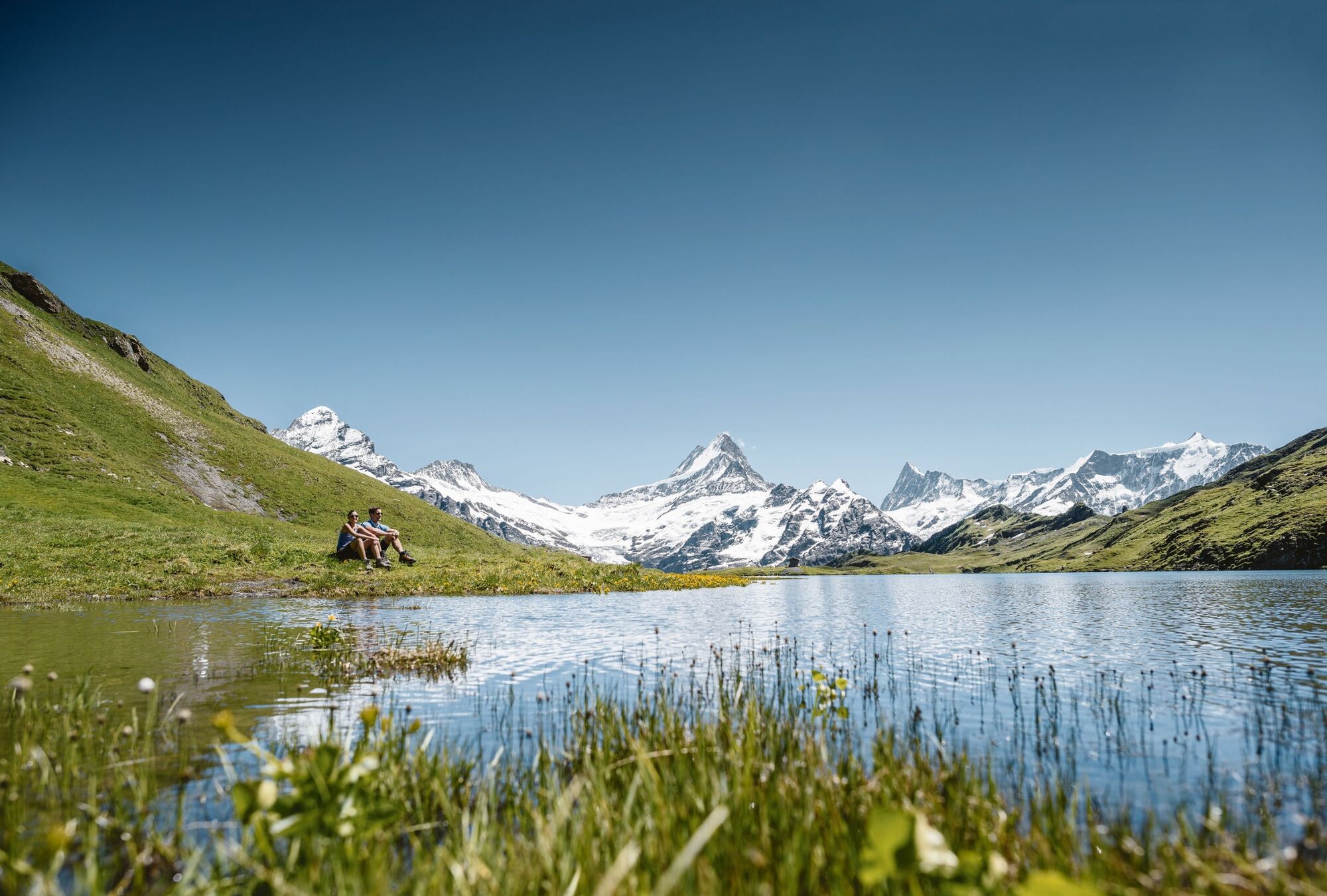
Hiking with unique views of the Schreckhorn and Finsteraarhorn
- Difficulty
-
medium
- Rating
-
- Starting point
-
First, summit station
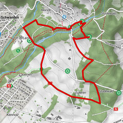
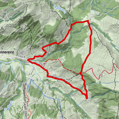
- Route
-
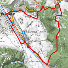
FirstBachlägerwasserfall5.8 kmBerggasthaus Waldspitz6.5 kmBort (1,564 m)8.0 kmChuestall8.1 km
- Best season
-
JanFebMarAprMayJunJulAugSepOctNovDec
- Description
-
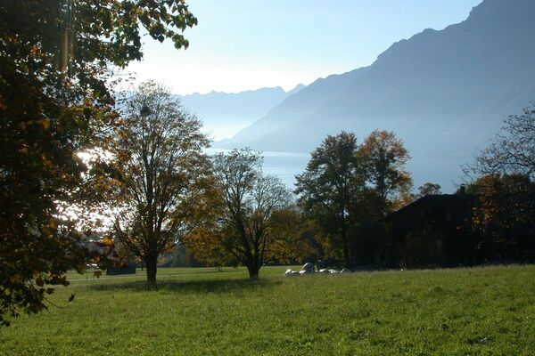
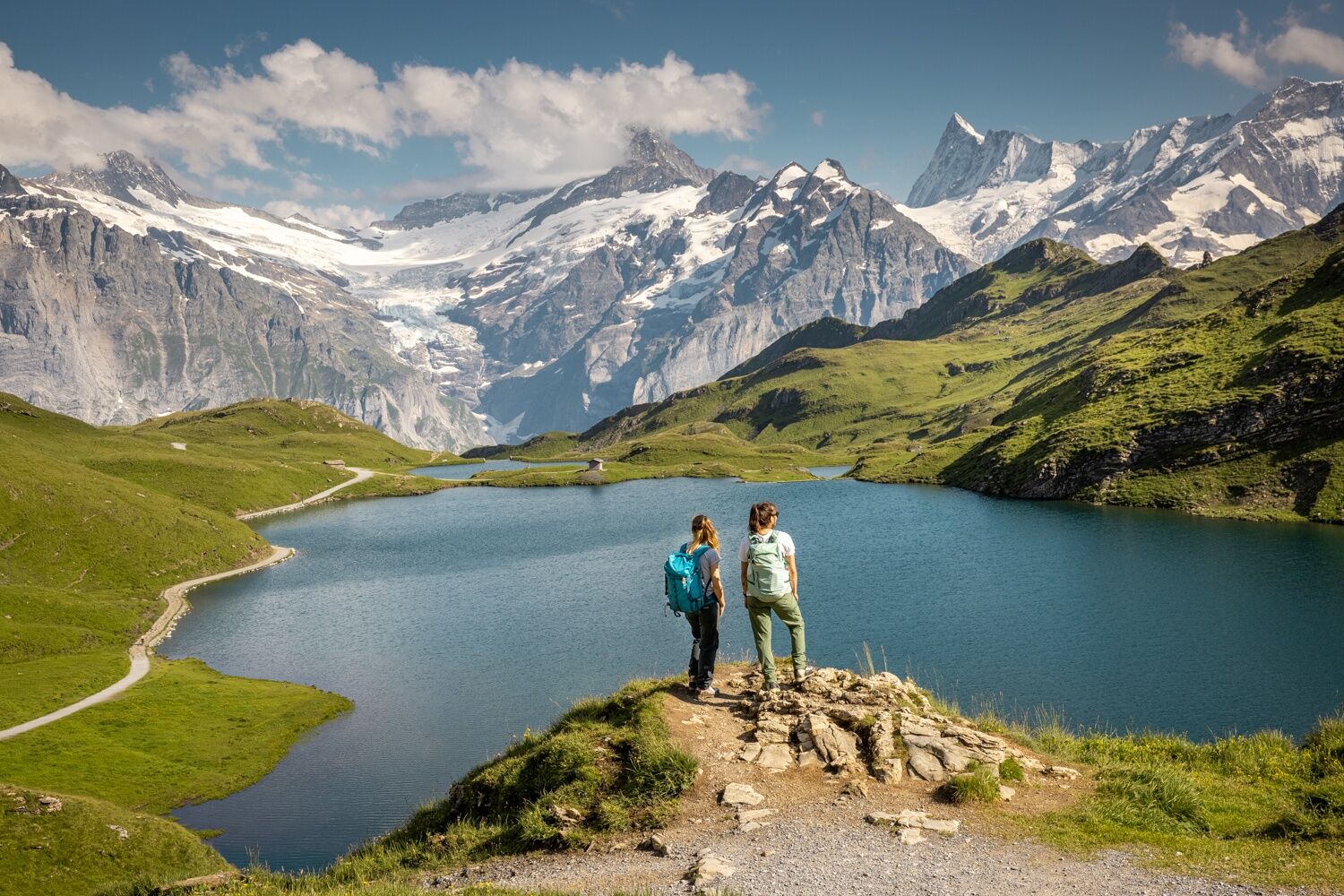
The cable car takes you from Grindelwald to First, where the Flower Trail starts at 2168 m above sea level. From the First mountain station the hiking trail leads up and down to Bachalpsee. During your hike you can marvel at the varied Alpine flora, signs along the way offer all kinds of interesting information about gentian, silver thistle, chamomile, cotton grass and many more.
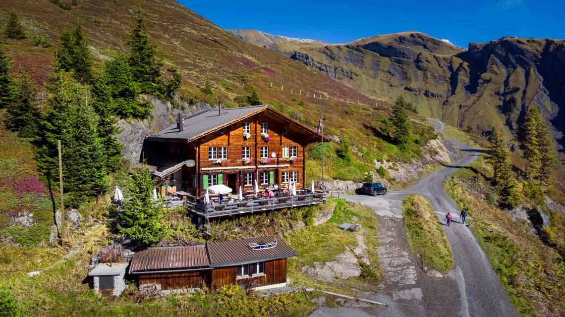
The footpath leads between the two Bachalp lakes and branches off shortly afterwards to the south, the path continues from Bachläger to Waldspitz. Treat yourself to a break and enjoy the sun terrace with a magnificent view of the mountains at the Waldspitz mountain inn. Below the mountain inn, the path winds through the forest down to the Bort middle station. Hiked enough? From Bort the cable car takes you back to Grindelwald. Those who prefer a fast ride can whizz back down to the valley on a scooter.
- Directions
-
First - Bachalpsee - Bachläger - Waldspitz - Bort
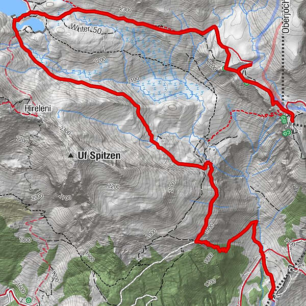
- Highest point
- 2,276 m
- Endpoint
-
Bort, middle station
- Height profile
-
 © outdooractive.com
 - Equipment
-
hiking daypack (approx. 20 liters) with rain cover
comfortable and sturdy footwear
adequate and durable outdoor clothing in multiple layers
sun and rain protection
snacks and drinking water
first aid kit
penknife
mobile phone
if necesessary: telescope sticks, headlight, maps - Safety instructions
- Tips
-
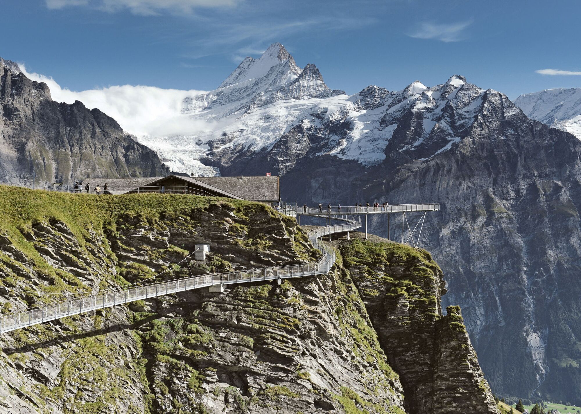
Start your hike with some thrills and visit the First Cliff Walk at the First mountain station.
- Additional information
- Directions
-
From Basel and Geneva, the fastest route to the Jungfrau Region is via Bern. From Zurich, the route via Lucerne and the Brünig Pass is recommended. The pass is open all year round.
From the south, travel to the Jungfrau Region via the Grimsel or Susten Pass. Both passes are only open in summer. An alternative is the Simplon Pass with subsequent car transport through the Lötschberg tunnel.
Grindelwald
From Interlaken we follow the main road to Zweilütschinen. Here we turn left towards Grindelwald. The whole trip takes about 30 minutes and leads over a partly winding road.
- Public transportation
-
Thanks to its central location in Europe, Switzerland is served by international trains from over 12 countries. Within Switzerland, Intercity trains run from Basel and Lucerne directly to the Jungfrau Region. Travellers from Zurich change trains in Bern. The trains run every half hour.
Grindelwald
From Interlaken Ost railway station we reach Grindelwald without changing trains on the Bernese Oberland Bahn (BOB). Important: Get on the rear part of the train, as it splits in Zweilütschinen. If you get on at the front, you will end up in Lauterbrunnen. The journey takes 30 minutes to Grindelwald Terminal (V-Bahn). Three minutes later we are at the terminal in the village.
There are three stations in Grindelwald (Terminal, Grund and Dorf). The terminal station (Dorf) is in the centre of Grindelwald.
- Parking
-
Grindelwald
There are three public car parks: Parkhaus Eiger+ (252 parking spaces), Parkhaus Sportzentrum (160 parking spaces) and the new Terminal Parking (1000 spaces) of the V-Bahn. Alternatively, we can also use the car park in Grindelwald Grund.
- Author
-
The tour «Flower Trail» First - Bachalpsee - Waldspitz - Bort No. 4 is used by outdooractive.com provided.


General info
-
Obwalden
2014
-
Jungfrau Region
1007
-
Grindelwald - First
396