
- Brief description
-
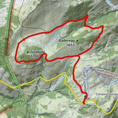
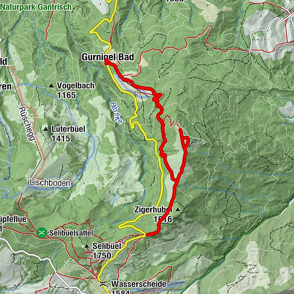
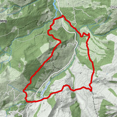
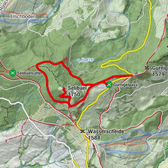
Der Obergurnigel Trail startet beim Berghaus Gurnigel und führt mit wenig Höhendifferenz zum wunderbaren Aussichtspunkt Obere Gurnigel.
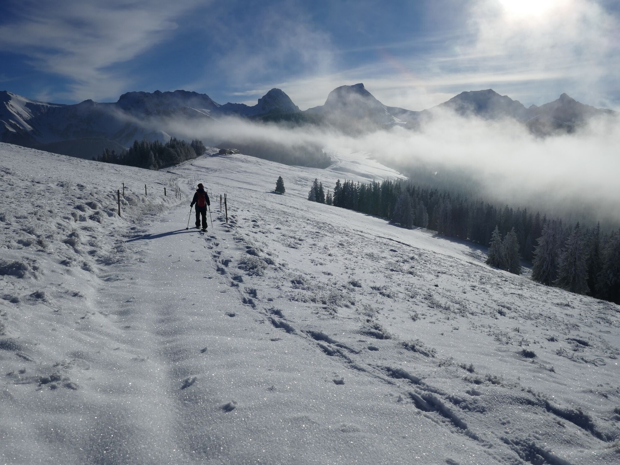
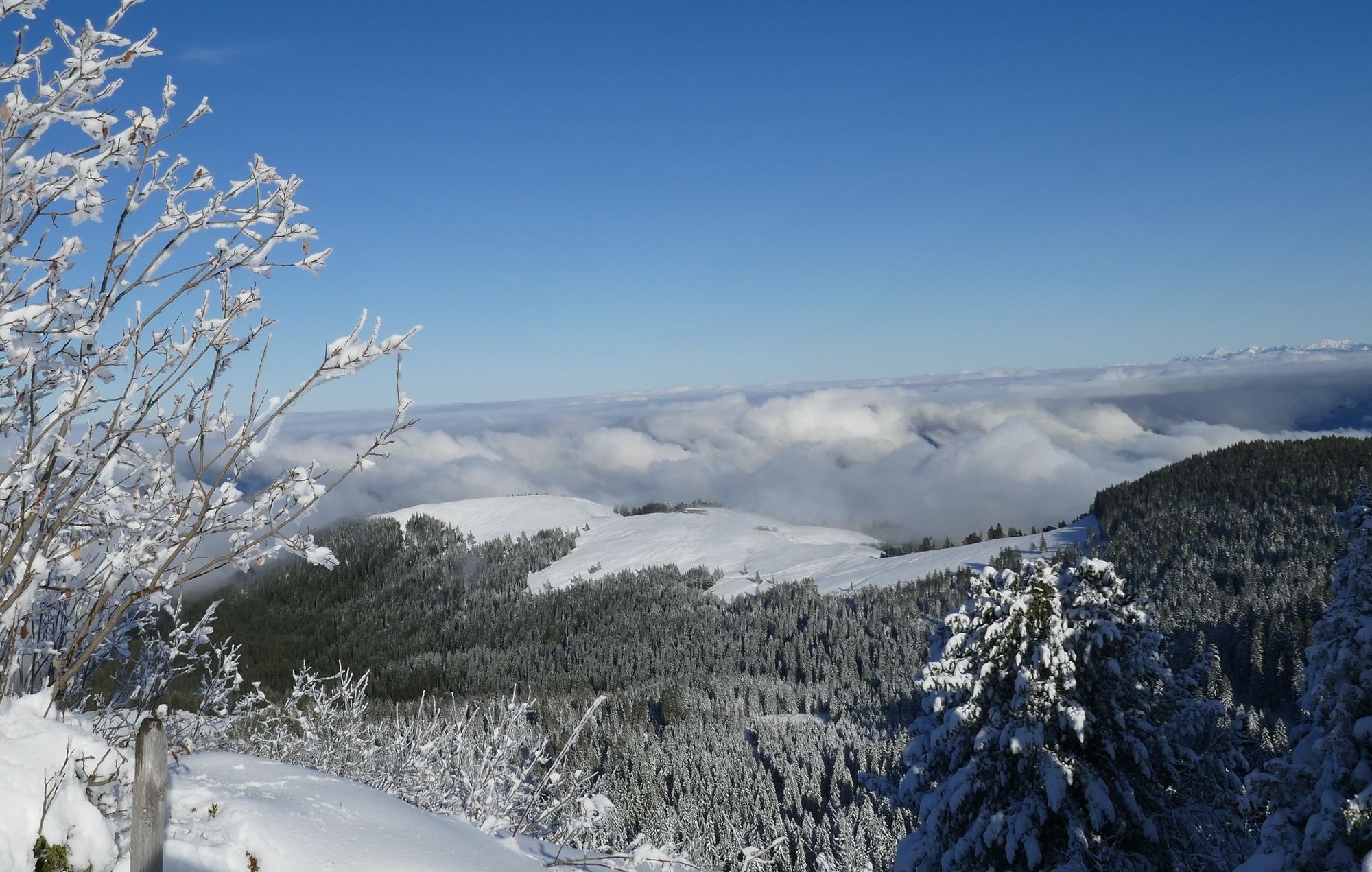
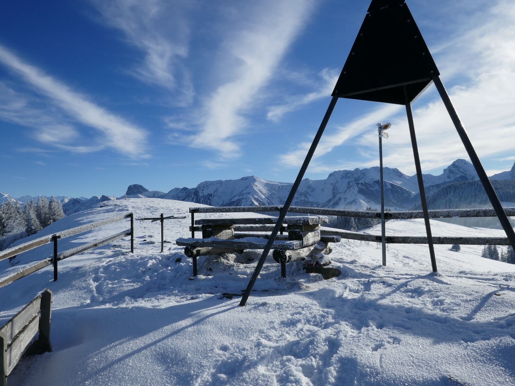
Die Strecke ist durchgehend signalisiert und führt abwechslungsweise durch wunderbaren Tannenwald sowie über den aussichtsreichen Grat am Gurnigelberg. Vom Westwind aufgetürmte Schneewechten säumen den Weg. Beim dreieckigen Vermessungssignal ist der Aussichtspunkt erreicht. Die Ausblicke ins Mittelland, Emmental und zu den Berner Alpen sind eindrücklich. Bei klarem Wetter ist sogar der Jura sichtbar.
Der Rückweg führt zurück zum Sattel des Gurnigelbergs. Hier beginnt der Abstieg durch wunderbaren Tannenwald via Stockweid zur Bushaltestelle Gurnigelbad. Wer vom Obere Gurnigel auf selber Strecke zum Berghaus Gurnigel zurückkehrt absolviert 4.5 km und 200 Höhenmeter.
Bitte den signalisierten Trail nicht verlassen. Sie befinden sich in einer Wildruhezone!
- Difficulty
-
medium
- Rating
-
- Route
-
Gurnigel Berghaus0.0 kmGurnigelpass (1,579 m)0.2 kmObere Gurnigel2.3 kmGassenscheuer6.0 kmGurnigel Bad6.5 kmGurnigelbad6.5 km
- Best season
-
AugSepOctNovDecJanFebMarAprMayJunJul
- Description
-
The approx. 4 km Obergurnigel Trail begins at Berghaus Gurnigel and takes you across to the wonderful Obere Gurnigel viewpoint, with little difference in altitude along the way. The route is signposted throughout and alternates through a wonderful forest of fir trees and the panoramic ridge up on the Gurnigelberg. The trail itself is lined with snow drifts piled up by westerly winds. The spectacular vista opens up at the pyramid marking the triangulation point. Here the views of the Mittelland, the Emmental valley and the Bernese Alps are stunning. And, on a clear day, you can even see across to the Jura. The way back is along almost the same route and involves a little more effort as it is mostly uphill back to Berghaus Gurnigel. The trail is signposted as a snowshoeing trail, but is not groomed!
It is also possible to access the trail from Gurnigel Bad or the Oberer Gurnigel bus stop.
- Highest point
- 1,589 m
- Endpoint
-
Gurnigelbad
- Height profile
-
 © outdooractive.com
 - Equipment
-
We recommend the following items: Sturdy and waterproof hiking boots, light to medium rucksack, protection against the cold, sun protection, hiking poles, first-aid kit, snacks, tea in a thermos flask, mobile phone.
- Safety instructions
-
The route itself is signposted as a snowshoeing route but is not groomed in any particular way.
- Public transportation
-
Outward and return journey: by train to Turnen railway station. From there by bus via Riggisberg to Gurnigel Berghaus.


-

-
AuthorThe tour Obergurnigel Trail is used by outdooractive.com provided.


")