


- Brief description
-
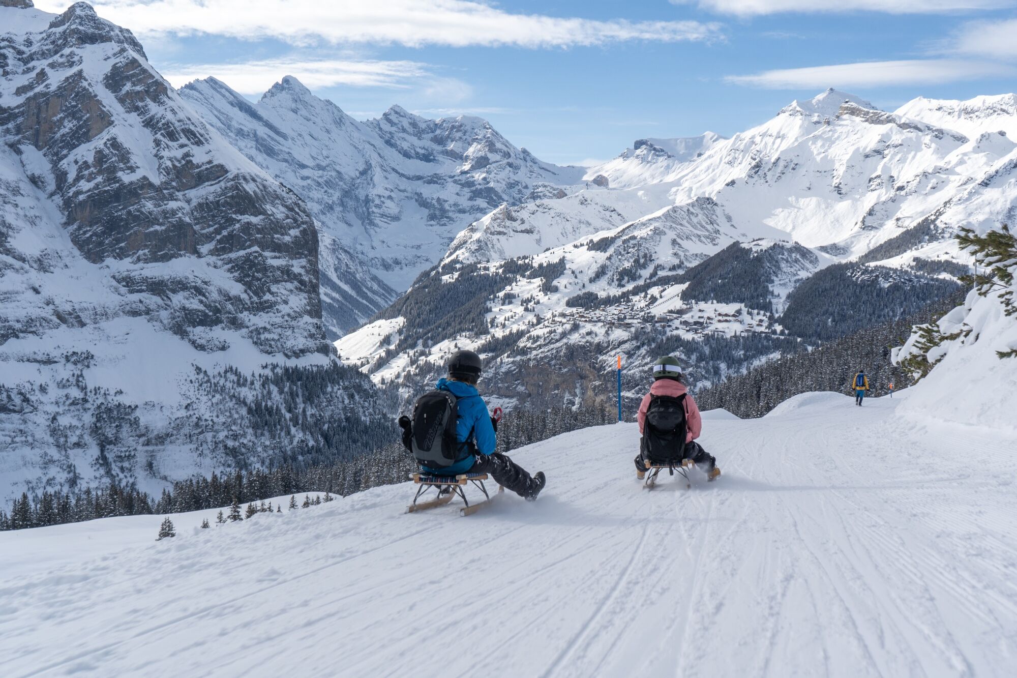
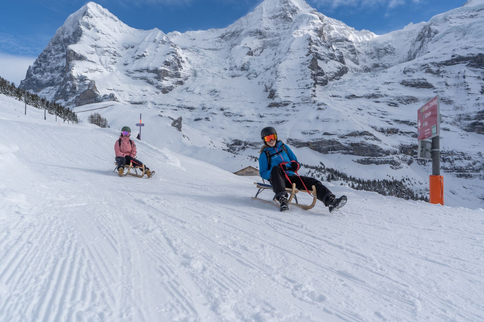
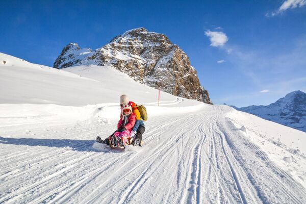
Sledging fun next to and above the famous Lauberhorn downhill run.
- Difficulty
-
easy
- Rating
-
- Starting point
-
Kleine Scheidegg
- Route
-
Kleine Scheidegg (2,061 m)0.0 kmBergrestaurant Kleine Scheidegg0.1 kmWengernalp2.2 kmBergrestaurant Allmend4.9 kmAuf dem Kneu5.9 kmSpendägerten6.2 kmRoossi6.3 kmAm Lehn6.3 kmSengg6.5 kmHalteweidli6.5 kmZum Wald6.6 kmWaldbort6.6 kmGruebi beim Falken6.6 kmSchonegg6.7 kmAm Acher6.7 kmÄllisbühl6.7 kmGlausfuhren6.8 kmWengen6.8 kmRestaurant Eiger (1,276 m)6.9 kmGertschlimatte6.9 km
- Best season
-
AugSepOctNovDecJanFebMarAprMayJunJul
- Description
-
4.5 kilometres of toboggan run right next to the Lauberhorn run: here tobogganists are closer to the racers than anywhere else. On the sometimes challenging, carefully prepared track, they can sled just as tactically as these. Which is the smartest line? How can the momentum be better exploited? If you think smart as a fox on the Fox Run, you'll really pick up speed right after the start on the Wengernalp and arrive with a shot at the finish, Wengen. To get back up right away and make it even better on the next round. Tip: If you go down fast enough, you can just about make it without waiting for the next train at Wengernalp. Toboggan until the runners glow!
- Directions
-
Kleine Scheidegg - Wengernalp - Allmend - Wengen
- Highest point
- 2,060 m
- Endpoint
-
Wengen
- Height profile
-
 © outdooractive.com
 - Equipment
-
Sled or toboggan
Ski helmetday
hiking backpack (approx. 20 liters) with rain cover
comfortable and waterproof winter shoes or sturdy hiking boots (if necessary dredges and gaiters)
hat/headband, scarf
waterproof glovessun and rain protection
Provisions and drinking water, thermos bottle with hot drink
first aid kit
pocket knife
Cell phone
if necessary headlamp and reflectors
Map material - Safety instructions
-
The 10 rules of sledging
Show consideration for others Adapt speed and driving style to ability Respect the lane of the vehicle in front Overtake with distance Look up before entering and approaching the road Stop at the edge Get on and off at the edge Observe signs and markings Provide assistance In the event of an accident: give personal details - Tips
-
After or between sledding: The unique «Röstizza» in the mountain restaurant Allmend
- Additional information
- Directions
-
From Basel and Geneva, the fastest route to the Jungfrau Region is via Bern. From Zurich, the route via Lucerne and the Brünig Pass is recommended. The pass is open all year round.
From the south, travel to the Jungfrau Region via the Grimsel or Susten Pass. Both passes are only open in summer. An alternative is the Simplon Pass with subsequent car transport through the Lötschberg tunnel.
Grindelwald
From Interlaken we follow the main road to Zweilütschinen. Here we turn left towards Grindelwald. The whole trip takes about 30 minutes and leads over a partly winding road.
Wengen
Wengen is car-free. If we arrive by car, we have to leave it in Lauterbrunnen and take the train. The journey from Interlaken to Lauterbrunnen takes about 20 minutes.
- Public transportation
-
Thanks to its central location in Europe, Switzerland is served by international trains from over 12 countries. Within Switzerland, Intercity trains run from Basel and Lucerne directly to the Jungfrau Region. Travellers from Zurich change trains in Bern. The trains run every half hour.
Grindelwald
From Interlaken Ost railway station we reach Grindelwald without changing trains on the Bernese Oberland Bahn (BOB). Important: Get on the rear part of the train, as it splits in Zweilütschinen. If you get on at the front, you will end up in Lauterbrunnen. The journey takes 30 minutes to Grindelwald Terminal (V-Bahn). Three minutes later we are at the terminal in the village.
There are three stations in Grindelwald (Terminal, Grund and Dorf). The terminal station (Dorf) is in the centre of Grindelwald.
Wengen
From Interlaken Ost station we reach Wengen in 44 minutes. The blue and yellow train of the Berner Oberland Bahn (BOB) takes us to Lauterbrunnen. Important: We sit in the front part of the train, as it splits in Zweilütschinen. If you take a seat at the back, you will make a detour to Grindelwald. In Lauterbrunnen we change to the yellow-green train of the Wengernalp Bahn (WAB). This takes us to Wengen in 12 minutes.
- Parking
-
Grindelwald
There are three public car parks: Parkhaus Eiger+ (252 parking spaces), Parkhaus Sportzentrum (160 parking spaces) and the new Terminal Parking (1000 spaces) of the V-Bahn. Alternatively, we can also use the car park in Grindelwald Grund.
Wengen
There is a multi-storey car park directly below Lauterbrunnen station. Alternatively, you can use the car park at the Lauterbrunnen church. From here, a bus leaves for the station every half hour. On foot we need about 10 minutes.
A covered passage leads from the Lauterbrunnen car park to the cable cars to Wengen.


- Author
-
The tour Fox Run Wengen is used by outdooractive.com provided.


General info
-
Aletsch Arena
62
-
Jungfrau Region
62
-
Wengen
41
")


")
