© Lenk-Simmental Tourismus AG - Lenk-Simmental Tourismus
© Lenk-Simmental Tourismus AG - Lenk-Simmental Tourismus
© Lenk-Simmental Tourismus AG - Lenk-Simmental Tourismus


© Lenk-Simmental Tourismus AG - Lenk-Simmental Tourismus
- Brief description
-
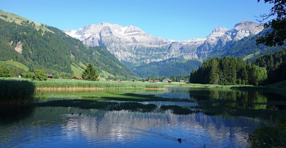
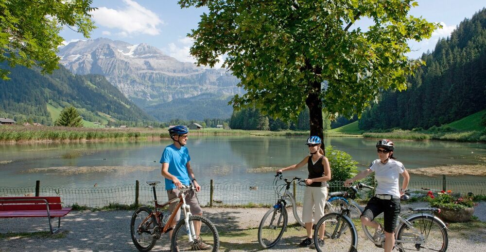
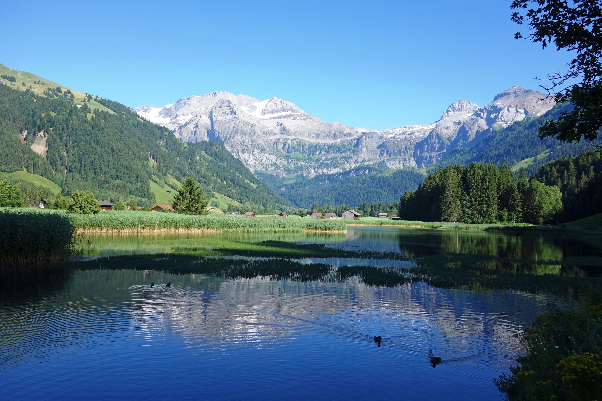
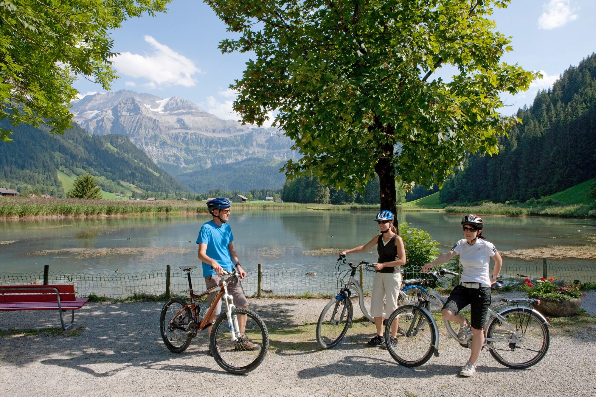
The cycle route from the village to the very end of the valley is a flattish affair along the valley floor. The detour to Lenkerseeli is always worthwhile.
- Difficulty
-
easy
- Rating
-
- Starting point
-
Lenk, Village
- Route
-
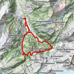
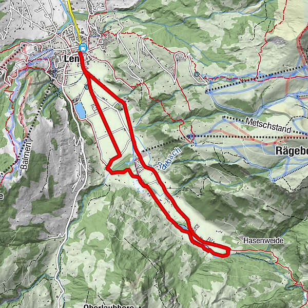
Kronenplatz0.1 kmLenk (1,068 m)0.1 kmSimmenfälle5.1 kmKuspo8.1 kmLenk (1,068 m)9.5 kmKronenplatz9.5 km
- Best season
-
JanFebMarAprMayJunJulAugSepOctNovDec
- Description
-
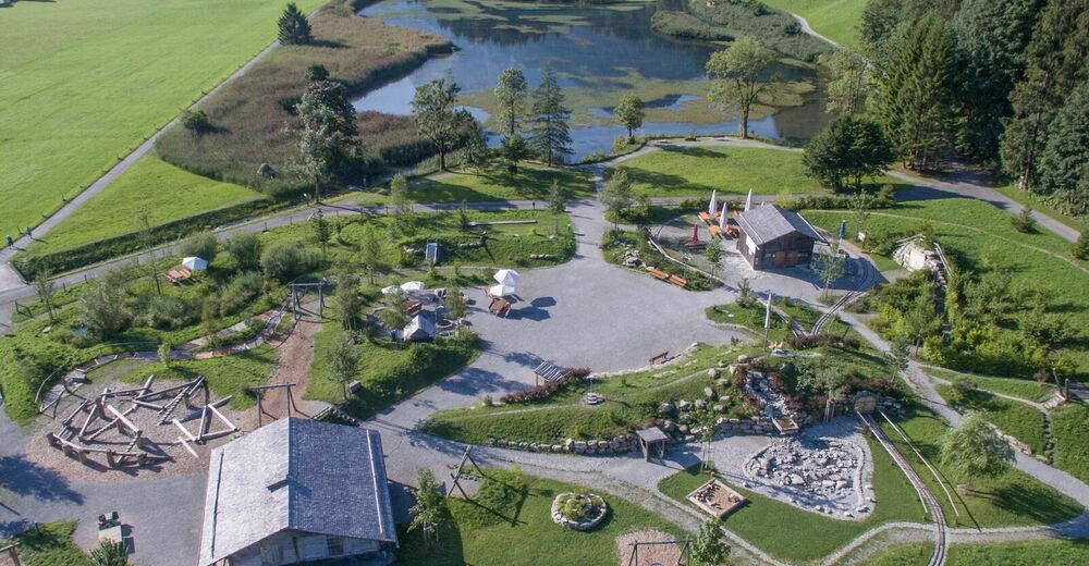
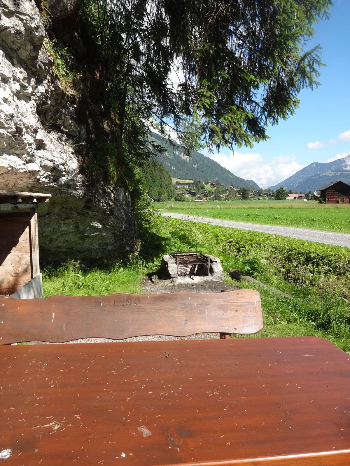
This route is suitable for the whole family. The view of the Wildstrubel massif is a constant companion on the way to the Simmen Falls. At the Simmenfälle Restaurant, the sheer rock faces of the Ammertehor seem almost within reach. The thundering Simmen waterfalls are a unique spectacle of nature that can be admired in comfort just a few steps from the restaurant itself. The cycle route follows side roads and dirt tracks away from any traffic, past a number of barbecue spots. The detour to the AlpKultur play area is definitely worthwhile. For the return leg, either take the same route or the road and, from Rothenbach, the dirt track running alongside the Simme river.
The tour itself does not pose any technical challenges.
- Highest point
- 1,104 m
- Endpoint
-
Lenk, Village
- Height profile
-
 © outdooractive.com
 - Tips
-
There are several BBQ areas along the route and, at the Simmen Falls, the Hotel Restaurant Simmenfälle.
The play area at Lenkerseeli has a snack kiosk and a toilet.
The route runs in both directions and is suitable for bicycle trailers, too.
- Public transportation
- Parking
-
The village of Lenk has public car parks.


-

-
AuthorThe tour Lenk – Simmen Falls Cycle Route is used by outdooractive.com provided.
GPS Downloads


General info
Refreshment stop
Other tours in the regions
-
Thyon les Collons
107
-
Adelboden
86
-
Lenk im Simmental
31