

- Brief description
-
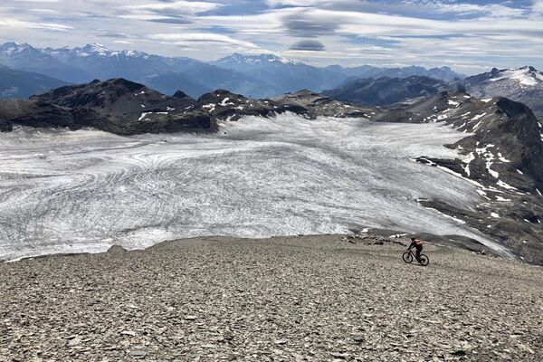
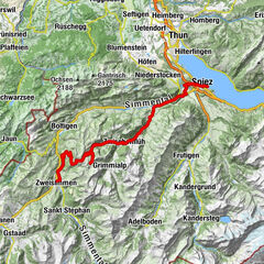
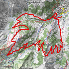
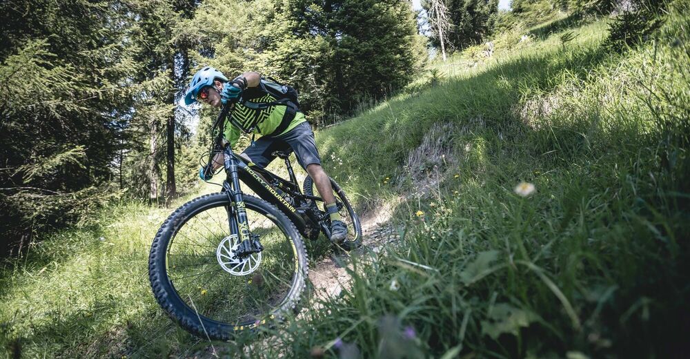
Mountain bike tour with great views from Gruben near Gstaad to the Alp Berschel and back via Schönried to Gruben. The medium-difficulty route is mostly on single trails.
- Difficulty
-
difficult
- Rating
-
- Starting point
-
School building Gruben bei Gstaad
- Route
-
Schönried (1,200 m)9.0 km
- Best season
-
JanFebMarAprMayJunJulAugSepOctNovDec
- Description
-
The tour starts at the Gruben school and then the first left turn onto the "Berschelstrasse". After about 800 meters the road continues sharp right on gravel. There is a barrier which can be easily opened. The path gets steeper and steeper and ends at the highest point on the alp "Berschel" with a breathtaking view.
From there the downhill run towards "Haldis Bärgli" begins, still on the gravel road. As soon as the path rises again slightly and passes the hut, the route climbs to the right along the path through the forest and then turns left onto the single trail. At the next crossing turn left again onto the "Horevorschessweg" and "Wittereweg" down to Schönried. In some places a little technique is needed, but mostly easy to ride. The tour leads to the valley station "Horneggli" to Schönried and then on the "Grubenstrasse" and over the "Cheserystrasse" to the left back to the schoolhouse Gruben. Don't miss the turn-off to the left from "Grubenstrasse" to "Cheserystrasse".
- Directions
-
Gruben – Berschel – Haldis Bärgli – Schönried – Gruben
- Highest point
- 1,596 m
- Endpoint
-
School building Gruben bei Gstaad
- Height profile
-
 © outdooractive.com
 - Equipment
-
Mountain bike, clothing and equipment appropriate to the weather, tool kit and first aid kit.
- Safety instructions
-
This tour is not signposted along the way. Use GPS.
- Tips
-
Connect the tour with a little pick nick. In Schönried there are many restaurants where you can enjoy lunch or dinner after the tour.
- Additional information
-
More information about the mountainbike routes in the Destination Gstaad: www.gstaad.ch/mountainbike
- Directions
-
The Destination Gstaad is located in the south-west of Switzerland right on the border to the French-speaking part of the country. The Destination is easily accessed by rail or car from the regions around Lake Thun and Lake Geneva and the Gruyere region Direct connections to the European high-speed rail network and all international airports in Switzerland guarantee a time-saving and pleasant journey.
More information on gstaad.ch: Travel & Public Transport.
- Public transportation
-
From Schönried train station by bike to the School building Gruben (5 minutes).
- Parking
-
Parking Train Station Schönried


-

-
AuthorThe tour Berschel Tour is used by outdooractive.com provided.


General info
-
Thyon les Collons
182
-
Destination Gstaad
108
-
Schönried
36