
- Brief description
-
A hike through the peaceful wooded Mutzgraben to the 14 m high Mutzbach Waterfall, then on to Wynigen over the gently undulating heights of the Wynigenberge. Short sections are on paved surfaces, even outside the residential area.
- Difficulty
-
easy
- Rating
-
- Route
-
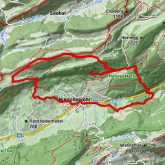
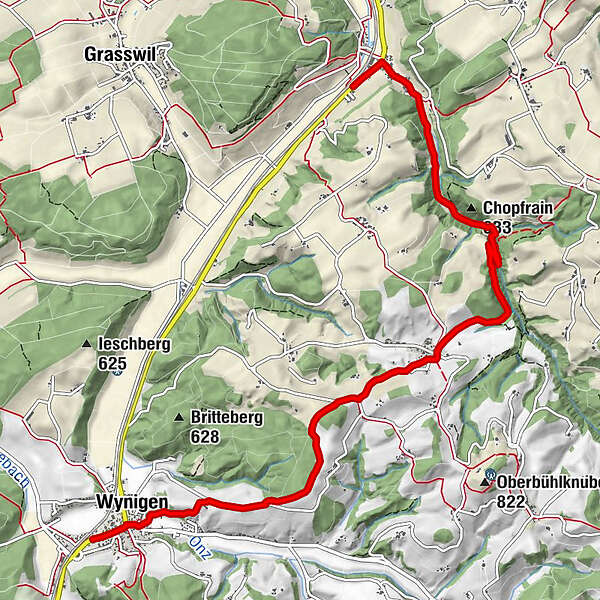
Riedtwil0.2 kmschöner Ort1.4 kmMutzbachtalhöhle1.5 kmChopfrain (633 m)2.0 kmMutzbachfall2.2 kmRüedisbach4.0 kmWynigen7.8 kmLandgasthof Linde7.9 kmBahnhof8.1 km
- Best season
-
JanFebMarAprMayJunJulAugSepOctNovDec
- Description
-
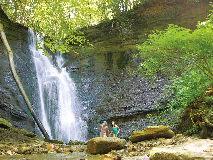
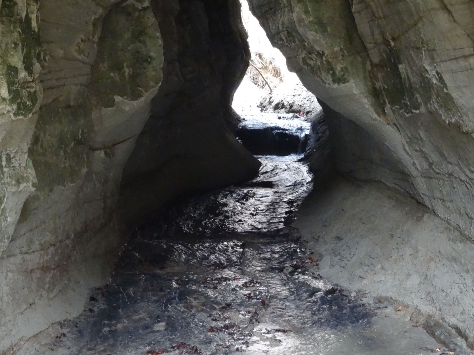
From the bus stop at Riedtwil railway station (no longer in service), our first stop is in the village centre. Next we follow the Oschwand road to the somewhat dilapidated old mill. The next section along the Mutzbach stream takes us through a delightful landscape. The Mutzbach itself meanders among the wooded hillsides from one side of the valley to the other, with crossing points at many a little bridge. As the valley gradually narrows, the hiking trail becomes a grassy track. Very soon the gushing sound of the Mutzbach Waterfall becomes clearly audible. These vast volumes of water, considerable in spring, cascade down a sheer sandstone rock face into a cauldron, with a stairway going around it. There is even a short metal ladder to take us up a small rock face. A narrow path blasted into the rock runs along the upper edge of the cauldron before crossing the stream on a small wooden bridge and following the water through a magnificent beech forest as it carves its course into the sandstone. Next up is a rather steep climb up to the heights of Rüedisbach. The panoramic views open up more and more as we cross from Hinter Leggiswil to Riedere, from where a narrow path leads us along a sandstone ravine down to Wynigen. The church with the delicate Dutch gable tower is where Albert Bitzius (Jeremias Gotthelf) was wed to Henriette Zeender.
- Highest point
- 694 m
- Endpoint
-
Wynigen
- Height profile
-
 © outdooractive.com
 - Equipment
-
Recommended gear: light trekking shoes, light backpack, sunscreen, rain jacket, first-aid travel kit, light picnic, plenty of fluids.
- Safety instructions
-
The vast majority of this route is along hiking trails.


-

-
AuthorThe tour The Mutzbach Waterfall – One of Nature’s gems is used by outdooractive.com provided.
-
Solothurn und Region
1453
-
Wasseramt
677
-
Wynigen
109