


- Rating
-
- Starting point
-
Interlaken Ost, railway station
- Route
-
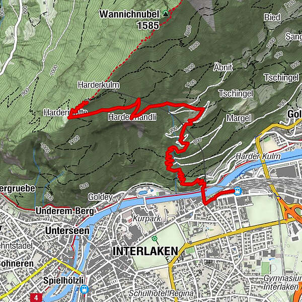
Interlaken Ost (567 m)Interlaken (568 m)0.3 kmHardermandli2.8 kmHardermatte3.8 kmHarderkulm4.1 kmZwei-Seen-Steg4.1 kmPanorama-Restaurant Harder-Kulm4.1 km
- Best season
-
JanFebMarAprMayJunJulAugSepOctNovDec
- Description
-
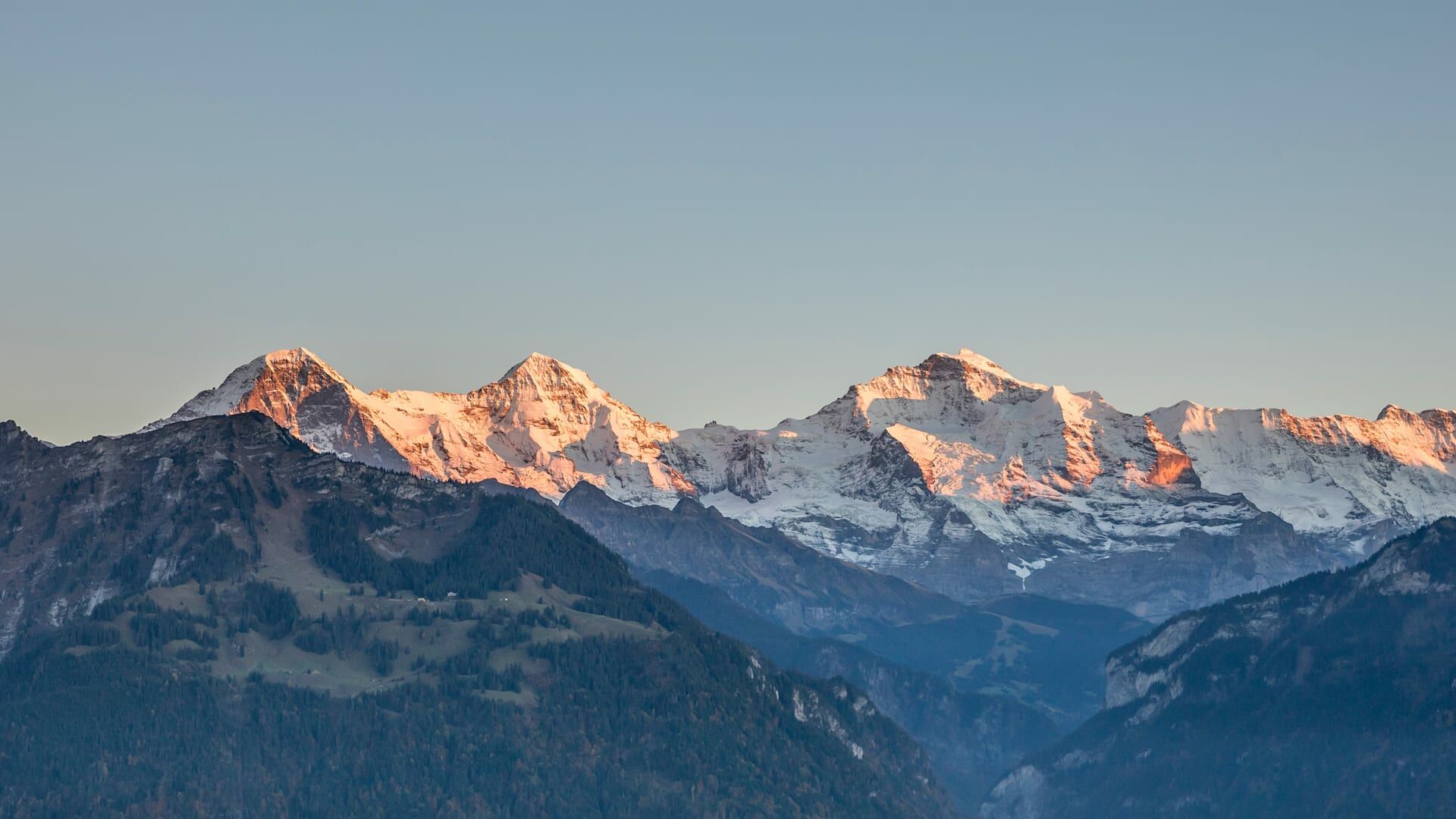
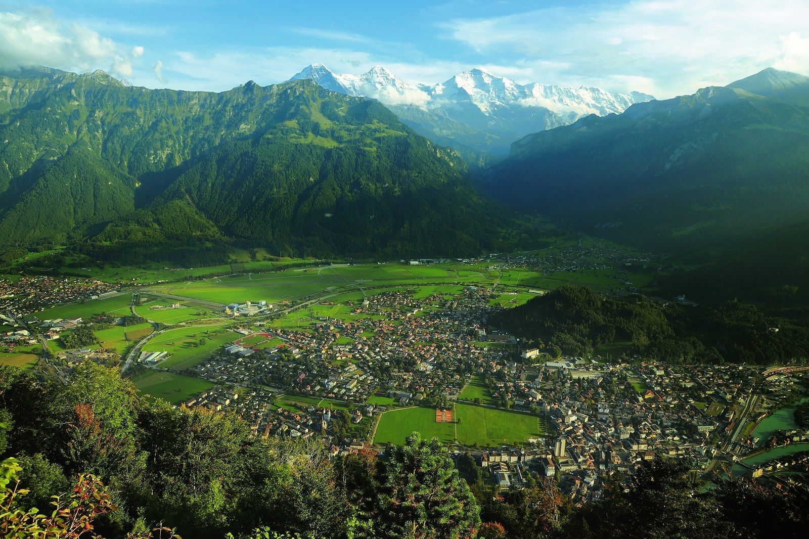
The trail leads from Interlaken Ost railway station along the River Aare to the valley station of the Harder Railway and in many, sometimes very steep, turns through the Bleiki forest to the Falkenfluh - a lookout point located above the Hardermannli rock face. The rock below the railings is practically perpendicular; Interlaken can be seen in a bird's eye view over the magnificent summits of the Eiger, Mönch and Jungfrau. The well-developed mountain trail then continues in a pleasant climb over wide Alpine meadows, with a view of Lake Thun and the pyramid-shape of the Niesen. Past the bustle on the terrace of the Harder Kulm mountain restaurant, the wide panorama trail leads to Harderbahn summit station.
- Directions
-
Interlaken Ost - Bleikiwald - Hardermanndlis - Harder Kulm
- Highest point
- 1,308 m
- Endpoint
-
Panorama Restaurant Harder Kulm
- Height profile
-
 © outdooractive.com
 - Equipment
-
Normal hiking gear, hiking boots with good soles and walking sticks help with the ascent.
- Safety instructions
-
Mountain hike with some exposed sections. The terrain off the marked trail is very steep and exposed, especially above the Hardermanndli rock face – DO NOT leave the trail!
- Additional information
-
Hike 72
(in the printed summer panoramic map of the Jungfrau Railways) - Directions
-
Via Bern or Lucerne to Interlaken. From the south via the Grimsel Pass (summer only) or via the Simplon Pass and then the Lötschberg car-transport train to Interlaken.
- Public transportation
-
Arrival and departure via Interlaken Ost railway station.
- Parking
-
Uncovered car park right next to Interlaken Ost railway station.


- Author
-
The tour Interlaken Ost - Harder Kulm is used by outdooractive.com provided.
General info
-
Aletsch Arena
1496
-
Interlaken
1119
-
Interlaken - Matten - Unterseen
467


