


- Rating
-
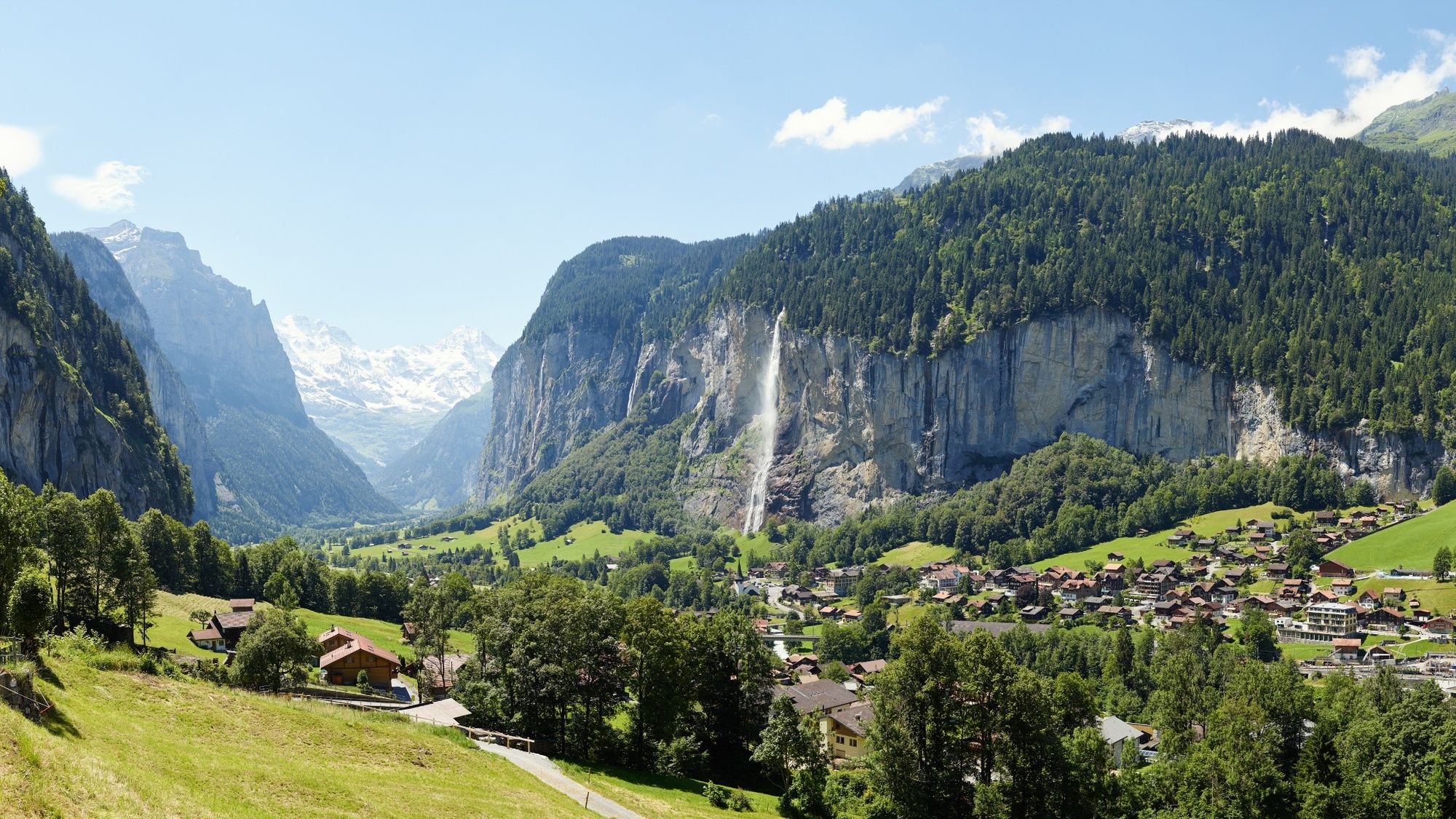
- Starting point
-
Lauterbrunnen, BOB end station
- Route
-
Bei der ZubenLauterbrunnen0.1 kmGreifenbach0.1 kmGsteigermatte0.2 kmLauterbrunnen0.4 kmDornimad0.5 kmGauchegg2.4 kmBätzenboden2.5 kmSchluecht2.6 kmRoossi2.6 kmAm Acher2.7 kmÄllisbühl2.8 kmSengg2.8 kmSchonegg2.8 kmGlausfuhren2.8 kmGruebi beim Falken2.9 kmWengen2.9 kmGertschlimatte3.0 kmRestaurant Eiger (1,276 m)3.0 km
- Best season
-
JanFebMarAprMayJunJulAugSepOctNovDec
- Description
-
The so-called "Hohstäg", the trail from Lauterbrunnen to Wengen, is part of the classic Bernese Oberland tour, which from the 18th century has attracted intellectuals and tourists in search of the grand nature experience to the alpine landscape. The area has lost none of its charm. In the footsteps of olden-day intellectuals: The hike from Lauterbrunnen begins along a wide trail to Zwirgi. From here it winds steeply up around many hairpin bends in a shady mountain forest to Wengen, set almost 500 metres higher on a sunny terrace. The reason for the steep ascent is the landscape fashioned by the hinteren Lauterbrunnental Glacier during the last Ice Age. The holiday resort of Wengen is a typical picture-postcard mountain village. It is still free of individual motorized traffic and thus the preserve of pedestrians. The wide terrace opens out towards the southwest, guaranteeing an above average amount of sunshine and magnificent views of the Swiss Alpine world.
- Directions
-
Lauterbrunnen - Zwirgi - Wengen
- Highest point
- 1,272 m
- Endpoint
-
Wengen, Bahnhof der Wengernalpbahn
- Height profile
-
 © outdooractive.com
 - Equipment
-
Normal hiking gear, hiking boots with good soles and walking sticks help with the ascent.
- Safety instructions
-
Partly steep but good hiking trail.
- Author
-
The tour Lauterbrunnen - Wengen is used by outdooractive.com provided.
GPS Downloads


General info
Refreshment stop
Other tours in the regions
-
Aletsch Arena
1485
-
Jungfrau Region
1021
-
Lauterbrunnen
441


