
- Brief description
-
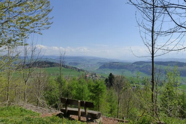
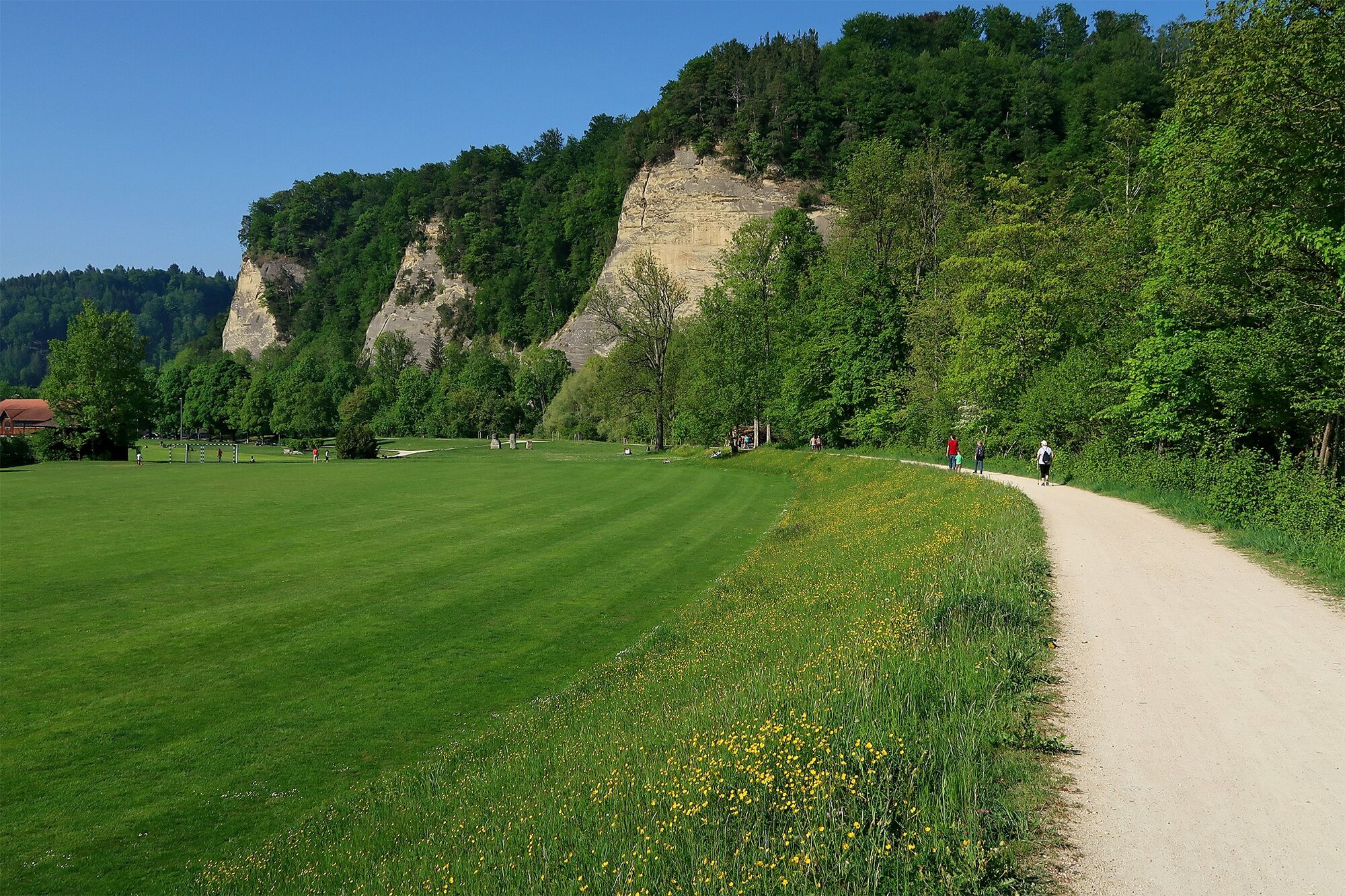
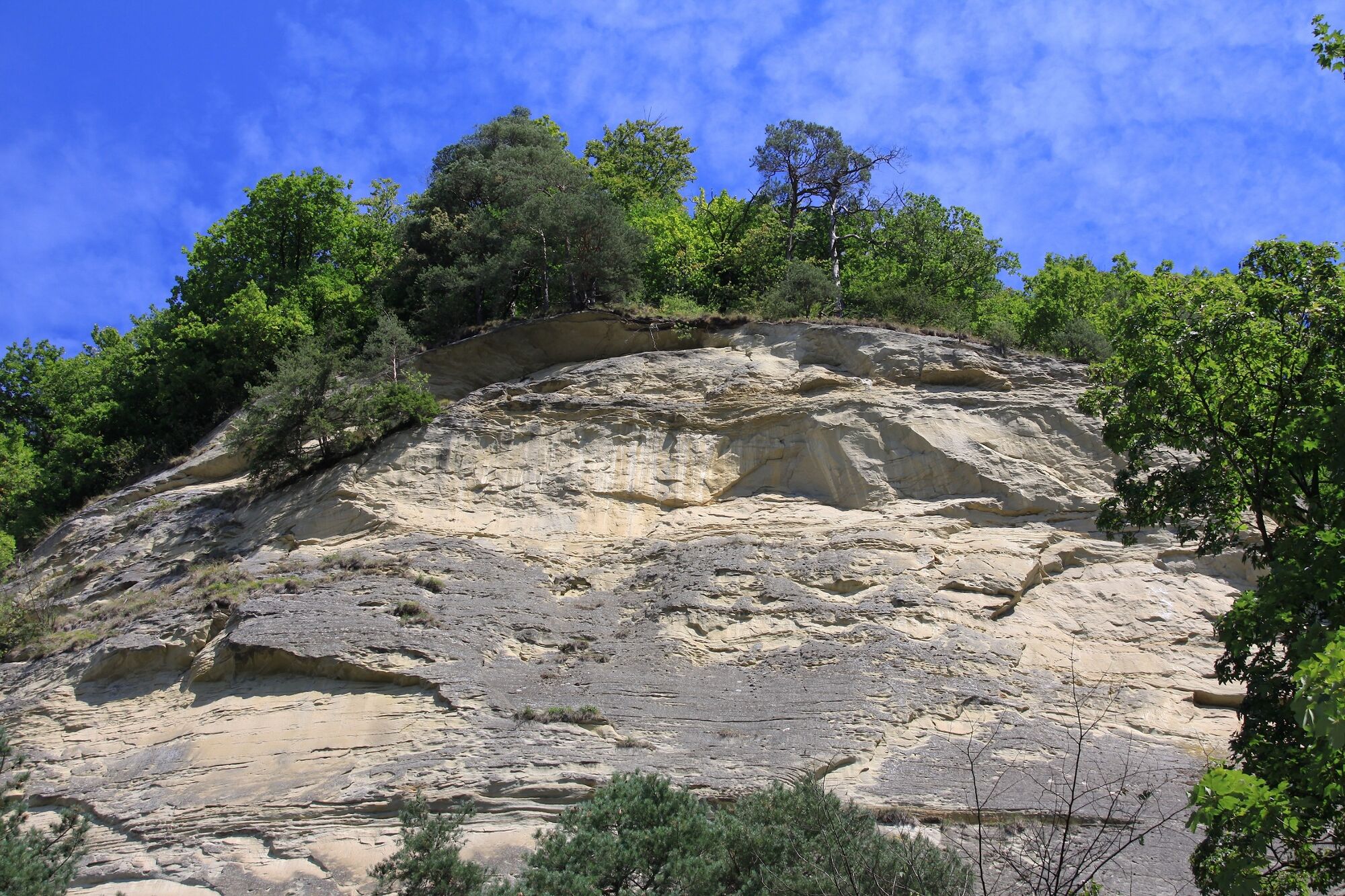
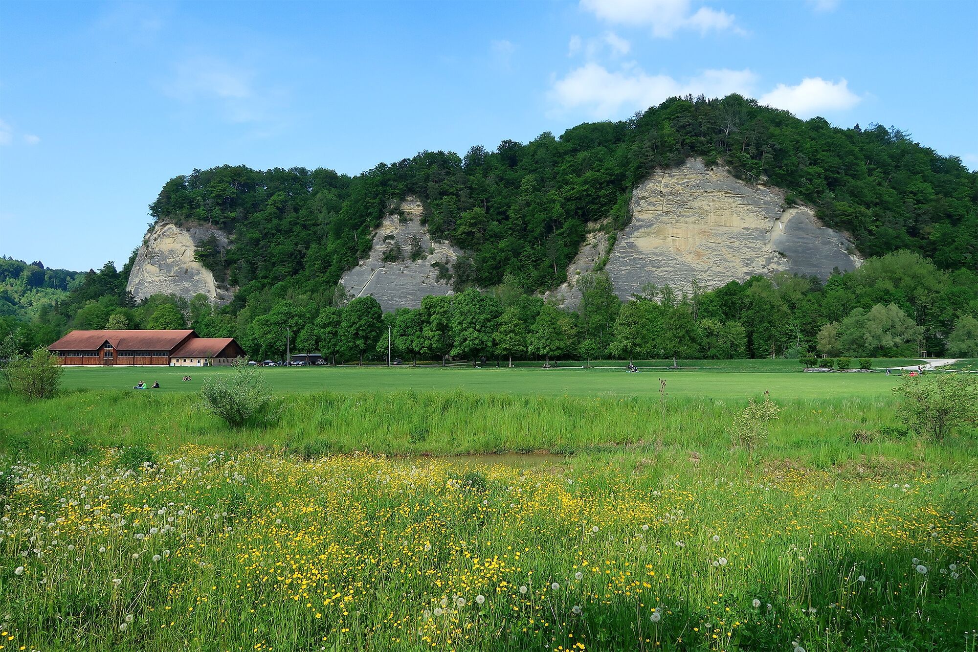
An interesting family walk that takes you high above Burgdorf, through the forest, and over the striking sandstone rocks of the Gysnauflühe. Afterwards, you may still have time to visit the castle or, depending on the season, for swimming in the river Emme.
- Difficulty
-
easy
- Rating
-
- Starting point
-
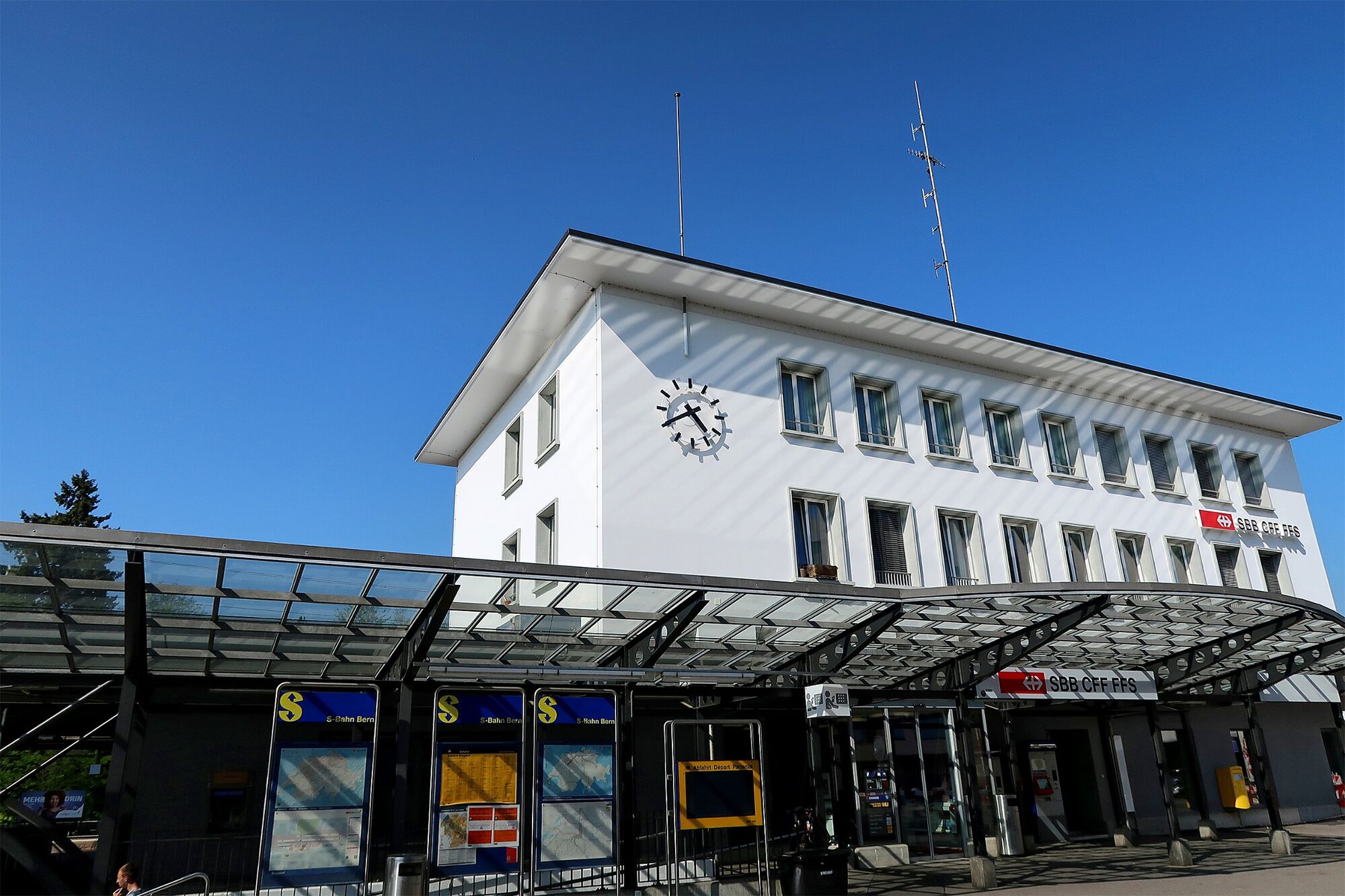
Burgdorf, train station
- Route
-
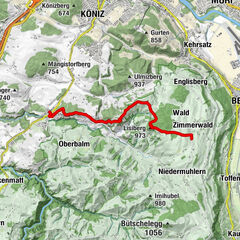
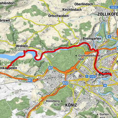
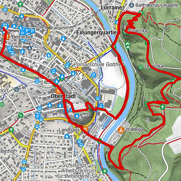
Burgdorf (533 m)Berthoud (557 m)0.5 kmVierte Flue2.3 kmErste Flue3.4 kmSiecheschache3.9 kmLorraine3.9 kmEinungerquartier4.1 kmOberstadt5.1 kmBurgdorf (533 m)6.0 km
- Best season
-
JanFebMarAprMayJunJulAugSepOctNovDec
- Description
-
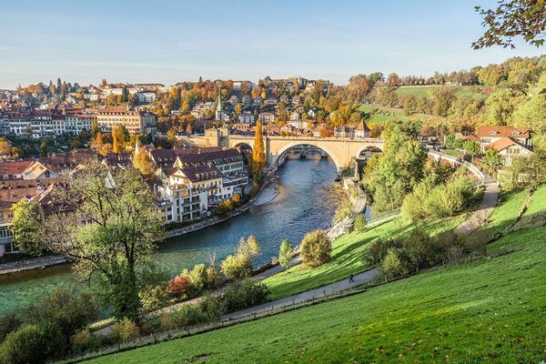
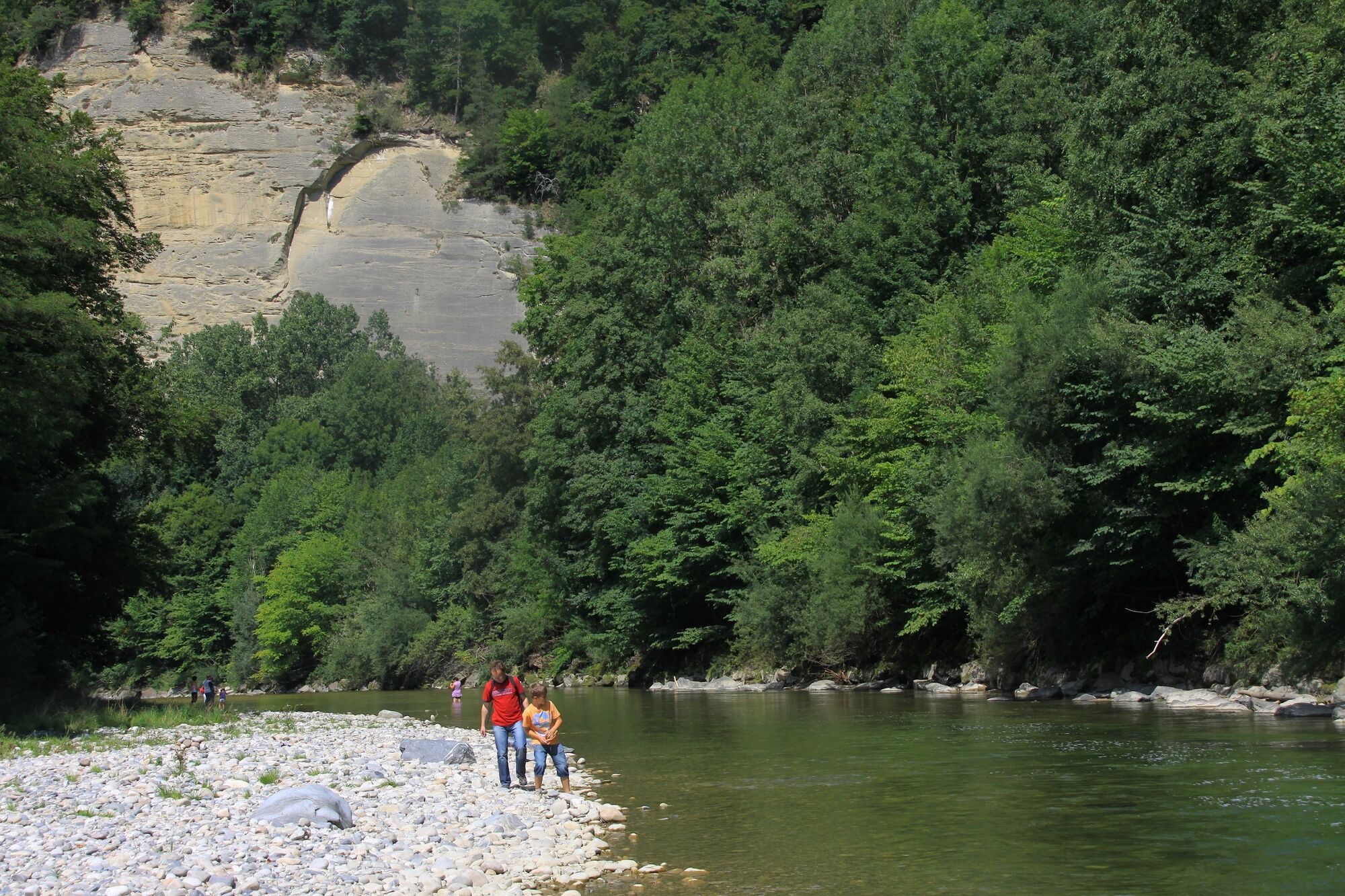
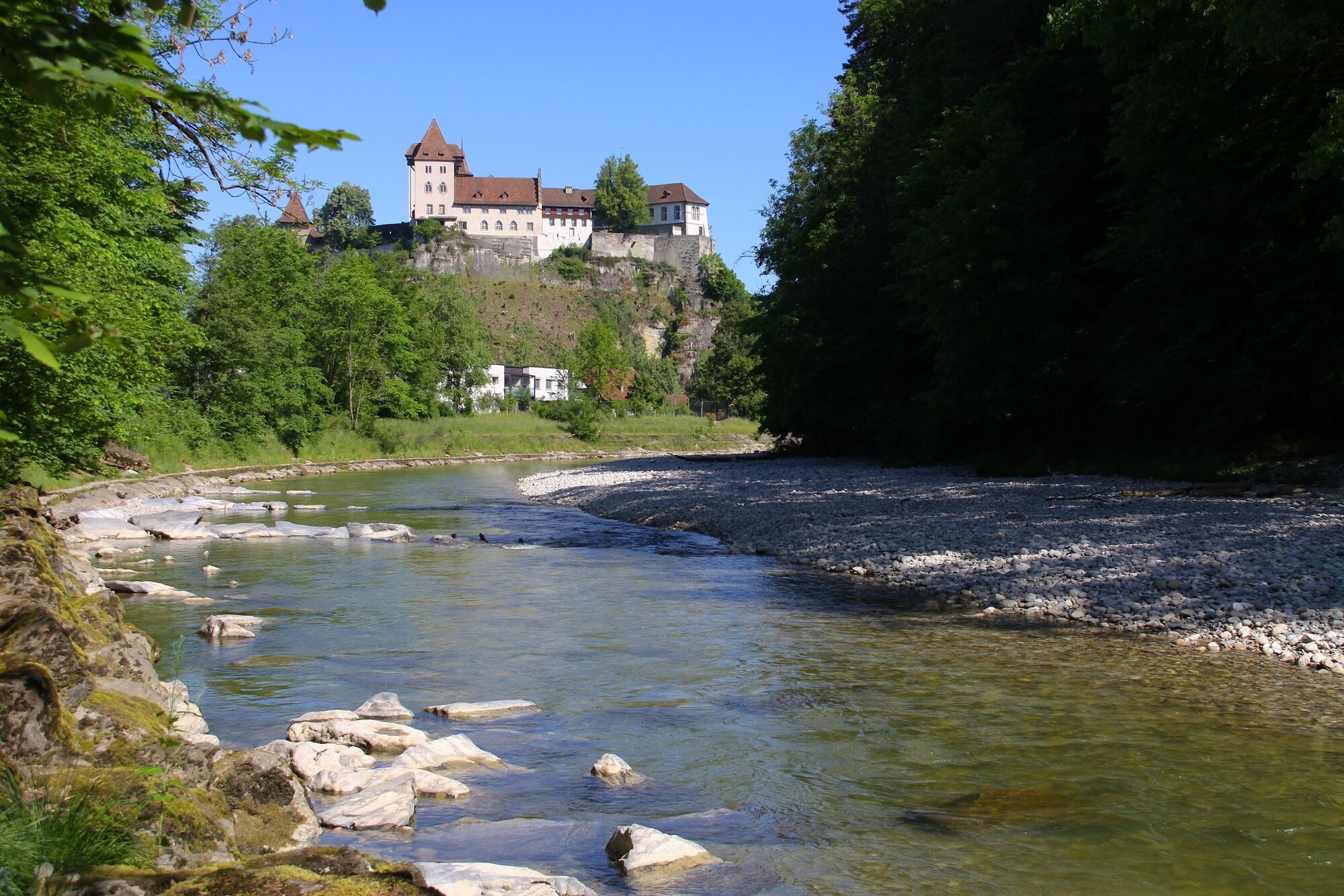
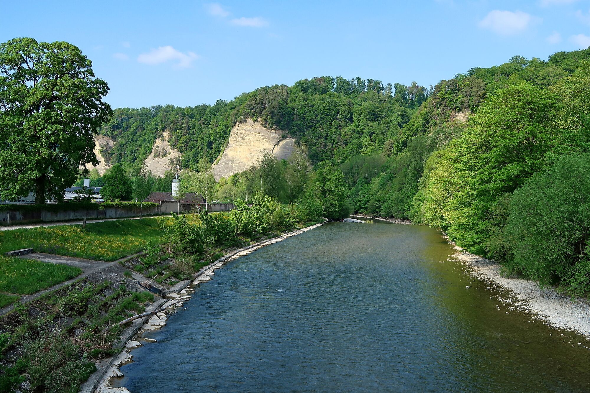
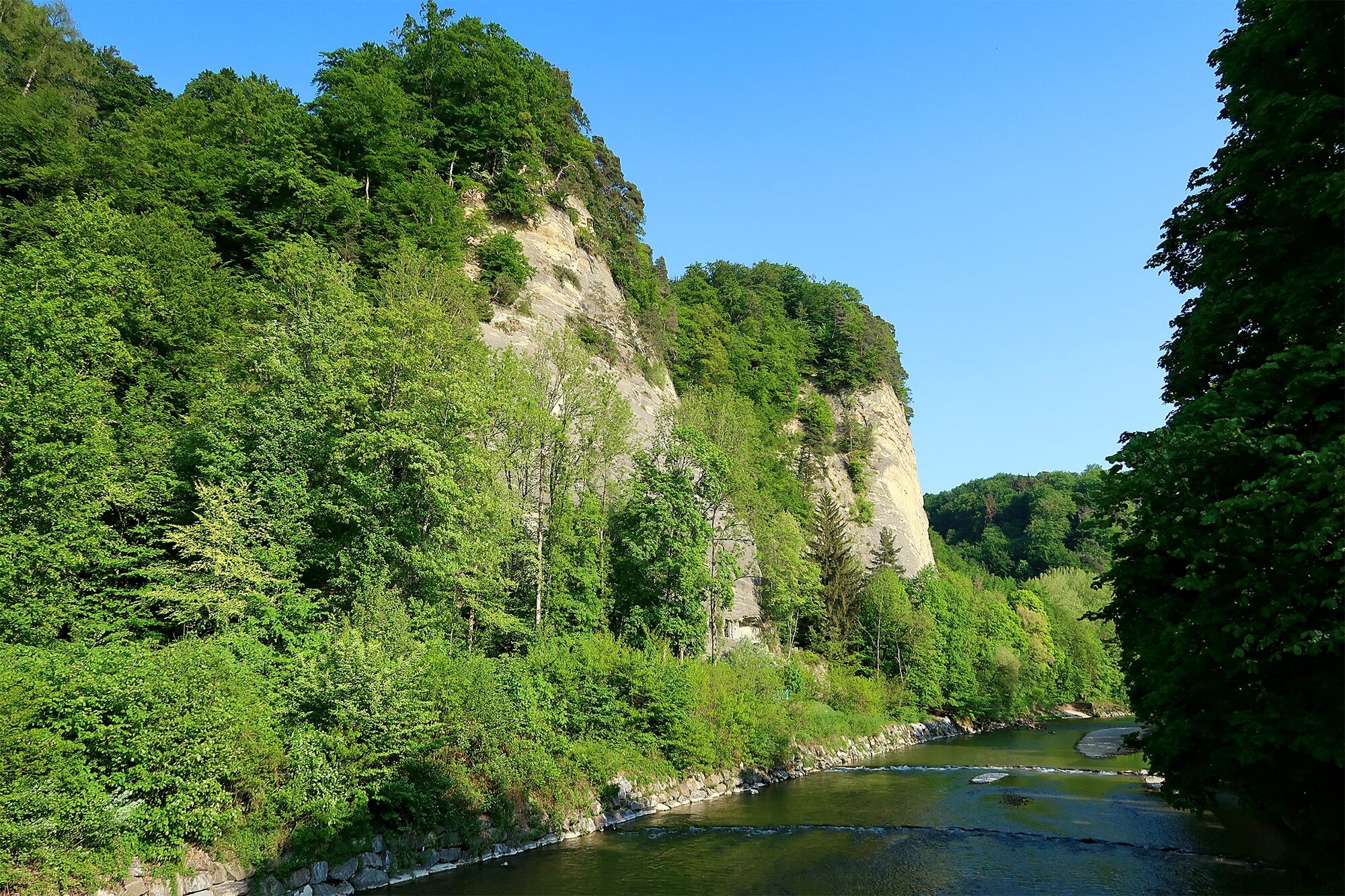
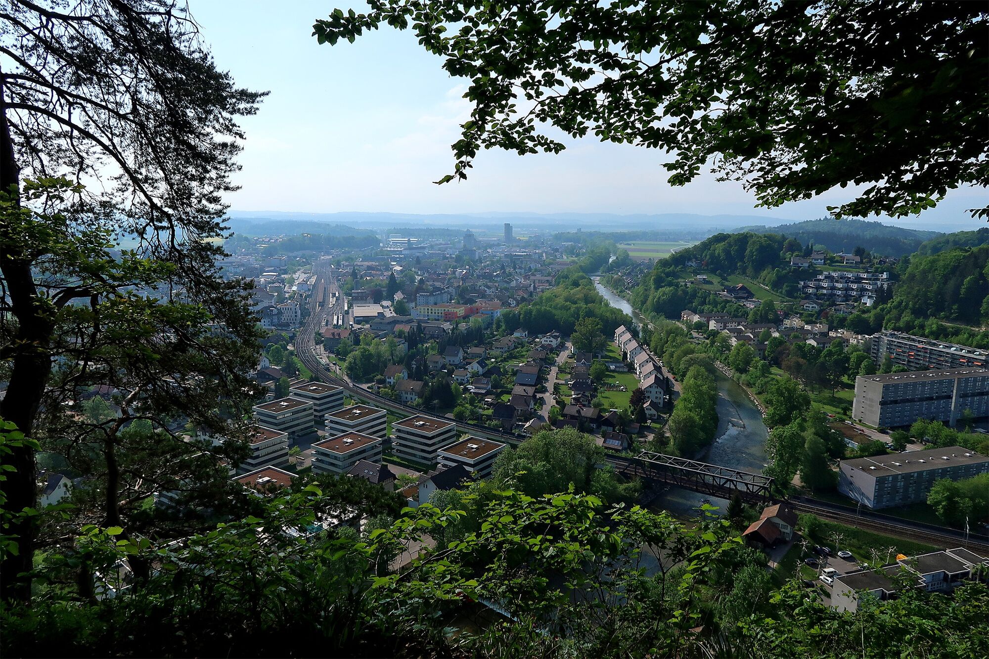
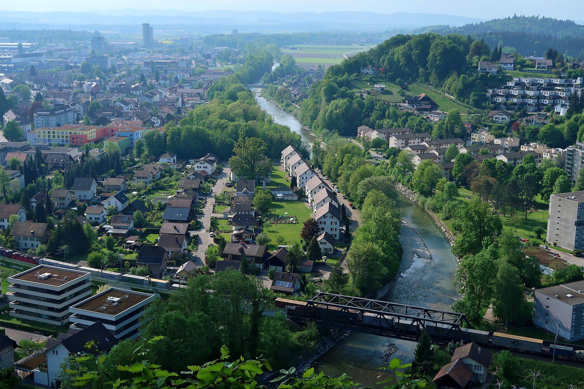
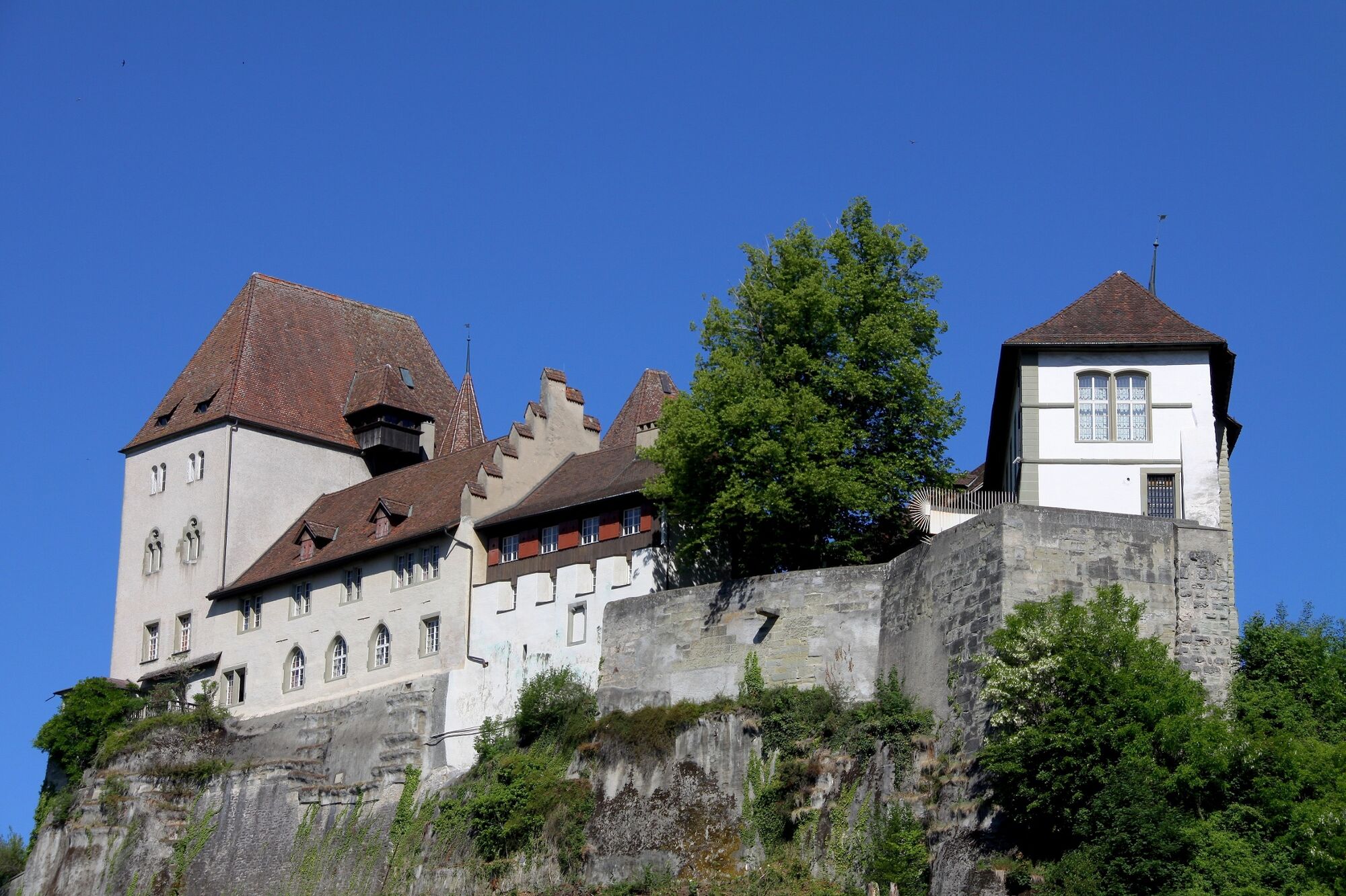
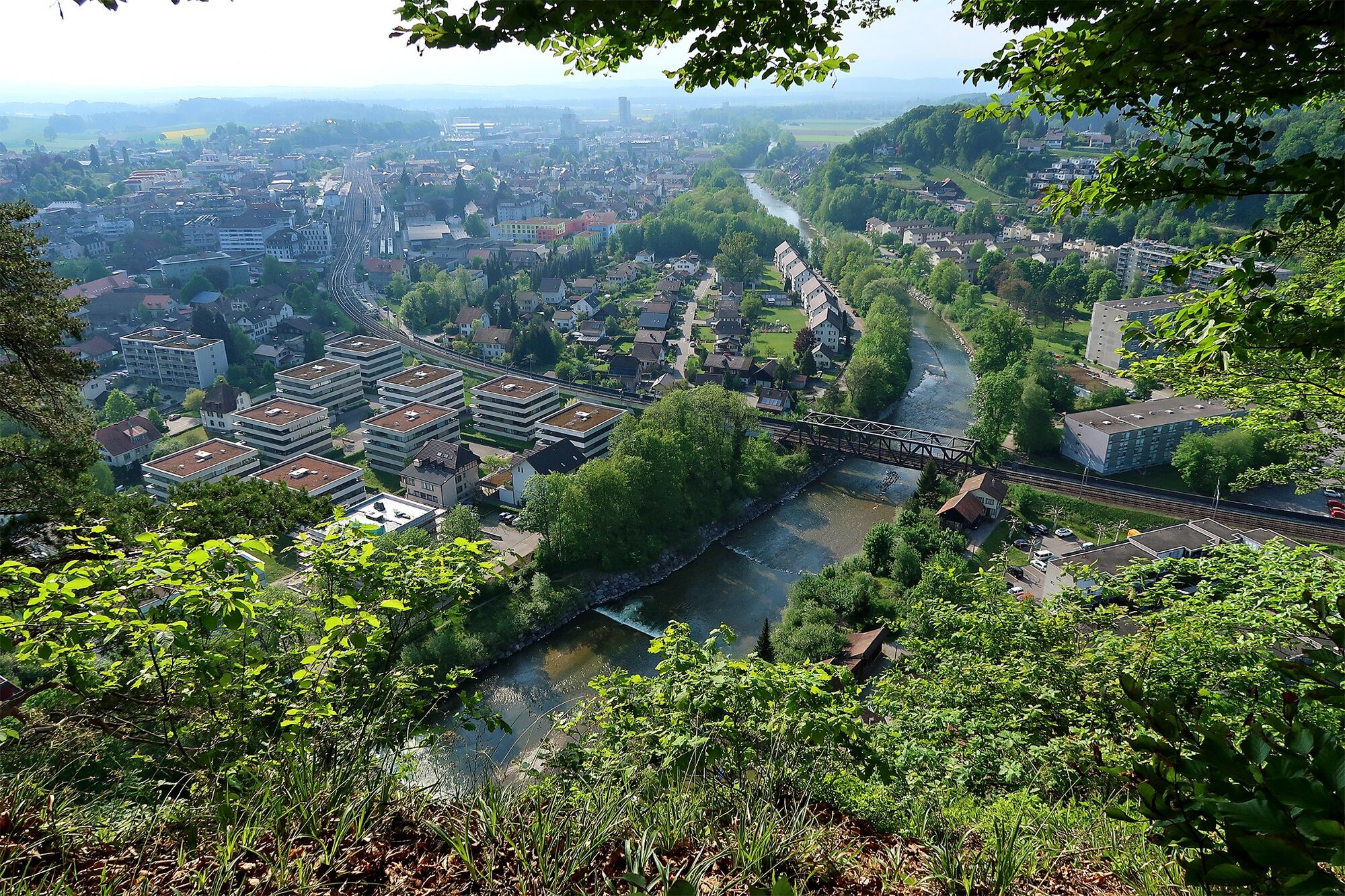
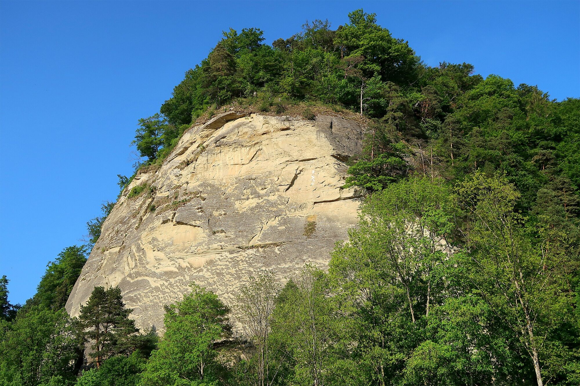
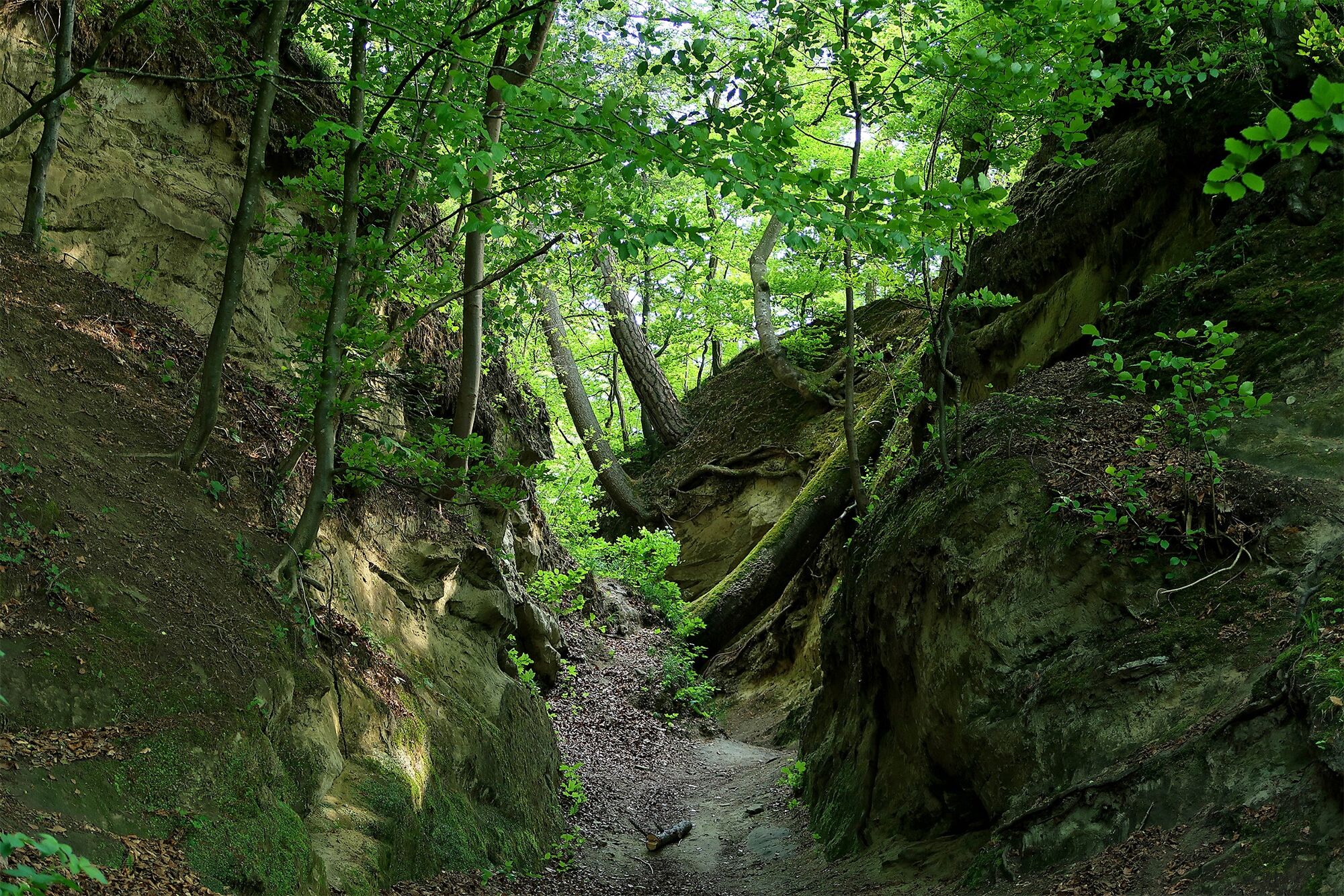
We stand in Burgdorf and marvel. At the castle which towers high above the city on a cliff and at the "Gysnauflühe", four striking sandstone formations that rise on the right bank of the river Emme. The Gysnauflühe and the former Zähringer fortress are the landmarks of the city and lend themselves perfectly to being combined on this family-friendly tour of discovery.
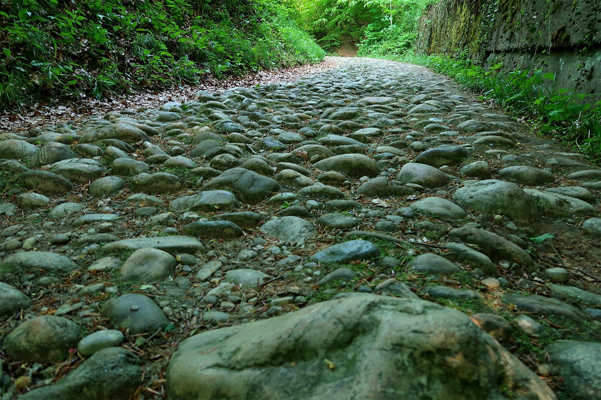
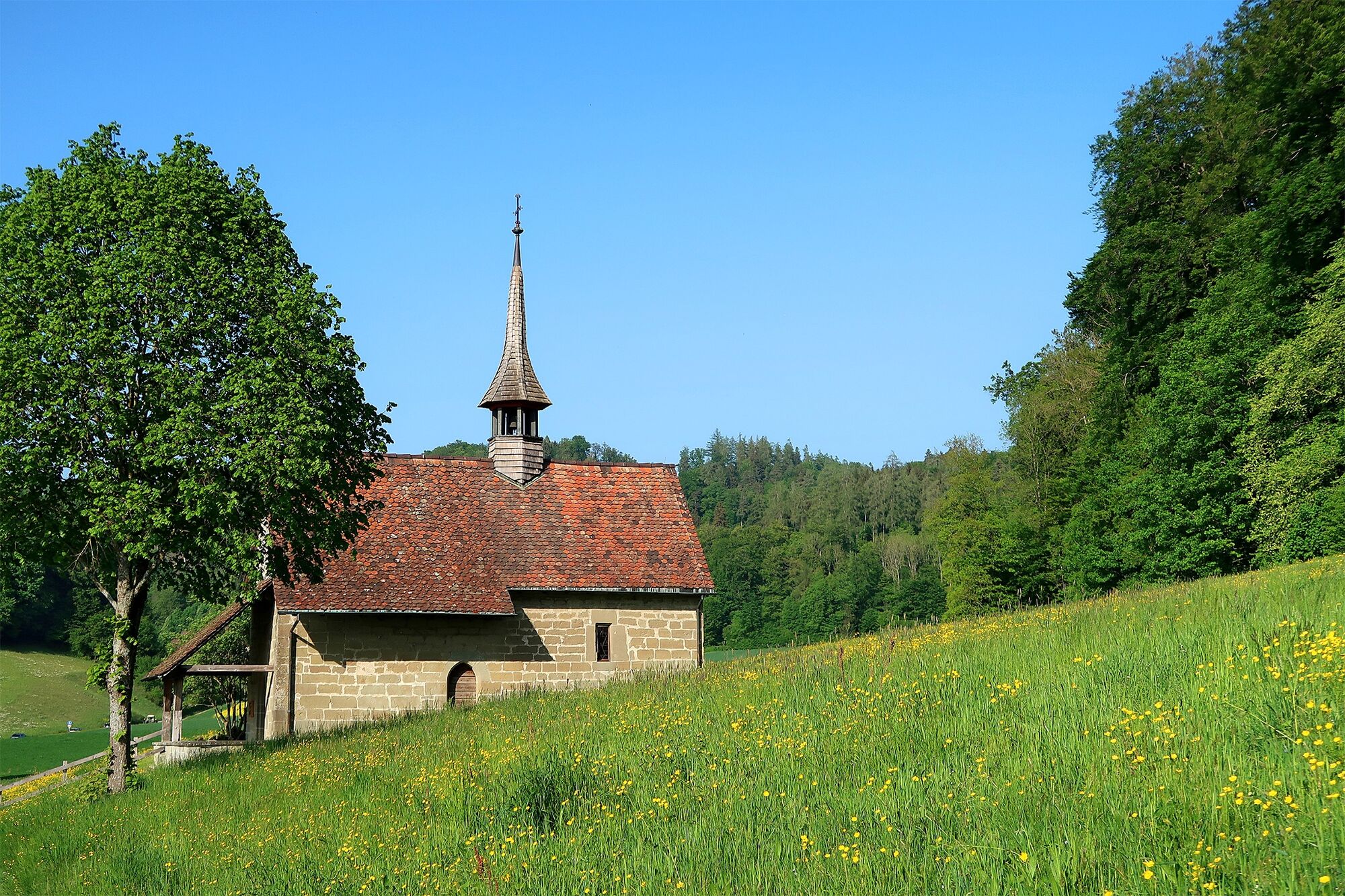
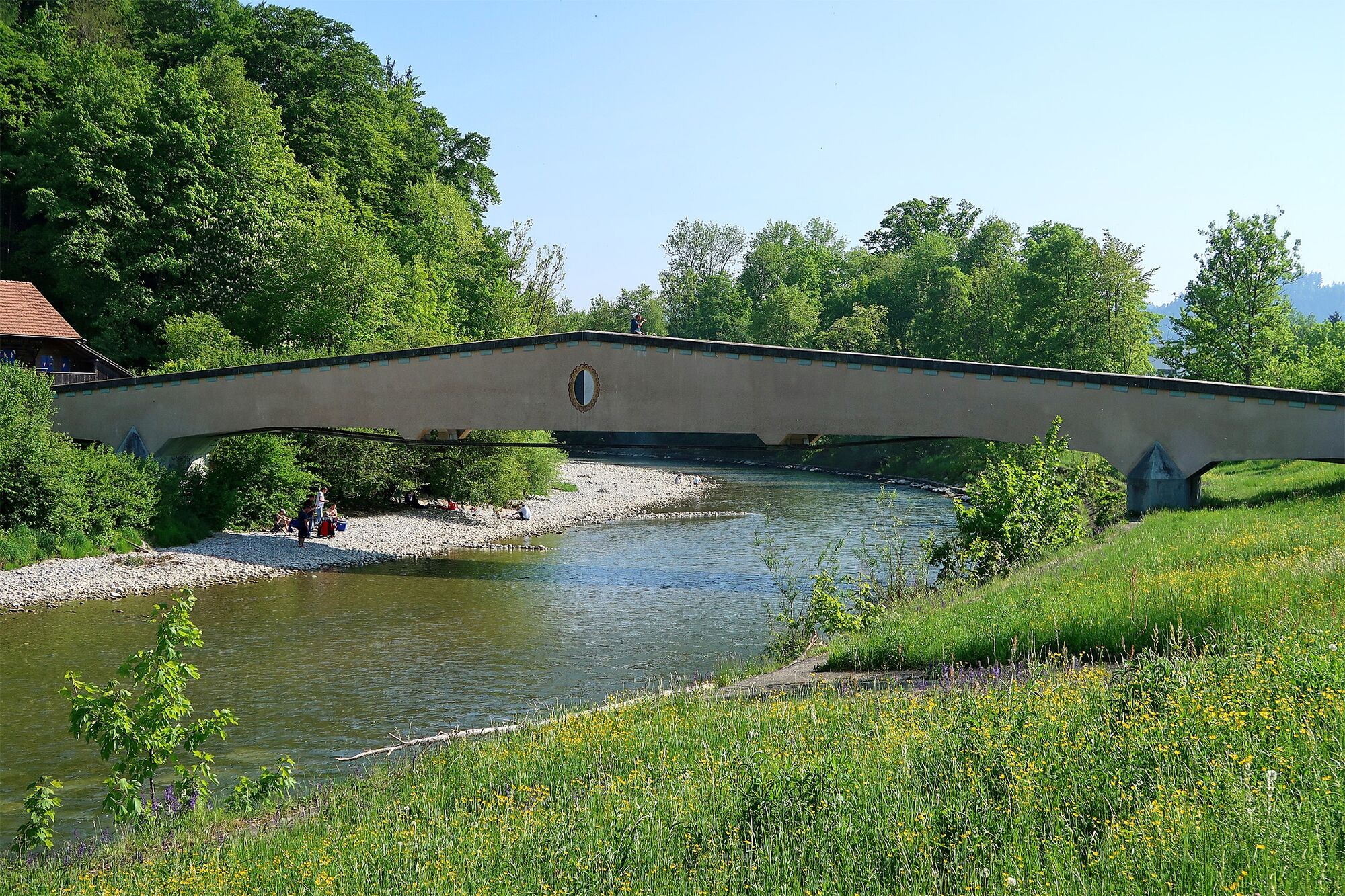
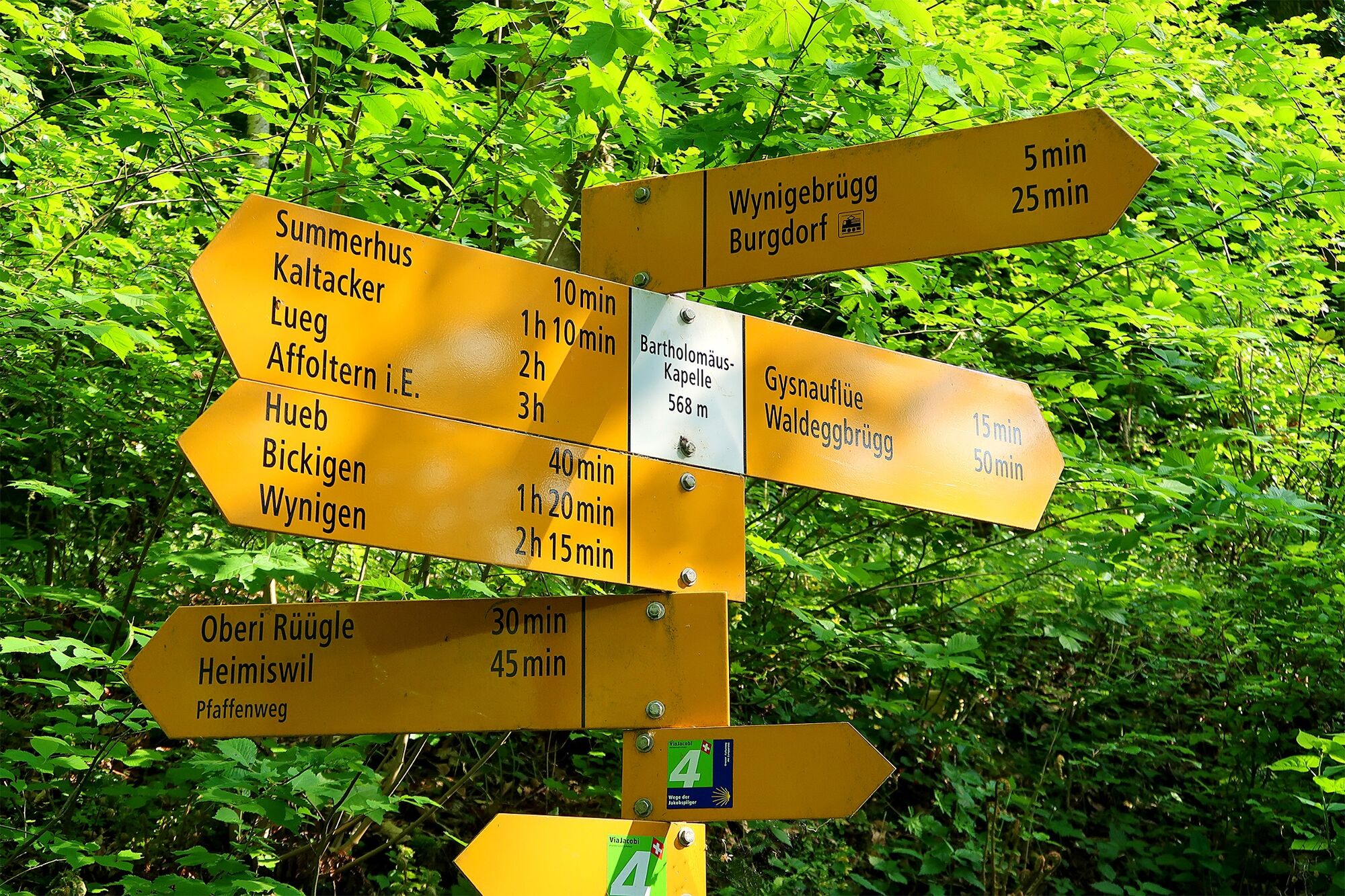
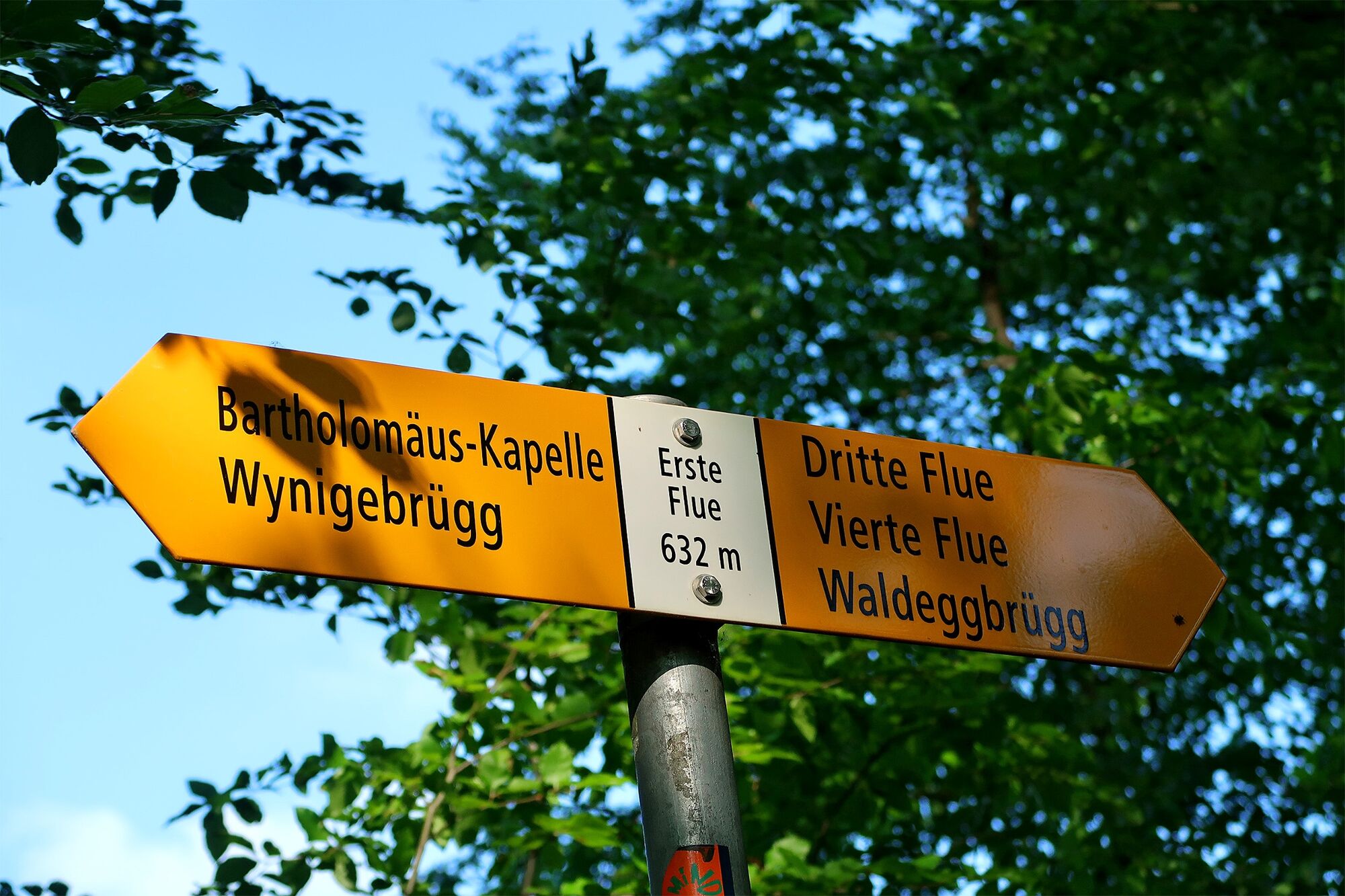
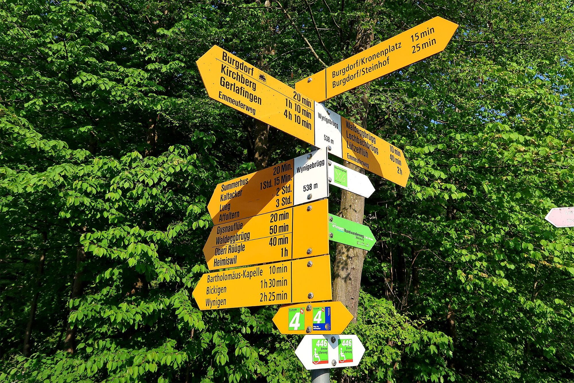
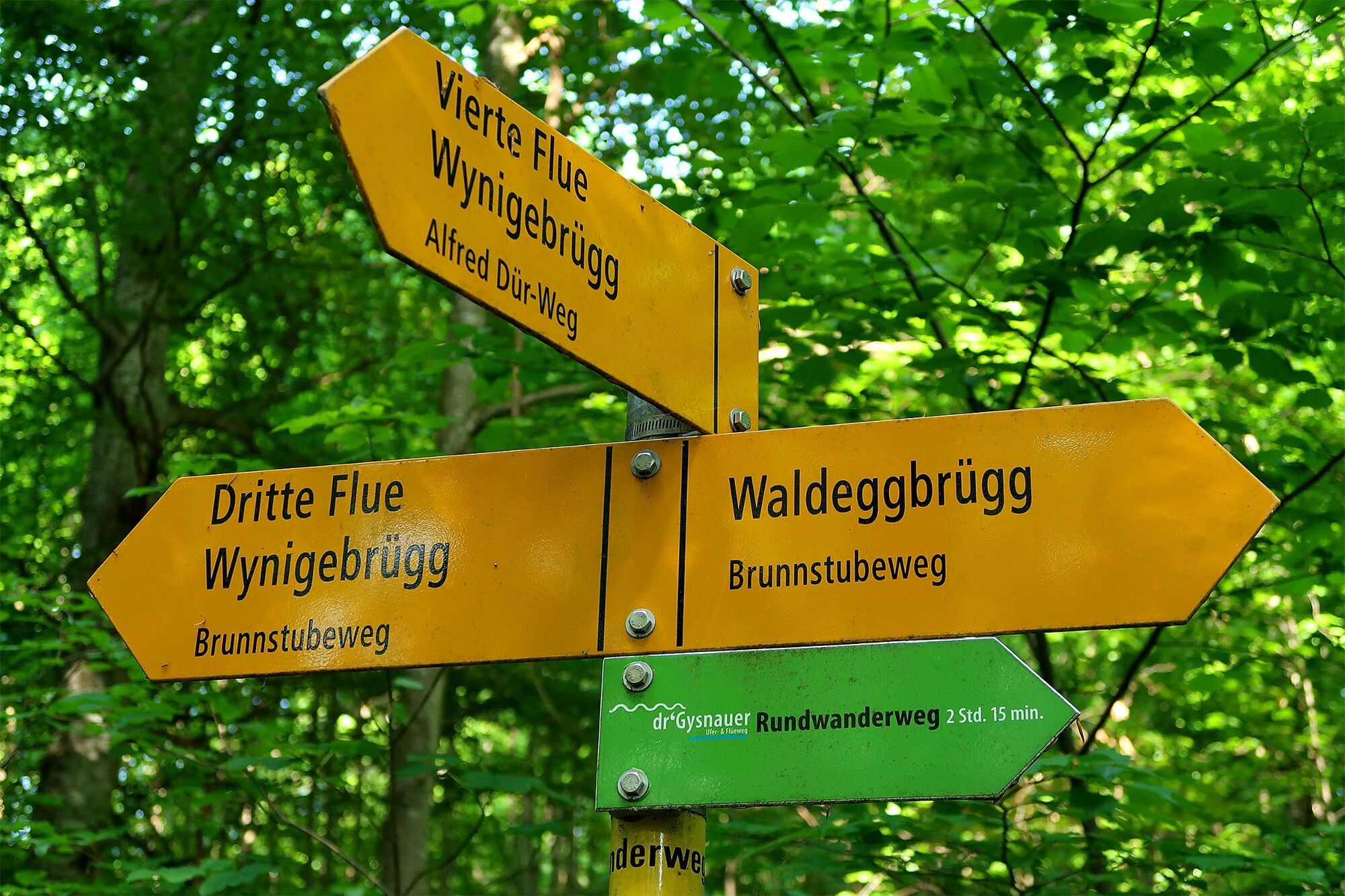
From the train station, you first walk down one of the many paths to the river Emme next to the "Waldeggbrügg". We cross the bridge and the river Emme, then climb the Waldegghole and already find ourselves in the middle of the Gysnauflühe nature reserve. The marked hiking trail meanders from rock wall to rock wall through the forest, and there is much for children to discover: lizards lurking under gnarled roots, mushrooms that are best only looked at and, from the first sandstone formation ("Flue"), a magnificent view over the city and the castle opposite. The steep descent down to St. Bartholomew's Chapel is also an adventure in itself. The chapel was also called the "Siechenkapelle" (hospice chapel) in the past, as it served as a place of worship for the lepers who had to live outside the city walls. Today, the chapel holds worship and wedding services, and doubles as a concert venue. At the Wynigebrügg (bridge), we reach the Emme again and walk at our own pace back to Burgdorf station.
- Directions
-
From Burgdorf train station (533 m), walk down to the river Emme and use the "Waldeggbrügg" (545 m) bridge to cross this. Walk up through the "Waldegghole" (550 m) for a short while, then keep following the yellow route markers, walking from "Flüe" to "Flüe" over the Gysnauflühe (650 m). Behind the first "Flüe" rock formation, walk down along the sunken path, passing St. Bartholomew's Chapel, until you reach Wynigebrügg (538 m) bridge. Cross the Emme on this bridge and walk back to Burgdorf train station at your own pace (either directly or with an en-route visit to the castle).
- Highest point
- 647 m
- Endpoint
-
Burgdorf, train station
- Height profile
-
 © outdooractive.com
 - Equipment
-
Normal hiking equipment; in summer, swimwear.
- Safety instructions
-
An easy circular walk on marked trails across the Gysnauflühe rock formations. Hard-surfaced and natural paths, yellow signposts. Keep a close eye on children on top of the Gysnauflühen rock formations (steep cliffs)! Climb grade: T2.
- Tips
-
Castle Burgdorf is currently in the process of being redeveloped. By 2020, it is envisaged that the castle will be home to a museum, a youth hostel and a selection of eateries.
- Directions
-
Travel by car to Burgdorf.
- Public transportation
-
Travel by train to Burgdorf.
- Parking
-
Car parking spaces and multi-storey car parks are available in Burgdorf.

-

-
AuthorThe tour Flüeweg Burgdorf is used by outdooractive.com provided.
En grande partie en forêt avec quelques points de vue sur la ville mais ceux-ci sont fortement bouchés par la végétation (même début mars). Secteur forestier bruyant à cause du trafic. Les secteurs les plus intéressants sont la chapelle, la 100ène de mètre du chemin en pierre ronde, la vieille ville et les cheminées de gypse visible depuis la rivière.


General info
-
Solothurn und Region
1454
-
Wasseramt
677
-
Burgdorf
102