


- Rating
-
- Starting point
-
Interlaken Ost, railway station
- Route
-
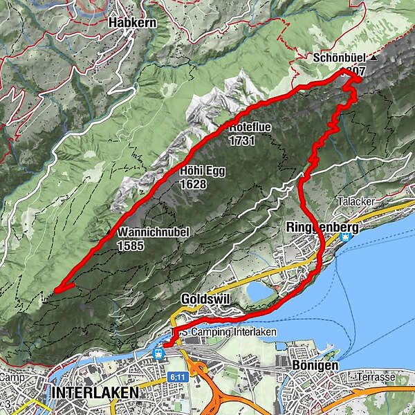
Interlaken (568 m)Ländte 1 / Ländte 20.1 kmGoldswil0.6 kmGoldswil (See) (566 m)0.9 kmSeegärtli1.4 kmRinggenberg (589 m)3.0 kmGassen3.1 kmBreitenacher3.1 kmMuri3.2 kmFlüela3.2 kmUndere Chleinenberg3.3 kmHopflouena3.3 kmOberes Stocki3.5 kmAm Hubel3.5 kmGaschwandi3.5 kmUssers Blatti3.7 kmDicki3.8 kmInders Blatti3.8 kmGuntmad4.8 kmByssmeren5.3 kmWeidli5.4 kmTorwang5.8 kmTeni Hüttli6.4 kmTeni6.6 kmHoretalp7.3 kmRoteflue (1,731 m)8.6 kmHöjenegg9.4 kmHöhi Egg (1,628 m)9.5 kmWannichnubel (1,585 m)10.7 kmHarderkulm11.6 kmPanorama-Restaurant Harder-Kulm11.8 km
- Best season
-
JanFebMarAprMayJunJulAugSepOctNovDec
- Description
-
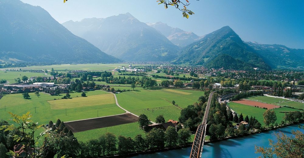
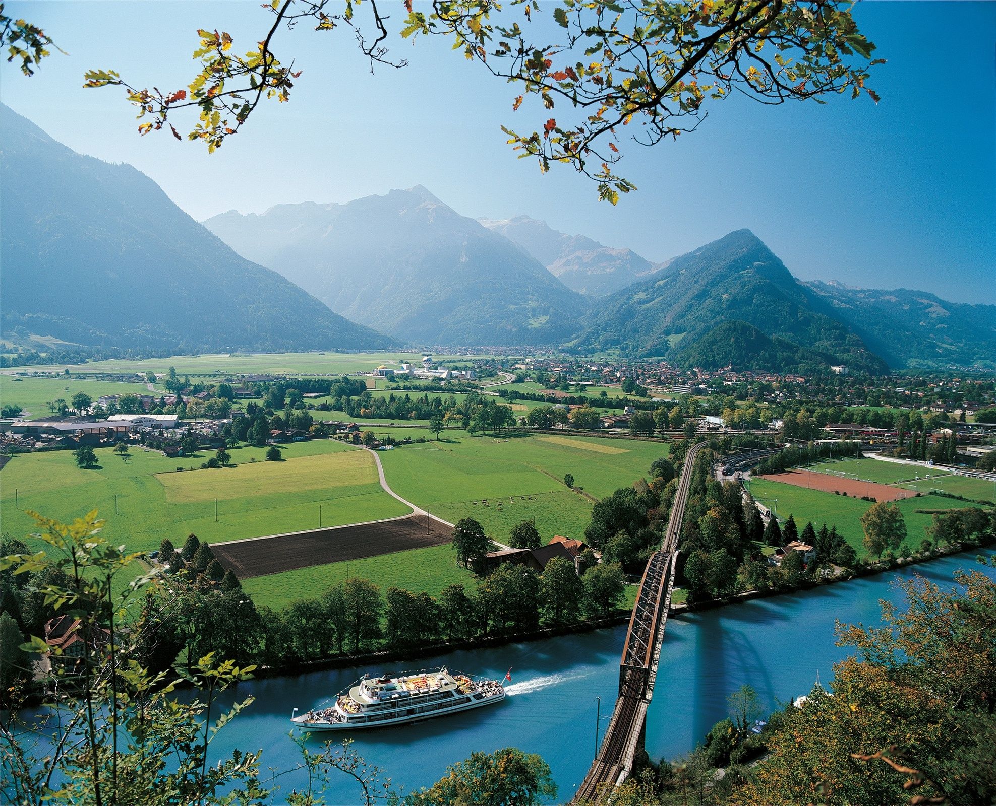
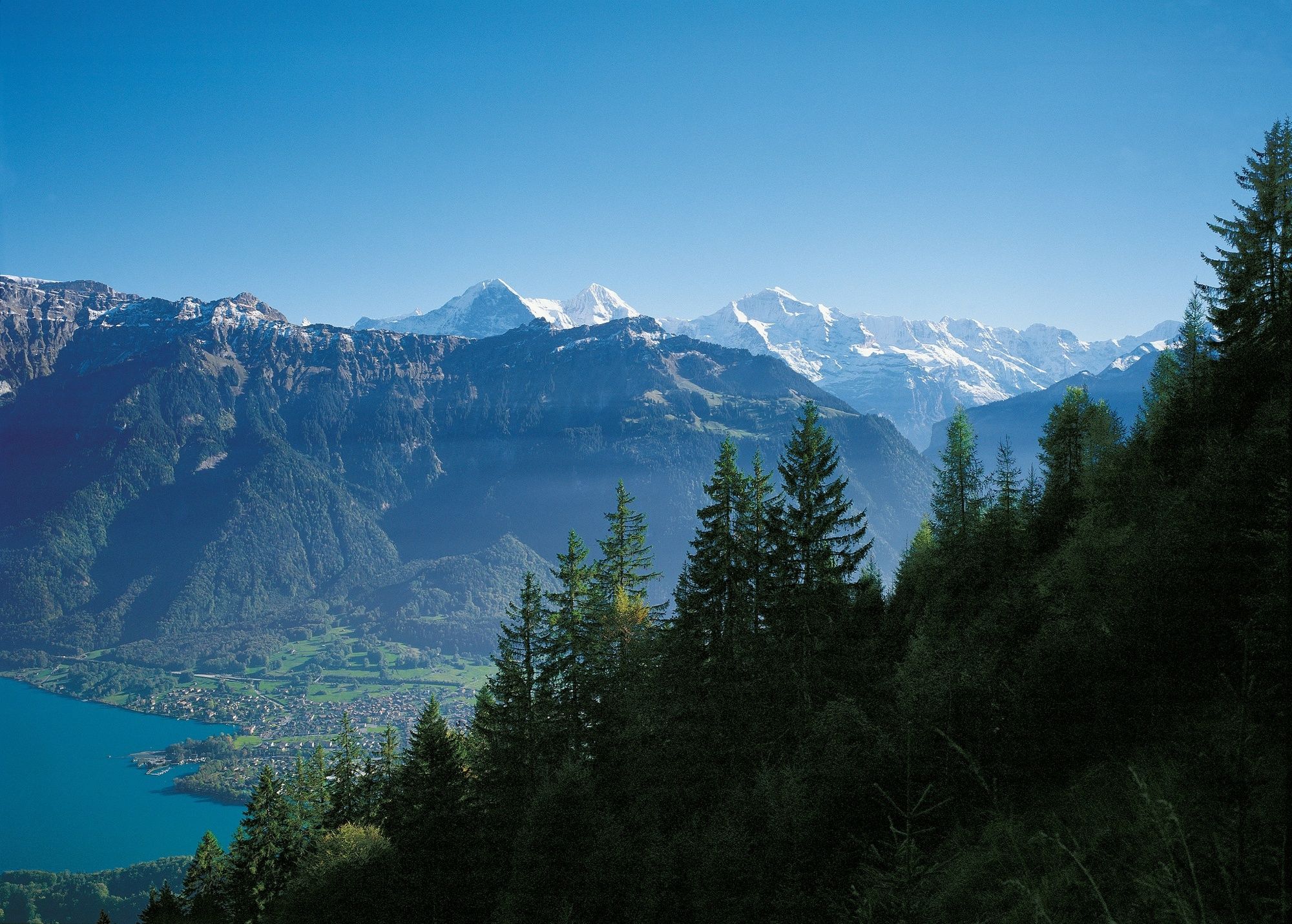
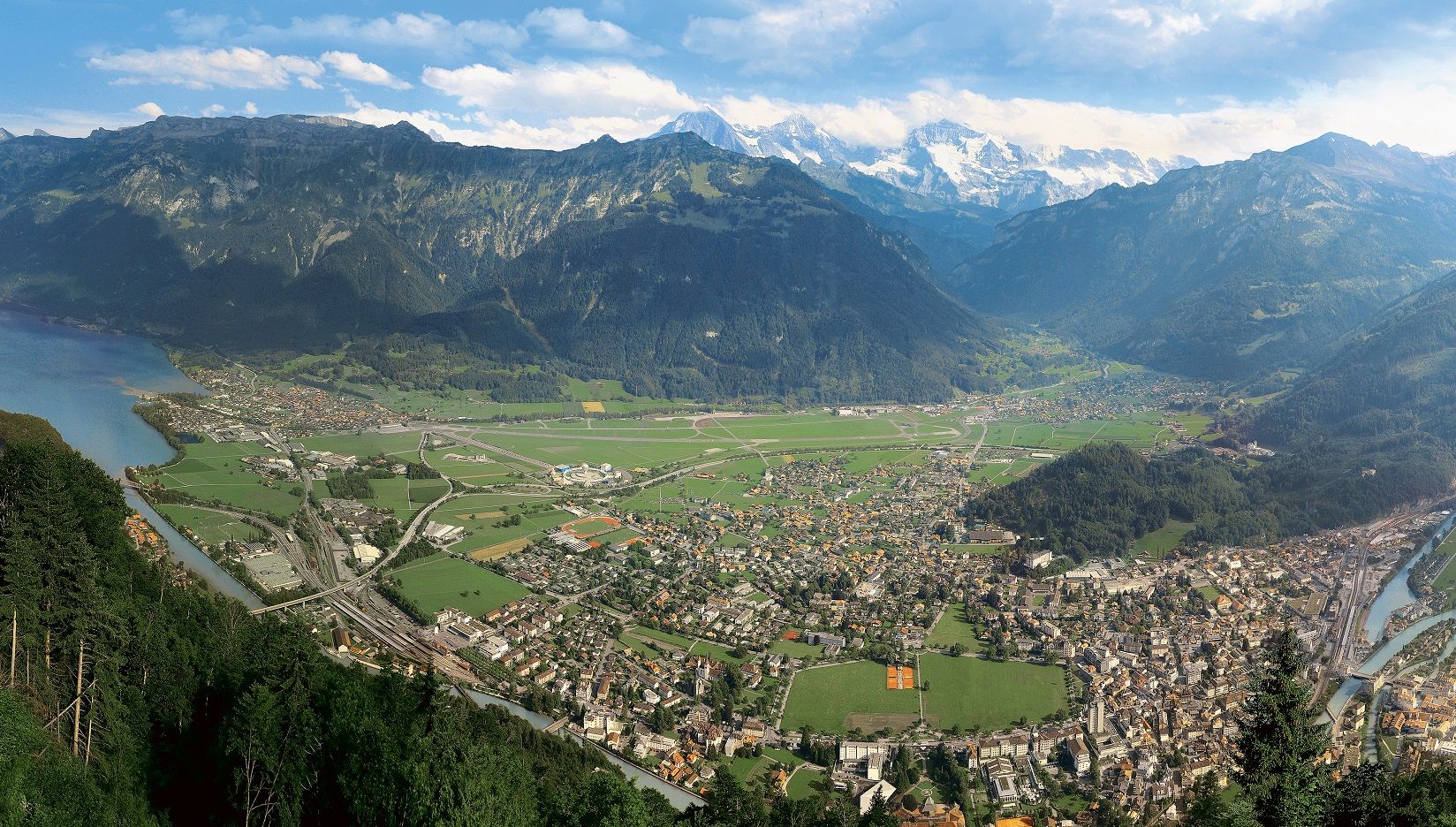
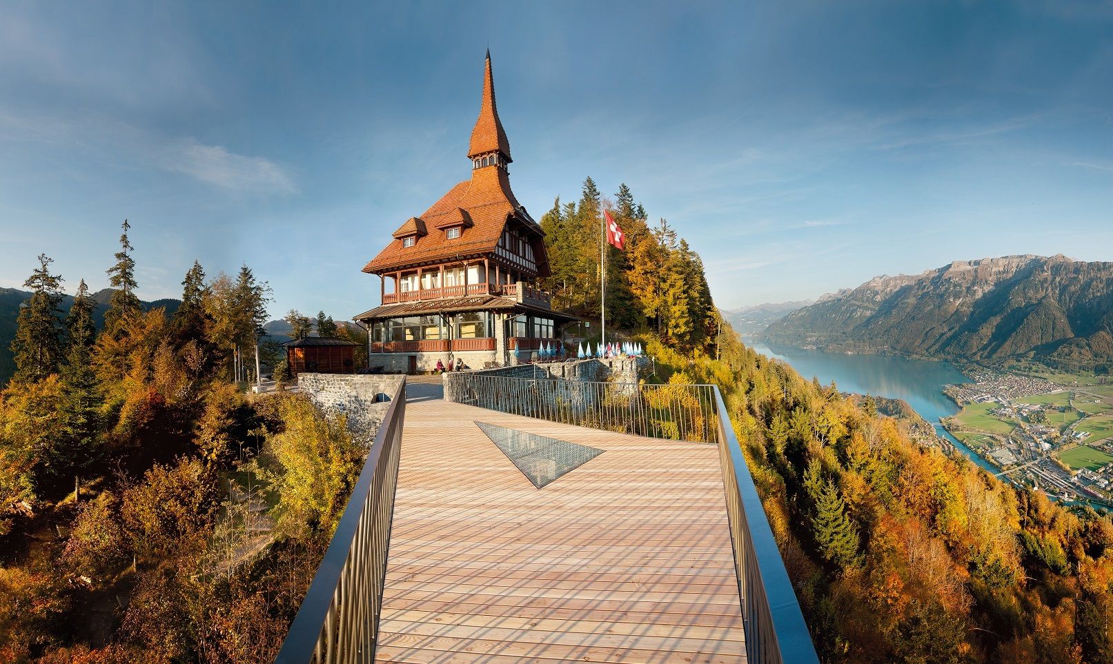
From Interlaken Ost, the trail first leads comfortably along the Aare River and the railway line to Ringgenberg. This is where the steep and challenging mountain trail begins for experienced hikers in good shape. The trail goes up to Blatti through a shady forest to the Graggentor, a natural rock arch. The path to the Alp Horet and on to the Roteflue runs flat over the Wannichnubel along the Harder ridge. The Harder Railway station, the destination of the walk, is no longer far from the Harder Kulm restaurant.
- Directions
-
Interlaken Ost - Ringgenberg - Graggentor - Harder Kulm
- Highest point
- 1,751 m
- Endpoint
-
Harderbahn, Bergstation
- Height profile
-
 © outdooractive.com
 - Equipment
-
Normal hiking gear, hiking boots with good soles and walking sticks help with the ascent.
- Safety instructions
-
Mountain hike with some exposed sections.
- Additional information
-
Hike 75
(in the printed summer panoramic map of the Jungfrau Railways) - Directions
-
Via Bern or Lucerne to Interlaken. Or from the south, via the Grimsel Pass (summer only) or the Simplon Pass and the Lötschberg car-transport train to Interlaken.
- Public transportation
-
Arrival and departure via Interlaken Ost railway station.
- Parking
-
Uncovered parking next to Interlaken train station.
- Author
-
The tour Interlaken - Ringgenberg - Roteflue - Harder Kulm is used by outdooractive.com provided.
GPS Downloads

General info
Refreshment stop
A lot of view
Other tours in the regions
-
Obwalden
2014
-
Interlaken
1099
-
Ringgenberg - Goldswil - Niederried
434


