- Brief description
-
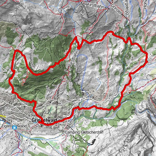
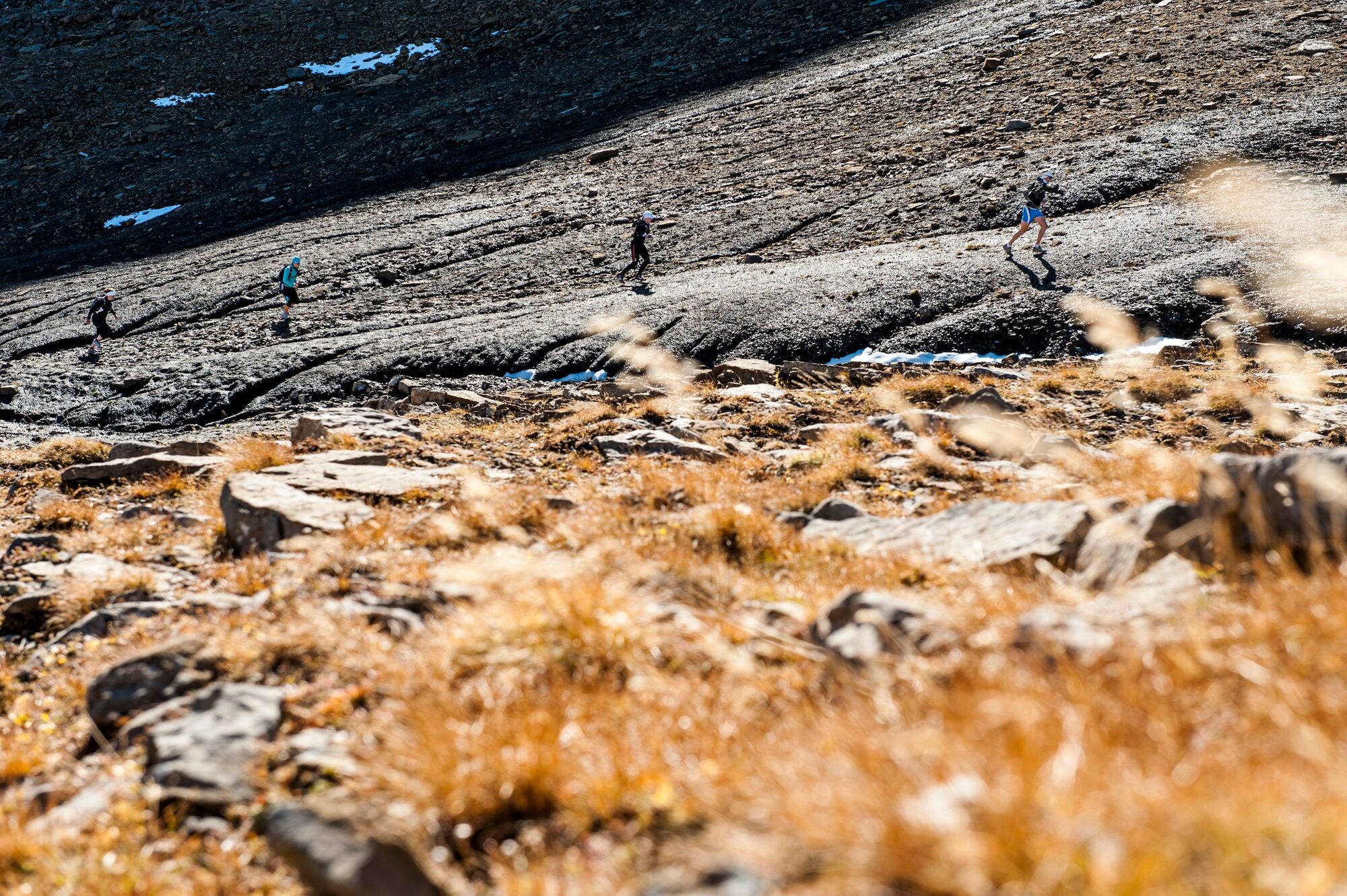
The E16 track is located on the sunny side of Grindelwald. Thanks to the southern exposure, training can be done on this section during eight months of the year.
- Difficulty
-
easy
- Rating
-
- Starting point
-
Grindelwald Sports Centre
- Route
-
Swiss Alp Resort0.5 kmGrindelwald0.9 kmBruderklausenkirche0.9 kmDorfkirche2.0 kmRancher Bar3.1 kmBergrestaurant Bort10.2 kmChuestall10.2 kmBort (1,564 m)10.4 kmNodhalten12.5 km
- Best season
-
JanFebMarAprMayJunJulAugSepOctNovDec
- Description
-
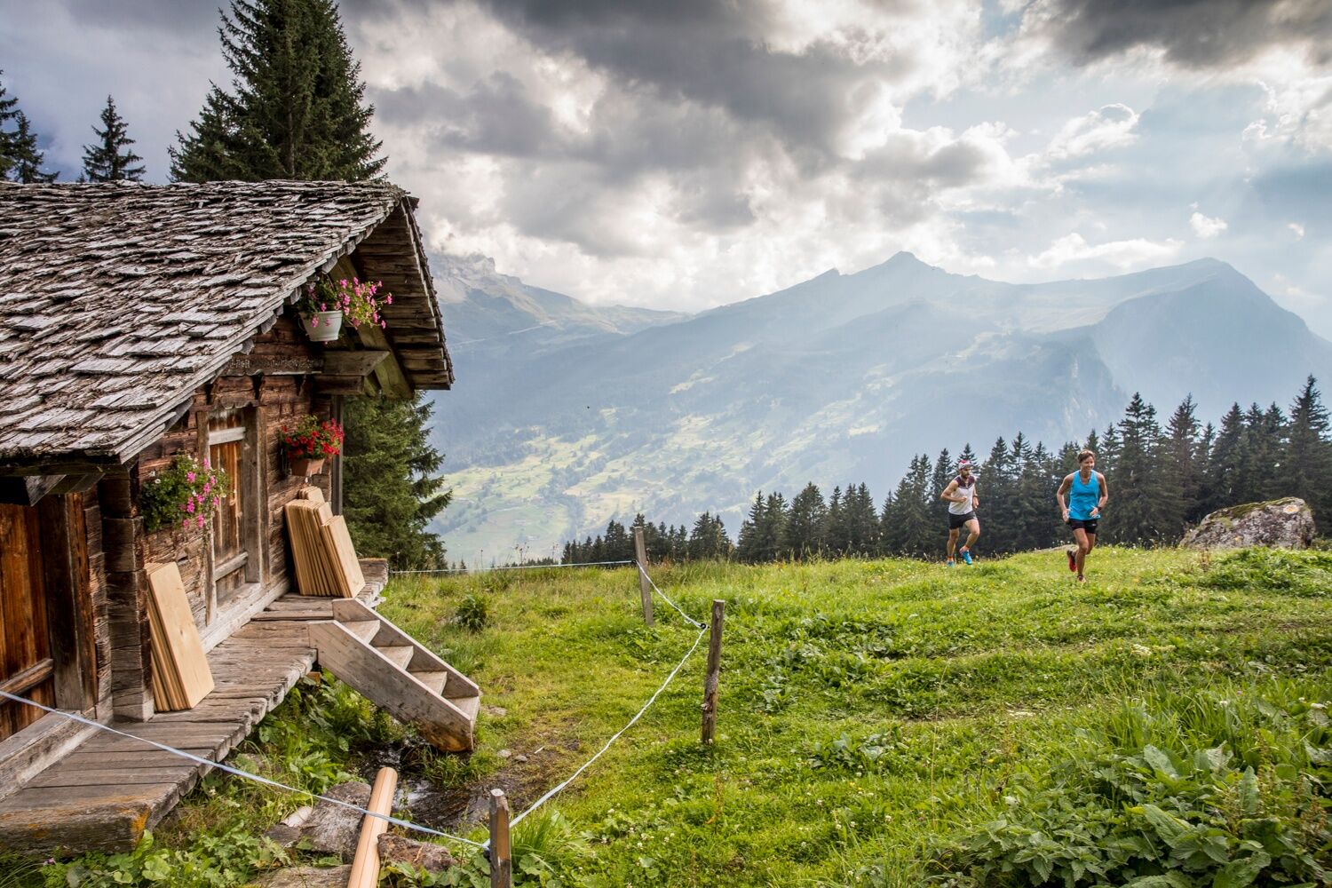
The E16 is the perfect pleasure trail. Thanks to the southern exposure, the route is snow-free from April to November. As with all distances, the start is in Grindelwald. The difference in altitude is 960 metres. 11km of the distance are on hiking and forest paths. The remaining 5km are asphalted roads. The views along the route are not bad. The view of the Wetterhorn north face or the view from Bort to the Eiger and Kleine Scheidegg makes you forget the exertions.
Route characteristics
Length 16km
Height difference + 960m / - 960m
68% (11km) trail, hiking path, forest path / 32% (5km) asphalt
Start direction Hotel Wetterhorn/Lauchbühl
- Directions
-
Grindelwald - Oberer Gletscher - Berien - Bort - Holewang - Grindelwald
- Highest point
- 1,640 m
- Endpoint
-
Grindelwald Sports Centre
- Height profile
-
 © outdooractive.com
 - Equipment
-
First aid kit
Clothing suitable for the weather (always bring rain gear)
Drink and food
Telephone - Safety instructions
-
In spring and autumn, snow can still be present.
- Tips
-
Free running shoe test at the Backdoor Shop Grindelwald
- Additional information
- Directions
-
From Basel and Geneva, the fastest route to the Jungfrau Region is via Bern. From Zurich, the route via Lucerne and the Brünig Pass is recommended. The pass is open all year round.
From the south, travel to the Jungfrau Region via the Grimsel or Susten Pass. Both passes are only open in summer. An alternative is the Simplon Pass with subsequent car transport through the Lötschberg tunnel.
Grindelwald
From Interlaken we follow the main road to Zweilütschinen. Here we turn left towards Grindelwald. The whole trip takes about 30 minutes and leads over a partly winding road.
- Public transportation
-
Thanks to its central location in Europe, Switzerland is served by international trains from over 12 countries. Within Switzerland, Intercity trains run from Basel and Lucerne directly to the Jungfrau Region. Travellers from Zurich change trains in Bern. The trains run every half hour.
Grindelwald
From Interlaken Ost railway station we reach Grindelwald without changing trains on the Bernese Oberland Bahn (BOB). Important: Get on the rear part of the train, as it splits in Zweilütschinen. If you get on at the front, you will end up in Lauterbrunnen. The journey takes 30 minutes to Grindelwald Terminal (V-Bahn). Three minutes later we are at the terminal in the village.
There are three stations in Grindelwald (Terminal, Grund and Dorf). The terminal station (Dorf) is in the centre of Grindelwald.
- Parking
-
Grindelwald
There are three public car parks: Parkhaus Eiger+ (252 parking spaces), Parkhaus Sportzentrum (160 parking spaces) and the new Terminal Parking (1000 spaces) of the V-Bahn. Alternatively, we can also use the car park in Grindelwald Grund.


-

-
AuthorThe tour Eiger Ultra Trail E16 – Enjoyment Trail Nr. 11 is used by outdooractive.com provided.