© Martin Wymann / Naturpark Diemtigtal

© Martin Wymann / Naturpark Diemtigtal

© Martin Wymann / Naturpark Diemtigtal

© Martin Wymann / Naturpark Diemtigtal

- Brief description
-
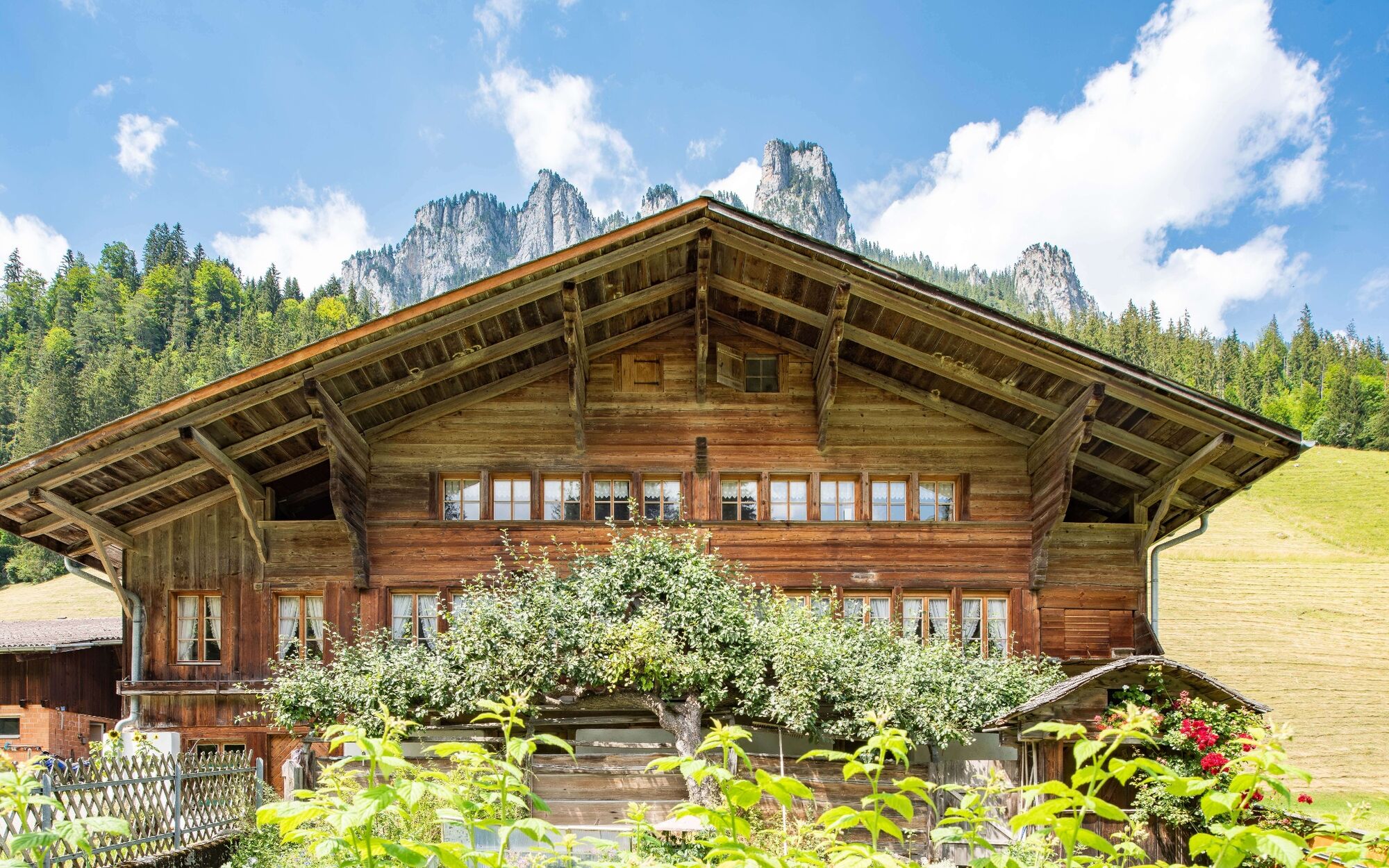
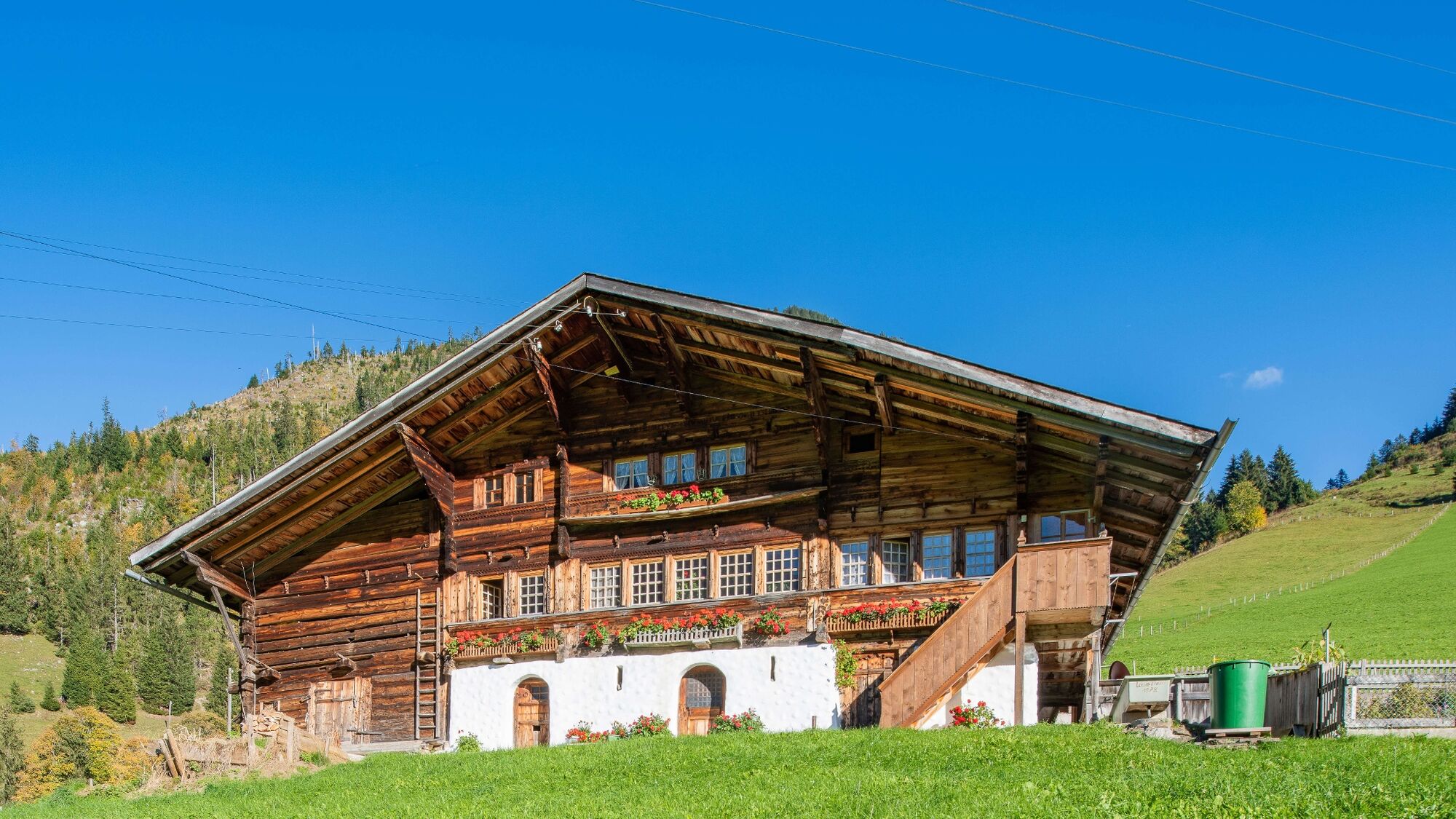
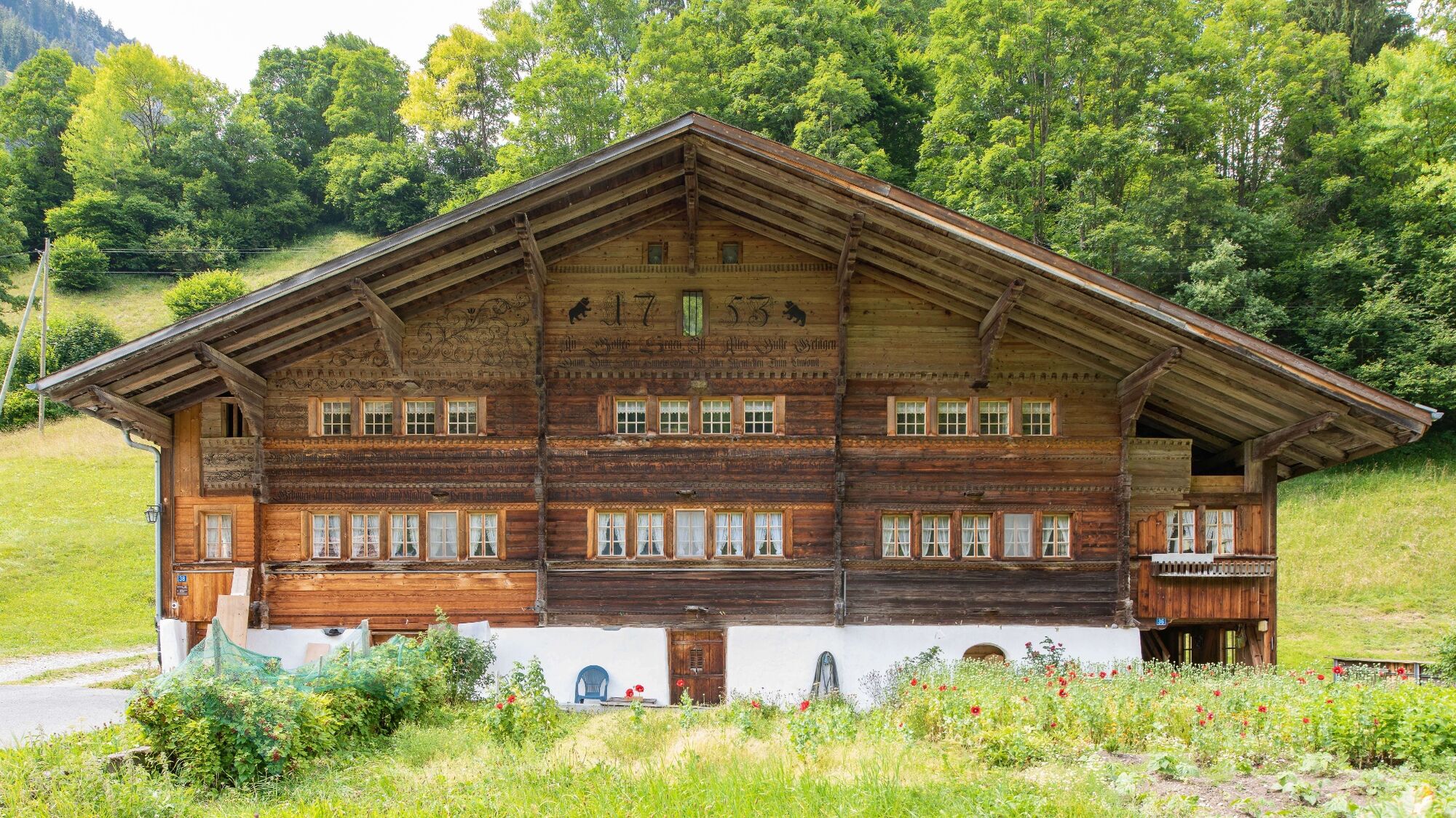
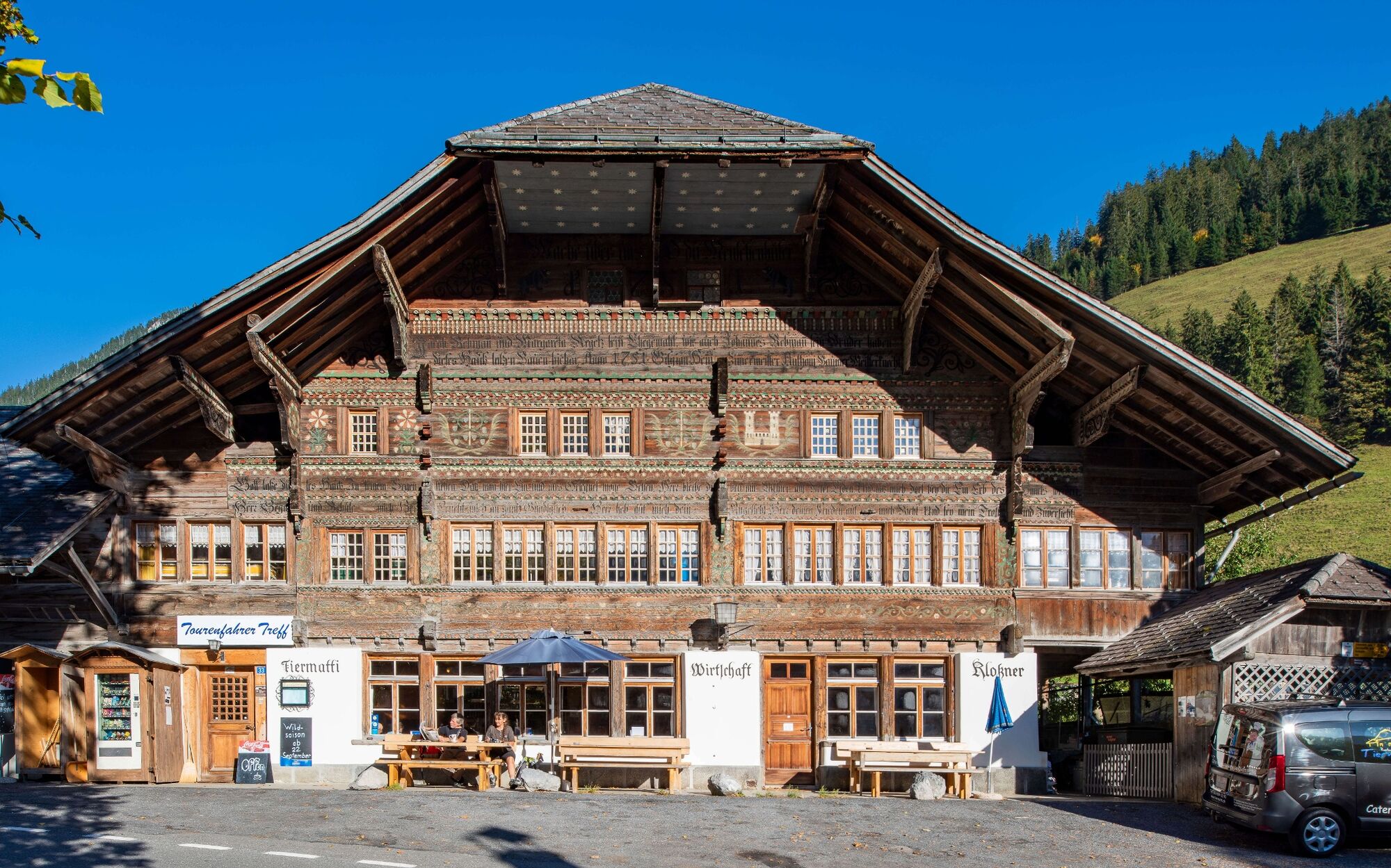
The municipality of Diemtigen was awarded the Henri-Louis Wakker Prize by the Swiss Heritage Society 30 years ago for its building culture and planning. The «Rear of the valley» house trail takes you to the most magnificent contemporary witnesses in the rear valley.
- Difficulty
-
easy
- Rating
-
- Starting point
-
Wiriehorn valley station, Zwischenflüh
- Route
-
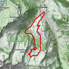
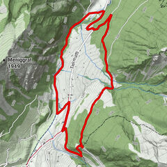
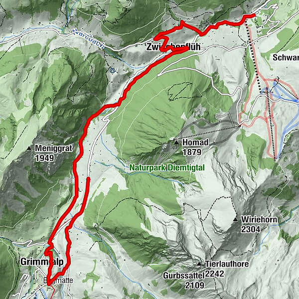
Riedli0.0 kmDiemtigen Riedli0.1 kmLaden1.6 kmMur1.6 kmZwischenflüh2.9 kmRestaurant Circus-Schenke6.7 kmKapelle Schwenden8.2 kmGrimmialp (1,235 m)8.5 km
- Best season
-
JanFebMarAprMayJunJulAugSepOctNovDec
- Description
-
The three house trails lead you to the most magnificent houses.
The oldest houses in the Diemtigtal date from the 16th century. However, it is the buildings from the second half of the 18th century and beginning of the 19th century which lend the landscape its special character. The Diemtigtal owes its magnificent buildings to a combination of prosperous farmers and talented craftsmen, including renowned carpenters such as the master carpenter Hans Messerli (1720-1806).
The three house trails «Front of the valley», «Middle of the valley» and «Rear of the valley» show you the most impressive houses and their stories. - Directions
-
Follow the Diemtigtal House Trail from the Wiriehorn valley station (Riedli) along the valley hiking trail in the direction of Schwenden. After a short climb through the Gandgraben, you reach Oeyen. Here you will find several fascinating buildings in a small area before returning to the valley hiking trail. The path leads you past three impressive houses to Schwenden. At Geissboden you walk along the valley road for 250 m and then branch off to the 100-year-old Schwenden Chapel. Right next to it you will find today's Hotel Kurhaus Grimmialp, which was originally built as a health resort for drinking and bathing cures. Via Schürmatte, on to Schlatti and the former Tiermatti inn, you walk mostly along the valley road. At the end point you will find the last house of the hike. The path is marked with brown direction signs.
The end point Tiermatti is at a PostBus stop (note the timetable!). From here you can also return directly to the valley hiking trail if you want to finish your hike at the starting point Riedli (additional 1 hour 20 minutes hiking time). - Highest point
- 1,234 m
- Endpoint
-
Tiermatti, Schwenden
- Height profile
-
 © outdooractive.com
 - Equipment
-
Sturdy shoes, clothing appropriate to the weather, food and drinks for the road
- Safety instructions
-
The hike leads mainly along side roads (car traffic).
- Tips
-
Can also be done in an e-bike day tour: combine all three trails and rent an e-bike from the Diemtigtal Nature Park office.
- Additional information
-
A flyer with an overview map and information in English about the magnificent buildings is available from the Diemtigtal Nature Park office. You can also find exciting background information on the houses along the trail in our > App.
Diemtigtal Nature Park
Bahnhofstrasse 20
3753 Oey
Phone +41 33 552 26 00
info@diemtigtal.ch
www.diemtigtal.ch
Open or closed?
Find out more in our > summer sports report - Directions
-
Motorway A6 Bern direction Zweisimmen, 1 km after the Simmenfluhtunnel turn left direction Diemtigtal. Follow the Diemtigtal road into the valley for 11 km to the Wiriehorn valley station.
- Public transportation
-
By train to Oey-Diemtigen station (Spiez–Zweisimmen line). Continue by PostBus to the stop «Riedli, Talstation Wiriehorn»
- Parking
-
Paid parking is available at the Wiriehorn valley station.
- Author
-
The tour Diemtigtal House Trail «Rear of the valley» is used by outdooractive.com provided.
GPS Downloads


General info
Cultural/Historical
Insider tip
A lot of view
Other tours in the regions
-
Oberwallis
1877
-
Naturpark Diemtigtal
934
-
Weissenburg - Därstetten
180