
- Difficulty
-
difficult
- Rating
-
- Starting point
-
Zweisimmen, railway station
- Route
-
Zweisimmen (942 m)0.0 kmE Basta0.1 kmSchlössli2.9 kmGrubenwald3.0 kmLaubeggfall4.2 kmRawil6.1 kmWeissenbach (843 m)6.2 kmWeissenbach6.5 kmSternen8.4 kmReidenbach8.5 kmSimmental9.5 kmBoltigen9.6 kmKirche Boltigen10.0 kmPfaffenried12.5 kmOberwil14.7 kmWeissenburg18.1 kmI der Fribrig18.8 kmGrabenmatte18.9 kmReichenbachmatte19.1 kmRichenbach19.1 kmDärstetten19.5 kmBären19.6 kmDärstetten (758 m)19.7 kmHüseli19.9 kmWiler20.7 kmJäger22.0 kmChlidorf Beizli23.9 kmErlenbach24.4 kmLinde24.4 kmOey (669 m)26.0 kmLatterbach (700 m)26.3 kmBrünnlisau28.9 kmOnkel Thoms Schnitzelscheune31.0 kmHirschen32.4 kmReutigen (622 m)32.9 kmTell33.2 kmNiederstocken (634 m)36.3 kmRestaurant Stockhorn37.6 kmOberstocken (691 m)39.3 kmPohlern (710 m)40.8 kmBären42.9 kmBlumenstein (659 m)43.2 kmRestaurant Traube44.9 kmWattenwil (603 m)46.9 kmKirche Wattenwil47.2 kmRüti bei Riggisberg53.3 kmRüti53.7 kmLandgasthof Bären54.5 kmGurnigelbad58.3 kmGurnigel Bad58.3 kmStierenhütte63.5 kmGurnigel63.5 kmWasserscheide (1,584 m)64.5 kmSchwefelbergbad68.3 kmSangernboden75.3 kmZollhaus78.9 kmRestaurant Zollhaus79.5 kmPlaffeien (856 m)83.1 kmLandgasthof Hirschen Plaffeien83.2 kmOberschrot (850 m)83.4 kmRestaurant Sahli84.5 kmPfarrkirche Sankt Martin85.9 kmJäger85.9 kmPlasselb (856 m)86.0 kmBuvette du Tennis86.9 kmRoggeli Wasserfall87.9 kmSpittelvorschis88.9 kmChemi-Hütta AG91.2 kmSankt Silvester (848 m)91.3 kmFörsterhaus91.3 kmNeumatt92.5 kmGomma92.9 kmCafé du Pafuet94.5 kmLe Pafuet94.6 kmRestaurant de la Croix Blanche96.1 kmLe Mouret96.4 kmPichlen (767 m)96.9 kmSenèdes98.9 kmCroix Blanche100.7 kmTreyvaux100.8 kmRossens (708 m)104.7 kmLe Bry107.6 kmSt-Pierre107.6 kmChapelle Avry-devant-Pont109.3 kmAvry110.1 kmGumefens111.4 kmChapelle Gumefens111.5 kmLa Cigogne111.9 kmWüppingen113.2 kmMaison-de-Ville113.5 kmSchärlingen116.3 kmAuberge de la Croix-Verte116.3 kmEglise Morlon118.9 kmMinotel Le Gruyérien119.1 kmMorlon (751 m)119.2 kmBulle (771 m)119.7 kmBruck (718 m)123.3 kmHotel de Ville123.5 kmPré de Joux126.8 kmLe Baron131.6 kmLa Bourliandaz132.5 kmIm Fang136.9 kmJaun (1,015 m)140.3 kmCascade de Jaun140.4 kmRestaurant Wasserfall140.4 kmSchüpfen148.1 kmEschi154.8 kmWeissenbach155.6 kmWeissenbach (843 m)155.9 kmRawil156.1 kmLaubeggfall157.9 kmSchlössli158.8 kmGrubenwald159.0 kmStalde162.2 kmZweisimmen (942 m)163.2 km
- Best season
-
JanFebMarAprMayJunJulAugSepOctNovDec
- Description
-
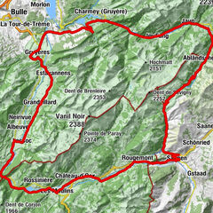
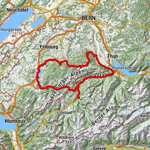
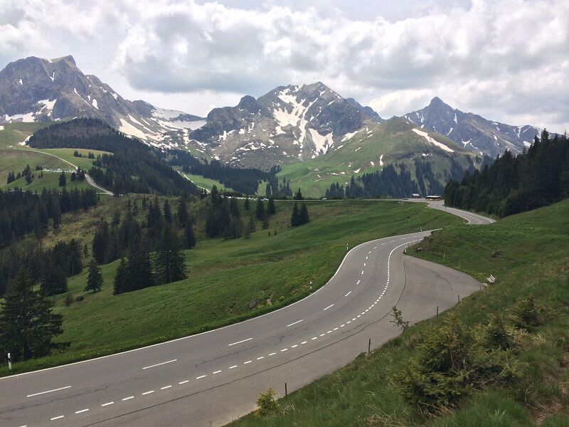
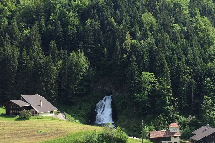
The king round to the north contains many kilometres, more altitude and all this with a variety of roads and landscapes. With the Gurnigel pass and the Jaun pass it conquers two well-known and long passes. In the canton Fribourg the route leads to the picturesque western side of the Lac de Gruyère.
- Directions
-
Zweisimmen - Reutigen - Wattenwil - Gurnigel - Plaffeien - Le Mouret - Rossens - Morlon - Broc - Jaunpass - Zweisimmen
- Highest point
- 1,609 m
- Endpoint
-
Zweisimmen, railway station
- Height profile
-
 © outdooractive.com
 - Tips
-
www.strava.com/routes/1147911
- Additional information
- Directions
-
The Destination Gstaad is located in the south-west of Switzerland right on the border to the French-speaking part of the country. The Destination is easily accessed by rail or car from the regions around Lake Thun and Lake Geneva and the Gruyere region Direct connections to the European high-speed rail network and all international airports in Switzerland guarantee a time-saving and pleasant journey.
- Public transportation
-
Zweisimmen station

-

-
AuthorThe tour Königsrunde Nord is used by outdooractive.com provided.
GPS Downloads

General info
Refreshment stop
Other tours in the regions