
- Brief description
-
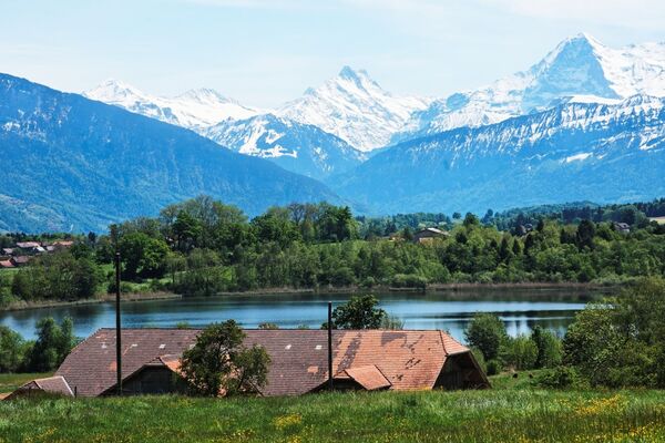
A panoramic route with stunning views of Lake Thun and four thousand-metre-high peaks.
- Difficulty
-
difficult
- Rating
-
- Starting point
-
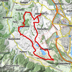
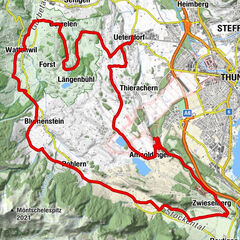
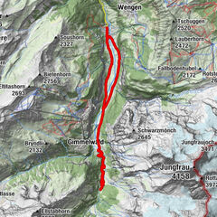
Steffisburg, railway station
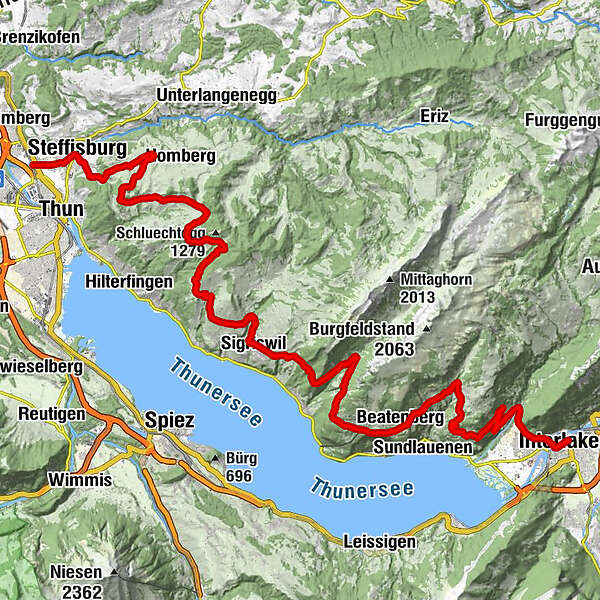
- Route
-
Steffisburg (585 m)1.7 kmThun (560 m)2.6 kmTäfeli4.5 kmGüetli4.6 kmGappen5.3 kmGappe5.9 kmFlühli6.0 kmBarmettle6.2 kmDörfli6.4 kmSchwendibach (880 m)6.6 kmBolzacher6.6 kmWilimatt6.8 kmGoldiwil8.3 kmKirche Goldiwil8.5 kmHeiligenschwendi12.1 kmHubelweid12.1 kmStapfebode12.2 kmSchwendi12.5 kmSigriswil (810 m)20.9 kmGrön25.8 kmSchmocken28.8 kmBeatenberg (1,121 m)29.2 kmBuffet29.4 kmBeatenberg30.8 kmTiefe31.1 kmKirche St. Beat31.6 kmKirche Beatenberg31.7 kmBurgfeld Bistro32.1 kmRegina33.8 kmWaldegg34.0 kmHohlen36.1 kmLuegibrüggli36.7 kmChienberg38.8 kmTanneboum39.7 kmBirmse40.3 kmSt. Niklausen40.7 kmZündli40.8 kmLuziwichel40.9 kmIm Muri41.3 kmBurgergruebe41.3 kmGumme41.4 kmUnterem Berg41.4 kmHomüedig41.6 kmUnderem Berg42.0 kmEvangelisch-Reformierte Kirche Unterseen42.1 kmStedli42.2 kmUnterseen (567 m)42.2 kmSpielmatte42.4 kmBleikimatta42.5 kmArmüli42.6 kmHübeli42.7 kmInterlaken (568 m)43.0 km
- Best season
-
JanFebMarAprMayJunJulAugSepOctNovDec
- Description
-
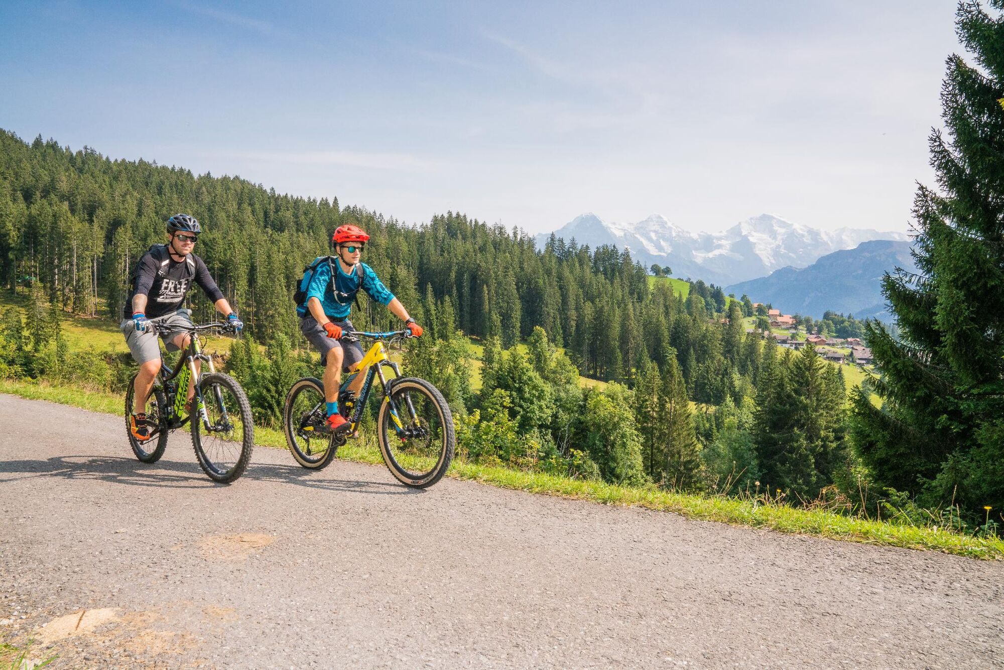
Starting at Thun railway station, the route leads towards Steffisburg. Although the ascent to Goldiwil will leave you mopping the sweat from your brow, any exertion will soon be forgotten when you catch sight of the stunning views of Lake Thun, pyramid-shaped Mount Niesen and four thousand-metre-high peaks. The undulating route continues through flower-carpeted meadows past Ringoldswil and Heiligenschwendi to Sigriswil. Another steep climb follows after Sigriswil. In places this tour is almost alpine in character, and you can enjoy the peace and quiet and scenic splendour of the Justistal valley. All roads are asphalted and therefore easy to ride. Perched on its sun-exposed terrace, the village of Beatenberg is another highlight of this route. Ride on to read Unterseen, traverse the picturesque old town and reach Interlaken's Höhematte meadow via a bridge over the Aare. Here, at the end of the tour, splendid views of the iconic Eiger, Mönch and Jungfrau peak trio await.
- Directions
-
Steffisburg (Thun) - Goldiwil - Schwendi - Ringoldswil - Sigriswil - Justistal - Beatenberg - Waldegg - Interlaken
- Highest point
- 1,199 m
- Endpoint
-
Interlaken West, railway station
- Height profile
-
 © outdooractive.com
 - Additional information
-
Information regarding duration, fitness requirements and technique depend on the chosen bike type (i.e. mountain bike, e-bike, touring bike, racing bike). These are approximate guidelines.
Interlaken Tourismus
Marktgasse 1
CH-3800 Interlaken
0041 33 826 53 00
mail@interlakentourism.ch
www.interlaken.ch
Thun-Thunersee Tourismus
Seestrasse 2
CH-3600 Thun
0041 33 225 90 00
thun@thunersee.ch
www.thunersee.ch
- Author
-
The tour Bernese Oberland Route Stage 1 is used by outdooractive.com provided.