
- Brief description
-
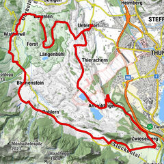
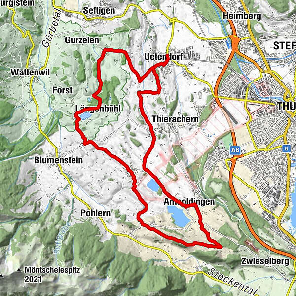
One of the most beautiful cycling routes to the west of Thun, leading through a primeval landscape and past four tiny moraine lakes.
- Difficulty
-
easy
- Rating
-
- Route
-
Uetendorf (554 m)0.2 kmBim Wald5.8 kmLängenbühl (654 m)5.9 kmUebeschi (685 m)9.9 kmHöfen (705 m)12.8 kmDürrenacker16.2 kmBühl16.2 kmAmsoldingen (637 m)17.7 kmUebeschi (685 m)20.0 kmGibliz23.6 kmWildenrütti23.8 kmUetendorf (554 m)25.1 km
- Best season
-
JanFebMarAprMayJunJulAugSepOctNovDec
- Description
-
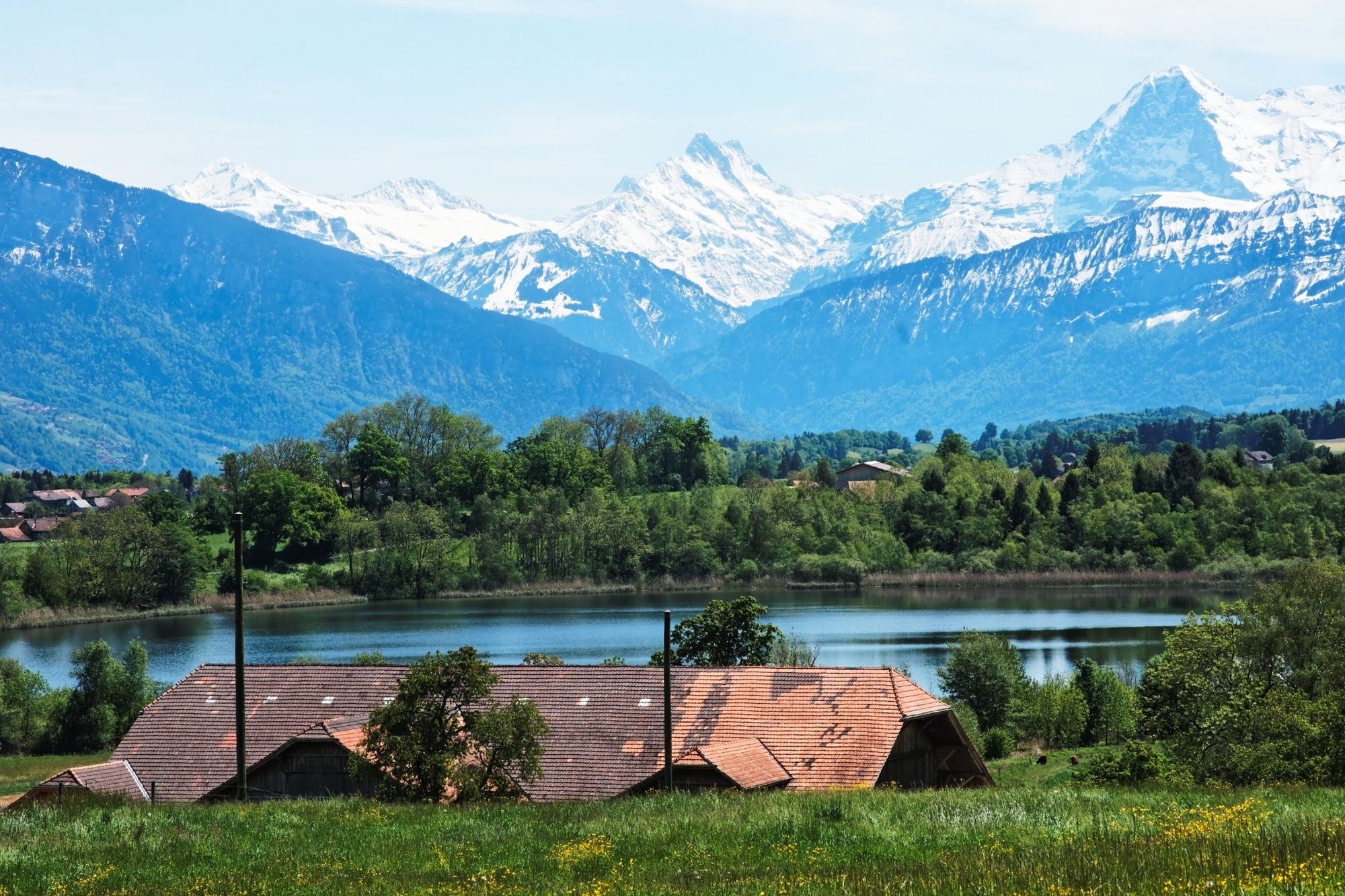
It is worth taking the time to let the impression of this primeval landscape against the backdrop of the Alpine foothills and Bernese Alps work its magic. The circular route takes you from Uetendorf railway station through a varied agricultural region, past the tiny Geistsee, Dittligsee, Uebeschisee and Amsoldingersee moraine lakes. Glacier-smoothed hillocks called drumlins rise in the landscape, often topped by a tree. They bear witness to the region's Ice Age past. In Amsoldingen stands the arguably oldest building in canton Bern – Amsoldingen church, erected around 1000 AD as a Romanesque pillar basilica and dedicated to Saint Maurice. The rectory and ancillary buildings were added around 1700. The small bridge between the former ossuary and the rectory attic was built for tithing storage. Together with the privately-owned castle, rectory and ancillary building, it forms an attractive group of buildings by the same-named lake.
- Highest point
- 747 m
- Endpoint
-
Uetendorf
- Height profile
-
 © outdooractive.com
 - Additional information


- Author
-
The tour Moraine Lakes Route is used by outdooractive.com provided.