- Brief description
-
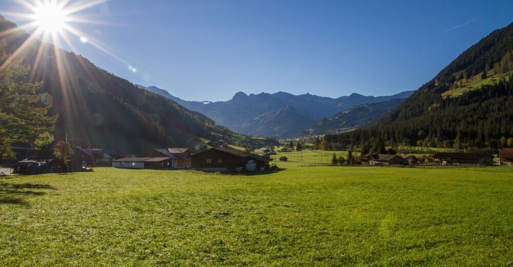
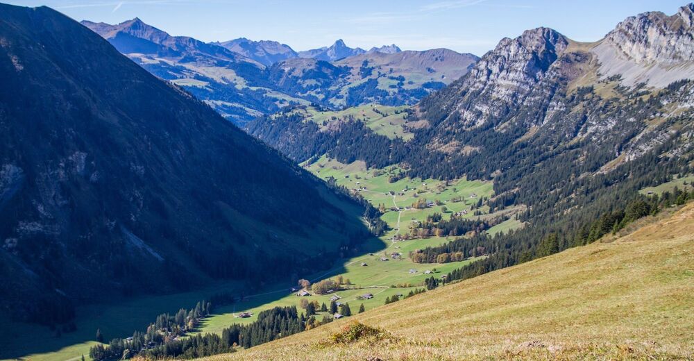
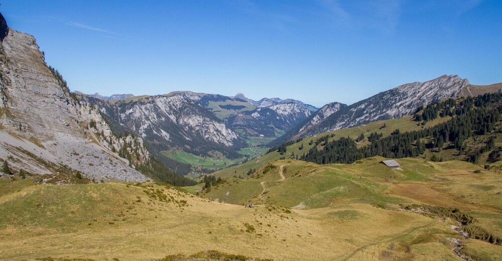
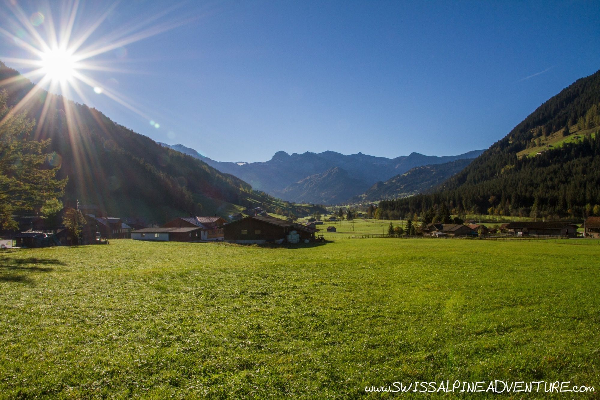
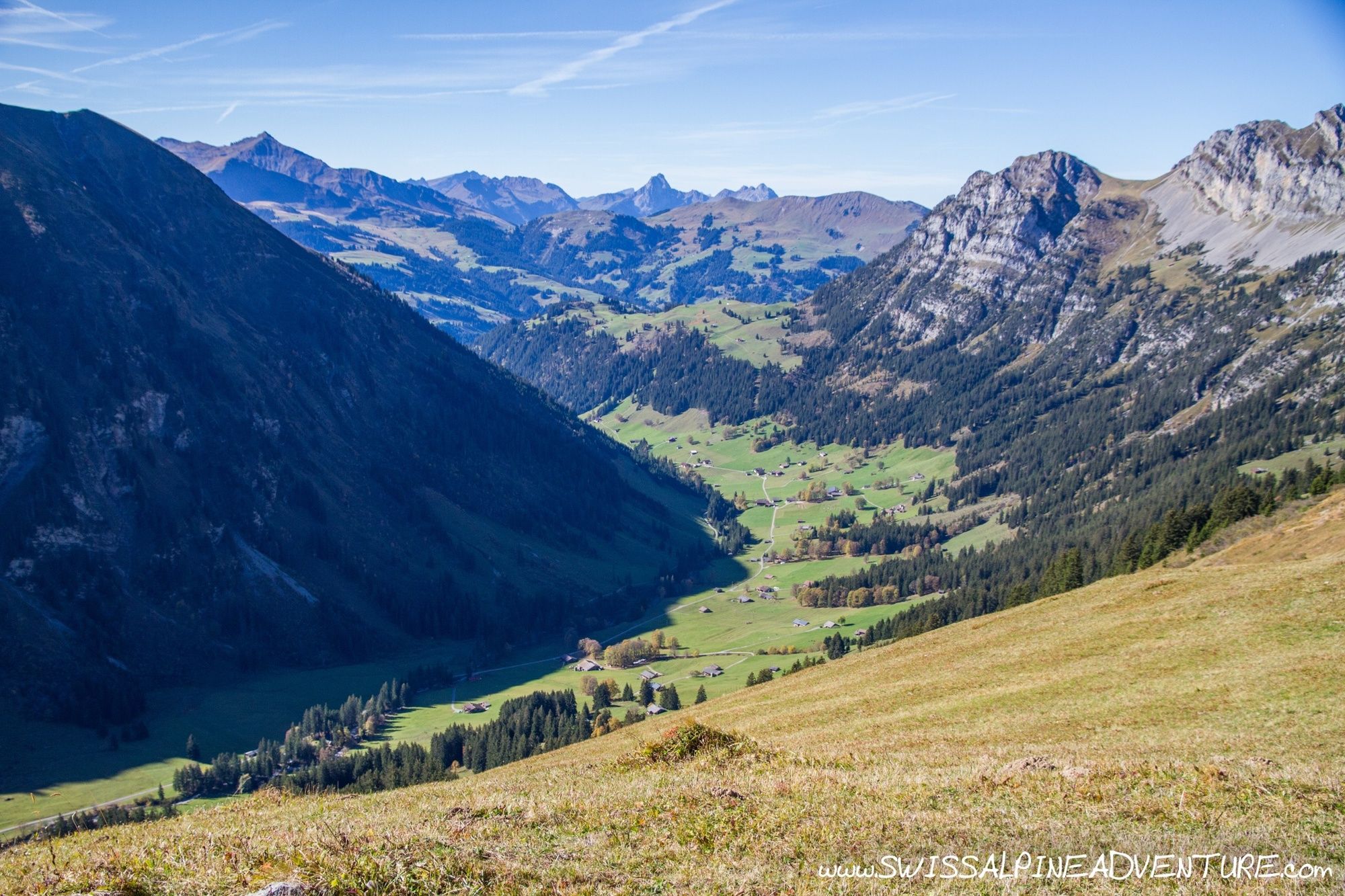
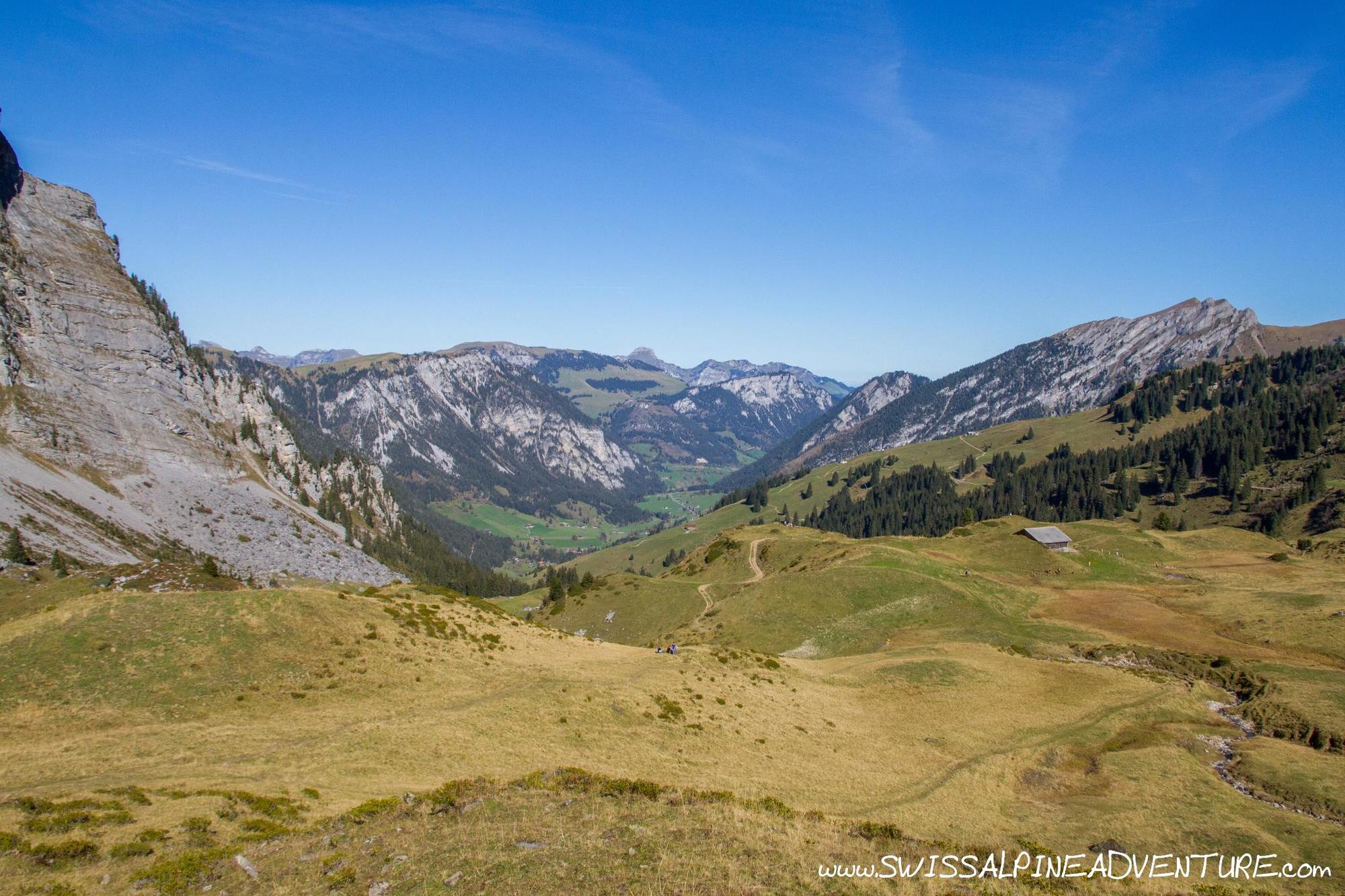
This tour is a scenic tour through some incredibly pretty valleys in the Berner Oberland. The Farmel valley is remote and stunningly beautiful with some of the surrounding mountains almost having a feel of the Dolomites to them. Once over the Grimmifurrgi the descent into the Diemtig valley is sometimes a little difficult with a trail that is often difficult to follow. From Grimmialp there is a singletrail following the main road down the valley almost the whole way to Wimmis.
- Difficulty
-
medium
- Rating
-
- Starting point
-
Lenk Train Station
- Route
-
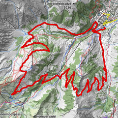
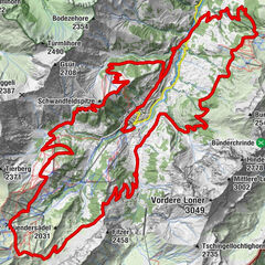
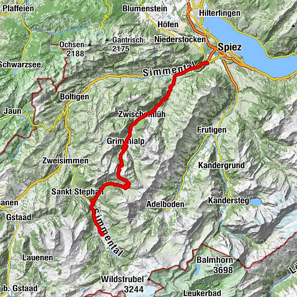
Lenk im Simmental (1,068 m)Lenk (1,068 m)0.2 kmBerghölzli5.5 kmMatten5.5 kmSchwäfelbrünneli8.3 kmRestaurant Alpenrose9.2 kmStalde9.3 kmZil9.7 kmBachti9.8 kmBüel10.4 kmAm Vordere Berg12.6 kmFärmelmeder15.3 kmGrimmifurggi (2,023 m)17.0 kmEggli22.8 kmSpillgerten22.8 kmGrimmialp23.2 kmGrimmialp (1,235 m)24.3 kmRestaurant Circus-Schenke25.9 kmZwischenflüh29.1 kmDiemtigen Riedli30.7 kmRiedli31.0 kmEntschwil32.4 kmDiemtigen36.9 kmBächlen37.1 kmOey (669 m)38.4 kmOey-Diemtigen (670 m)38.6 kmLatterbach (700 m)38.7 kmPort42.6 kmWimmis43.5 kmWimmis (629 m)43.7 km
- Best season
-
JanFebMarAprMayJunJulAugSepOctNovDec
- Description
-
The tour starts in a relaxed manner along the river Simme from Lenk to Matten. The initial part of the climb from Matten is moderately steep on a tar road. Once up into the Farmel valley the climb gets somewhat less steep until it becomes unpaved at the back of the valley. At this point only those who are very fit will have the legs to ride the next 200m of ascent as it is very steep, but it does get easier again the closer you get to Grimmifurggi.
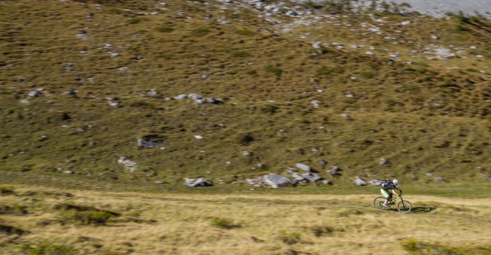
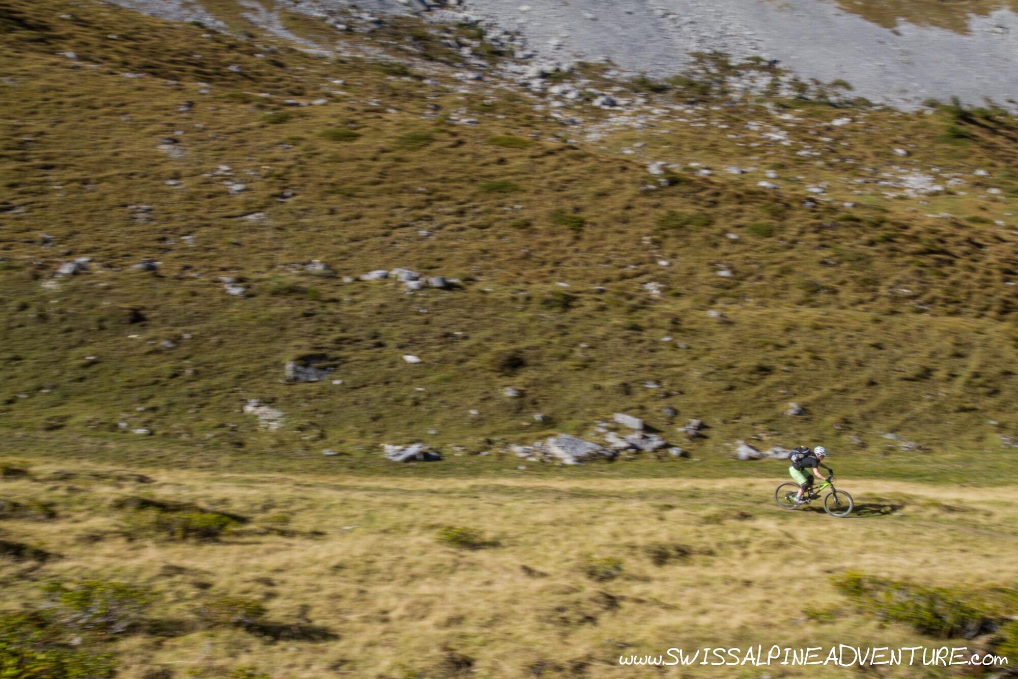
The tour offers amazing scenery and some beatiful solitude in the Farmelvalley and on the descent into the Diemtig valley towards Grimmialp. After Grimmialp the tour manly goes out of the valley along the side of the road, but it has a very high proportion of singletrail (mainly of S0 grade). The tour is a nice day out and a good way of getting from Lenk to Spiez if putting a multi-day tour in the region together.
- Directions
-
From the train station in Lenk follow the signs for the Alpine Bike (National Route 1) towards Matten. When passing the military runway in Matten take the road accross the runway and through the town. Go straight accross the main Lenk/Zweisimmen road and keep going until the end of the street. Turn left and take the second right signposted Farmeltal.
The climb into the Farmelvalley is for the most part on a relatively pleasant gradient, but be aware that on a busy day there can be a little traffic on the road. Keep riding approximately 6km back the valley to "Am Vordere Berg" where there is a small car park. From here turn left accross the bridge and take the unpaved road that rises very steeply. This road is particularly steep for the first two switchbacks but then it flattens off and becomes rideable almost the whole way to the Grimmifurggi. There is a short singletrail section after point 1994 (1:25000 map) and then a short hike-a-bike from Furgi to the pass.
From Grimmifurgi follow the trail down to the fingerpost just before the Alp at point 1839. At this sign post you can take the singletrail to the left (caution, may require pushing the bike) or ride to the Alp and then skirt around the back of the Alp onto a fire road. Both route options join up and you can continue descending on either fire road or at times singletrail to about 1400m where there is a bridge accross the river and you can veer right into a trail that skirts around the mountain and brings you down to Egg.
At the junction in Egg stay left and follow the paved road back towards Grimmifurggi until you see a bridge on your right which will allow you to cross the river and follow a very easy singletrail along the otherside of the river north. Keep following this trail (it changes from S0 singletrail to fire road a number of times) to Anger where you will cross the main road down the valley and then follow the Trottinet route to the valley station of the Wiriehorn lift at Riedli.
After Riedli the trail once again crosses to the other side of the road and continues for about 1.5km before once again crossing the road. At Chollerebrügg where there is a paved bridge accross the river to the main road, stay right on the unpaved road and climb about 30m (vertical ascent) until you see a singletrail on the left which will take you down to Horboden where you will cross the road and river to take an easy singletrail which runs down the left hand side of the river towards Oey.
In Oey ride past the train station following the cycleroute towards Wimmis. About 500m after the train station turn left and there is a section of singletrail which can be followed allong the side of the river. At the end of this trail follow the normal bike route to Wimmis. Those who want can continue to follow the bike route to Spiez and finish the tour there.
- Highest point
- 2,013 m
- Endpoint
-
Wimmis Train Station
- Height profile
-
 © outdooractive.com
 - Equipment
-
Normal equipment for a day tour is recommended. There are some nice spots to picnic between Grimmifurggi and Grimmialp and there is a restaurant in Grimmialp.
- Safety instructions
-
Depending on your network you may have no telephone reception for much of this tour. On a sunny day there may be a lot of hikers on the trails between Grimmifurggi and Riedli.
- Tips
-
This is a beautiful tour to do on a clear autumn day.
- Additional information
-
The route grading on the singletrail maps for this area are very bad. We rode trails that were marked as Red or Black singletrail and in fact they were jeep access roads. The only maps that are accurate are the 1:25000 Toposchweiz maps of which 4 are needed for this tour. Alternatively you can print them out from https://map.geo.admin.ch
For more of our favourite tours remember to check out www.swissalpineadventure.com - tours.
- Directions
-
If coming by car Spiez is easily accessible using the A6 from Bern or the A8 from Luzern/Zurich.
- Public transportation
-
Public transport is available to Lenk and from Wimmis or Spiez.
- Parking
-
This tour is a point to point tour and best accessed by public transport. Parking is available in Spiez train station if you do come by car.
-

-
AuthorThe tour Lenk - Grimmifurggi - Diemtigtal - Wimmis is used by outdooractive.com provided.