
- Brief description
-
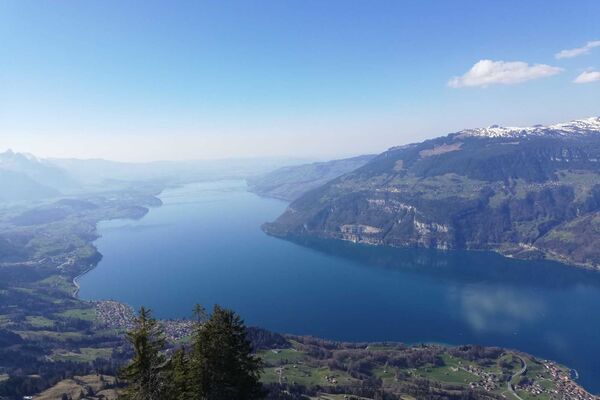
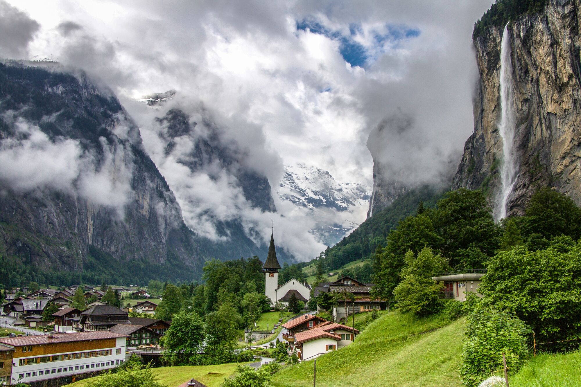
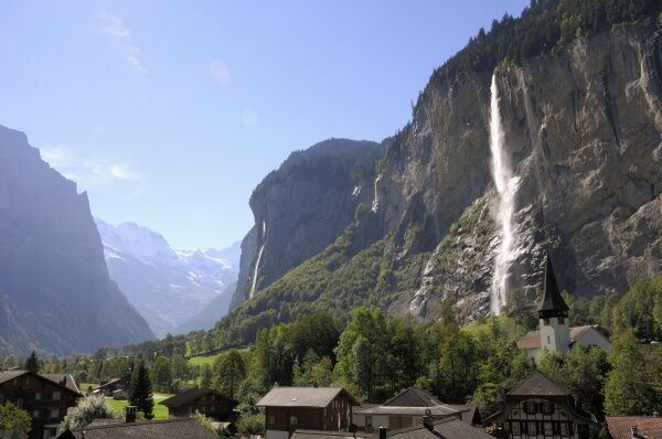
A scenic route along the River Lütschine with a constant but gentle ascent to Lauterbrunnen. There, the magnificent Staubbach Falls are a captivating sight.
- Difficulty
-
easy
- Rating
-
- Route
-
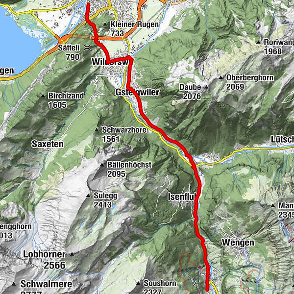
Interlaken West (564 m)Interlaken (568 m)Unterseen (567 m)Möösli0.2 kmWagneren0.6 kmWagnerschlucht0.7 kmUnspunnen1.2 kmWilderswil2.7 kmWilderswil (584 m)3.1 kmHirschen3.3 kmGsteig3.3 kmKirche Gsteig3.5 kmSteakhouse Steinbock3.5 kmGsteigwiler4.9 kmStation8.1 kmZweilütschinen8.2 kmZweilütschinen8.4 kmIsenfluh9.7 kmLauterbrunnen12.4 kmGsteigermatte12.5 kmFuhrenboden12.9 kmBeim Pfrundhaus13.0 kmCascada de Staubbach13.2 kmStaubbach13.2 kmBeim Schulhaus13.5 kmLauterbrunnen13.6 kmFood Point13.9 kmGreifenbach13.9 kmBei der Zuben14.1 kmSteinbock14.1 kmGydisegg14.4 kmIsenfluh16.5 kmZweilütschinen18.0 kmZweilütschinen18.2 kmStation18.4 kmGsteigwiler21.4 kmSteakhouse Steinbock22.9 kmKirche Gsteig22.9 kmGsteig23.1 kmHirschen23.2 kmWilderswil (584 m)23.3 kmWilderswil23.8 kmUnspunnen25.3 kmWagnerschlucht25.9 kmWagneren26.0 kmMöösli26.4 kmInterlaken West (564 m)26.5 kmInterlaken (568 m)26.6 kmUnterseen (567 m)26.6 km
- Best season
-
JanFebMarAprMayJunJulAugSepOctNovDec
- Description
-
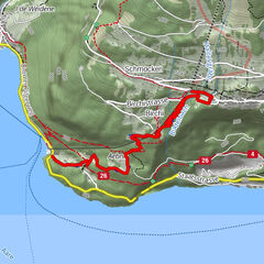
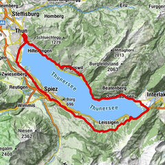
This tour leads from Interlaken West railway station via the Rugen hill to the village of Wilderswil. At the church, you will cross a charming wooden bridge before taking on the challenging ascent to Gsteigwiler. From here the route continues mainly on unsurfaced roads. Ride along the Lütschine river, through shaded forests and lush meadows to the enchanting Valley of the 72 Waterfalls. This varied route has something for everyone – gentle ascents, flat sections and different surfaces. Once you arrive in Lauterbrunnen, take the time to admire the magnificent Staubbach waterfalls and the surrounding mountain scenery. Round off your tour with relaxing picnic or, a few minutes down the road, a visit to the roaring Trümmelbach Falls. Your tour to Lauterbrunnen assures a memorable experience, crowned by a refreshing descent back to Interlaken.
- Highest point
- 810 m
- Endpoint
-
Interlaken, Bahnhof West
- Height profile
-
 © outdooractive.com
 - Additional information
-
Information regarding duration, fitness requirements and technique depend on the chosen bike type (i.e. mountain bike, e-bike, touring bike, racing bike). These are approximate guidelines.
Interlaken Tourismus
Marktgasse 1
CH-3800 Interlaken
0041 33 826 53 00
mail@interlakentourism.ch
www.interlaken.ch
Lauterbrunnen/Isenfluh Tourismus
Stutzli 460
Postfach 23
CH-3822 Lauterbrunnen
0041 33 856 85 68
info@lauterbrunnen.ch
www.mylauterbrunnen.com
- Author
-
The tour Tour to the Valley of the 72 Waterfalls is used by outdooractive.com provided.
GPS Downloads


Other tours in the regions
-
Aletsch Arena
126
-
Interlaken
70
-
Gsteigwiler
28