Creeks, ravines, moors - waterway 9 in the western Allgaeu - entry Oberreute


")
- Brief description
-
Roaring mountain streams and deep ravines, green meadows and idyllic moors, fertile forests and picturesque villages - on this demanding cross-border one-day-hike (tour 9) you can explore the whole diversity of the western Allgaeu and the Bregenz forest.
- Difficulty
-
difficult
- Rating
-
- Starting point
-
Village square/church square Oberreute
- Route
-
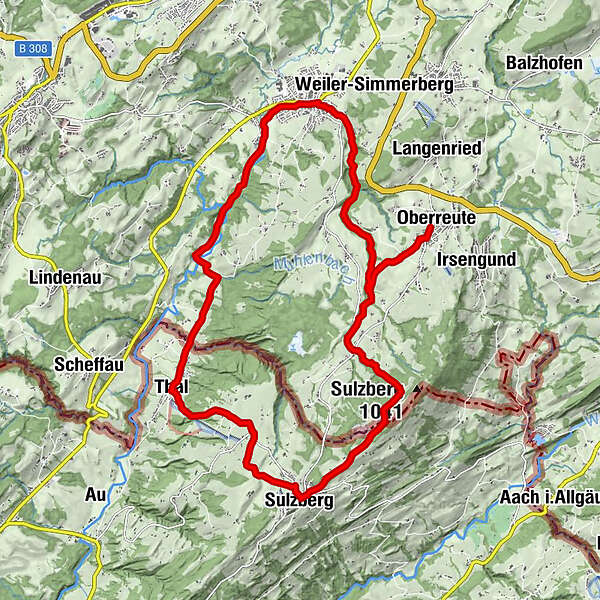
Sankt MartinOberreuteKrone0.1 kmBächen1.2 kmSchnellers2.4 kmVorderschweinhöf3.0 kmGalgenholz (1,030 m)6.5 kmGasthof Alpenblick6.9 kmAdler Pizze&Pasta7.0 kmSulzberg7.0 kmGasthof Ochsen7.1 kmThal10.9 kmHl. Franz Xaverius11.0 kmEyenbach12.2 kmSalmers12.7 kmAlte Quellfassung der Siebersquelle13.7 kmSiebersquelle13.9 kmBremenried16.5 kmWeiler im Allgäu17.3 kmLourdeskapelle17.8 kmHasenried18.8 kmRiegen20.0 kmUntertrogen20.2 kmBächen22.3 kmKrone23.5 kmSankt Martin23.5 kmOberreute23.5 km
- Best season
-
JanFebMarAprMayJunJulAugSepOctNovDec
- Description
-
Starting at the village square of Oberreute along the main street towards Sulzberg, we hike until we come across a riding school to our right. Shortly before we reach the riding school, we turn left and cross a meadow towards the "Obere Hausbachklamm" (Upper Hausbach ravine). We follow the signpost "Obere Hausbachklamm" and get into the forest after some time. We hike along the ravine upstream and follow the pathway up to the headwaters and further on into the romantic "Wildrosenmoos" (moss of wild roses).
In the "Wildrosenmoos", a landscape consisting of moors and marshes, the big swamp pond invites us to take a rest . The waters of the abandoned peat-ditch reflect downy birches and mountain pines. The plants in these habitats are very vulnerable. That is why you must not leave the trail here. A small shack at the wayside reminds you of the times when peat was extracted: Some devices, formerly used for peat extraction, are shown in the shack. The pathway leads us from the "Wildrosenmoos", maybe after a little side trip to the "Kalter Brunnen" (cold well), to the Austrian municipality Sulzberg. When you split the circular hike into two stages, you have enough time for a short side trip to the "Kalter Brunnen". The hiking trail leads us from the "Wildrosenmoos" to the "Hochsträß", with 1041 metres in heigjht the highest point of the elongated "Sulzberger Rücken" (Sulzberg Ridge). Here stands an old house that was used by frontiersmen as a reminder of the times when the German-Austrian border was more controlled by customs officers. We continue our way to the source are "Kalter Brunnen". Here, a wooden well and a beautiful resting place with a small shelter, including table and benches are waitng for us. The hiking trail continues to the Austrian municipality Sulzberg that is located at an altitude of 1015 metres.
Descending from sulzberg, we can repeatedly enjoy fantastic views of the Rothach valley, the Rhine valley behind and the mountains of the "Pfänderstock" and the massif of the Saentis. The circular route starts in the village Thal and leads us via the villages Eyenbach and Salmers with its nice "Augenkapelle" to the river Rothach. We cross the river on a bridge, coming to the old well house in the village Siebers. The well in Bad Siebers is one of the oldest bathing and minerals springs in the Allgaeu region. It is documented until far into the middle Ages. Severeal metres further, you can see the new well house of the spring Siebers-Quelle. In this well house, 60 litres of pure natural mineral water are extracted per minute. Along the Rothach river, the trail leads us through a floodplain forest that is rich in species, to the village Bremenried.The barbecue area right on the riverbank is a perfect place to rest. We pass the sewage plant of the waste water association "Rothach" that has to deliever a particularly high cleaning performance like all sewage plants in the catchment area of the Lake Constance. Where the streams Rothach and the Hausbach meet, a small power station that has to produce energy, is located. A way alongside the Hausbach leads us to Weiler.
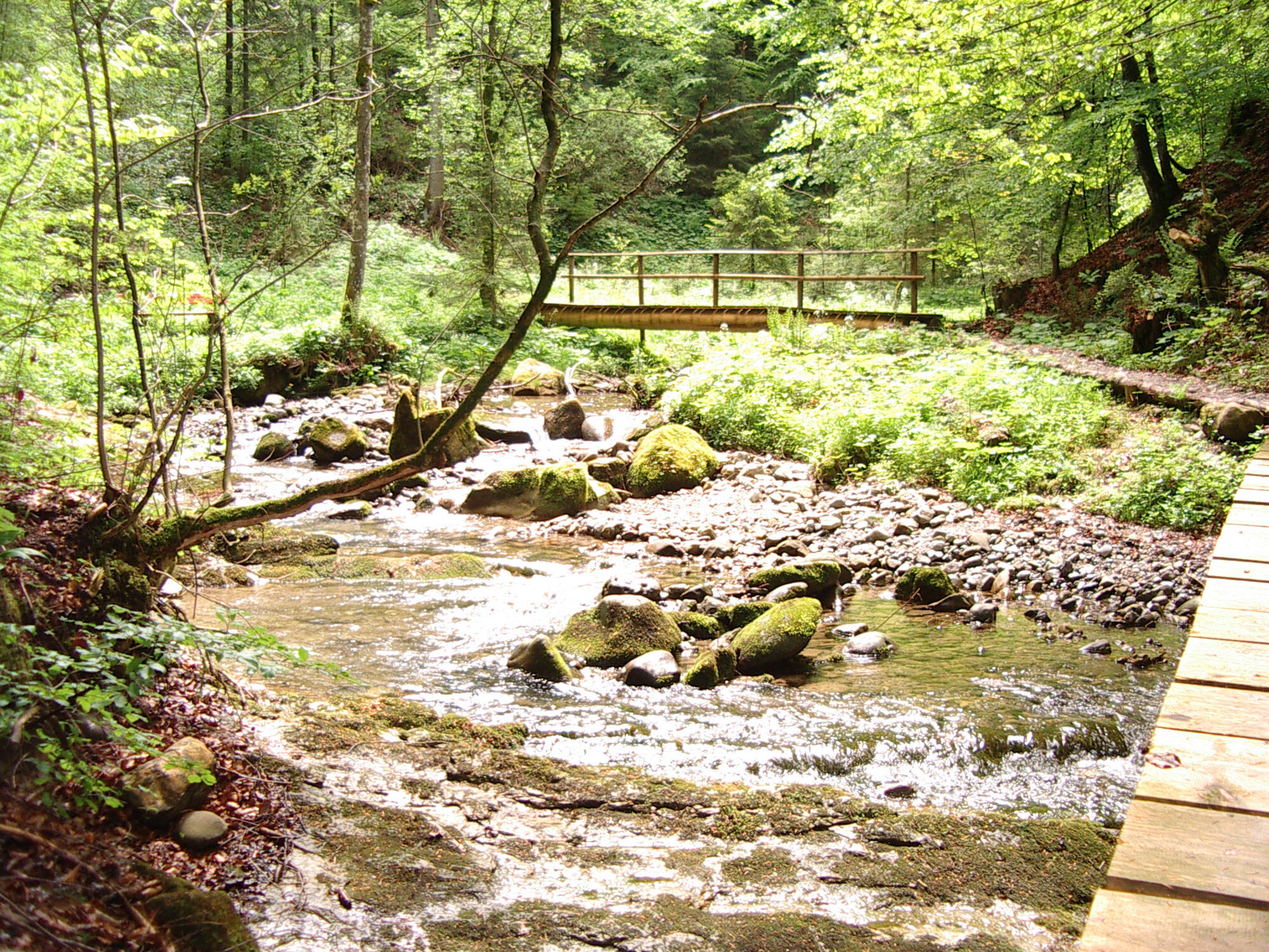
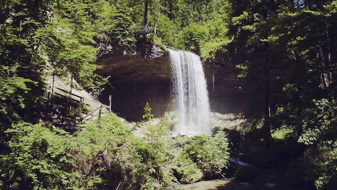
The entry of the ravine Hausbachklamm begins at the parish church of Weiler. Only few metres further, you come across the Lourdes grotto built in 1890 and enters a shady canyon forest. Passing small waterfalls and weirs, the trail leads us past a blocking debris. It is a reminder that the Hausbach, with its gradient of seven per cent, on average, can become a roaring mountain torrent at high watermark . Also on hot summer days. The section at the bridge Kapfmühlenbrücke is especially beautiful: here, the Hausbach makes his way through a bottleneck that's milled deeply into the sandstone. The pathway leads steeply uphill to the impressive mountain ridge "Hohe Wand" ("High Wall"). We cross the creek on a bridge and can see a second blocking debris. The steep lopes with its dripping moss cushions and the Hausbach, rushing into the valley in deep channels.
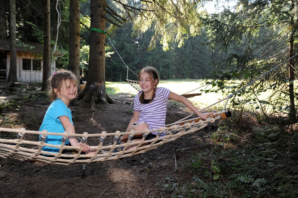
On the bridge called "Tobelbachbrücke" we hike uphill until we reach the bridge called "Trogener Brücke". Directly above the bridge there is a beautiful resting place for families with children: at the barbecue area the children can rampage and play in the shallow and gravelly streambed. Now, the path is not so steep anymore. A little bit upstream there is a Wendy house and a rope slide crossing the Hausbach stream for adventurous children. Having passed the playground we follow the path upstream for a little while and then we are heading back to Oberreute following the signposts.
- Directions
-
Course: Village square Oberreute - Upper ravine of the Hausbach ("Obere Hausbachklamm") - Schnellers - Headwaters - Wildrosenmoos (side trip: "Kalter Brunnen") - Sulzberg - Thal - Eyenbach - Salmers - Bad Siebers - Bremenried - church square Weiler - Lourdes grotto - Lower Hausbachklamm - Upper Hausbachklamm - Oberreute/village square
- Highest point
- 1,032 m
- Endpoint
-
Equivalent to starting point
- Height profile
-
 © outdooractive.com
 - Equipment
-
You will definitely need sturdy shoes in the ravine of the Hausbach.
- Tips
-
Bring a hearty picnic. There are several big stages where we have no opportunity to stop for a meal.
- Additional information
-
Tourist office Oberreute, Hauptstr. 34, 88179 Oberreute, Tel. 08387-1233, info@oberreute.de, www.oberreute.de

- Author
-
The tour Creeks, ravines, moors - waterway 9 in the western Allgaeu - entry Oberreute is used by outdooractive.com provided.


General info
-
Allgäu
2357
-
Westallgäu
1263
-
Sulzberg
640