- Brief description
-
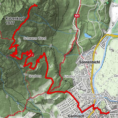
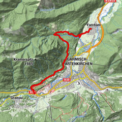
Wanderbücherl Tour Nr. 12 a
- Route
-
Eibsee0.1 kmEibsee-Alm0.4 kmHochthörlehütte4.4 km
- Highest point
- 1,487 m
- Endpoint
-
Hochtörlenhütte
- Height profile
-
 © outdooractive.com

- Author
-
The tour Vom Eibsee zur Hochthörle Hütte (1.459m) is used by outdooractive.com provided.
GPS Downloads


Other tours in the regions
-
ZugspitzLand
1639
-
Zugspitze
438