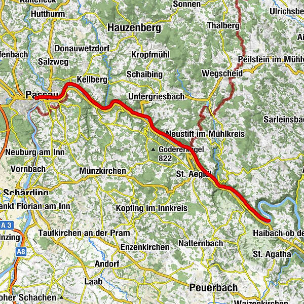
Danube Cycle Path Stage 1 North Bank: Passau - Schlögen


- Brief description
-
From the Bavarian Venice to the Giant of the Danube
- Difficulty
-
easy
- Rating
-
- Starting point
-
Passau
- Route
-
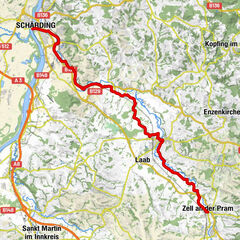
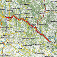
Islamische Gemeinschaft Passau0.8 kmPassau (312 m)0.9 kmSpitalkirche "St. Johann"1.0 kmSchiffanlegestelle Wurm+Köck1.1 kmAltstadt1.3 kmIlzstadt2.1 kmJägerhof2.3 kmRosencafe Aschenbrenner3.5 kmLindau4.5 kmSulzsteg5.1 kmLöwmühle5.9 kmKernmühle6.7 kmZum Edlhof10.3 kmEdlhof10.5 kmErlau11.9 kmWörth14.2 kmPyrawang14.8 kmKreuzsäulenkapelle15.9 kmObernzell17.1 kmKasten19.4 kmKohlbachmühle20.1 kmGrünau20.7 kmSchiffsanlegestelle23.3 kmBistro24.1 kmKapelle24.6 kmJochensteinblick (Fernrohr)24.6 kmGasthaus-Pension Kornexl24.7 kmJochenstein24.8 kmEngelhartszell26.8 kmEngelszell27.3 kmKramesau28.6 kmNiederranna32.6 kmPfarrkirche Niederranna32.8 kmKling34.4 kmWesenufer34.8 kmFreizell36.4 kmFreizeller Stüberl36.5 km
- Best season
-
JanFebMarAprMayJunJulAugSepOctNovDec
- Description
-
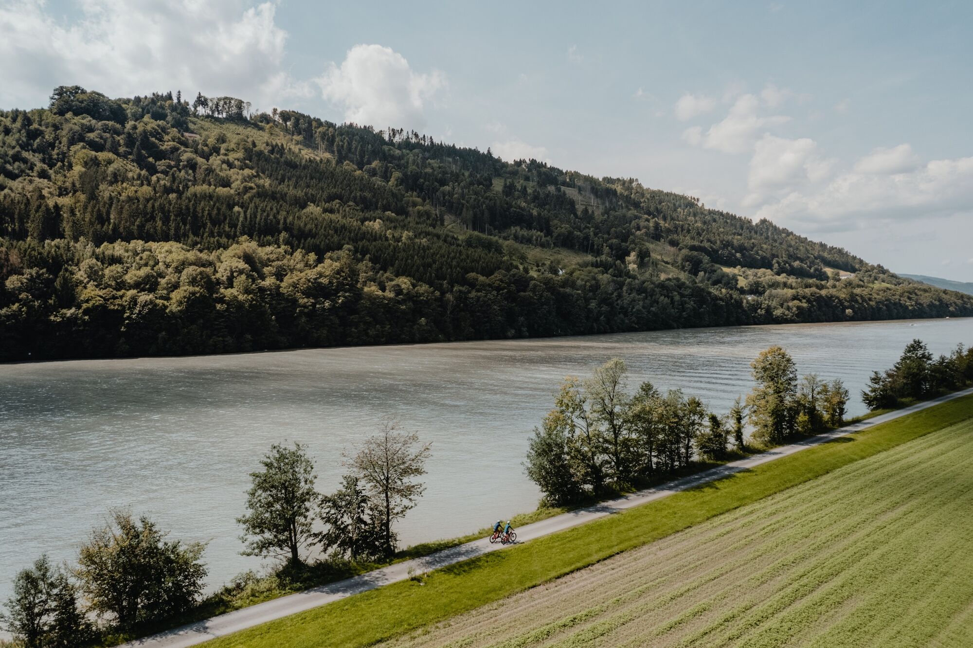
The north route or the south route? This is the first question you need to answer when starting your first stage, as you can approach your destination for today on both banks of the Danube. No matter what choice you make, before you start, you have a lot of time to visit Passau’s sights such as the old town, the residence and St. Stephen’s Cathedral (q.v. E1-S). As soon as you cross the Ilz on the Luitpold Bridge, two fortresses, Oberhaus and Niederhaus, bid you farewell from the Three River City. Oberhaus, which used to be the residence of the bishop of Passau, now houses a city museum and a medieval museum.
Soon thereafter you can already enjoy views of the sunny and impressive south-facing hillsides of the nature reserve Donauleiten, home to cyclamens, gorgeous Turk’s cap lilies and shimmering green lizards. Through the village of Erlau you continue the journey to Obernzell, where you can visit a pottery museum in the massive castle right at the river. As you continue your journey you are accompanied by the view of the enormous castle keep of the 12th c Vichtenstein Fortress on the other side of the river. On that side you can also see the Haugstein (895m) looming out of the Sauwald (forest), the highest elevation in the area.
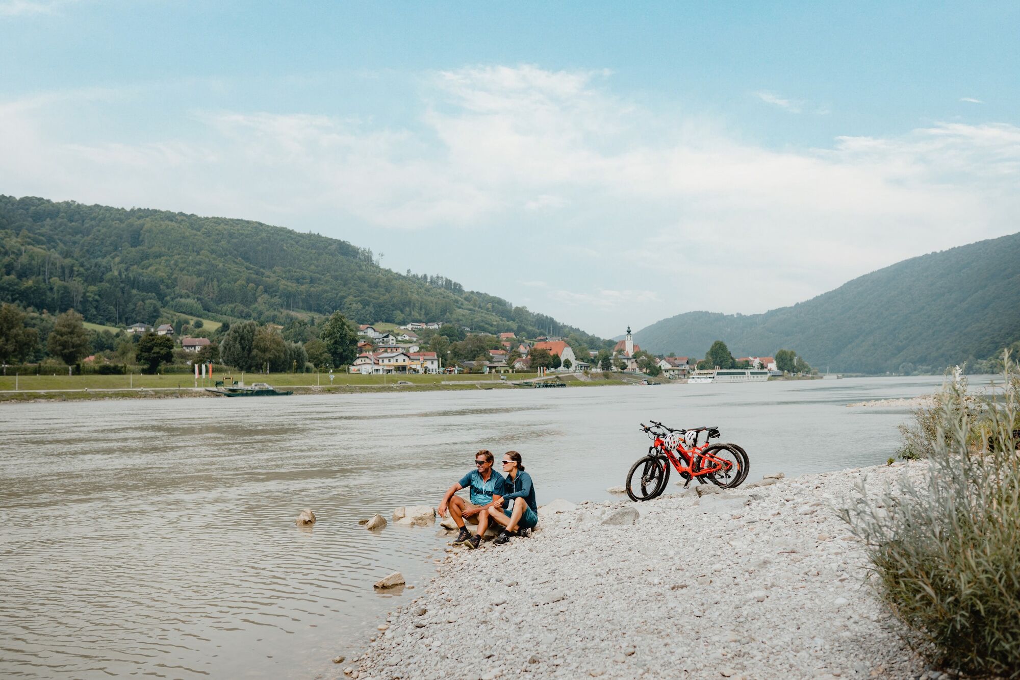
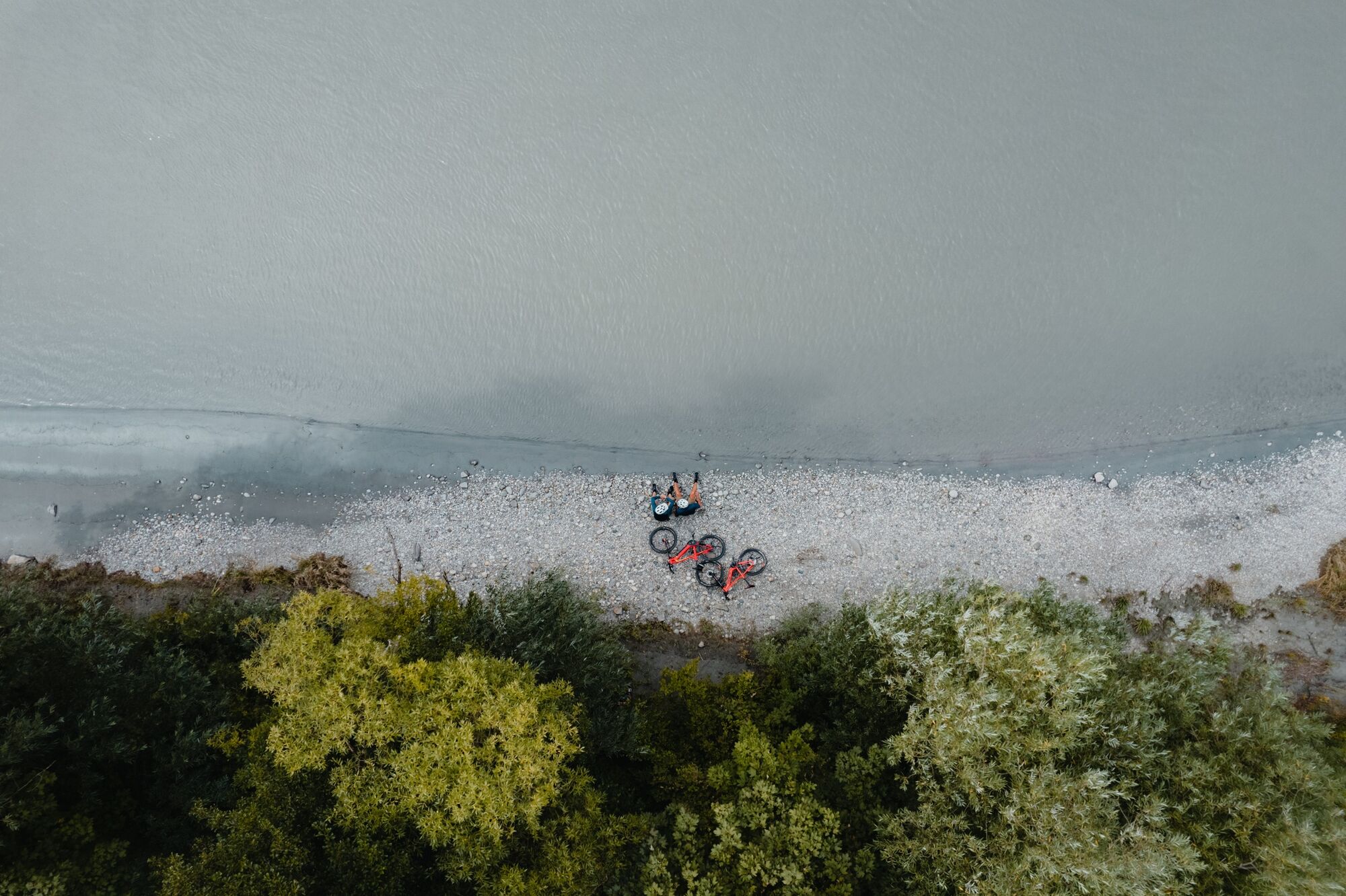
The “Haus am Strom” Nature Adventure Centre is shaped by an architect’s hand like “wave and pebble stone“ and has a special water elevator in store for you, among other things. A variety of interesting and fun nature tours help familiarize you with the local flora and fauna. Afterwards, if the sight of Engelszell Abbey on the opposite bank piques your curiosity, you can cross the Danube via the power station Jochenstein. On the north bank, you soon reach Niederanna (Danube bridge), where a builder of zillen (flat-bottomed boats common to the region) offers zillen rides on the Danube. It is not at all far from here to the ferry that will take you to Schlögen.
- Directions
-
Passau - Ilzstadt -Erlau - Obernzell -Niederranna -Schlögen
Route description
The stage begins right at the Passau train station. To go directly to the Danube, follow the signs “zum Donauradweg”. You catch your first glimpse of the river a few moments later. It will be your constant companion. You follow the Danube downstream and cross it over the Luitpoldbrücke (bridge). Already from here you can see the Veste Upper and Lower House, a center of power, residence,, administration building and fortress in one.
After crossing the Ilz bridge, you bear right and from this point onward, follow the sign-posted path along the Danube. Soon you reach the nature reserve Donauleiten, whose steep slopes mark the southern edge of the Bavarian Forest. The slopes are densely forested, so you catch only occasional glimpses of the bizarre rock formations located there. Due to the steep terrain and the south-facing orientation, nature in this area is largely untouched and has an impressive variety of flora and fauna.
In Erlau, you cross the creek of the same name and follow the bike path to Obernzell. The imposing 12th c Vichtenstein Castle comes into view on the opposite river bank along with the 895 m high Haugstein, a slightly offset rise regarded as the highest point in the Alpine foothills. A few kilometers downstream you come upon a hotel whose architecture is reminiscent of the shape of a wave (“Haus am Strom”). With its many fountains, an exhibition and beer garden with regional cuisine, the hotel is an inviting destination for a break. As an alternative to Weiterweg (path) with views of Engelszell Abbey, you can also cross the Danube over the Jochenstein power station and then take the Engelhartszell ferry back to the north bank.
Zillenverleih Witti in Niederranna is one of the last builders of zillen, flat-bottomed boats common to the region. Shortly after the Haichenbach ruins, the famous Schlögener meander begins, where the Danube forms a picturesque 180 ° curve. This stage ends here in Schlögen with a short ferry ride.
- Highest point
- 316 m
- Endpoint
-
Schlögen
- Height profile
-
 © outdooractive.com
 - Directions
-
Follow the E56 to the exit Passau-Mitte (116) and continue on the B12 in the direction of Fürstenzell/Donau. At the Danube turn right onto the B8/Regensburger Strasse and follow signs to the train station (Bahnhof).
- Public transportation
-
Take the train to the Passau main train station.
- Parking
-
Parking in Passau.
- Author
-
The tour Danube Cycle Path Stage 1 North Bank: Passau - Schlögen is used by outdooractive.com provided.