
- Brief description
-
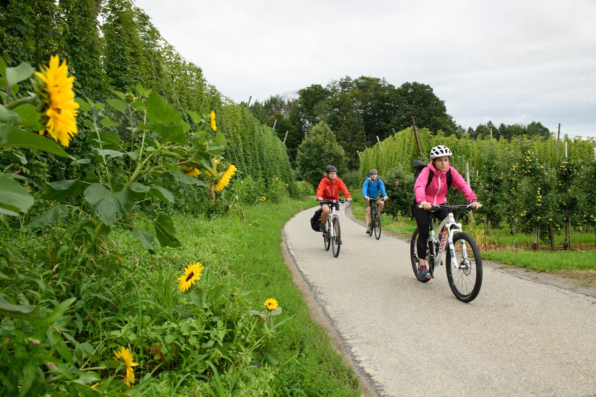
Through pleasant orchards and hop gardens.
With views of glittering Lake Constance backed by the mighty Alpine chain, we pass through towns which have evolved over the centuries and boast all kinds of interesting features.
- Route
-
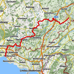
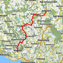
Wangen im Allgäu (556 m)Auwiesen0.7 kmLottenmühle2.2 kmNiederwangen3.3 kmPfarrkirche St. Andreas3.5 kmKnobel4.0 kmEttensweiler6.0 kmHochbühl7.1 kmKernaten8.0 kmSchomburg8.6 kmRuhe-Christi-Kapelle8.8 kmHaslach10.5 kmPfarrkirche Sankt Stephanus Haslach10.5 kmKleber10.5 kmHaslachmühle11.1 kmLitzelmannshof11.3 kmGunzenweiler12.8 kmMehetsweiler13.8 kmNeukirch15.2 kmSt. Maria15.2 kmOberrussenried18.2 kmUnterrussenried18.8 kmNotzenhaus20.0 kmFlockenbach21.0 kmSt. Anna21.4 kmEnzisweiler21.9 kmGasthaus zum Hirsch / Zitterell22.9 kmObereisenbach22.9 kmHerrgottsweiler24.4 kmBernau26.0 kmTettnang (466 m)27.7 kmHeilig-Kreuz-Kapelle27.7 kmBechlingen28.7 kmFünfehrlen29.4 kmHabacht30.6 kmMeckenbeuren31.9 kmPauluskirche31.9 kmBrochenzell33.3 kmWaltenweiler36.2 kmLindenholz36.9 kmBlankenried38.7 kmSt. Martin40.4 kmOberteuringen40.4 kmUnterteuringen41.8 kmHepbach44.5 kmLeimbach45.8 kmMarkdorf48.5 km
- Best season
-
JanFebMarAprMayJunJulAugSepOctNovDec
- Description
-
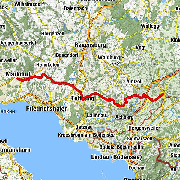
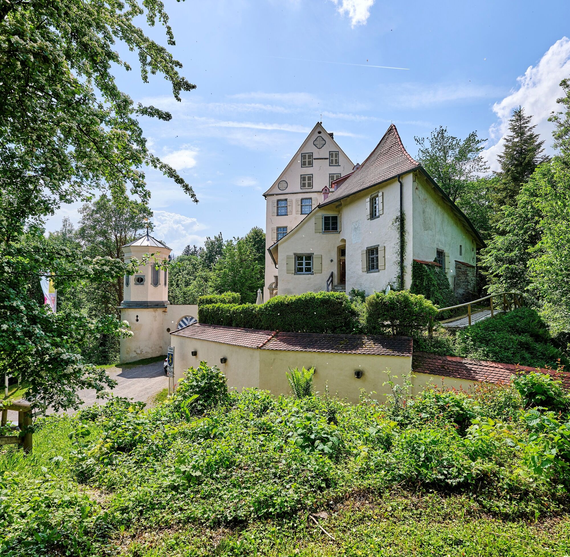
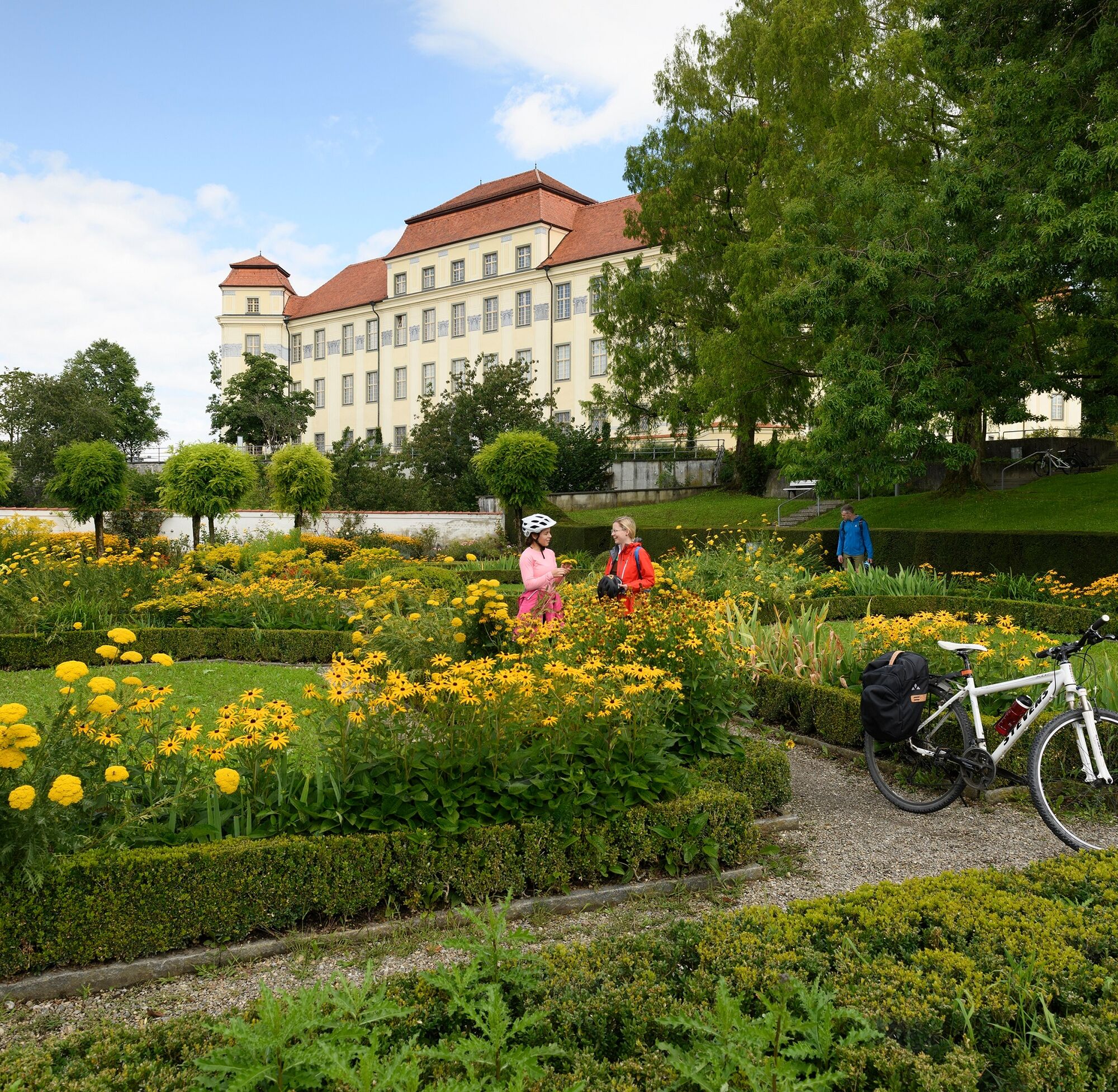
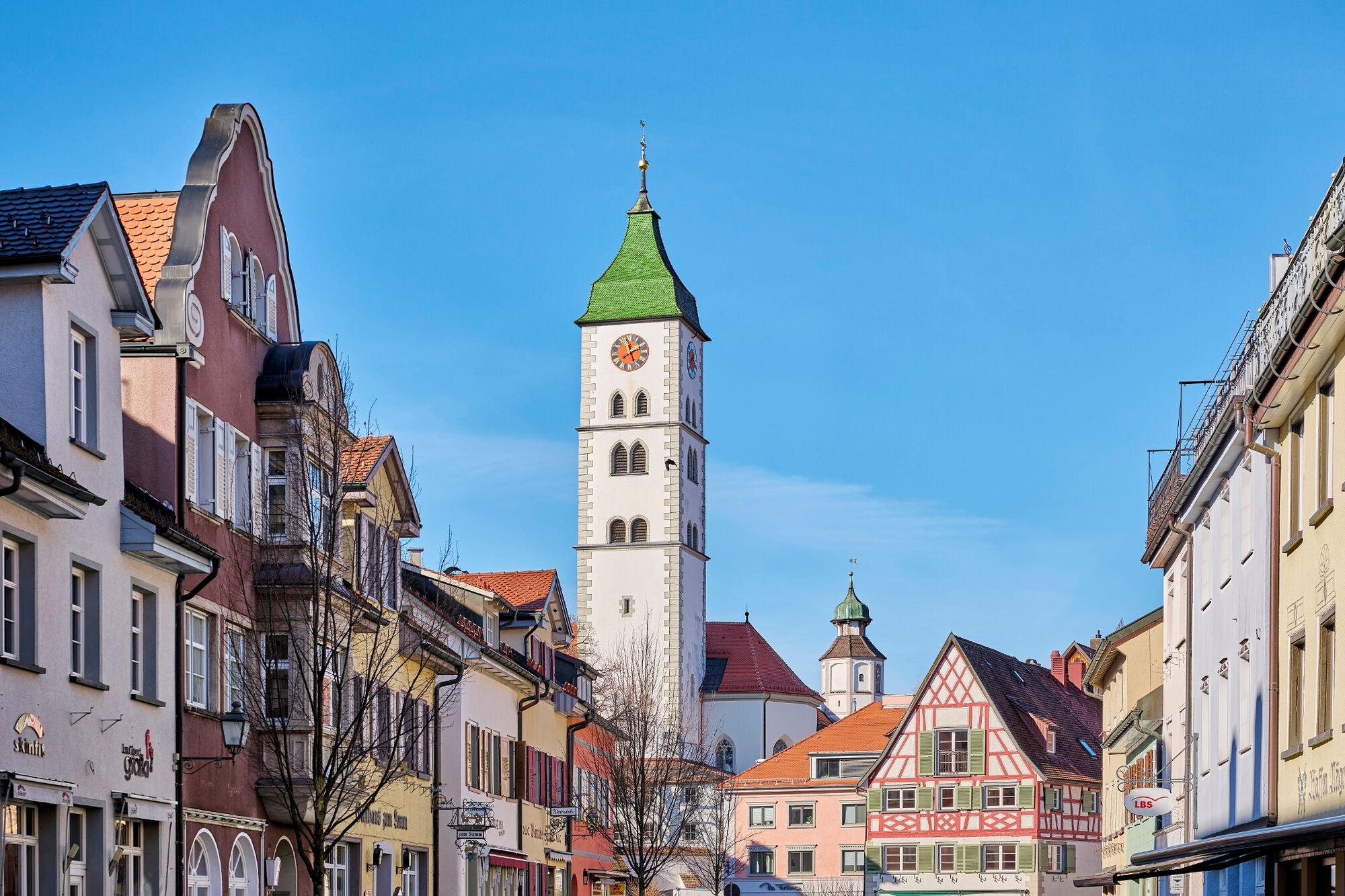
Following the course of the Obere Argen River we cycle out again into hilly farmland. Beyond Oberrussenried the scenery changes. The dark strips of forest become punctuated with fruit plantations. Between the charming villages it's mainly apples that are harvested here, which thrive in the mild, lakeside climate on the sun-kissed, south-facing slopes. Alongside, there are pears, plums and sweet cherries as well as hops, which in this region are cultivated on an area of some 1,200 hectares. In this romantic spot we find the town of Tettnang, from where we get a glimpse of the dark blue, shimmering surface of Lake Constance. The silhouette of the New Palace, built between 1712 and 1720, is an imposing sight. Behind its old walls, the magnificent Bacchus Hall, the impressive staircase and the palace chapel bear witness to the splendour of court life in the days of the Counts of Montfort-Tettnang. The "hop town" greets its guests with wonderful town houses from the 17th and 18th centuries clustered round the Torschloss gatehouse tower. The region's commitment to the cultivation of the plant that's so indispensable to beer brewers can be seen at Tettnang's Hop Museum, located in nearby Siggenweiler. The scenic tour continues through Meckenbeuren with its new Bike Tower to Markdorf, which sprawls at the foot of the wooded, 754-meter-high Gehrenberg. The "Pearl of Linzgau" is best explored on foot. The main attractions are St. Nikolaus' Church, the Bishop's Palace and the historical wall towers.
- Highest point
- 585 m
- Endpoint
-
Markdorf
- Height profile
-
 © outdooractive.com
- Author
-
The tour Upper Swabia-Allgäu Route - 4th leg is used by outdooractive.com provided.