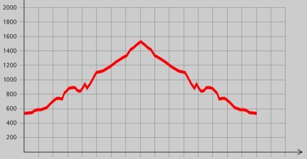
Tour data
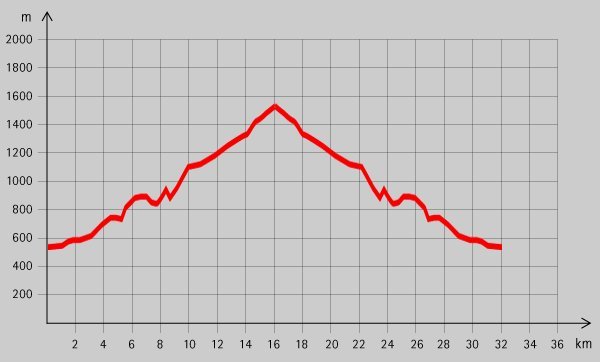
39.6km
547
- 1,558m
1,828hm
1,828hm
03:30h
- Brief description
-
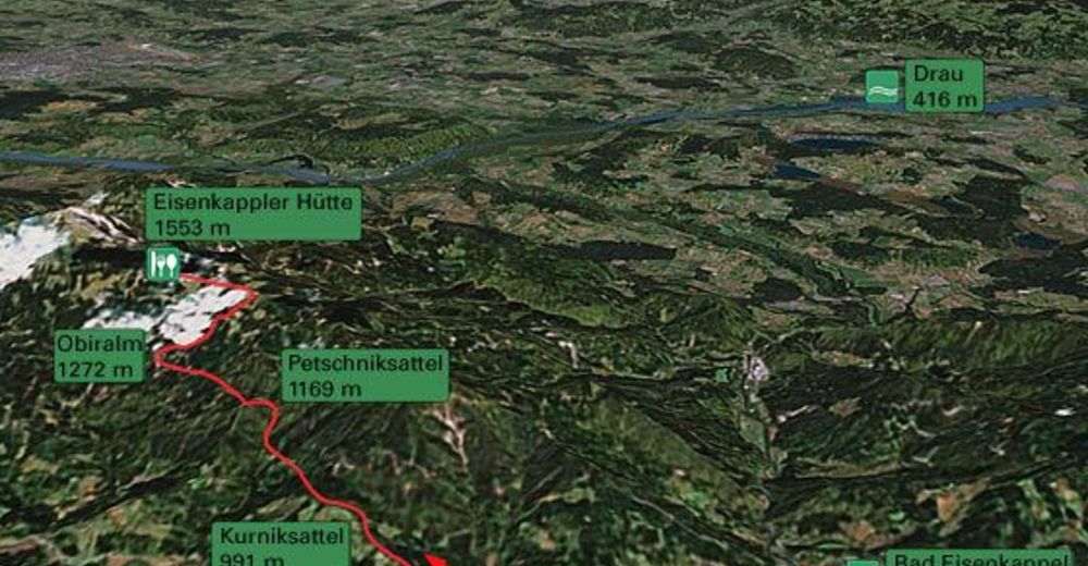
Anstrengende Biketour zur Eisenkappler Hütte.
- Difficulty
-
difficult
- Rating
-
- Starting point
-
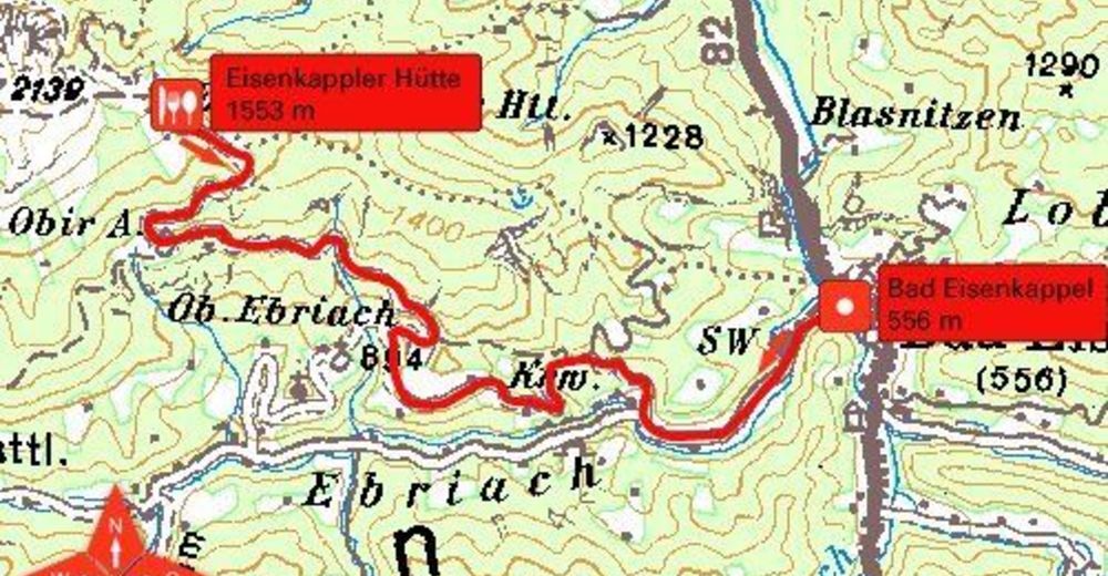
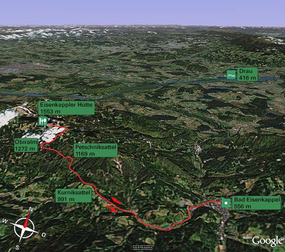
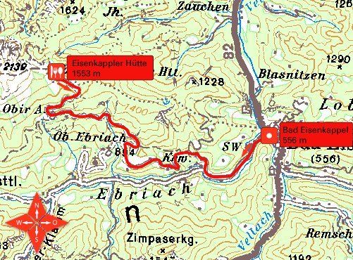
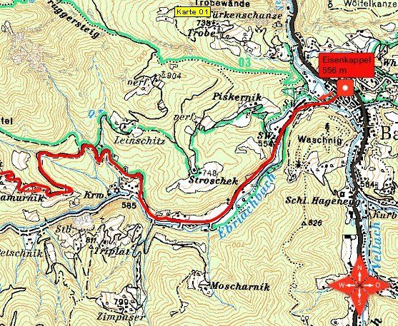
Hauptschule Bad Eisenkappel (556 m)
- Route
-
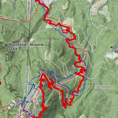
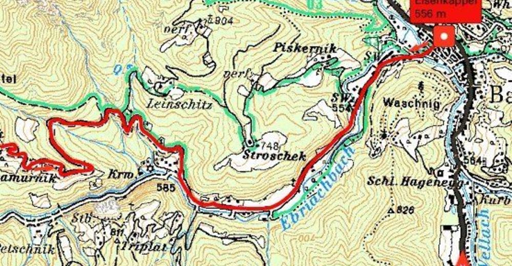
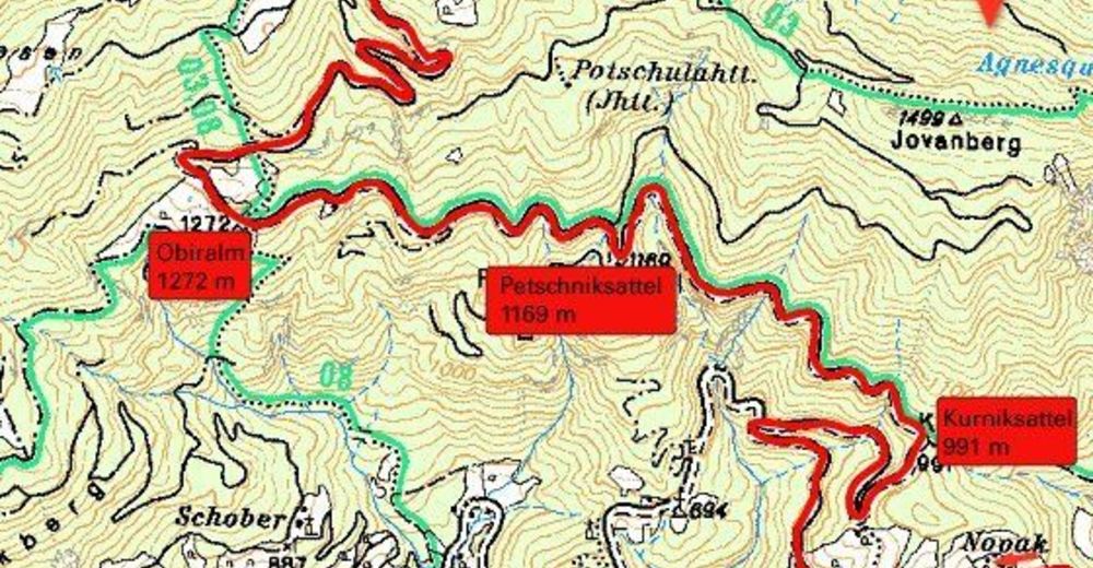
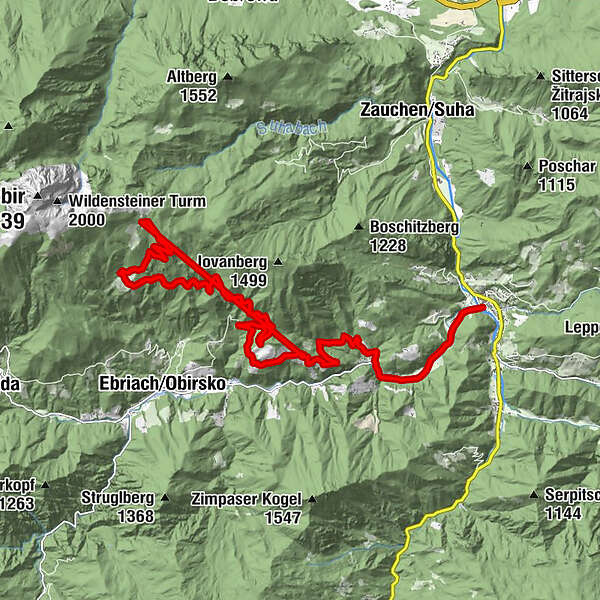
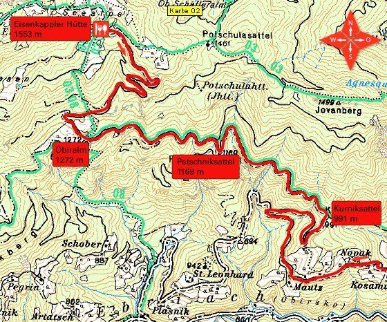
Bad EisenkappelKurniksattel (991 m)9.0 kmPetschniksattel (1,169 m)11.2 kmObiralm (1,272 m)12.9 kmEisenkappler Hütte (1,533 m)16.1 kmKurniksattel (991 m)19.0 km
- Best season
-
JanFebMarAprMayJunJulAugSepOctNovDec
- Highest point
- 1,558 m
- Rest/Retreat
-
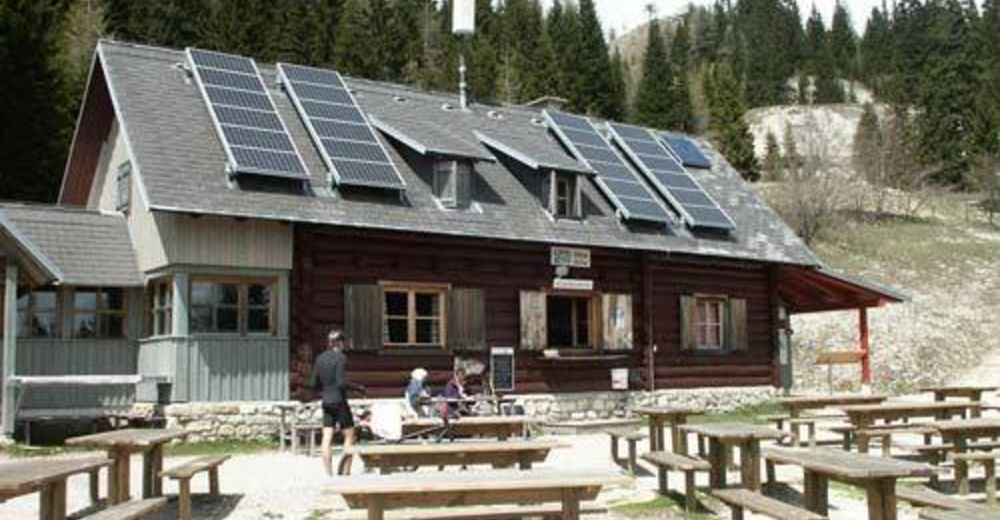
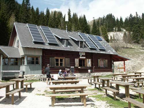
Eisenkappler Hütte
- Ticket material
GPS Downloads


Surfaces
Asphalt
Gravel
Forest
Mountain paths
Single trails
Trial
Traffic
Other tours in the regions