
- Brief description
-
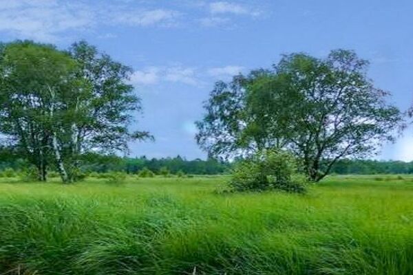
Xhoffraix is one of the villages which lie directly on the High Fens and have to brave the rough weather of the plateau.
- Difficulty
-
medium
- Rating
-
- Starting point
-
Opposite the church: at the parking lot, turn left away from the school. GPS coordinates: 50.2737 - 6.0410
- Route
-
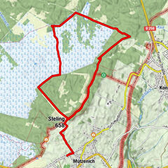
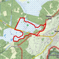
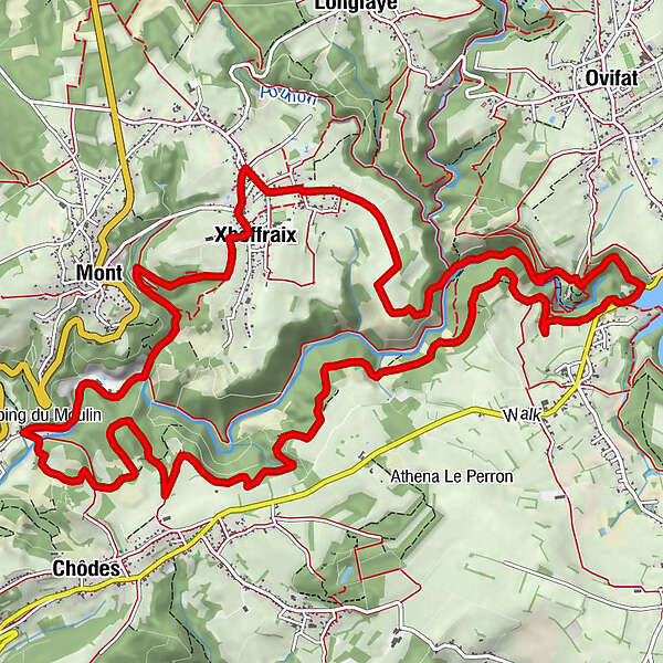
Schoffrä0.4 kmCascade de Reinhardstein4.0 kmNez de Napoléon6.5 kmG'Doumont10.9 kmTaverne Camping Du Moulin13.3 kmMont15.5 kmÉglise Saint-Hubert16.6 kmSchoffrä16.7 km
- Best season
-
JanFebMarAprMayJunJulAugSepOctNovDec
- Description
-
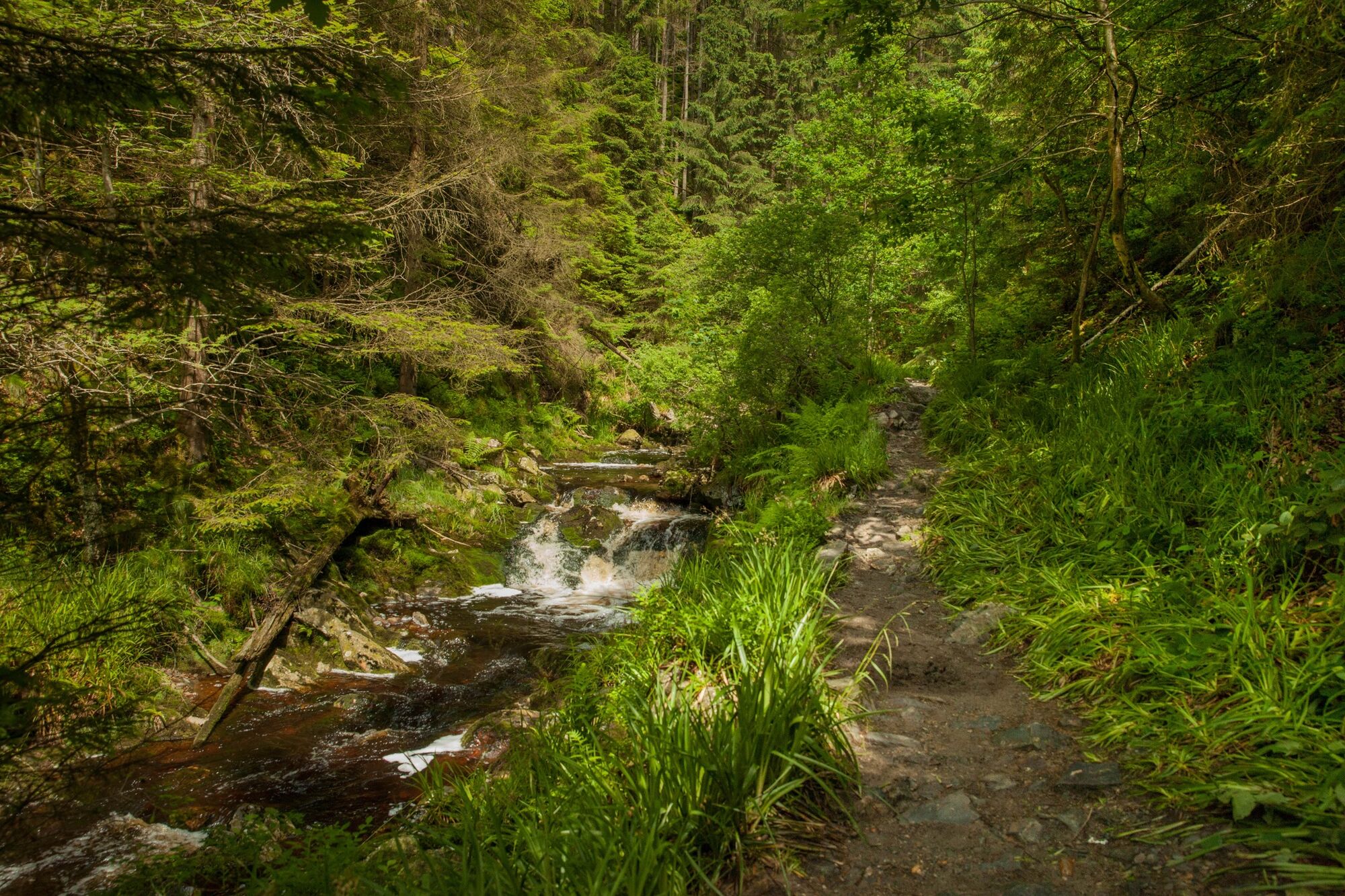
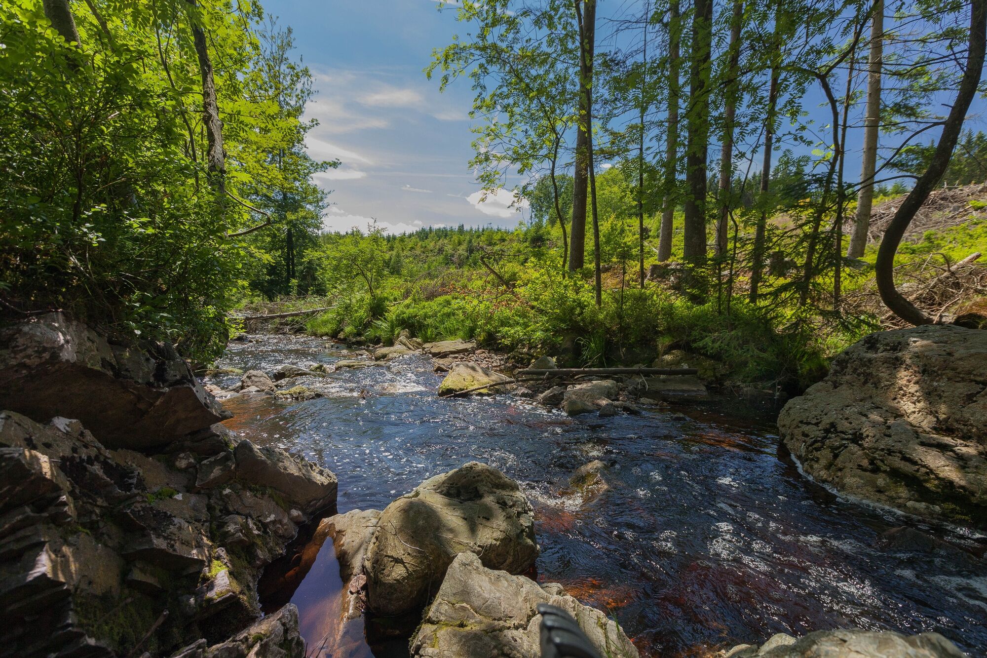
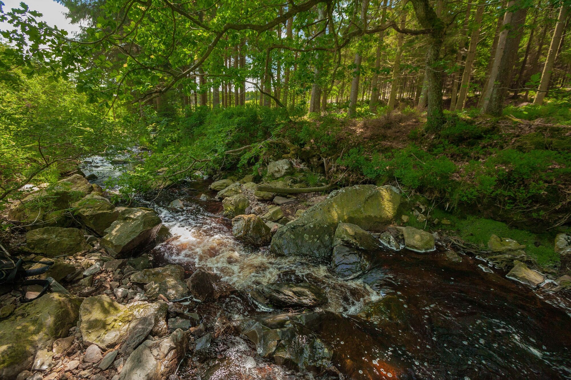
Tall hedges surround the houses here for protection against the tough climate. After the biting wind up on the plateau, things are certainly more bearable on the banks of the Warche and the Bayehon. As we climb out of the valley floor, the crystal-clear river water contrasts the green even more clearly.
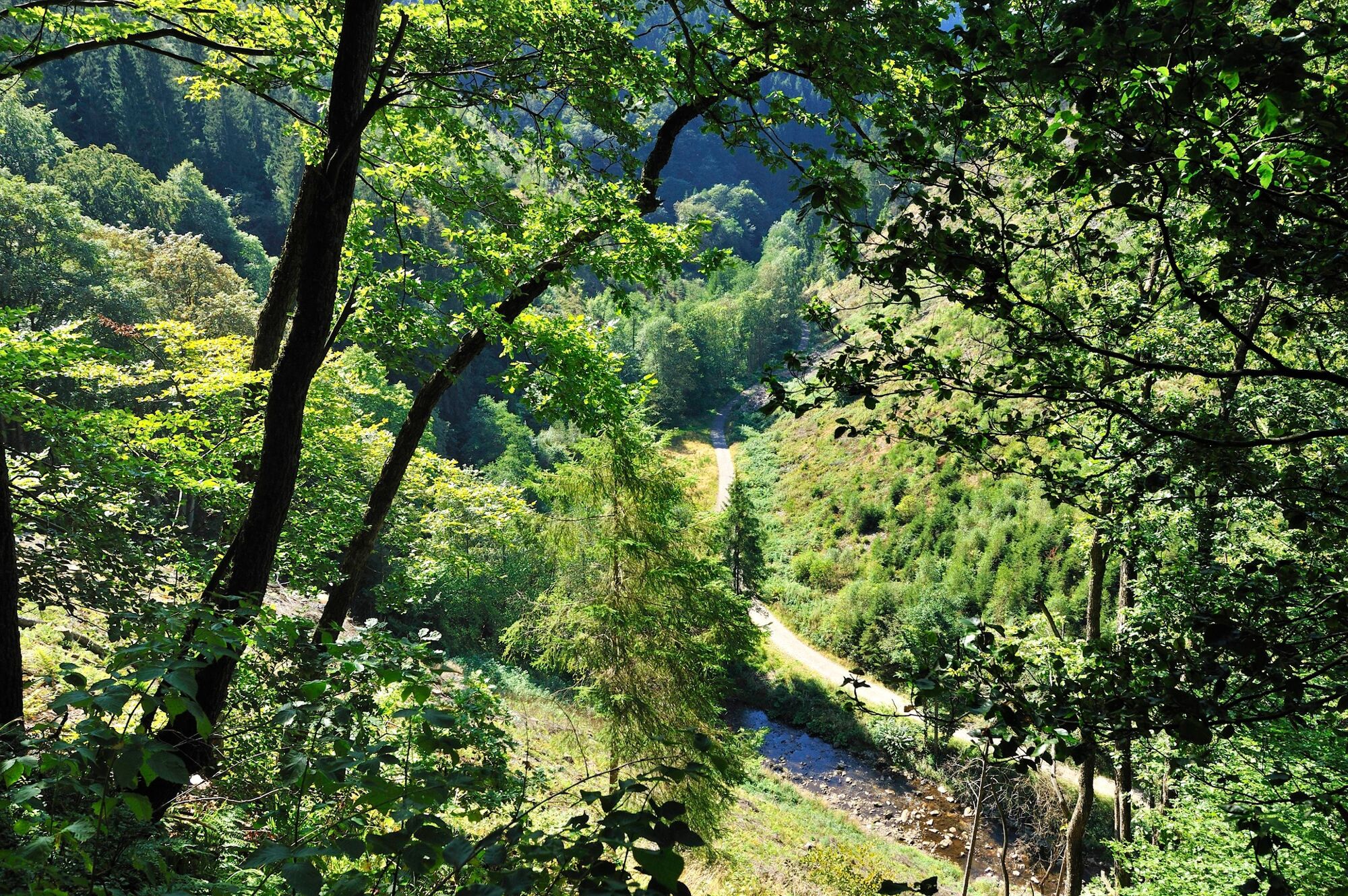
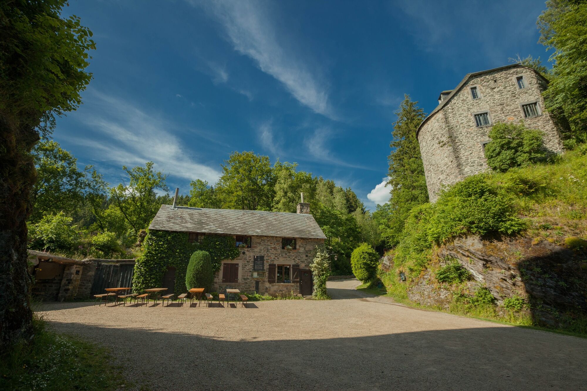
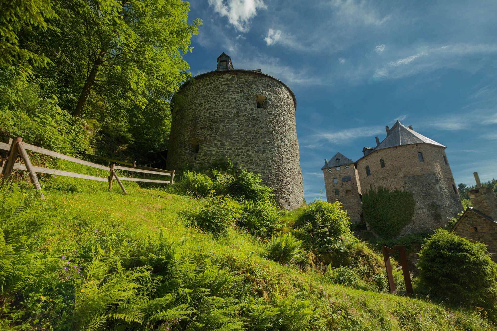
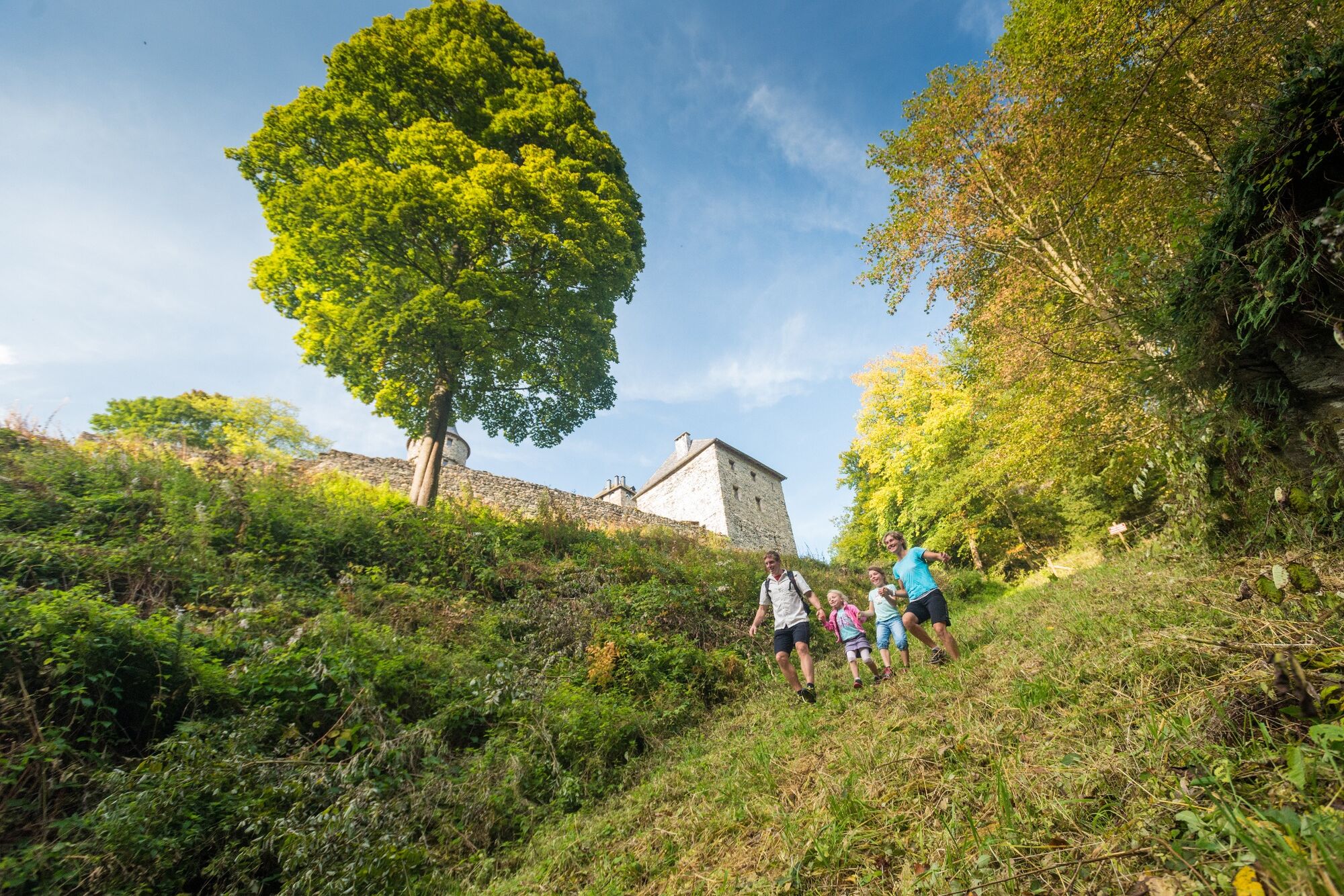
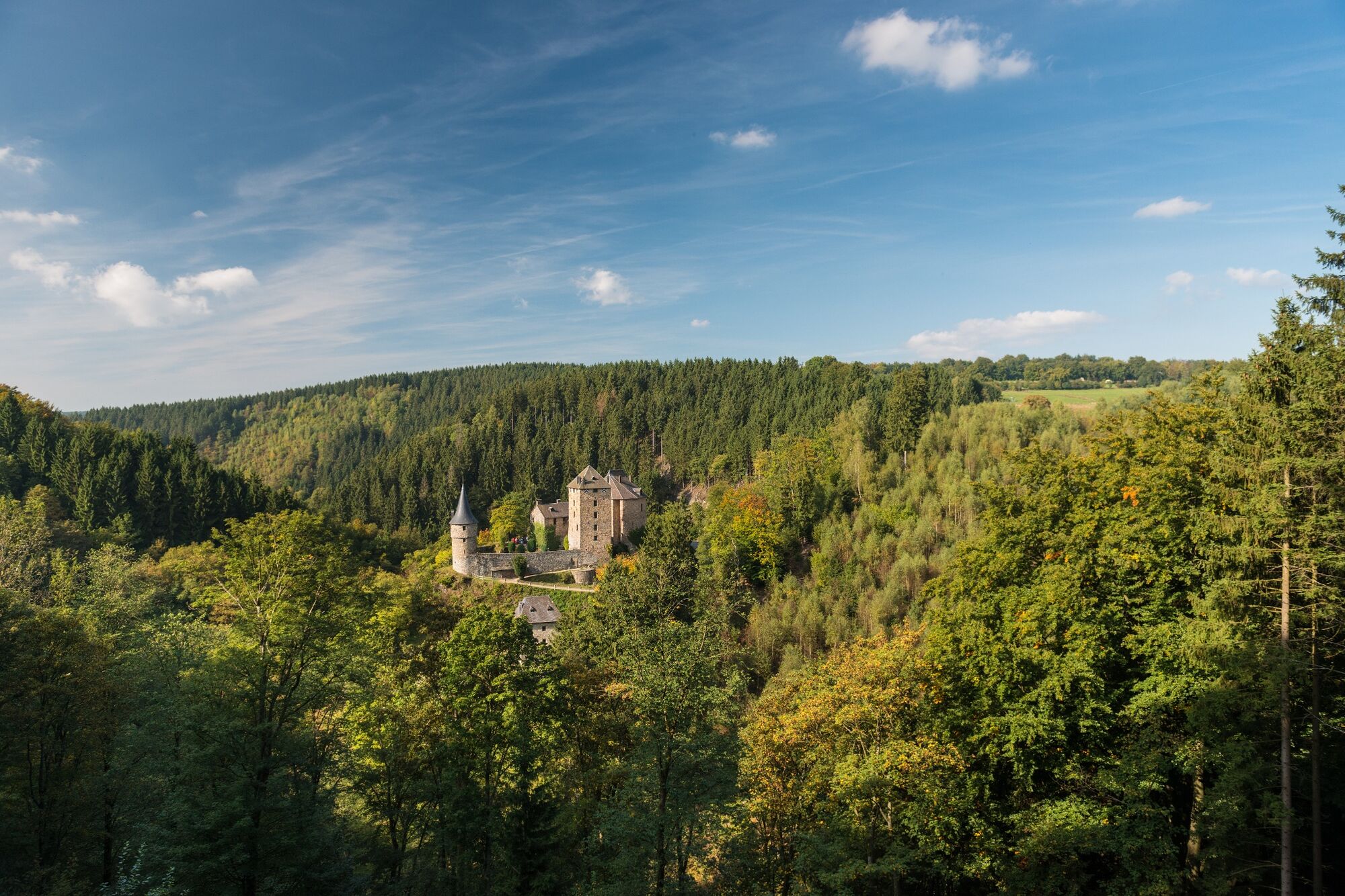
After the bridge, in the remoteness of the forest, we come upon Burg Reinhardstein. On the other side, the ascent to the ridge calls for the very highest concentration, as the path is steep and slippery. Once you reach the top, the view out on to the gentle loops of the Warche in the valley compensates you for the effort. Between craggy rocks and fast-flowing streams we reach the valley basin. Now meadows and pastures frame the route and announce that the river is nearby.
You almost seem to be on a mountain hike here. There's a steep descent before we pass the mill campsite, which is also the gateway to the Warche valley. The final slope follows the course of the Coreu stream and really puts the icing on this hike up hill and down dale.
- Directions
-
Marking: Green rectangle and "Duck" logo
- Highest point
- 518 m
- Endpoint
-
The parking lot.
- Height profile
-
 © outdooractive.com
 - Equipment
-
High hiking boots. Clothing adapted to the weather.
- Safety instructions
-
A quite long hike with several steep climbs. Long section at the crest of the hill.
Dogs must be kept on a leash.
- Tips
-
Burg Reinhardstein – discover the knights' hall, keeper's hall and chapel, fitted out with suits of armour, paintings, chests and tapestries.
- Additional information
- Directions
-
Please use the route planner.
- Public transportation
- Parking
-
Opposite the church in Xhoffraix.
- Author
-
The tour Pleasure tour 16 – The ridges above the Warche valley is used by outdooractive.com provided.


General info
-
Eifel/ Rheinland-Pfalz
1056
-
Hohes Venn
606
-
Weismes
123