ORTOVOX tour tip: Brouillard Ridge Integral – isolated, remote, very long


- Brief description
-
The complete Brouillard ridge tempts only those mountaineers who intend climbing all four-thousanders – or those seeking a great adventure.
Duration: 2-3 days
- Difficulty
-
difficult
- Rating
-
- Starting point
-
La Visaille, Val Veny
- Route
-
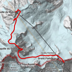
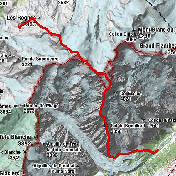
Col du Brouillard (3,350 m)5.8 kmPointe Baretti (4,013 m)7.1 kmMont Brouillard (4,069 m)7.7 kmCol Émile Rey (4,030 m)7.7 kmPic Louis Amédée (4,460 m)8.2 kmCol Major (4,740 m)9.1 kmMont Blanc (4,805 m)9.8 kmRocher de la Tournette (4,677 m)10.3 kmPetite Bosse (4,547 m)10.7 kmGrande Bosse (4,513 m)11.0 kmCapanna Vallot11.5 kmCol du Dôme (4,250 m)12.0 kmAiguille du Goûter (3,863 m)14.1 kmGrand Couloir15.2 kmLe Nid d'Aigle18.6 km
- Best season
-
JanFebMarAprMayJunJulAugSepOctNovDec
- Description
-
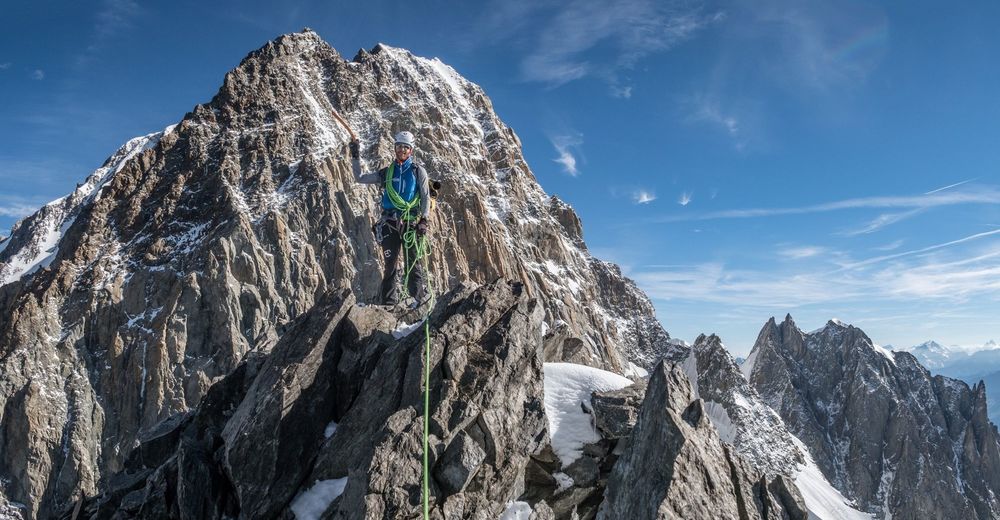
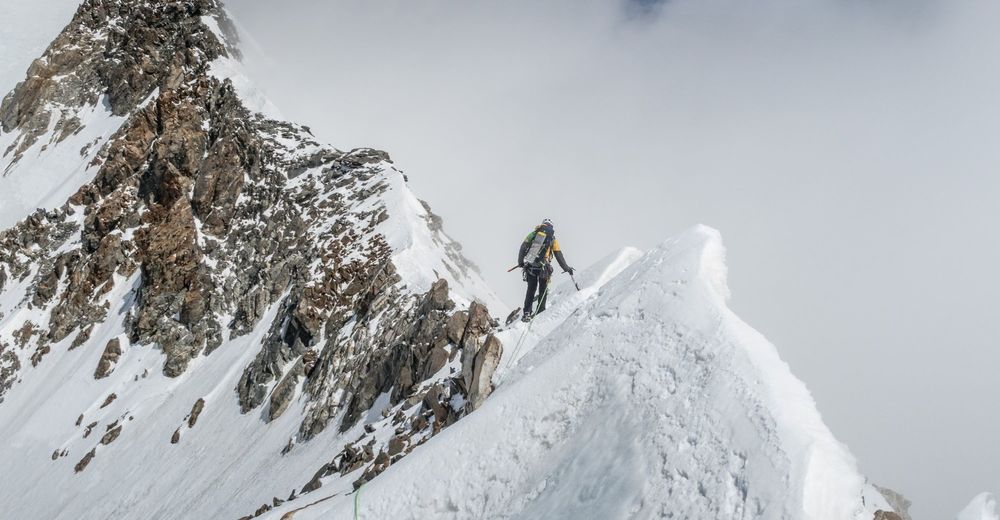
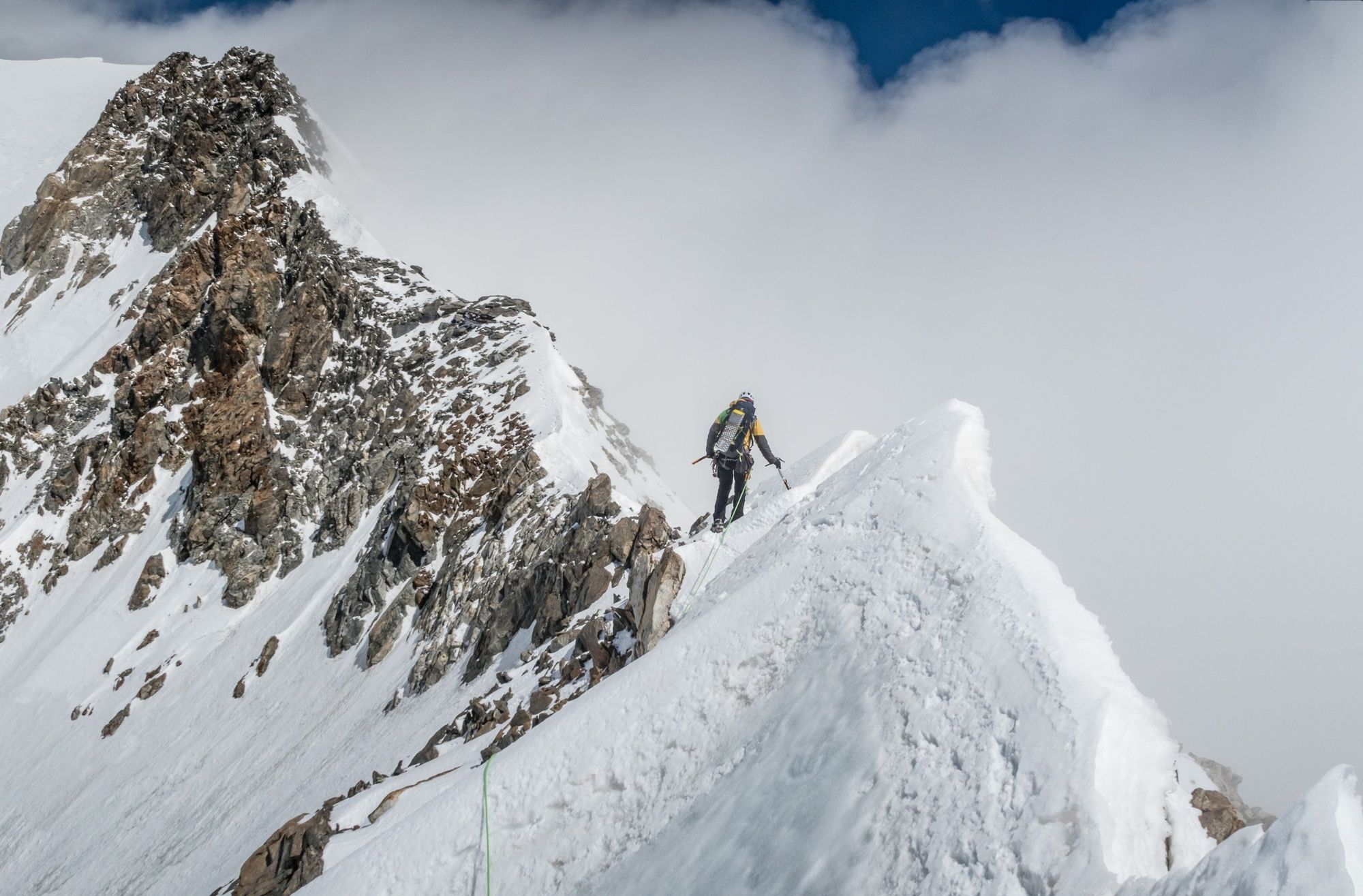
The Brouillard Integral is a Jacob’s ladder, the first rung of which is the green valley floor, and you never leave this ridgeline again until you reach Mont Blanc. It joins a total of five four-thousanders, including the three least visited: Punta Baretti (4013m), Mont Brouillard (4063m) and Picco Luigi Amedeo (4469m).
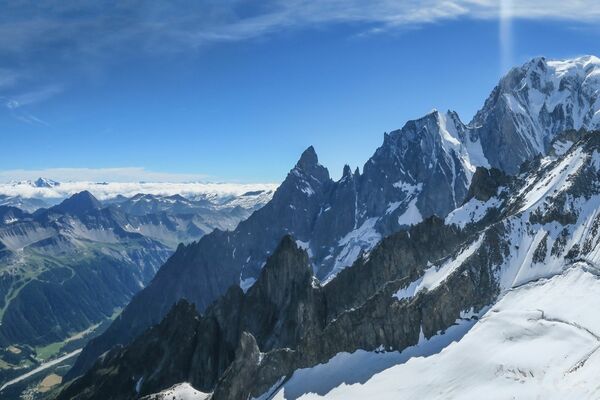
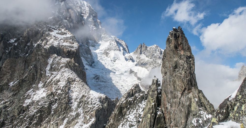
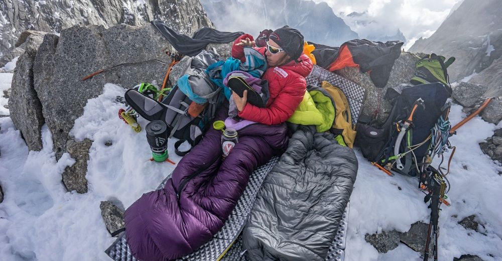
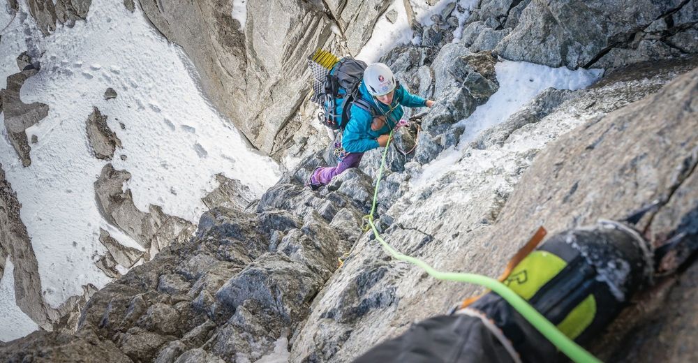
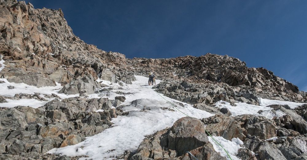
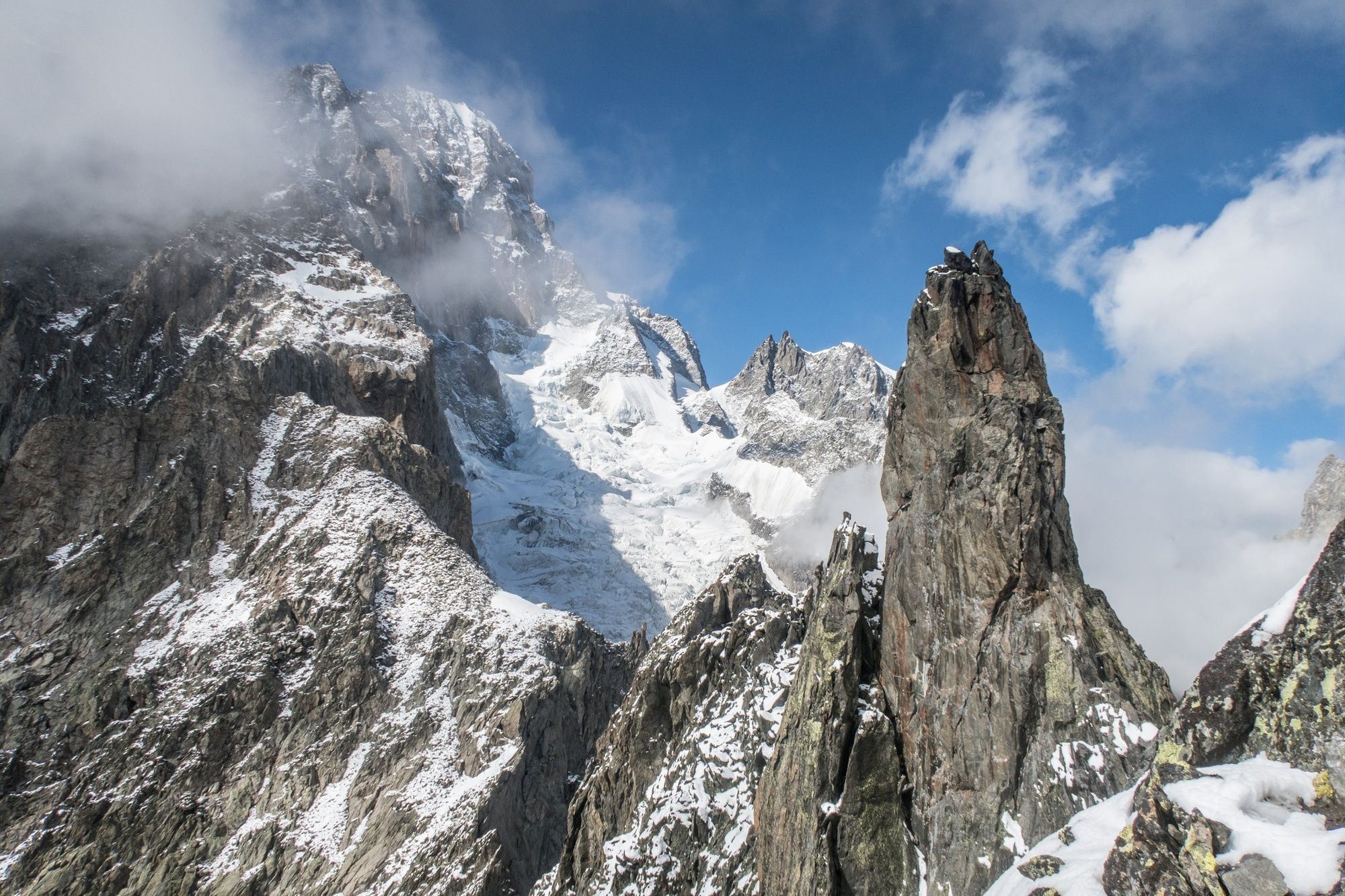
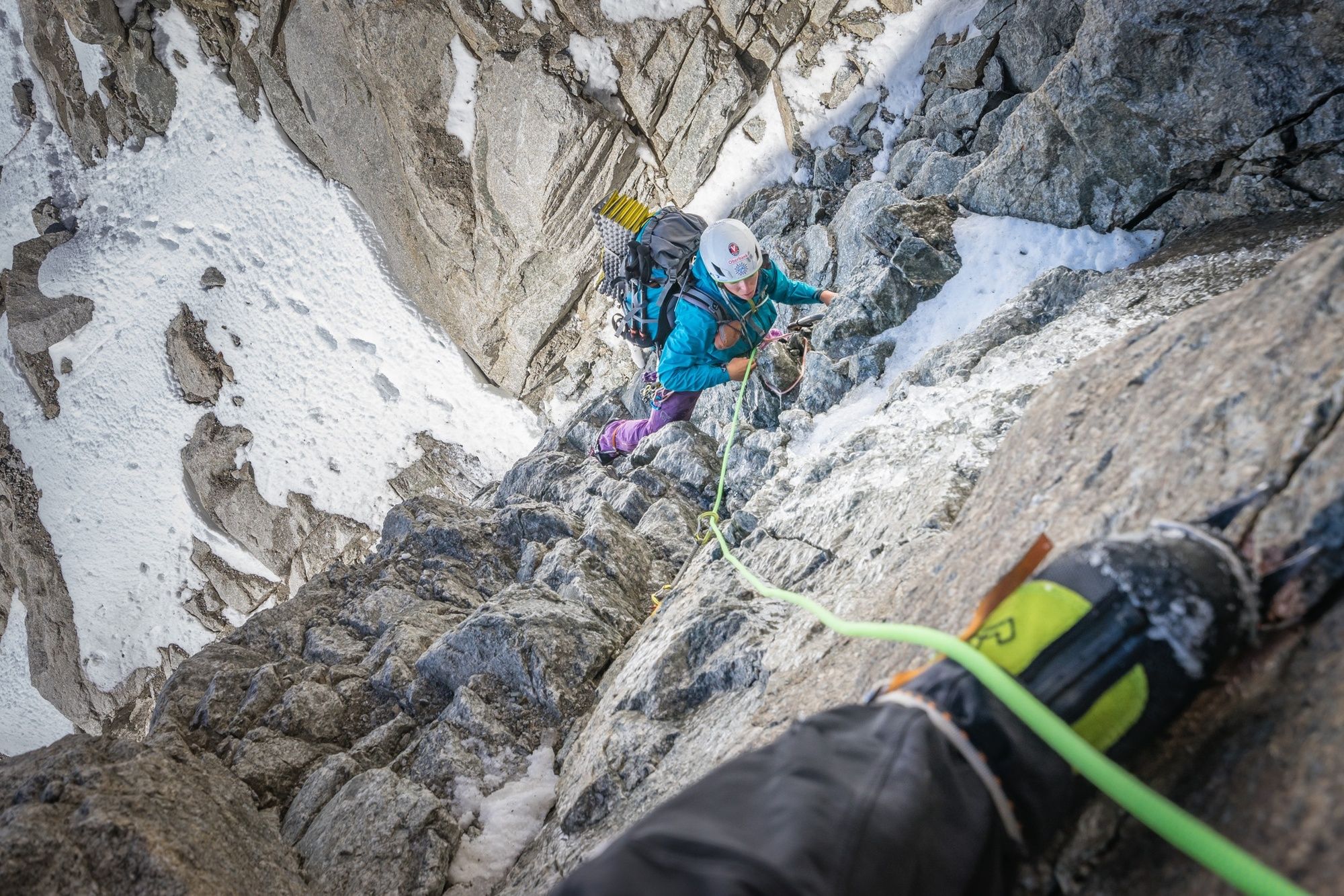
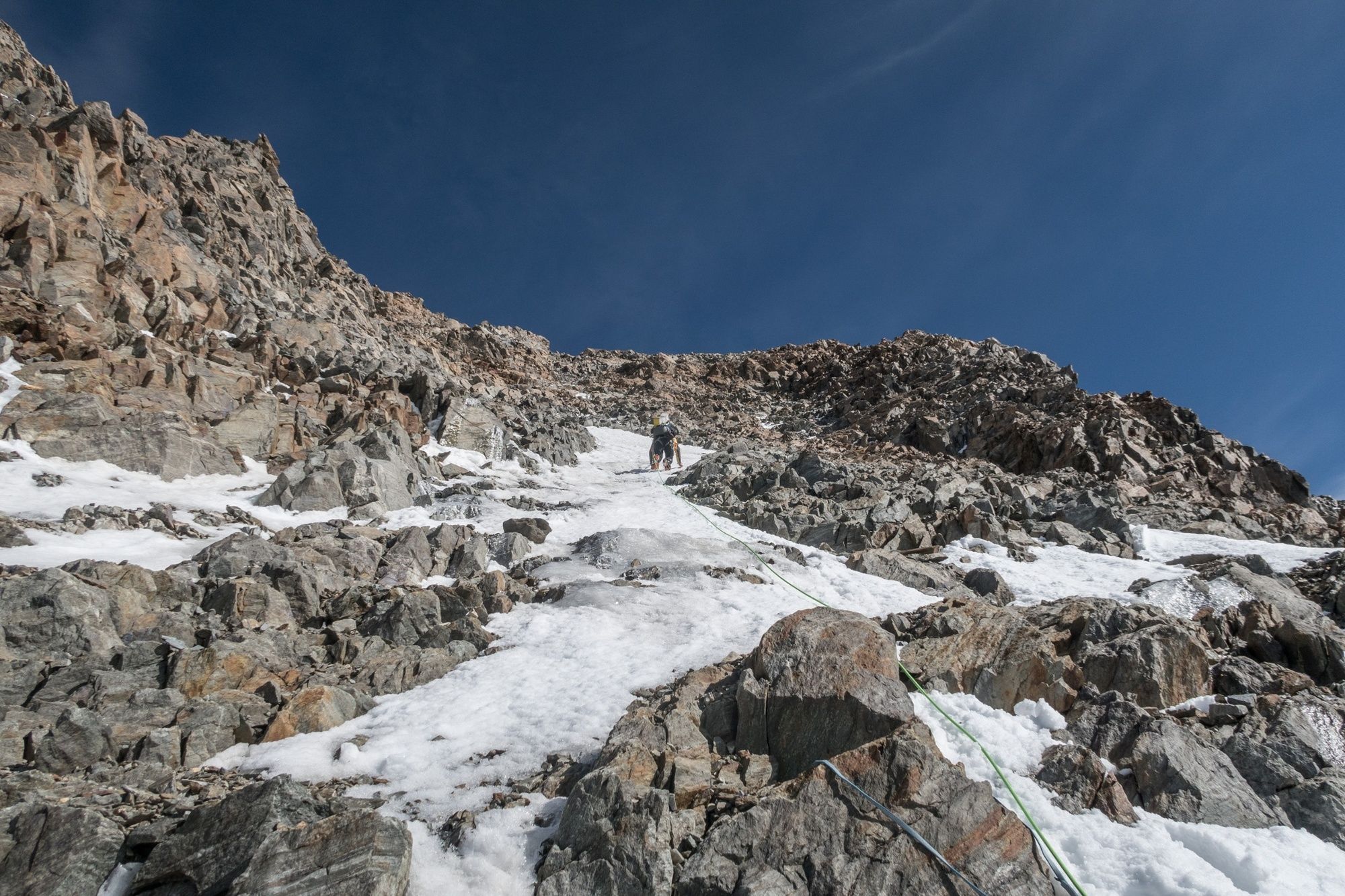
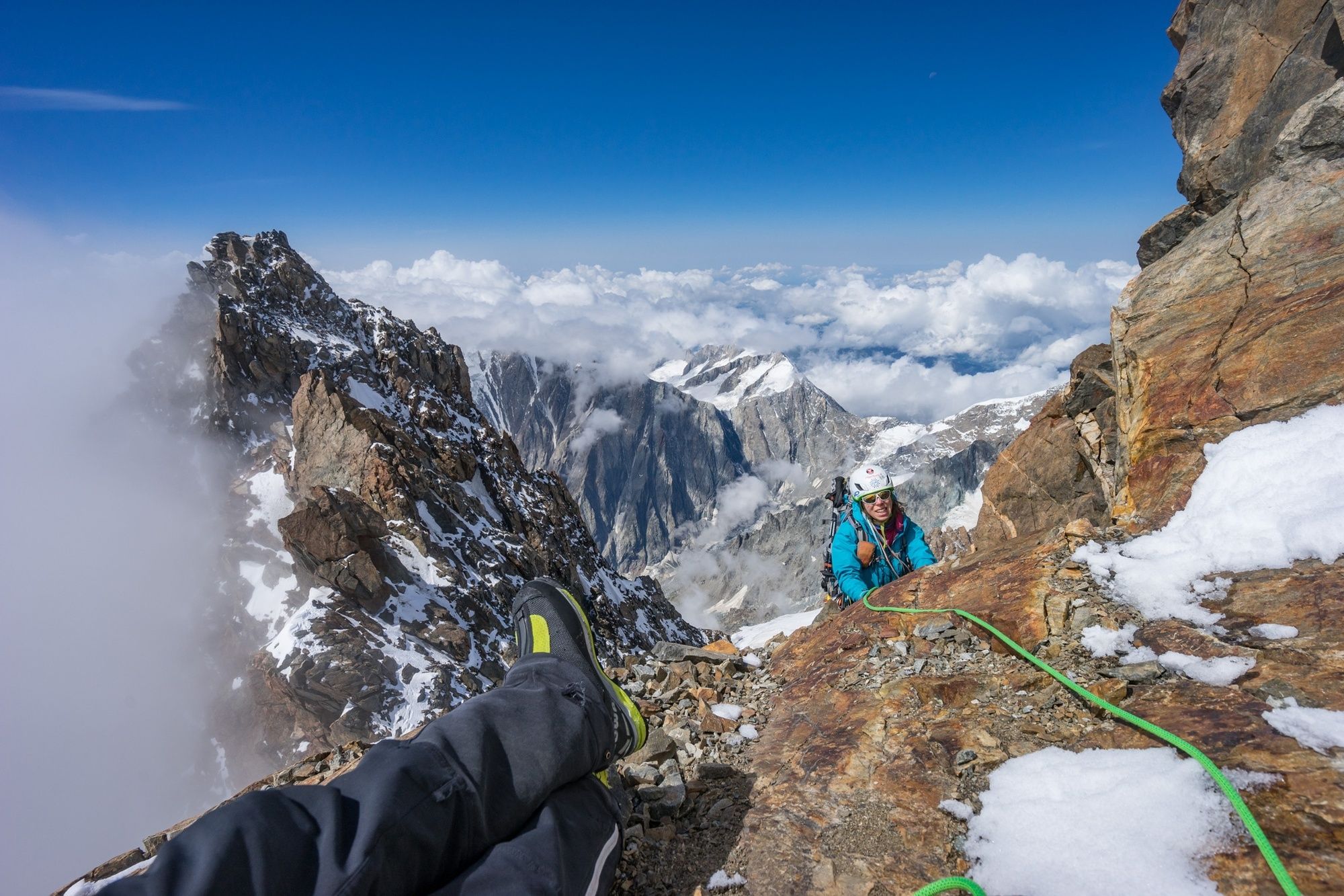
Between Val Veny and the highest point in the Alps, climbers face an elevation difference of 3500m and a distance of seven kilometers as the crow flies. This probably makes the Brouillard Integral the longest ridge on Mont Blanc – and throughout the entire Alps, too. There are no huts and no bivouac boxes to offer comfort along this long route, which is never easy but also never particularly difficult. It’s only the crux that can be a bit awkward, waiting as it does in the often combined terrain beyond the Col Émile Rey (IV?). The rest of the rock outcrop up to Mont Blanc de Courmayeur is extremely unsound in places.
“Just like in the Himalayas” is how some mountaineers who have climbed this part of Mont Blanc describe it. And there’s not many of them.
- Directions
-
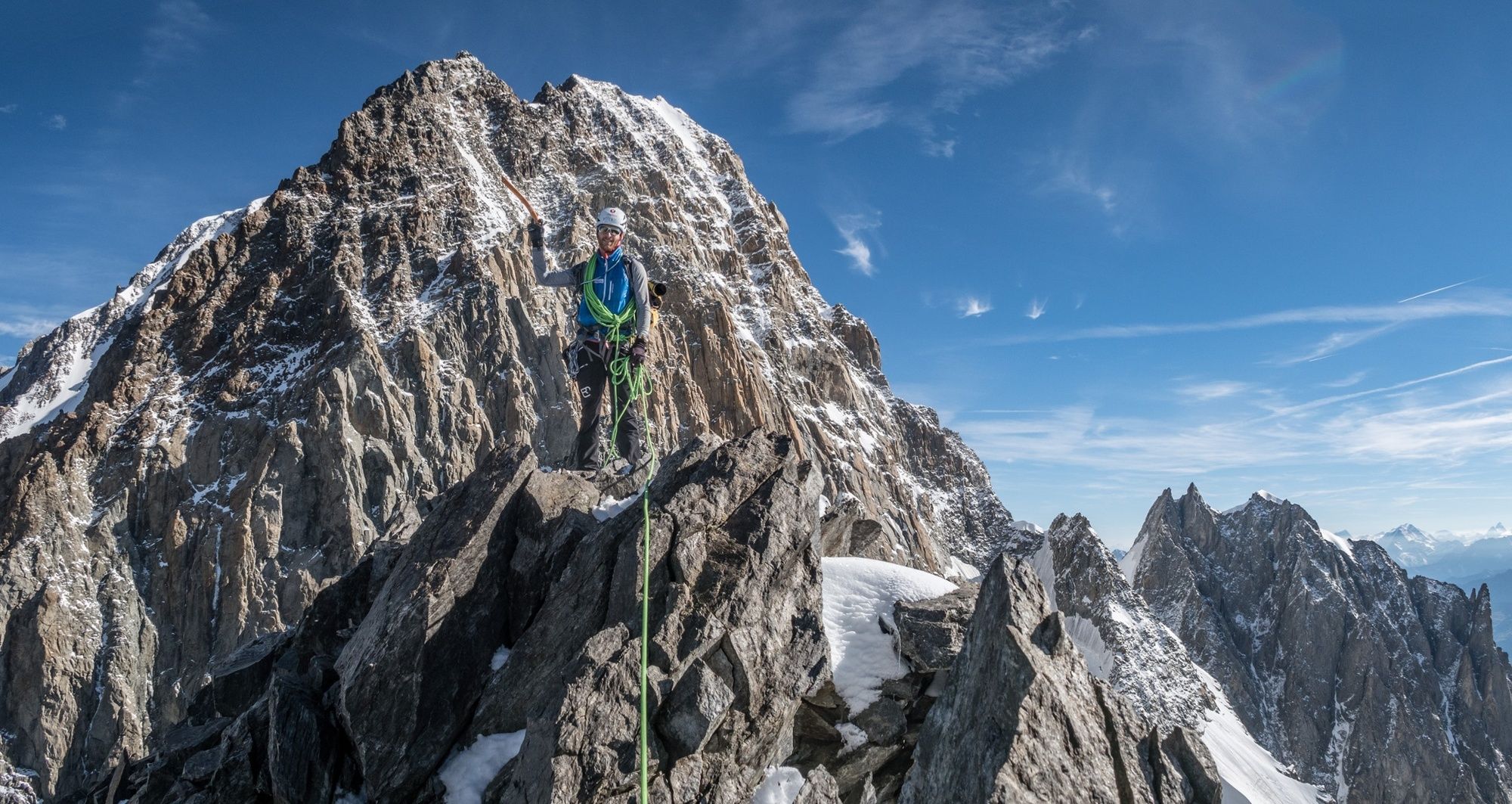
First follow the route in the direction of the Gonella Hut. This will take you to the (initially) grassy spine of the ridge. From here it’s a mixture of grass and rock. Continue through a very visible gorge up to the ridge. Keep on the ridge or slightly to its left up to the Aiguilles Rouges. Some of these are to be climbed over, some bypassed. From Col Brouillard, stay almost continually directly on the ridge until Punta Baretti, Mont Brouillard and Col Émile Rey. Some of the rappelling points have slings.
From Col, go to the right into the distinctive and usually wet chimney (IV). Now it gets really confusing and you’ll need good alpine instincts. Climbing continually upwards and sometimes slightly to the right will take you to the Picco Luigi Amedeo. Rappel down from here. Several difficult rock passages follow, taking you up to Mont Blanc de Courmayeur.
There are three ways to get down:
a) The normal southerly route via the Gonella Hut (often has too little snow in midsummer).
b) The traverse from Mont Maudit and Mont Blanc du Tacul to the Aiguille de Midi upper station (then take the cable car to Chamonix and go back through the Mont Blanc Tunnel, or take the Panoramic Mont Blanc cable car to the Torino Hut, where you can take the cable car down to Entrèves).
c) Via the normal route to Chamonix (Bosses ridge – Goûter Hut – Tête Rousse – Nid d’Aigle station – Les Houches).
- Highest point
- 4,767 m
- Endpoint
-
Chamonix or La Visaille
- Height profile
-
 © outdooractive.com
 - Equipment
-
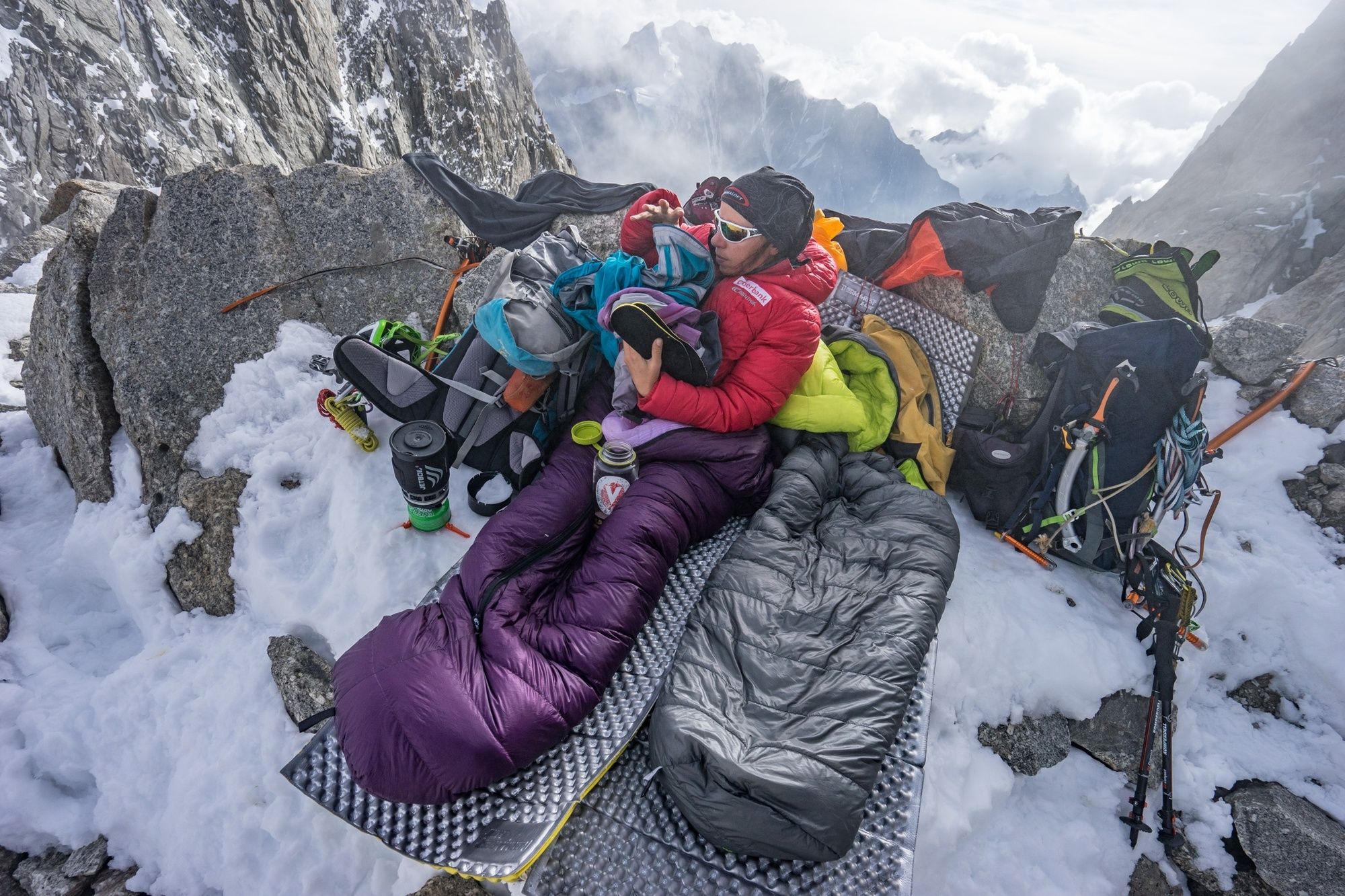
Rock climbing equipment including a basic assortment of mobile protection devices, crampons, ice screws, ice axe and perhaps additional ice gear, bivouac equipment
- Safety instructions
-
You will encounter all the dangers that high mountain terrain can throw at you: Falling rocks and ice, unsound rock, crevasses, risk of avalanche, sudden bad weather, difficult retreating possibilities.
- Tips
-
The Brouillard Ridge continues downwards without an integral extension – you climb from the Eccles bivouac through a gully into the Col Émile Rey.
- Additional information
- Directions
-
Through Val d’Aosta or from the north through the Mont Blanc Tunnel to Courmayeur. Into Val Veny until you reach the little village of La Visaille.
- Author
-
The tour ORTOVOX tour tip: Brouillard Ridge Integral – isolated, remote, very long is used by outdooractive.com provided.