
- Brief description
-
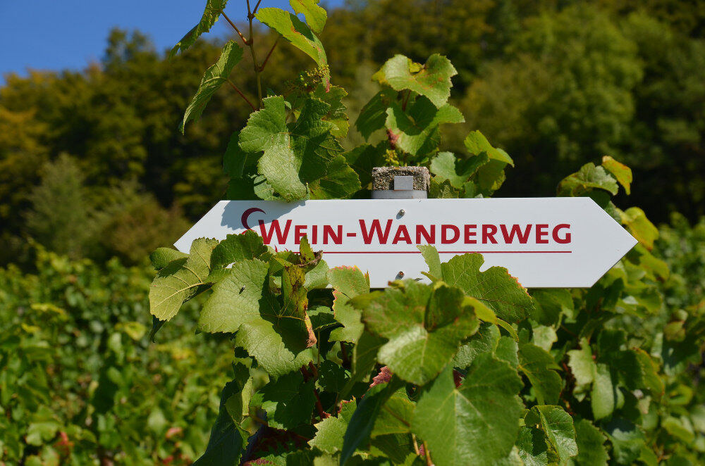
On this signposted trail, you will learn interesting facts about winegrowing and also get to know the scenic attractions and cultural values of the Zurzi region. Interesting hiking route through the vineyards of the Surb and Aare valleys with several entry and exit points.
- Difficulty
-
easy
- Rating
-
- Starting point
-
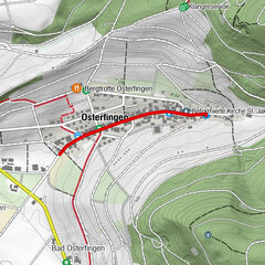
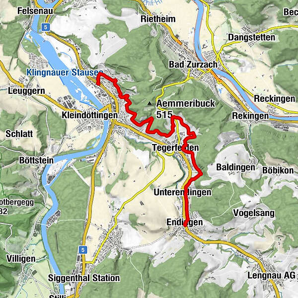
Endingen, Post bus stop
- Route
-
Endingen (384 m)Unterendingen (386 m)1.1 kmDe Finibus Terrae1.3 kmStocke2.8 kmTegerfelden (364 m)3.3 kmWeijedal4.2 kmDöttingen (328 m)9.7 kmKlingnau (321 m)11.5 km
- Best season
-
JanFebMarAprMayJunJulAugSepOctNovDec
- Description
-
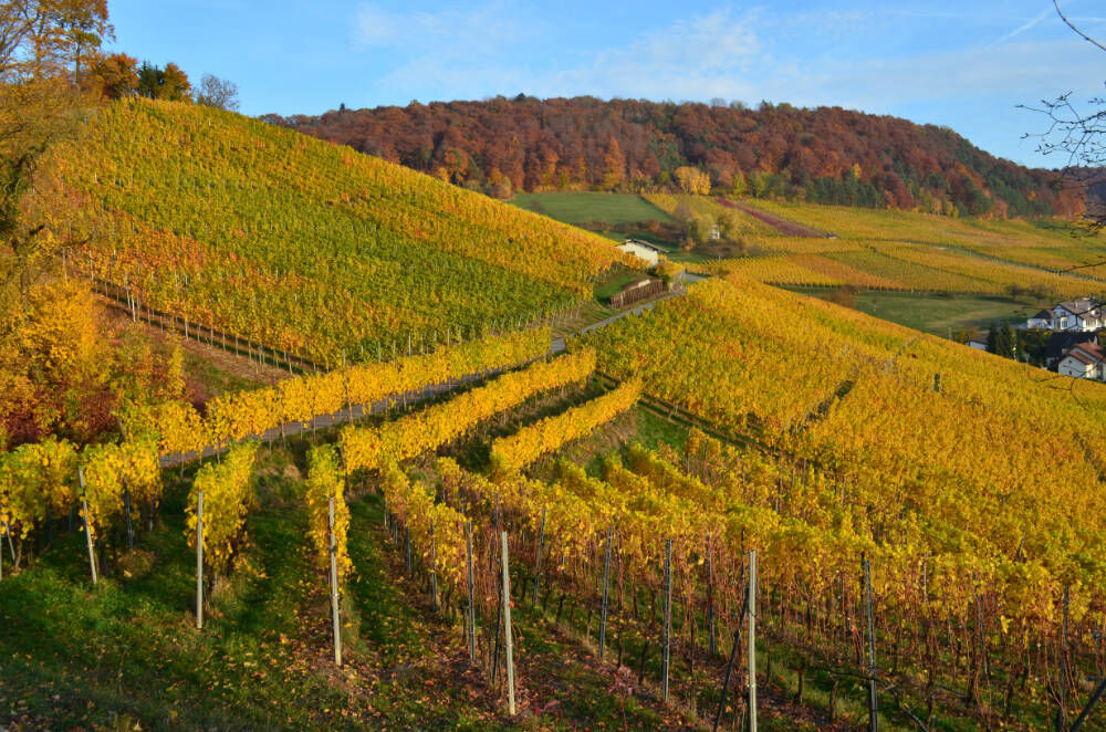
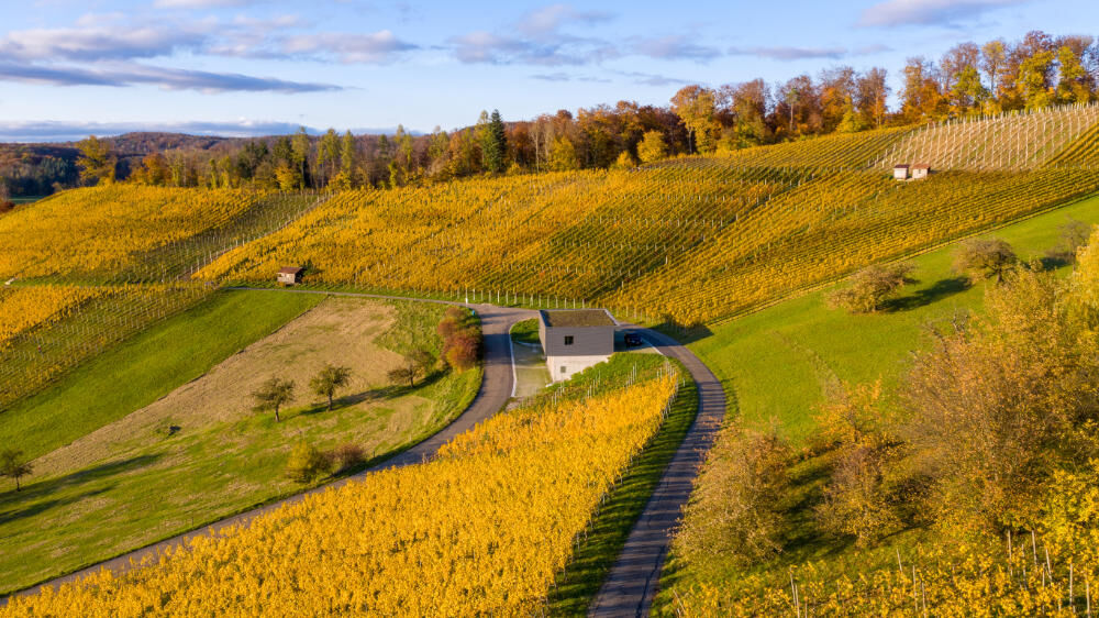
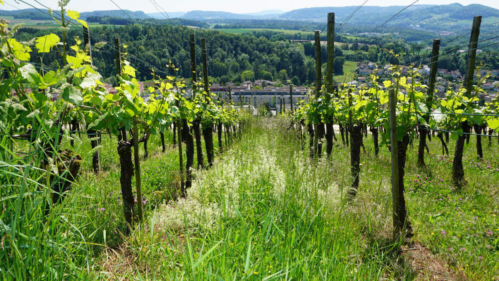
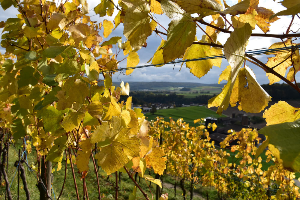
It is a delight to set off from the former Jewish village of Endingen or (in the opposite direction) from the medieval town of Klingnau and hike through the vineyards on the sunny slopes of the Aare and Surbtal valleys. The route reveals the scenic charms, cultural and historical values of the Zurzibiet. This forms the north-east corner of the Aargau and is part of the wine region of Eastern Switzerland. Local wines can be tasted in the restaurants or wineries (on request) along the way.
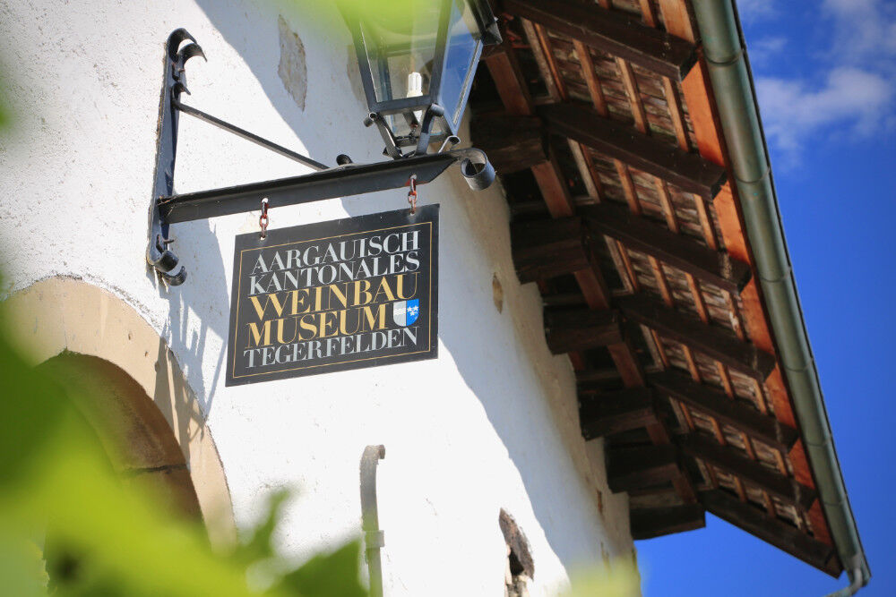
In addition to Klingnau Castle and the Endingen Synagogue, there are two cantonal museums: the fire brigade museum in Endingen and the wine-growing museum in Tegerfelden. Everywhere you go, there are restaurants serving delicious food and local wines.
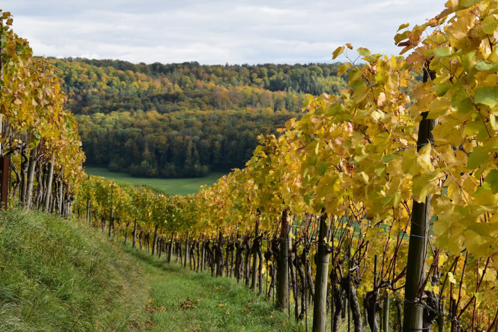
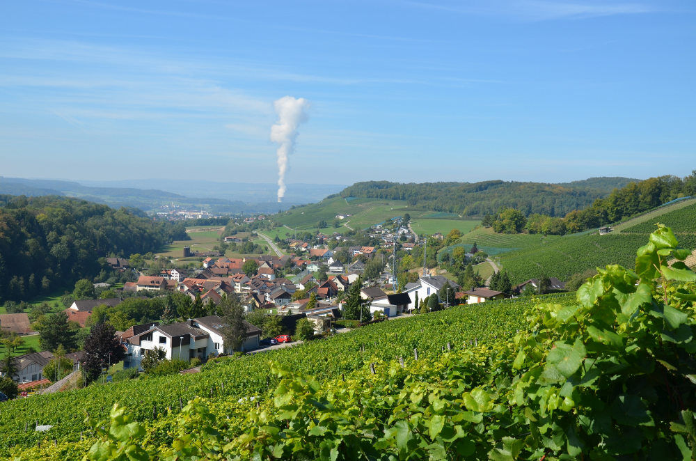
From vantage points and rest areas in the Surbtal valley, the view sweeps over the fertile Ruckfeld and in the Aare valley over the Klingnau reservoir, which is of European importance as a breeding and stopover site for migratory birds. Beyond the parish, the horizon is formed by the Jura and Black Forest mountain ranges. - Directions
-
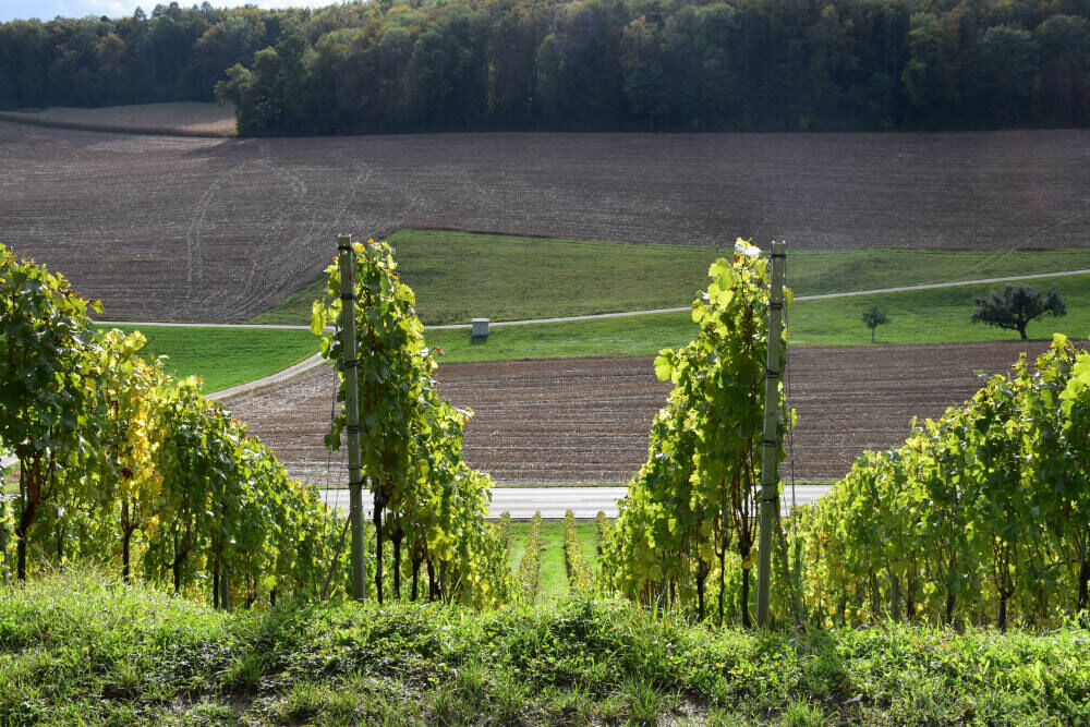
Nature of the paths: Half natural and half asphalt paths (accessible with pushchairs)
VariantA: Access point Tegerfelden
OptionB: This route leads through the middle of the vineyard
VariantC: Exit option Döttingen
- Highest point
- 441 m
- Endpoint
-
Klingnau, railway station
- Height profile
-
 © outdooractive.com
 - Tips
-
Special views:
From Tegerfelden into the Surbtal valley, from Döttingen into the Aare valley and to the Klingnau reservoir, from the Schwändi vineyard to the historic old town of Klingnau.
- Additional information
-
See also:
Bad Zurzach Tourismus AG
Dr Martin Erb-Strasse 9
CH-5330 Bad Zurzach
Tel: +41 (0)56 269 00 60
E-mail: welcome@badzurzach.info
Internet: www.badzurzach.infoKantonales WeinbaumuseumTegerfelden
Tel: +41 (0)56 225 22 74
E-mail: info@weinbau-museum.ch
Internet: www.weinbau-museum.chFire brigade and craftsmen's museum
Schöntal 4
CH-5304 Endingen
Tel: +41 (0)56 242 17 69
E-Mail: info@feuerwehrmuseum.ch
Internet: www.feuerwehrmuseum.ch - Public transportation
-
Endingen-Tegerfelden-Döttingen-Klingnau hike:
Take the bus from Bad Zurzach, Baden or Brugg to the Post bus stop in Endingen.
Hike Klingnau-Döttingen-Tegerfelden-Endingen:
Take the train from Bad Zurzach or Baden to the Klingnau stop.


-

-
AuthorThe tour Wine trail in the Zurzibiet vineyards is used by outdooractive.com provided.

General info
-
Kanton Aargau
1492
-
Baden
651
-
Tegerfelden
169